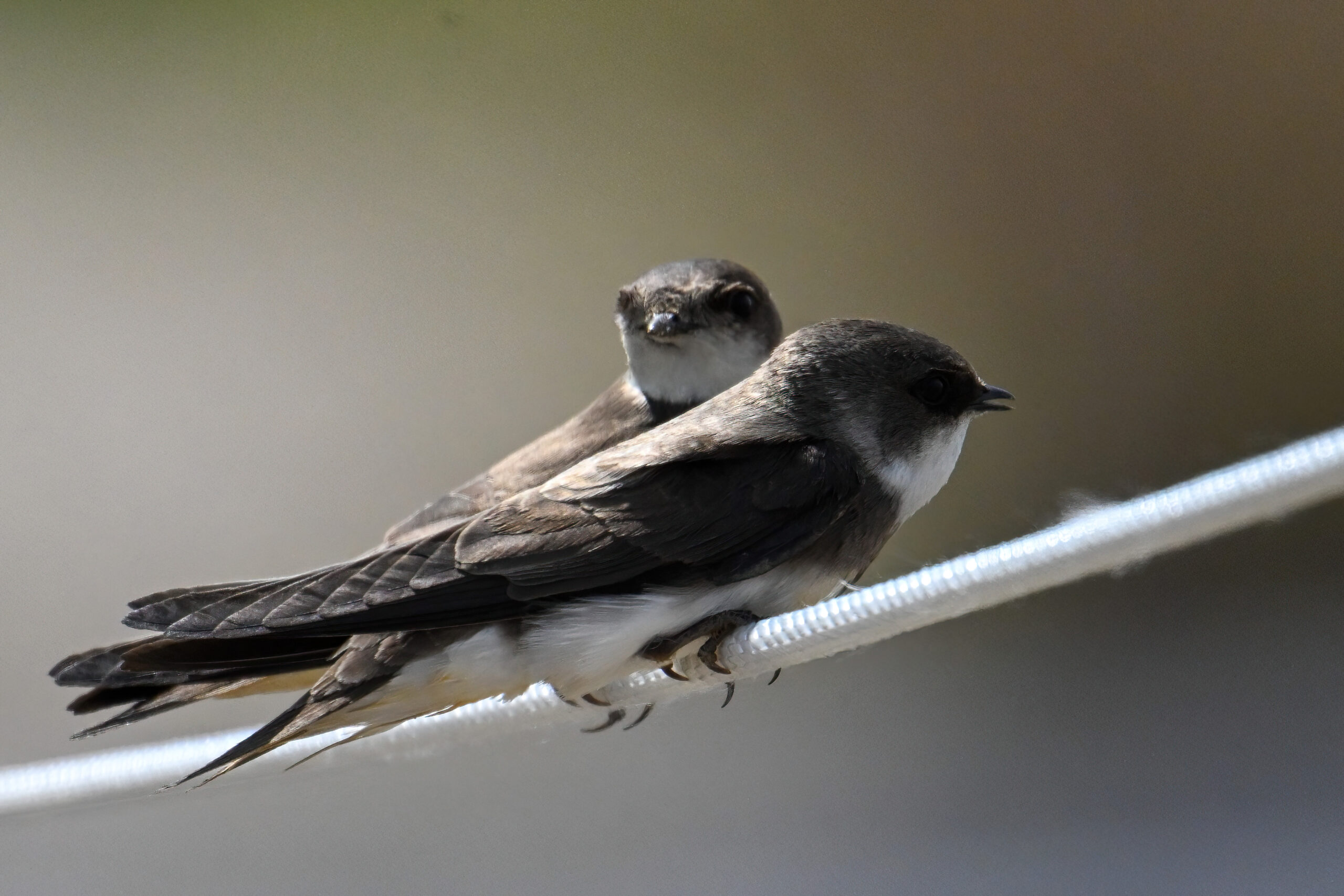
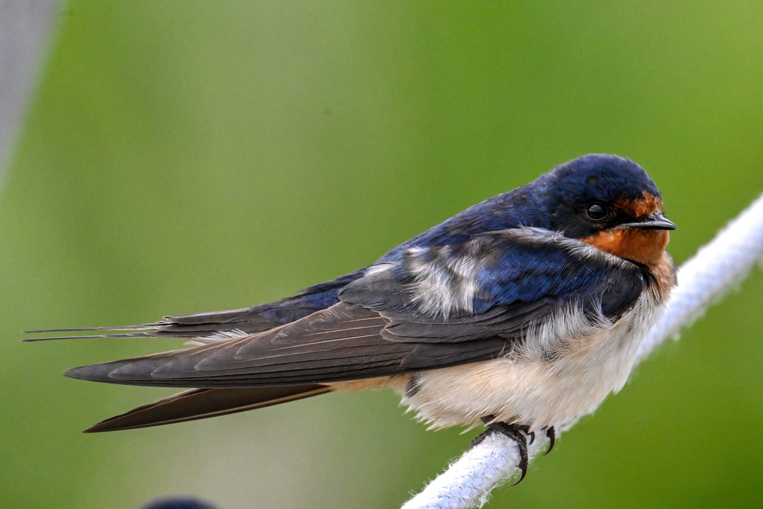
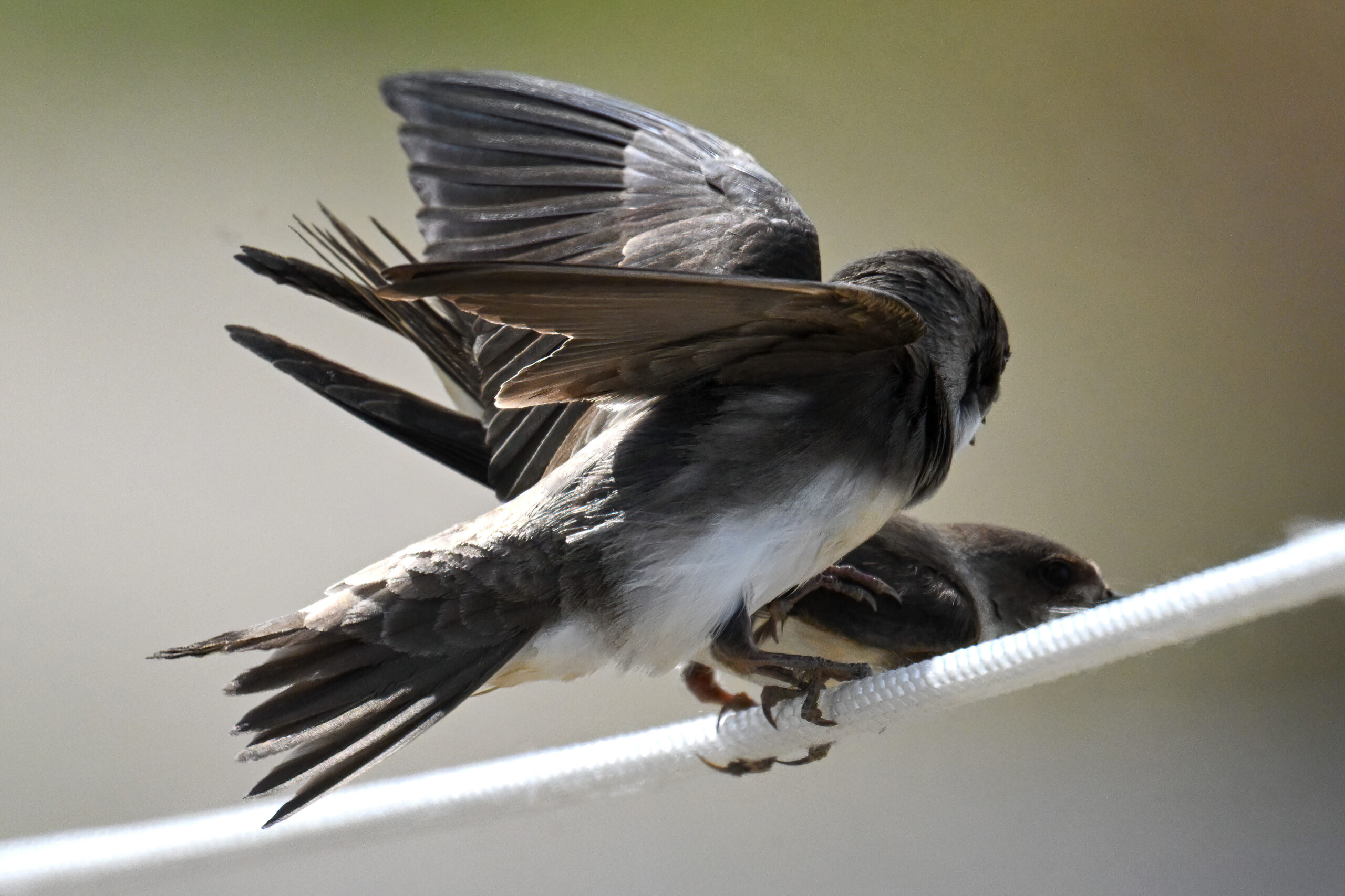
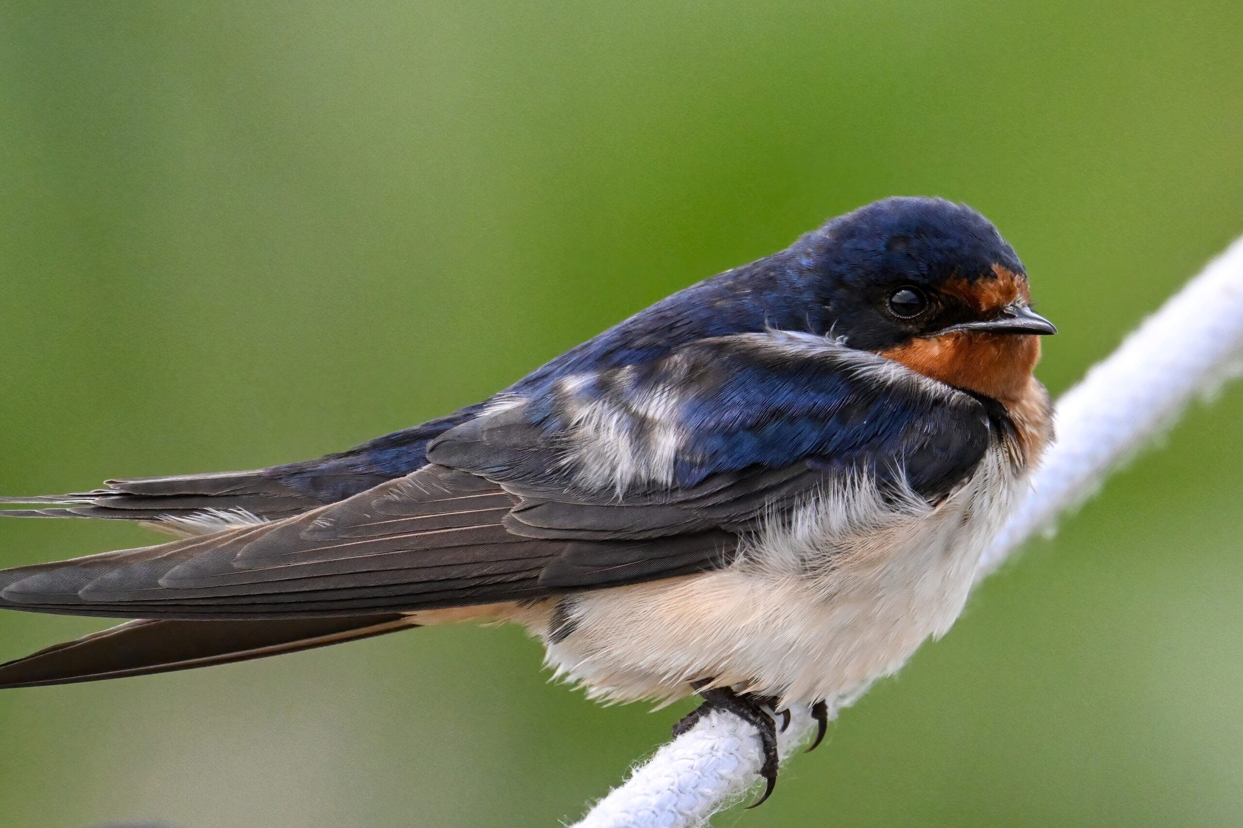
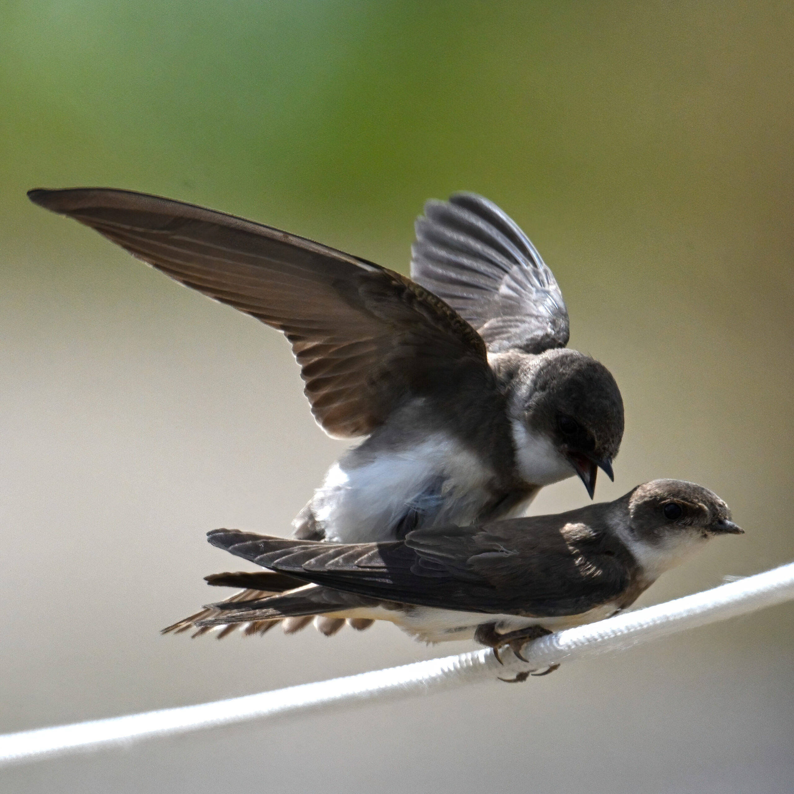
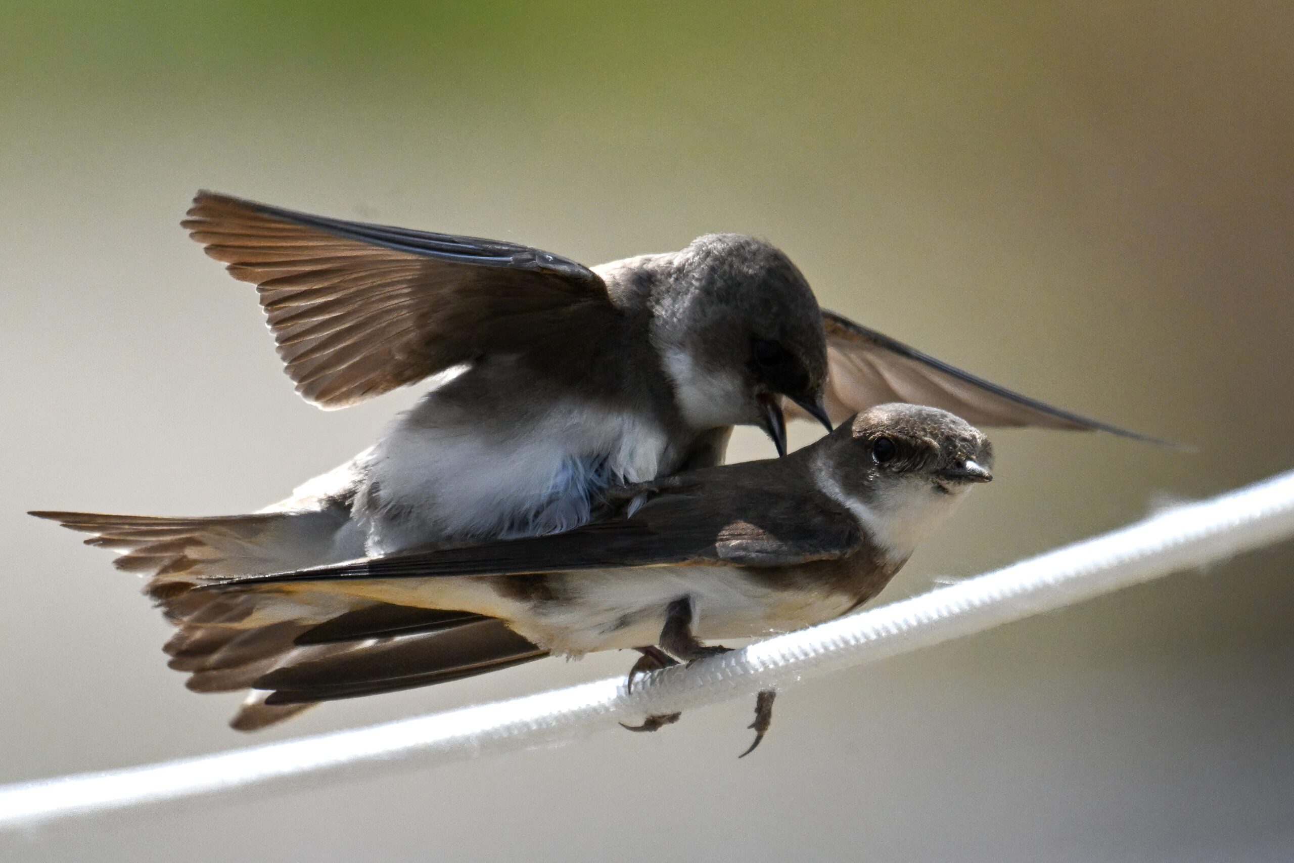
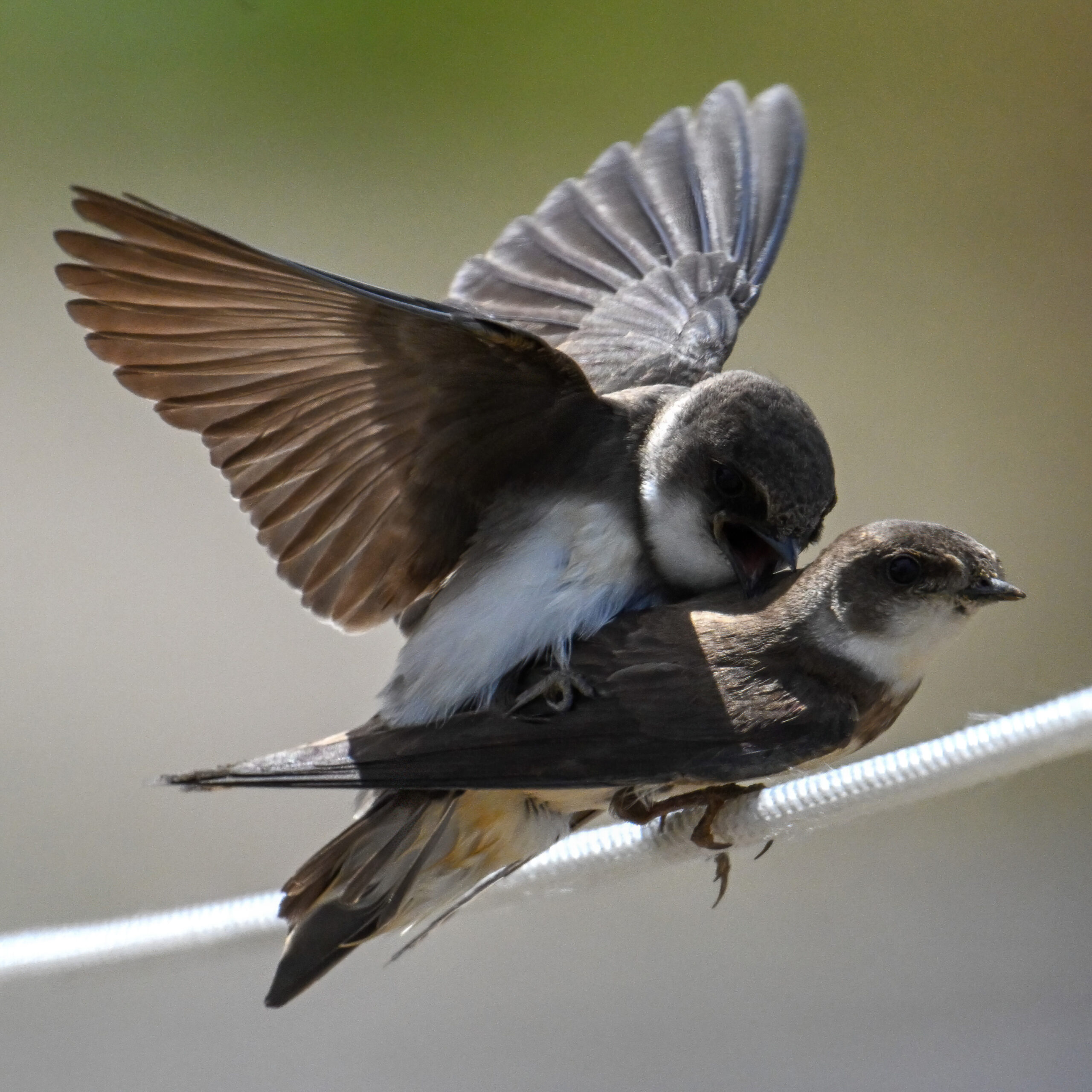
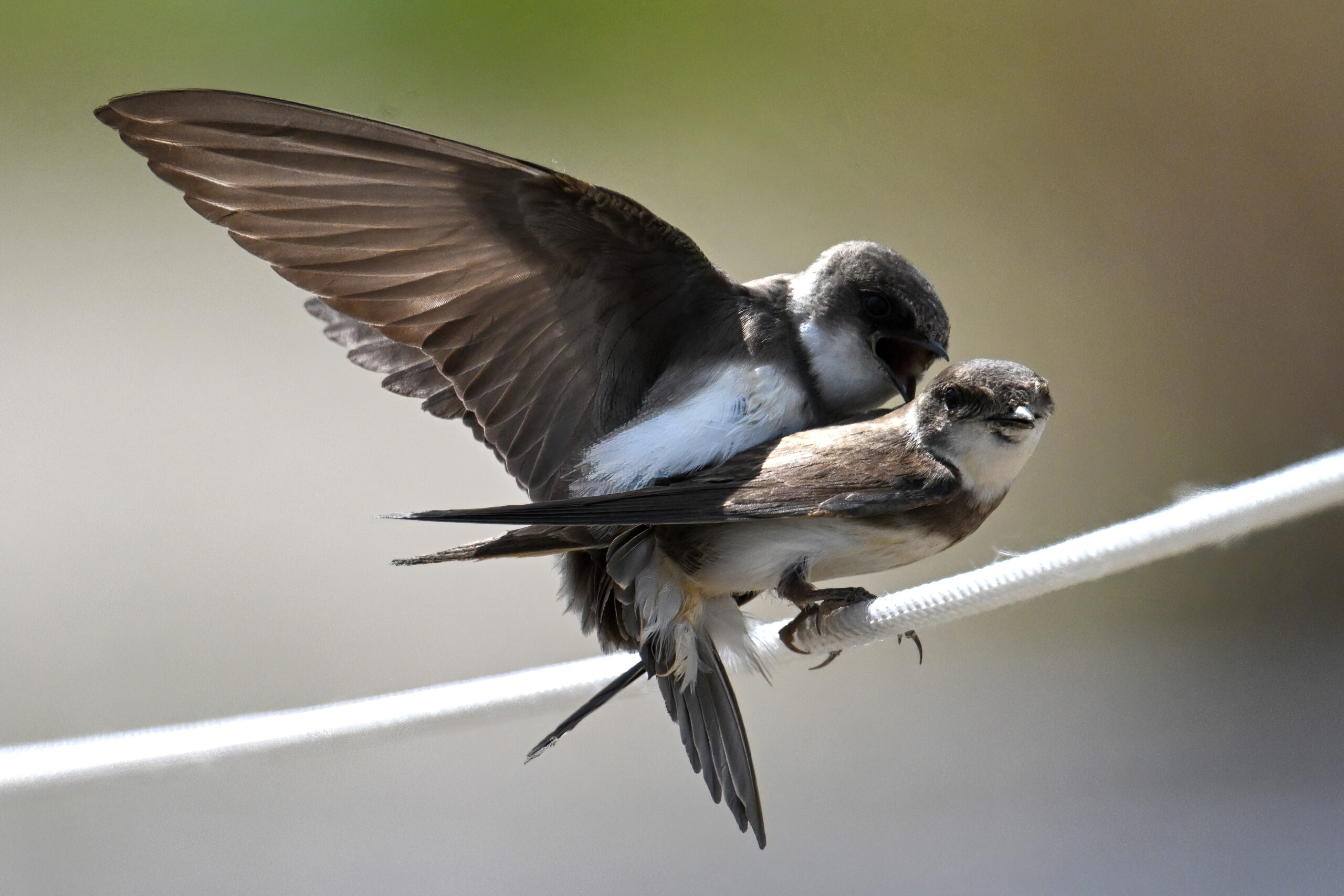
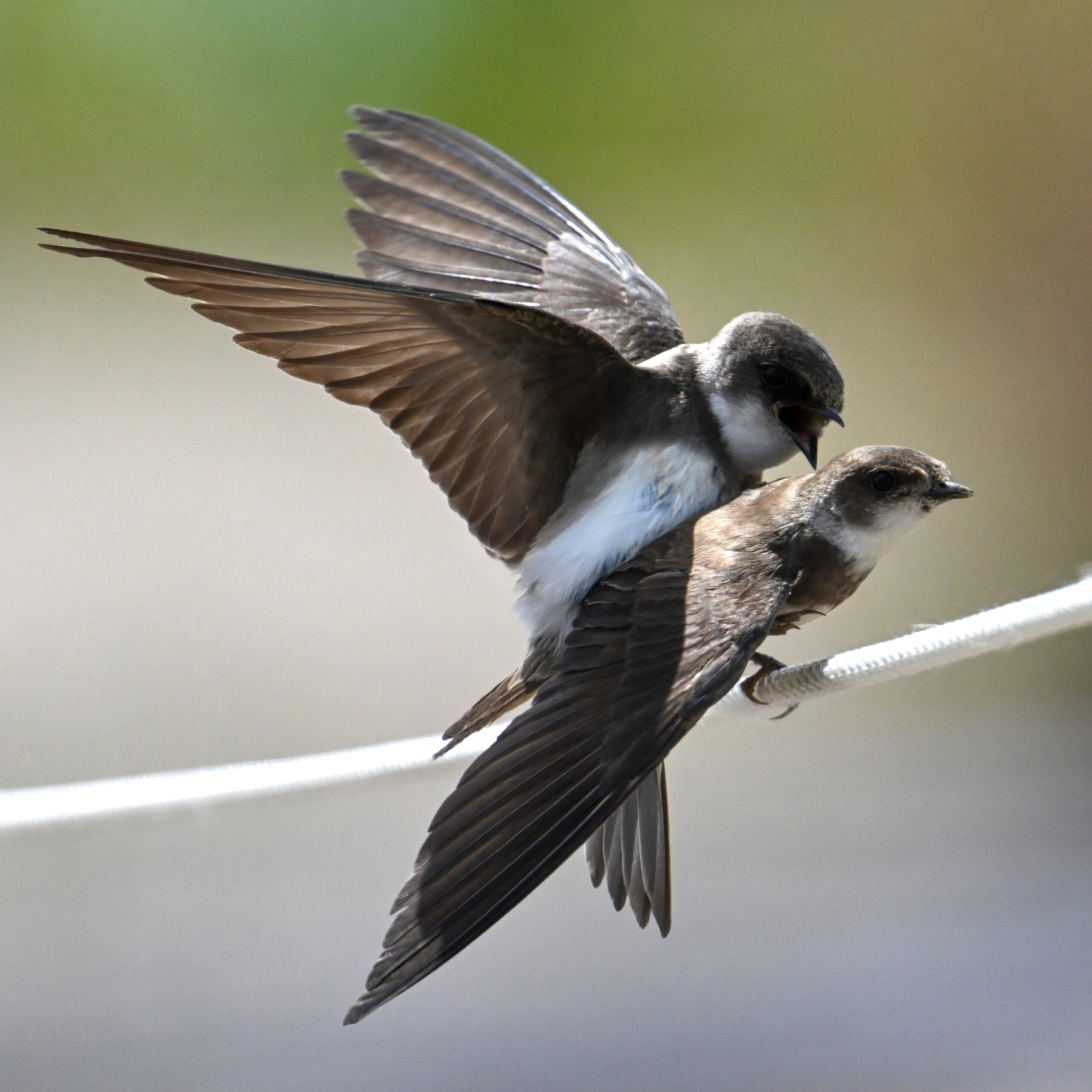
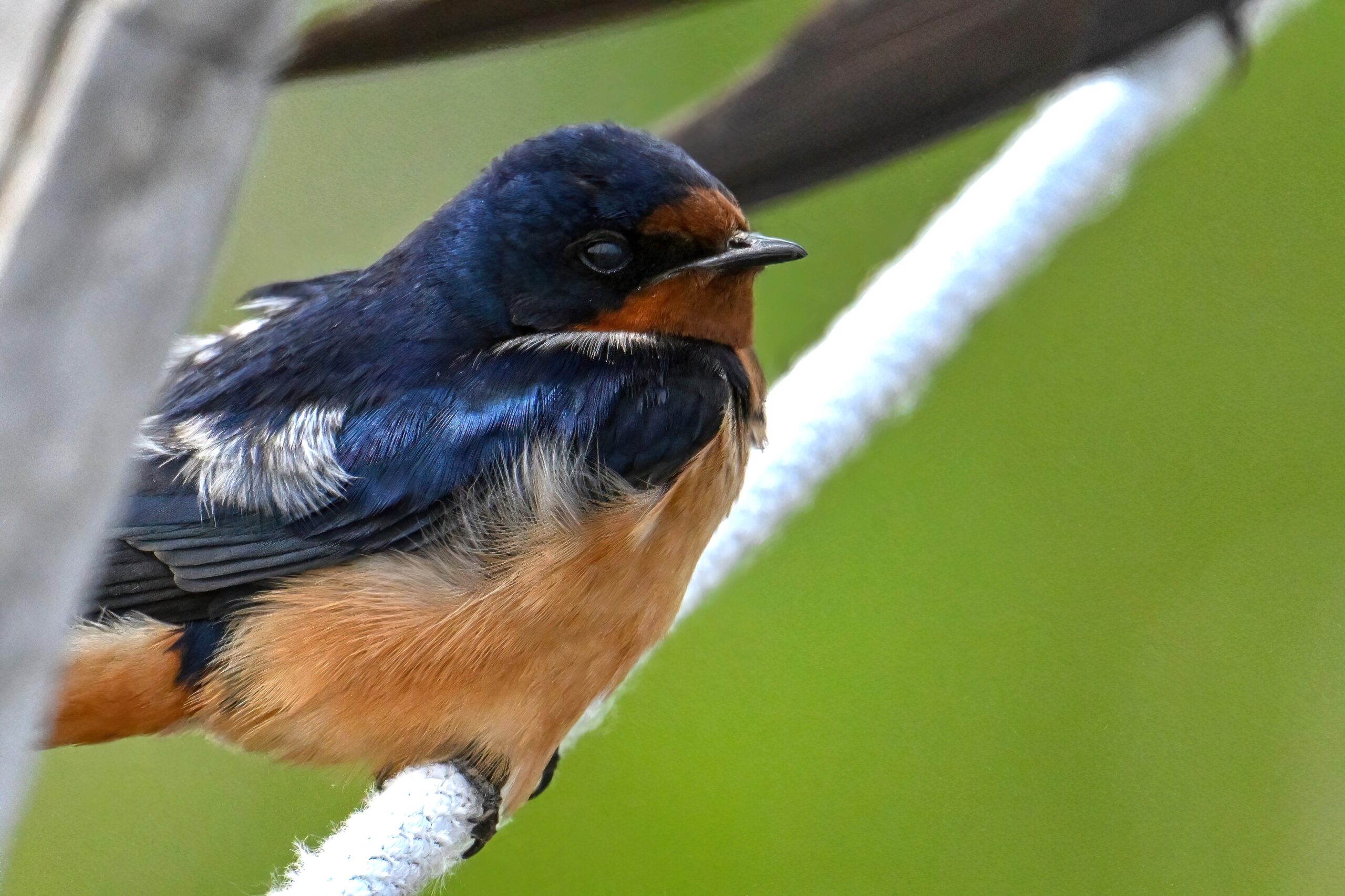
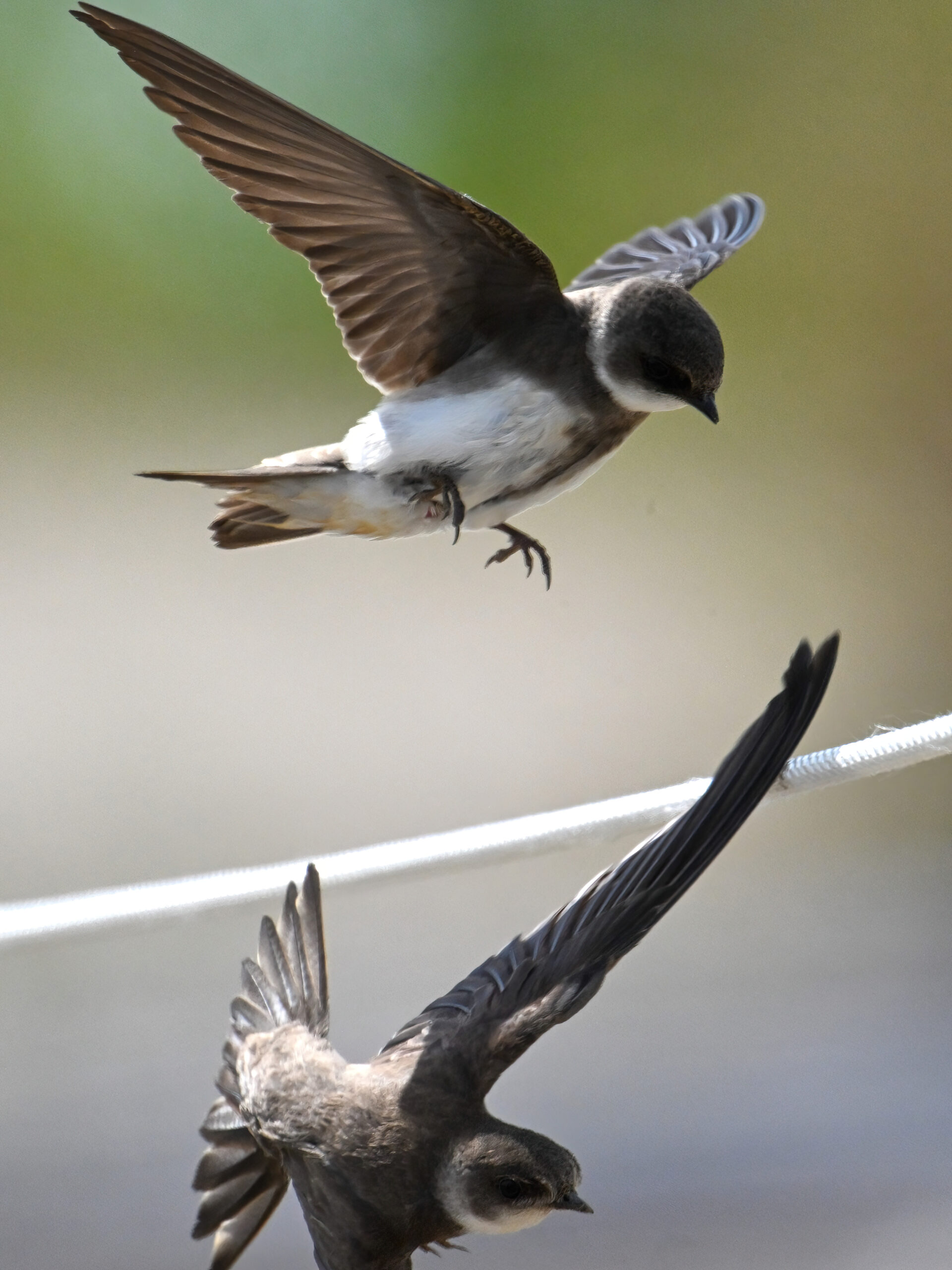
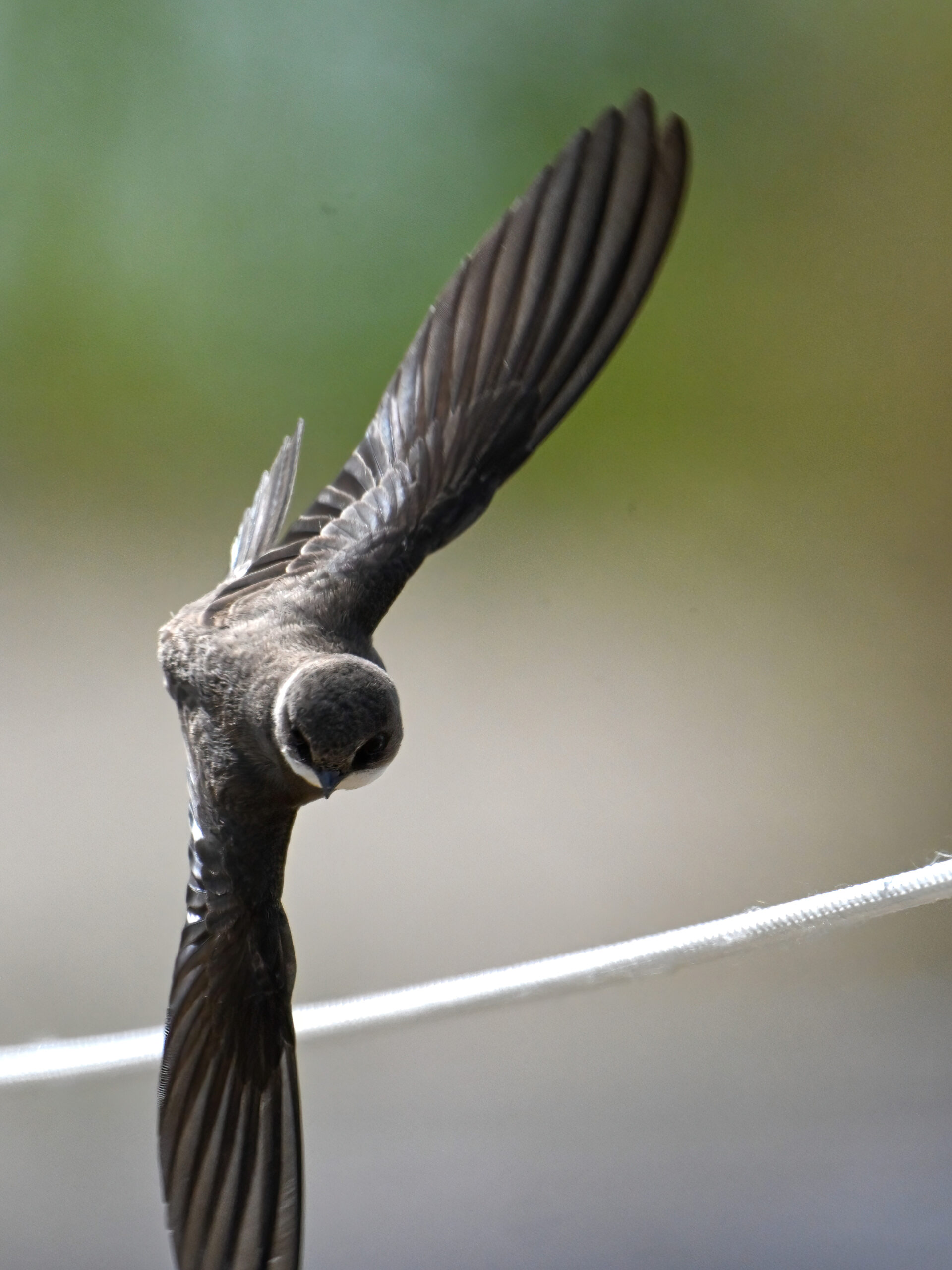
As always, since sensibilities vary even in the context of ‘G-rated’ nature content, ‘NSFW‘ = snakes, ticks, bird-on-fish violence (or blood generally), & certain avian copulation behavior. Here, it’s the latter (beautiful Bank Swallows) x lovely Barn Swallows, along the Gull Point ‘rope trail.’
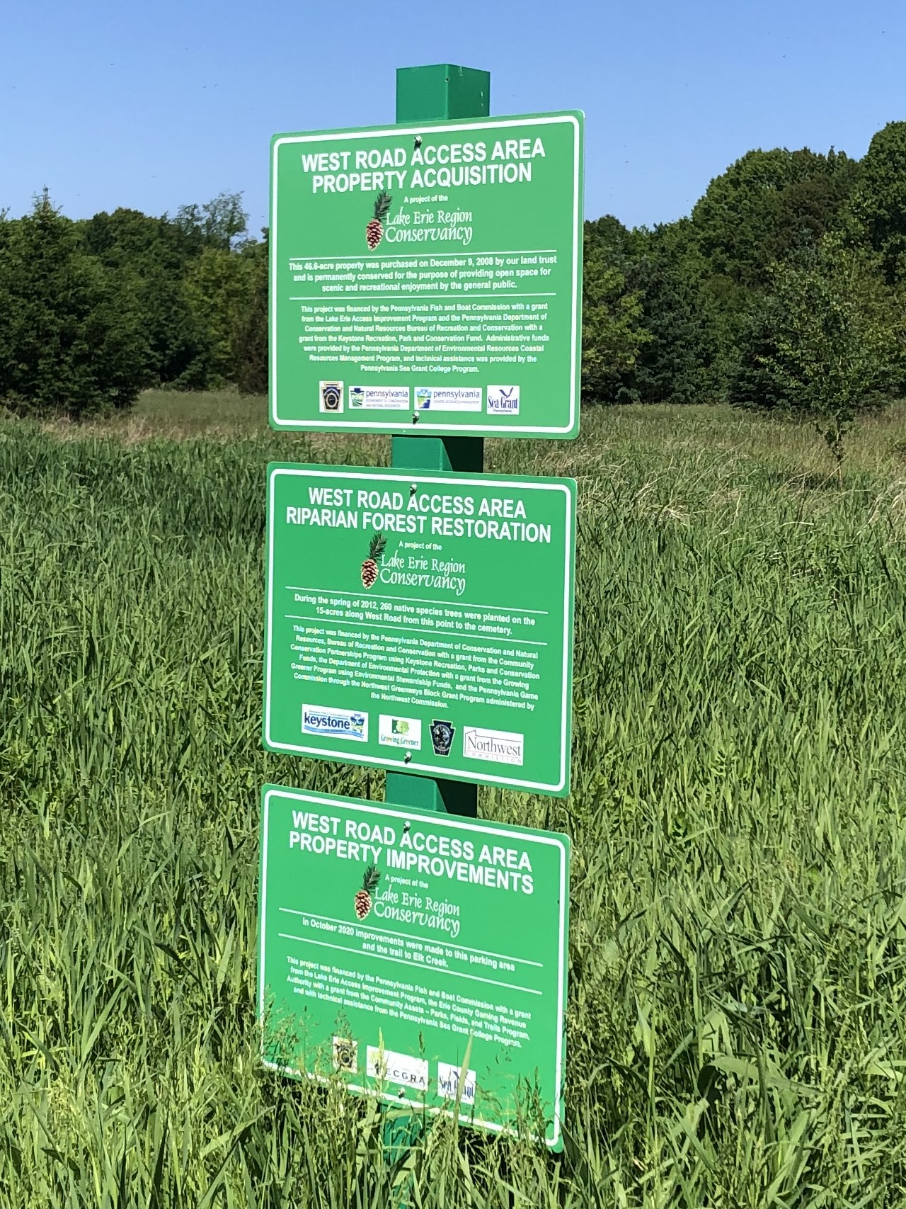
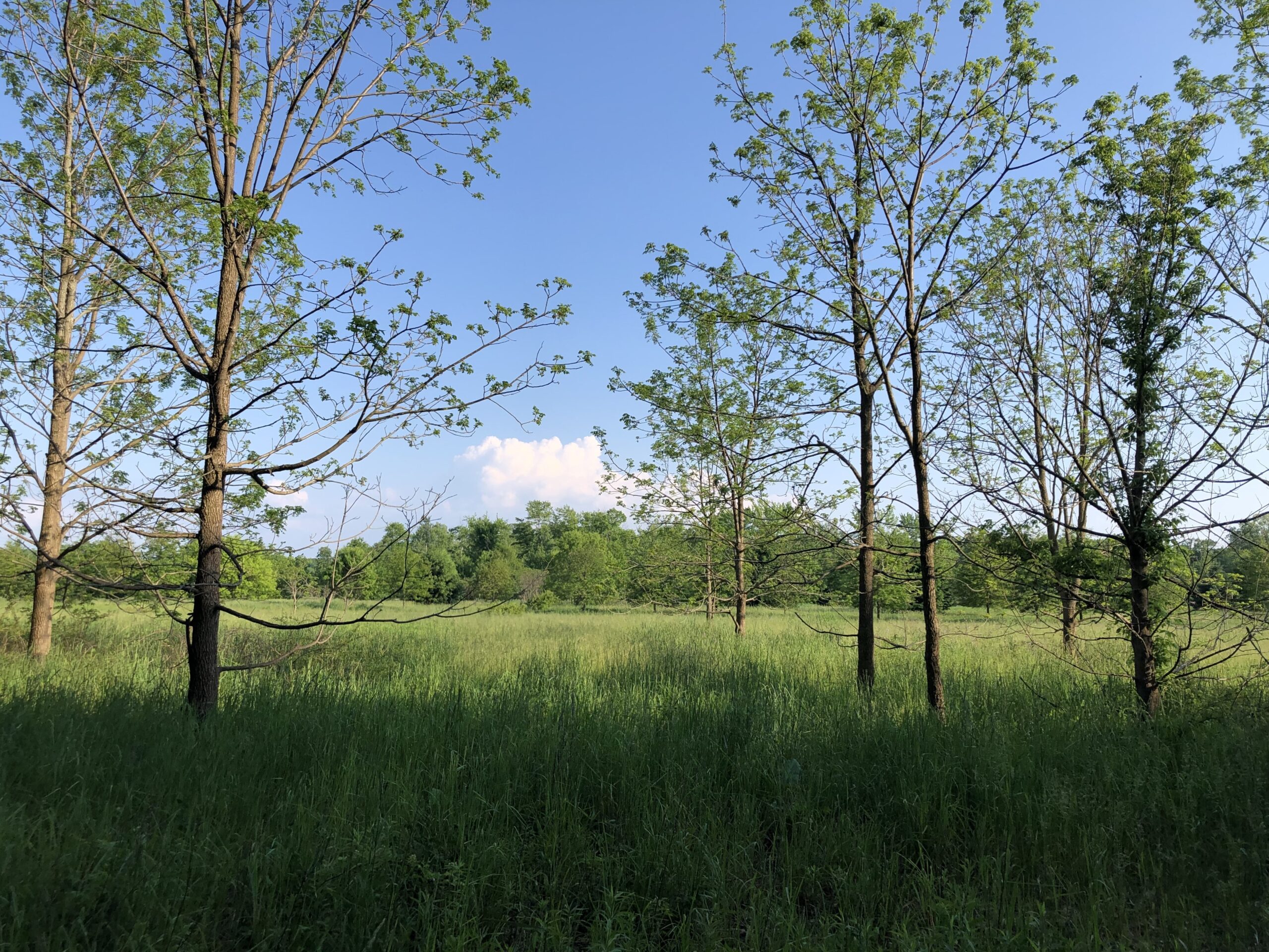
Part 1 of a special report from a great, under-the-radar “nature spot” in Erie County, PA: West Road Access Area along upper Elk Creek in McKean Twp. Close to the junction of Interstates 90 and 79 on the southwest side, this is 18+ hectares of old farmland bordering the south side of Elk Creek, one of the important riparian corridors of the Erie-area watershed.
West Road Access signage
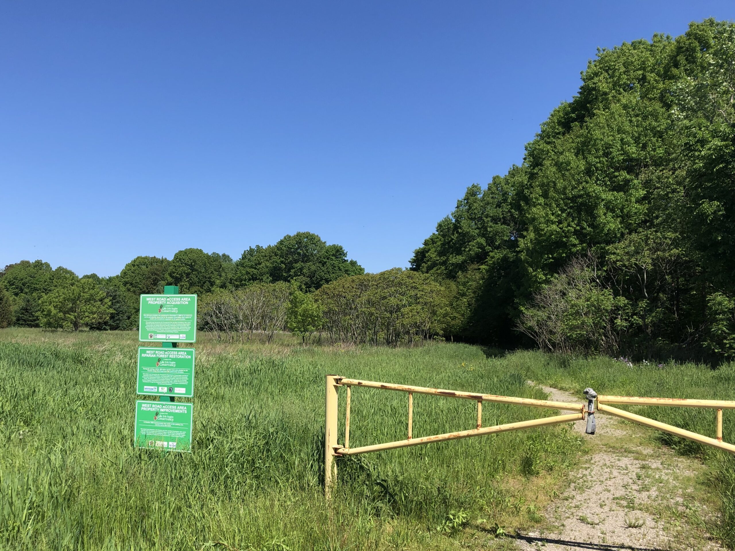
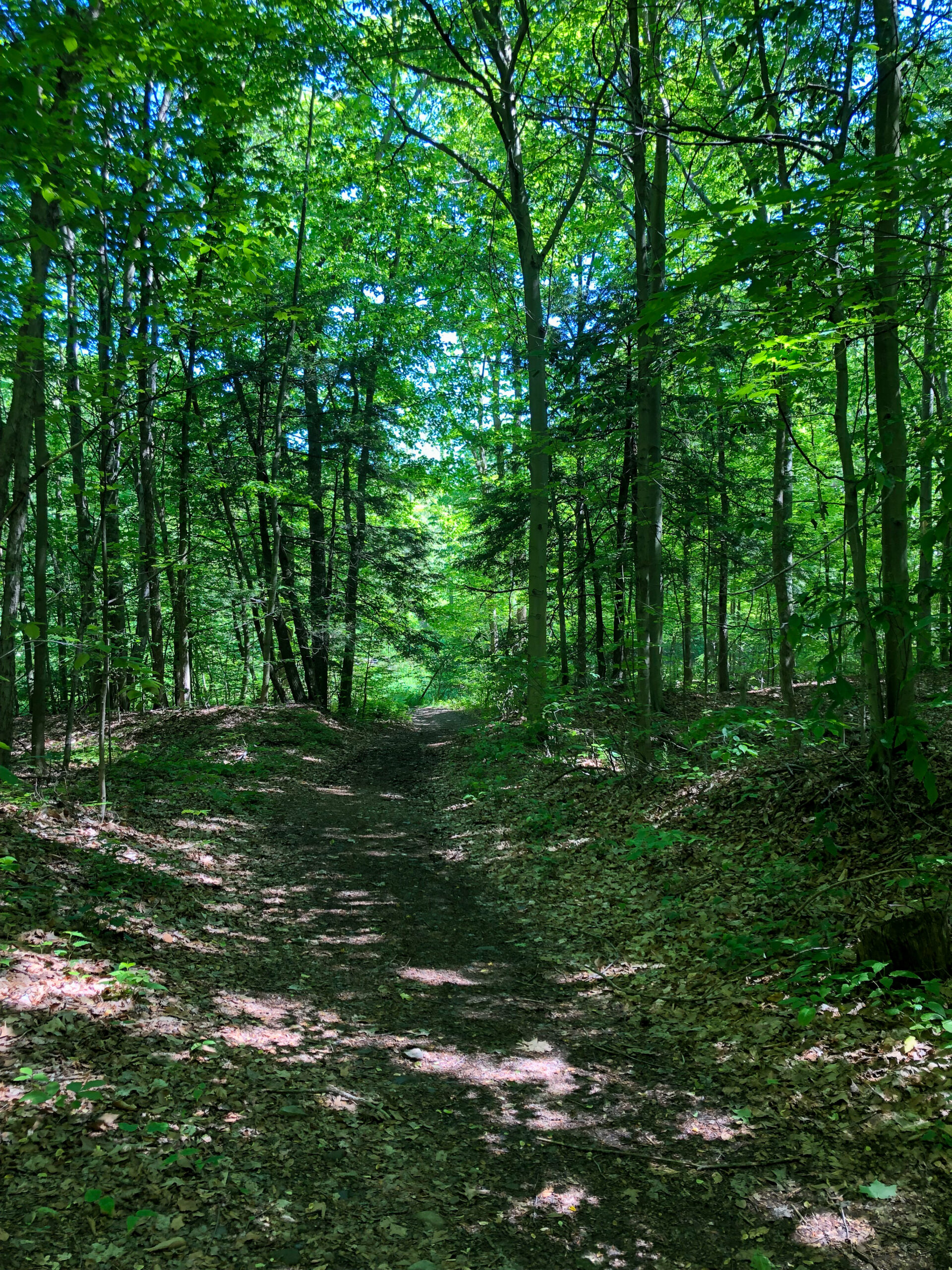
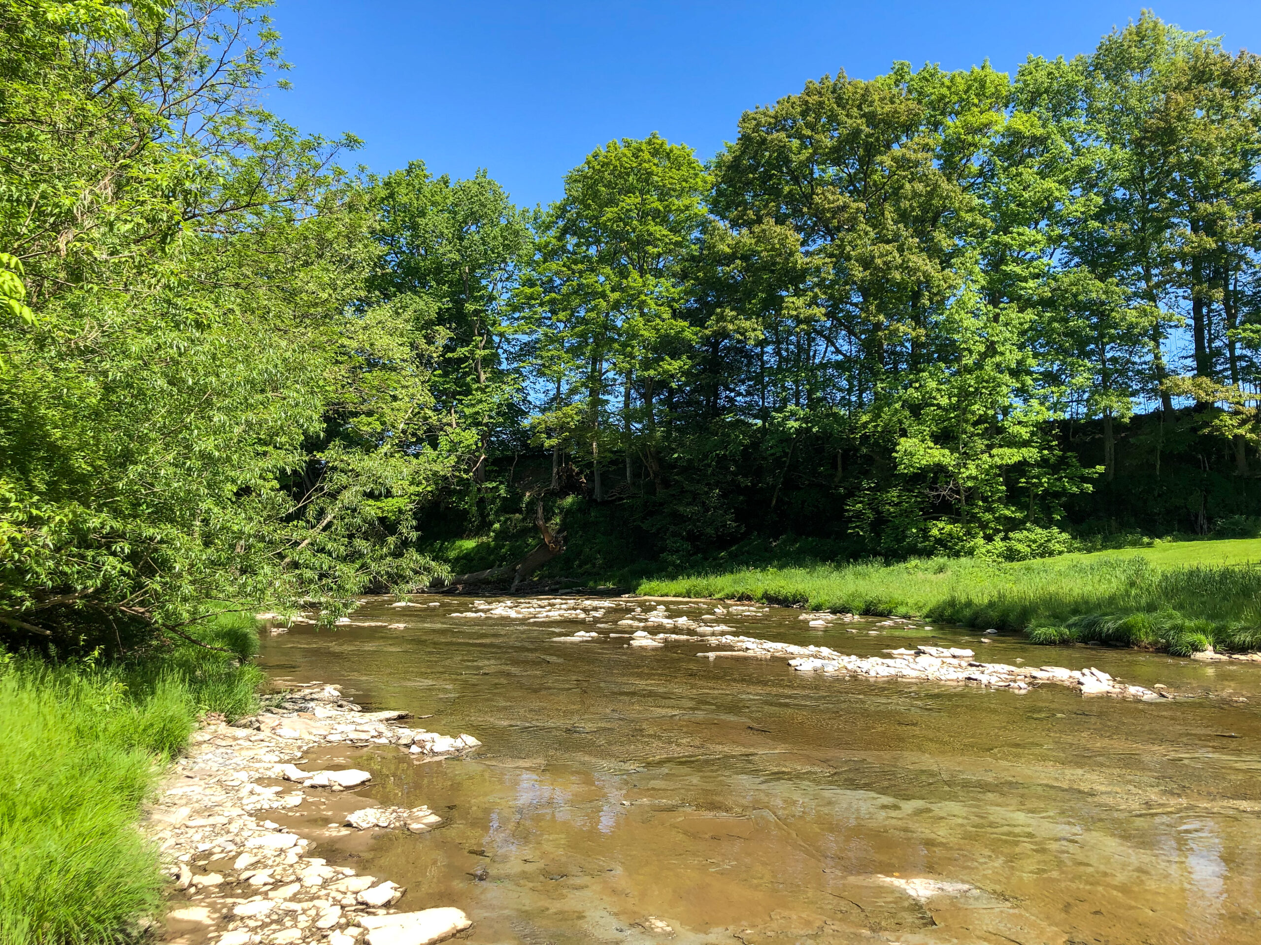
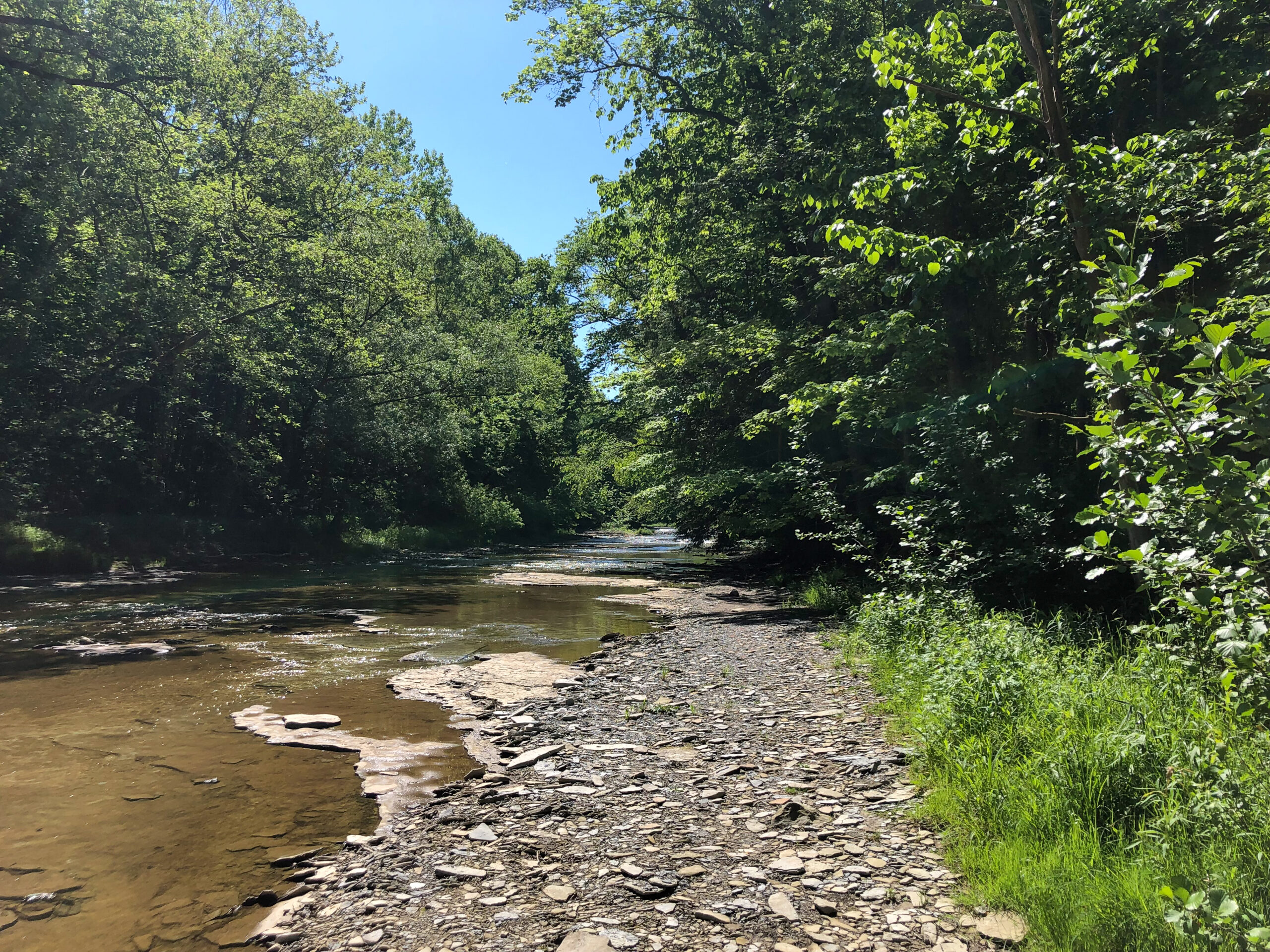
The shot below shows the main access + main gravel trail leading along the tree line and eventually down to Elk Creek. (The creek – really a small river – is to the right of the mature trees on the right-hand side of this shot, down a steep embankment.)
West Road Access, main trail
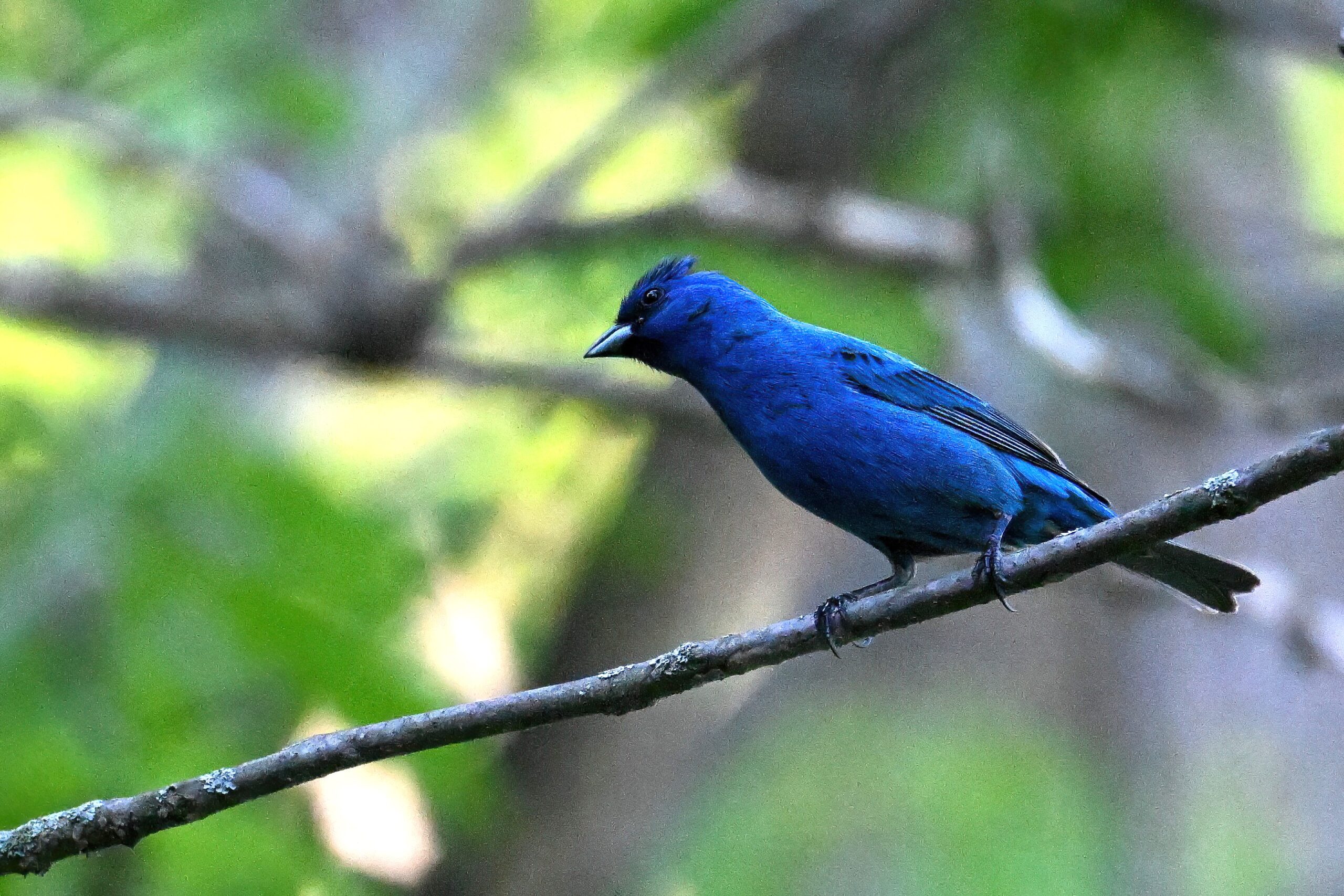
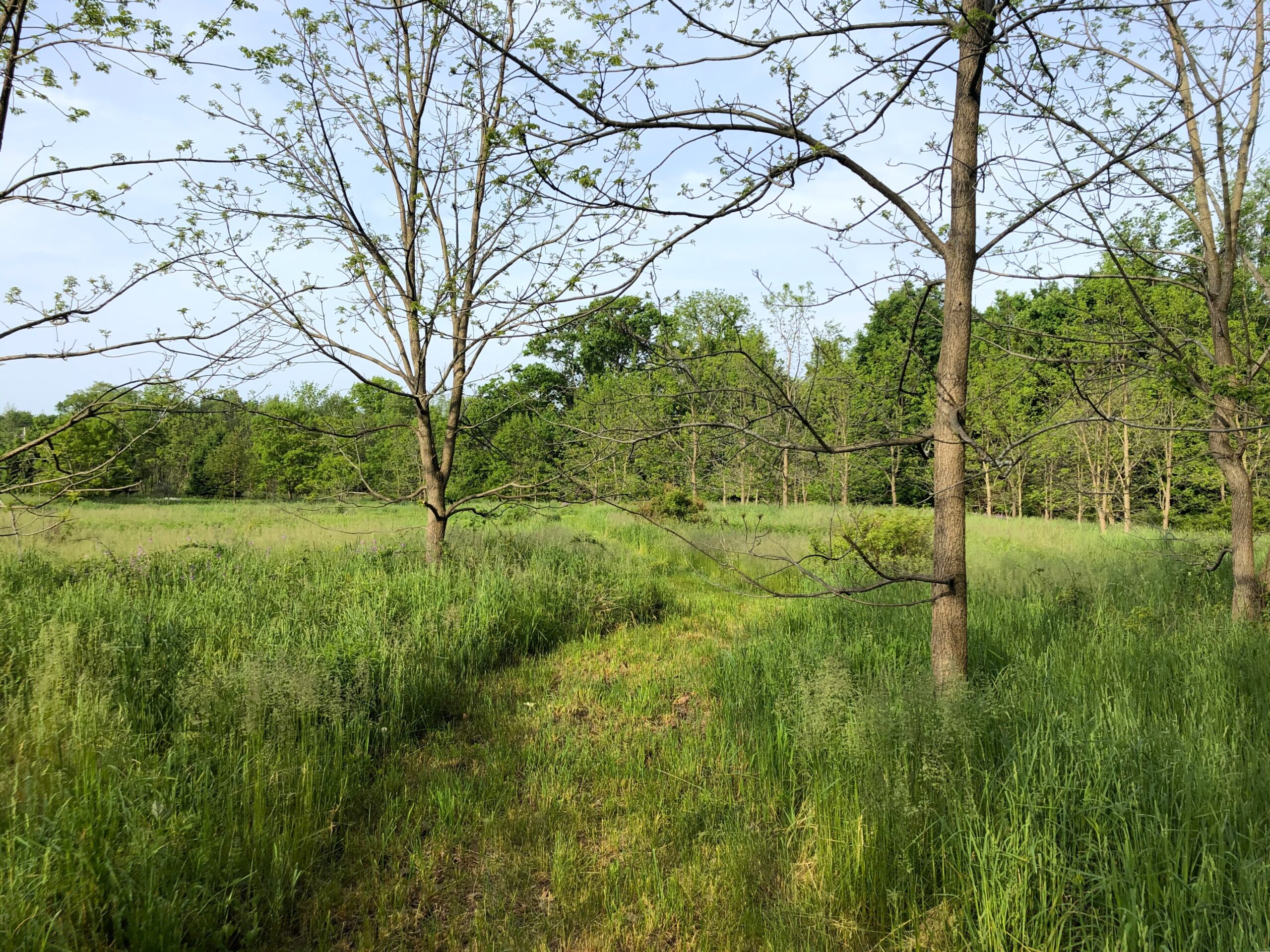
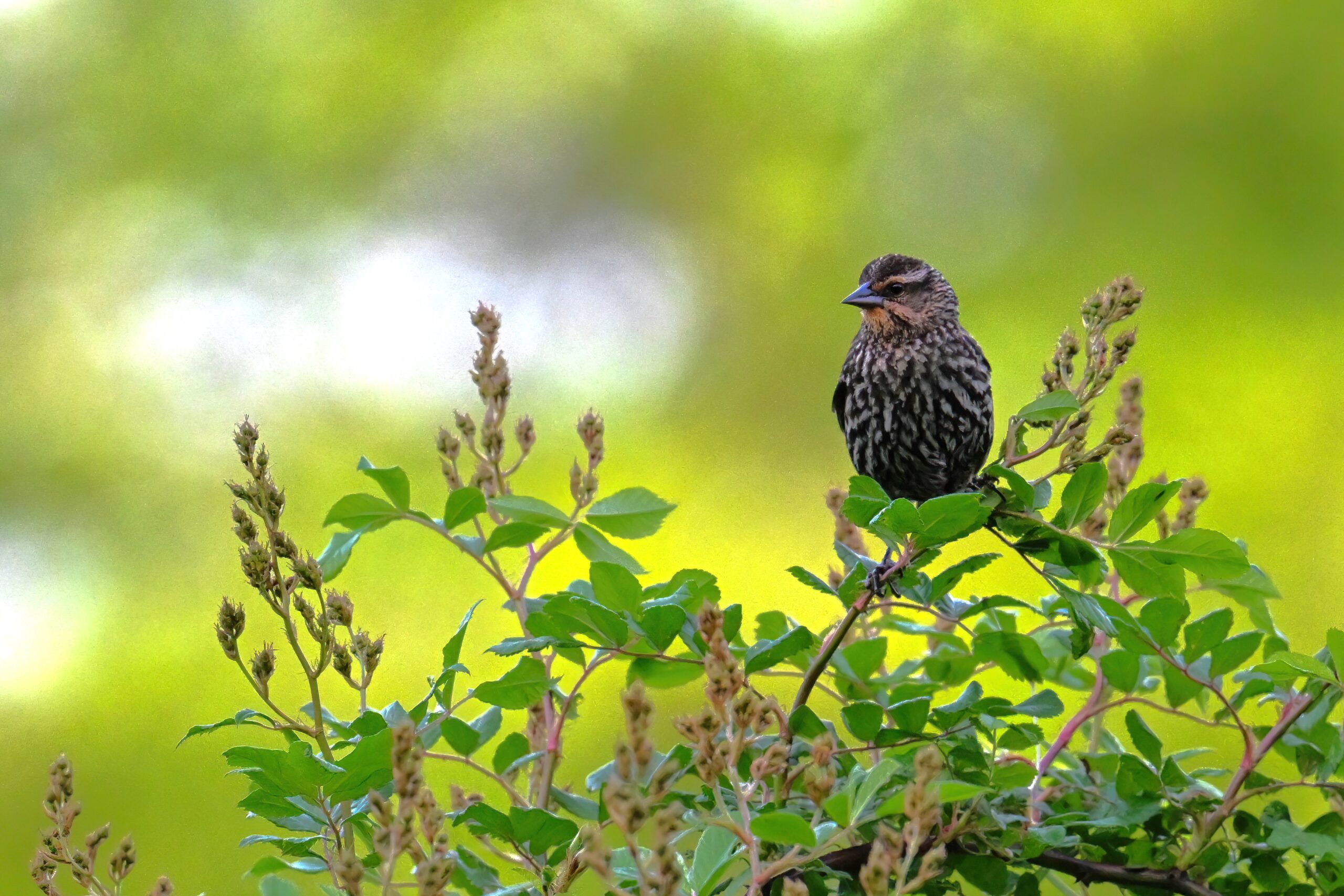
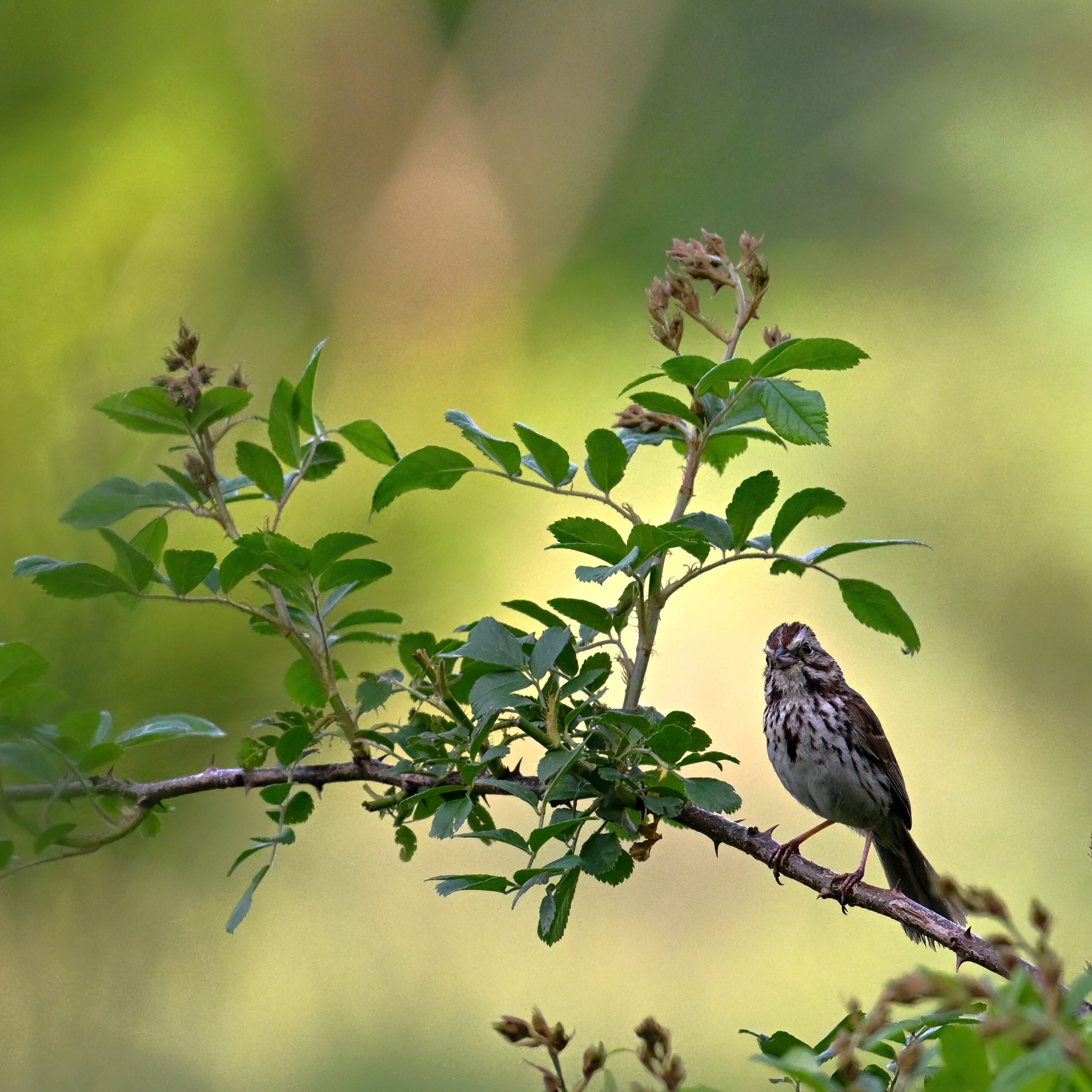
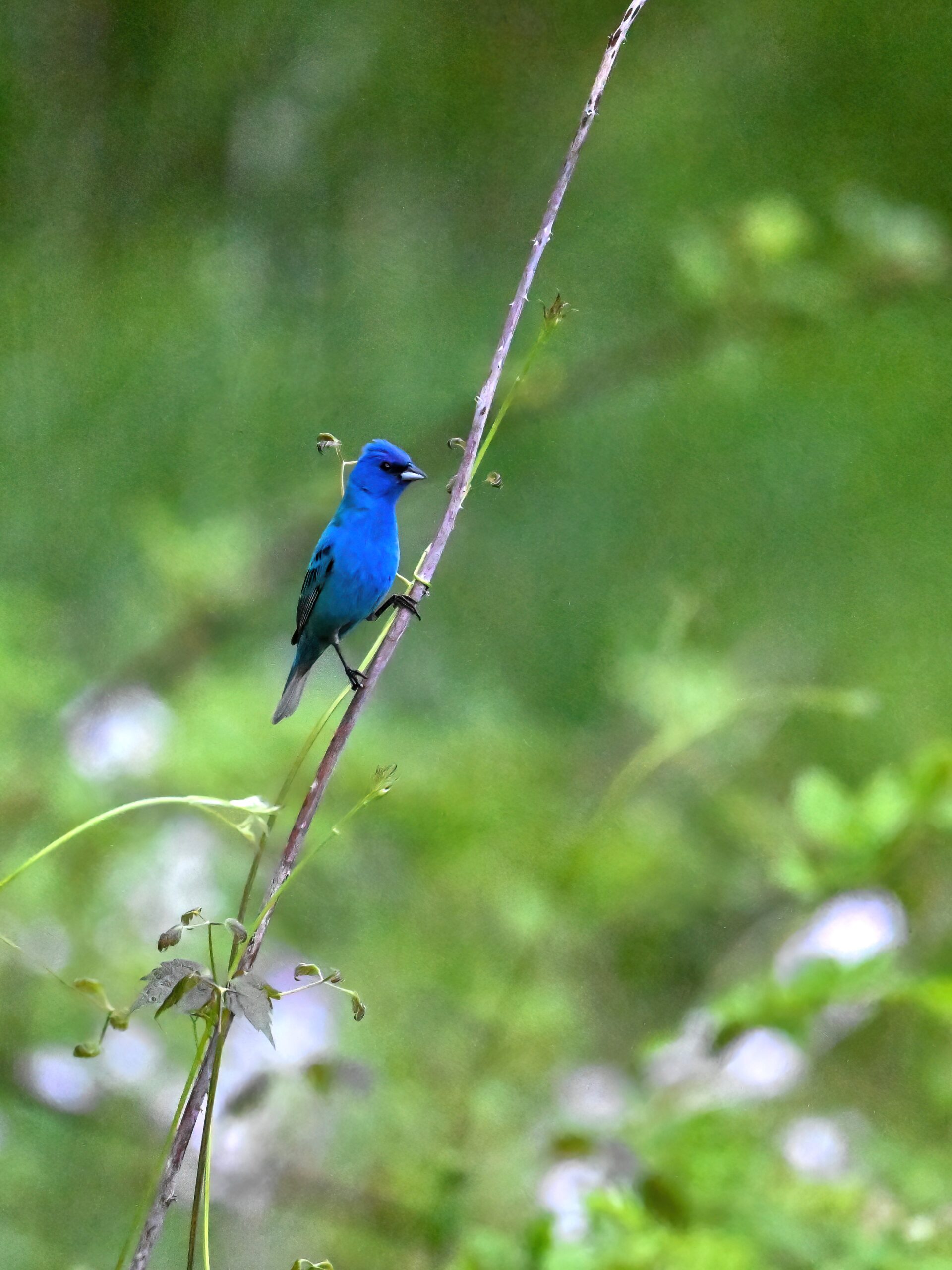
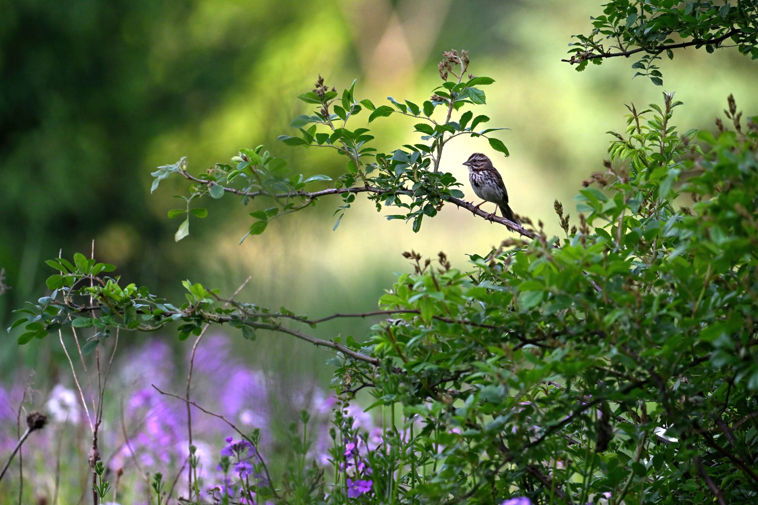
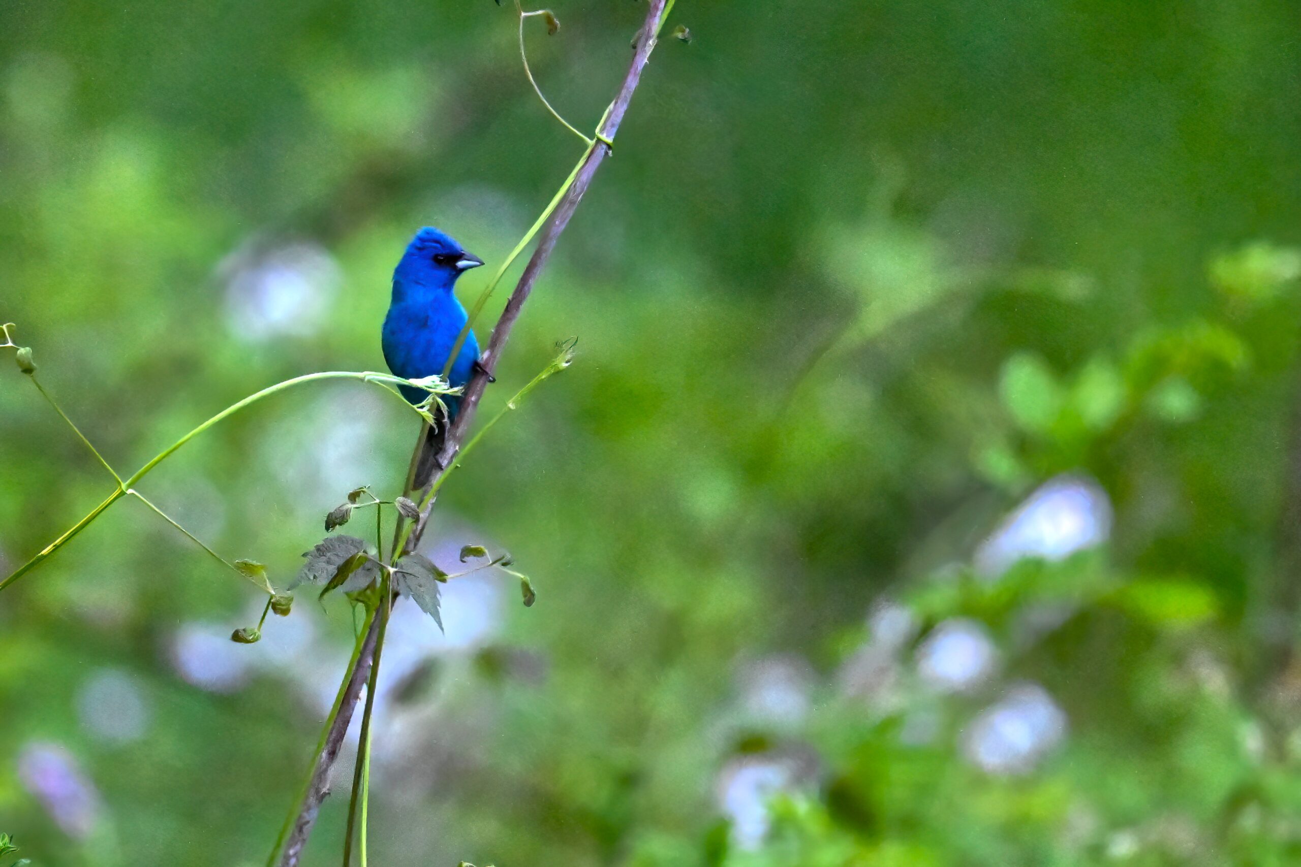
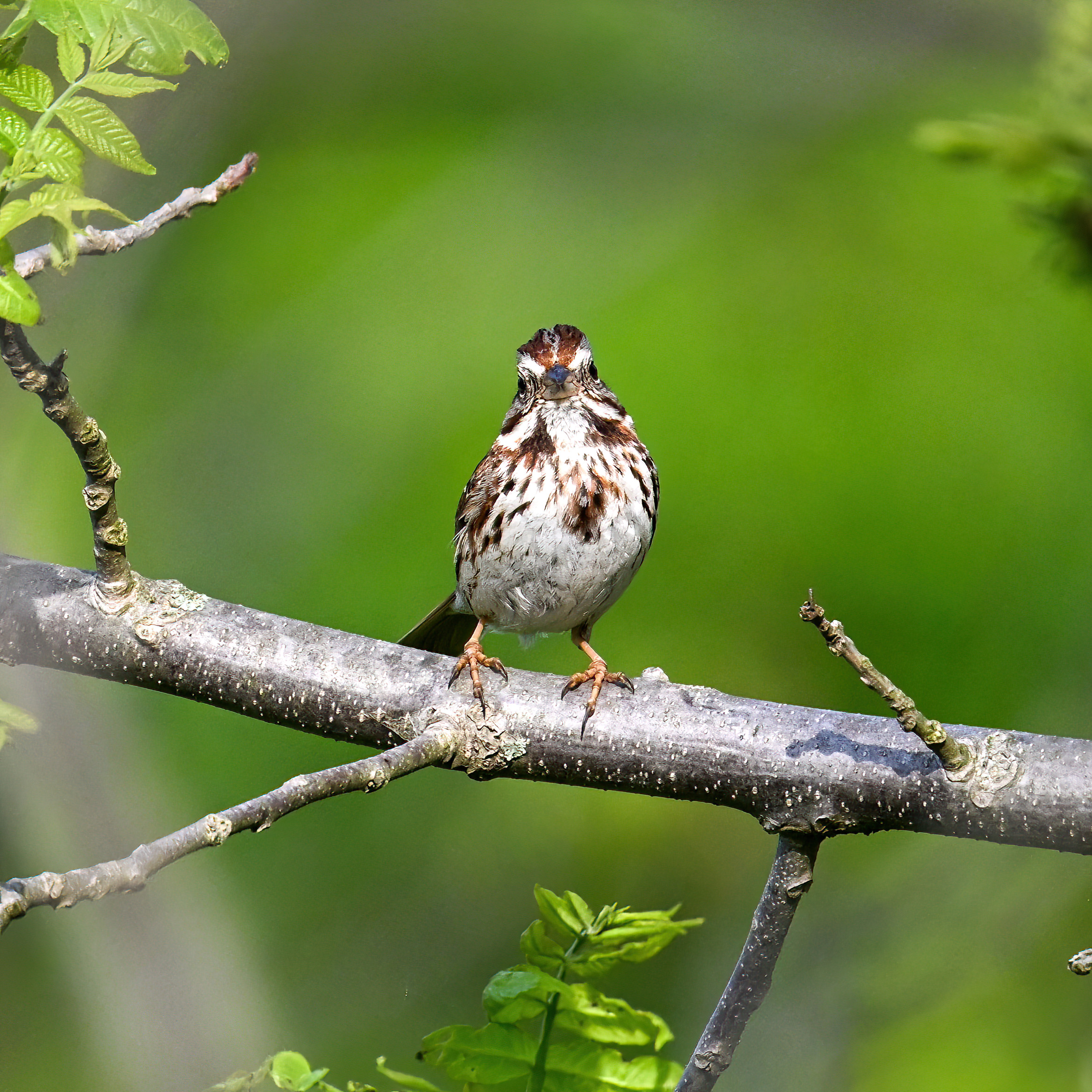
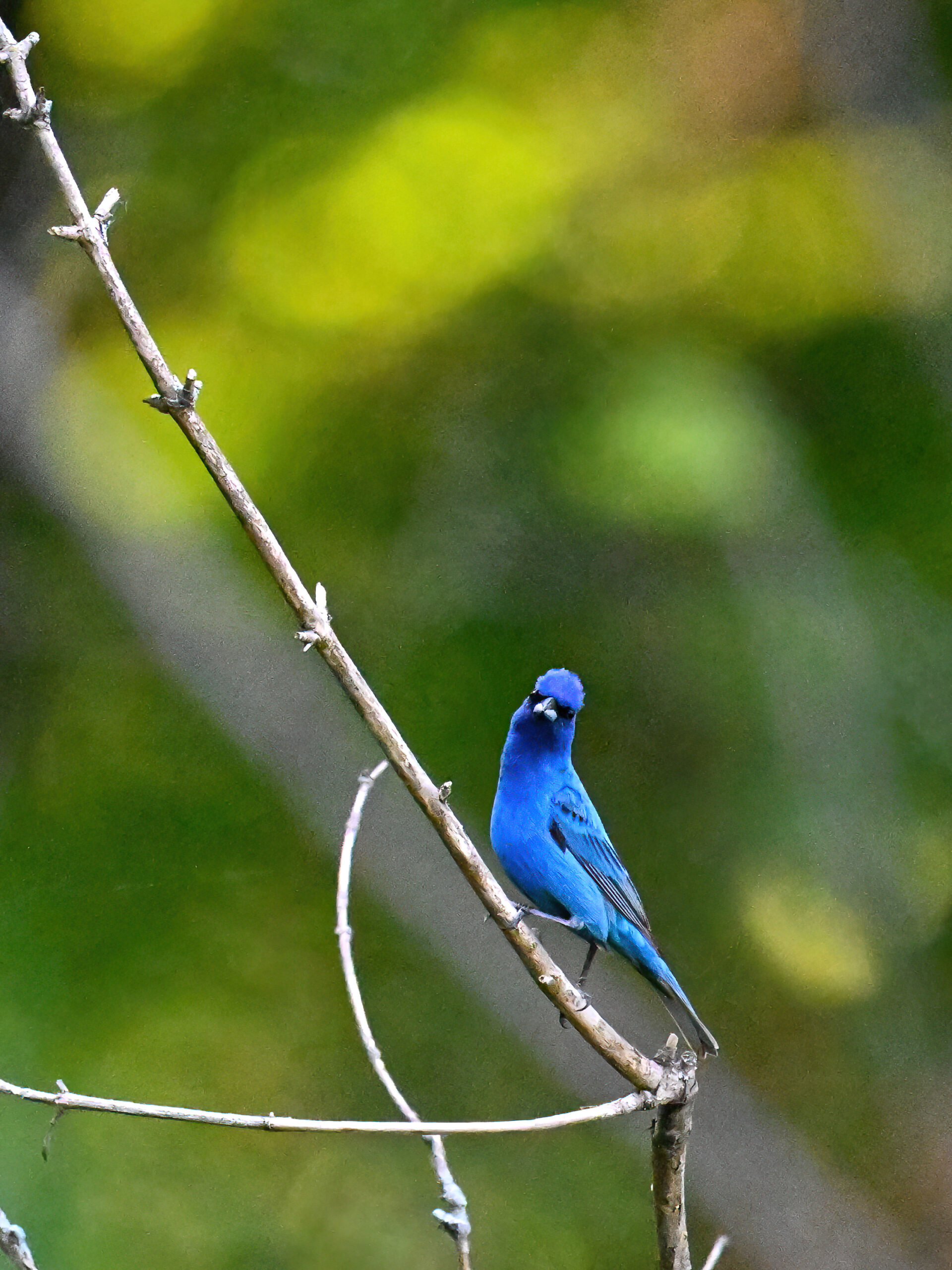
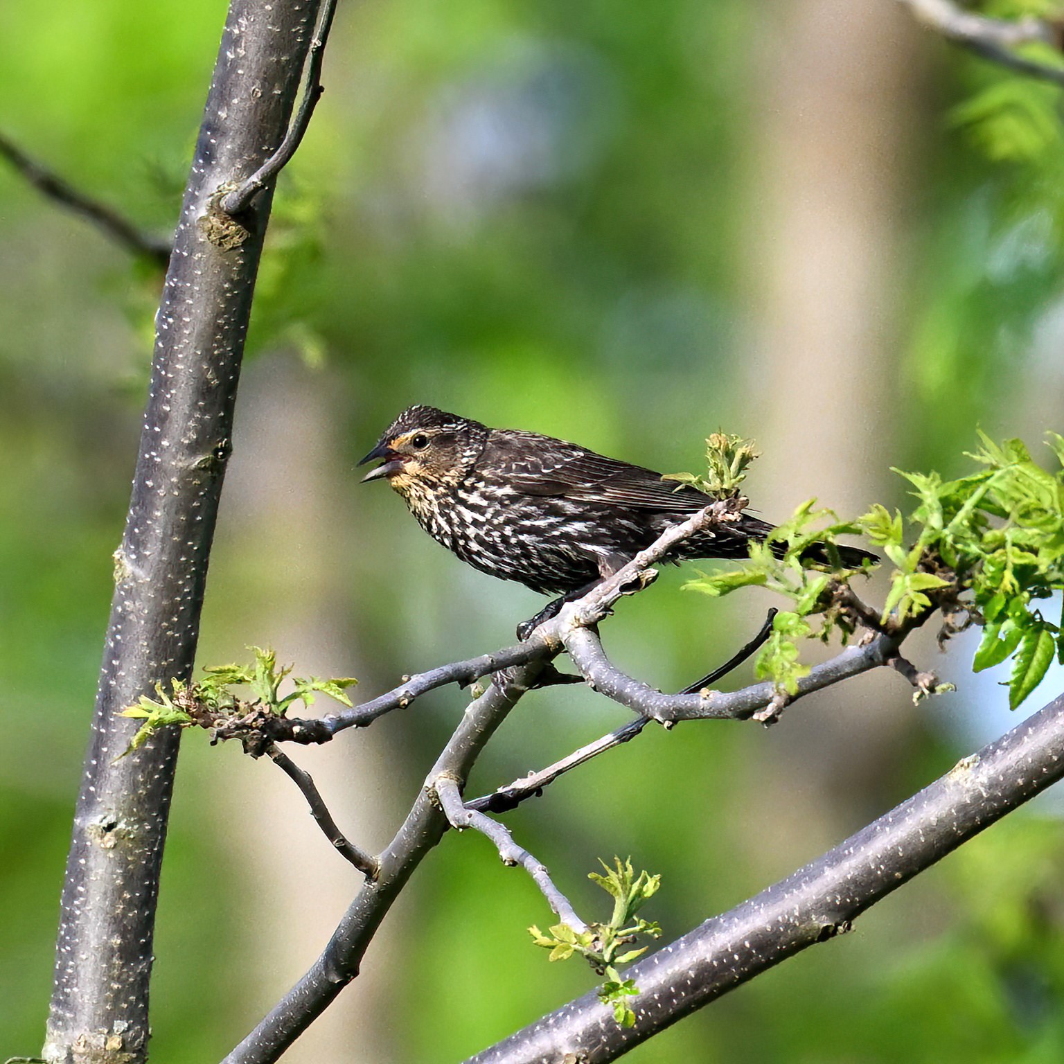
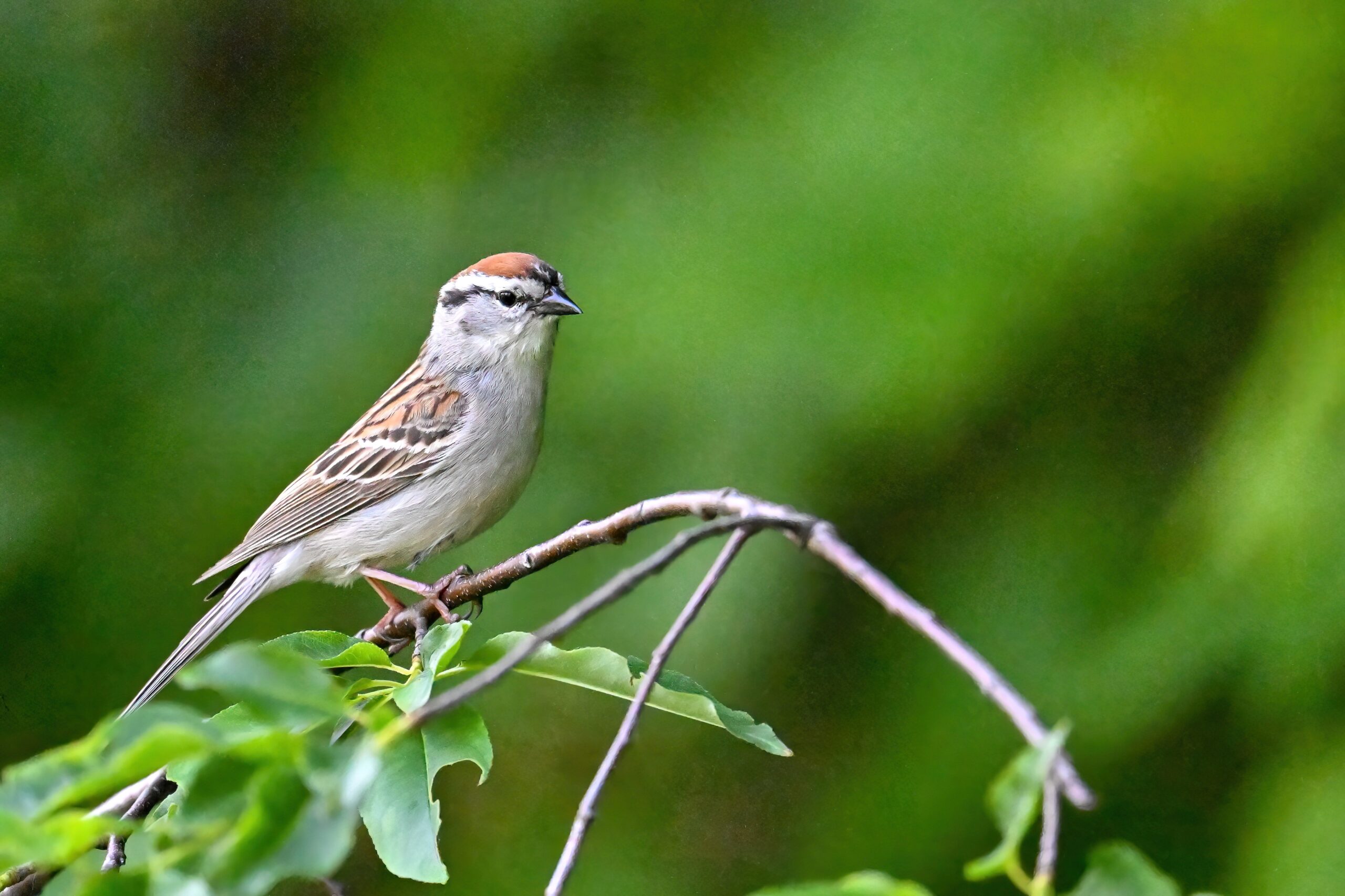
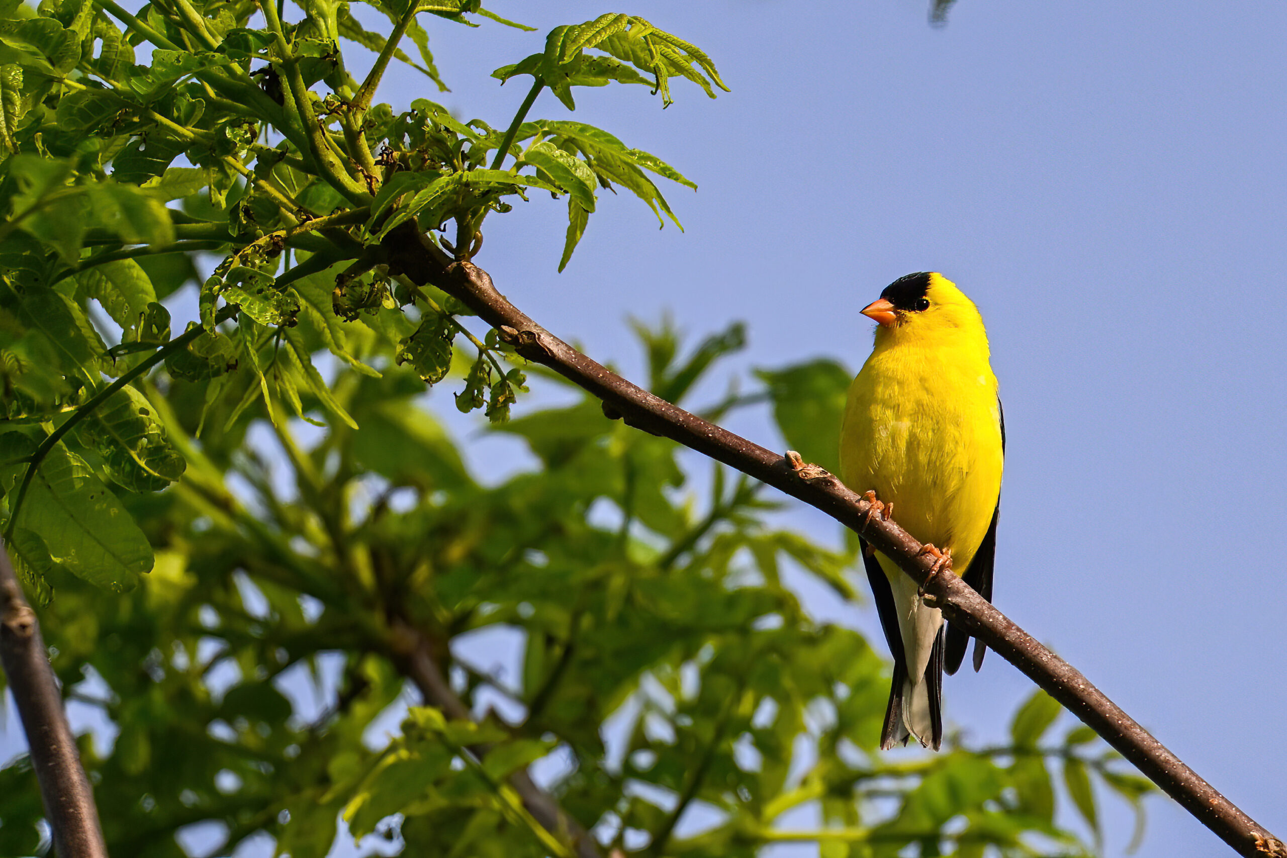
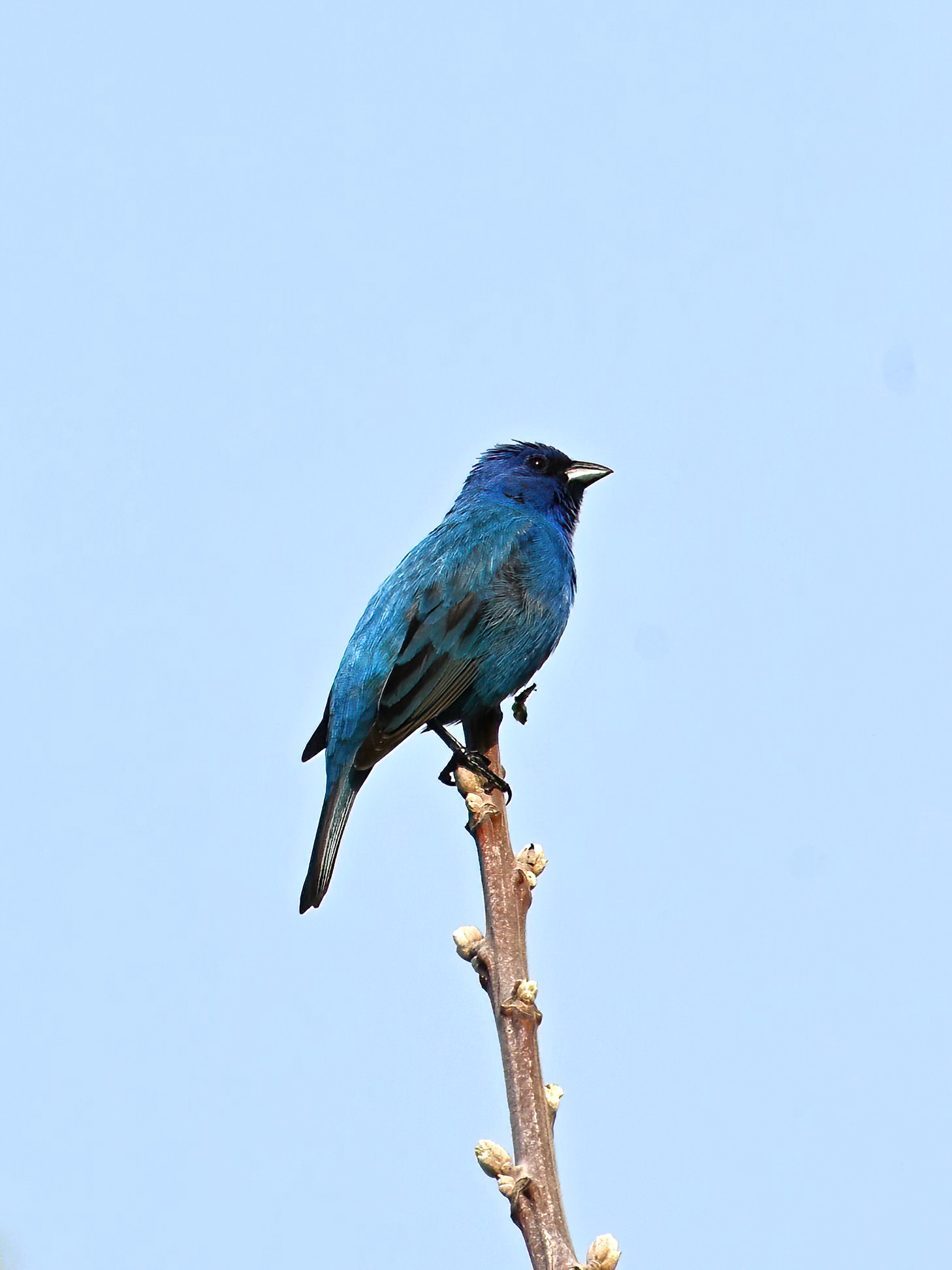
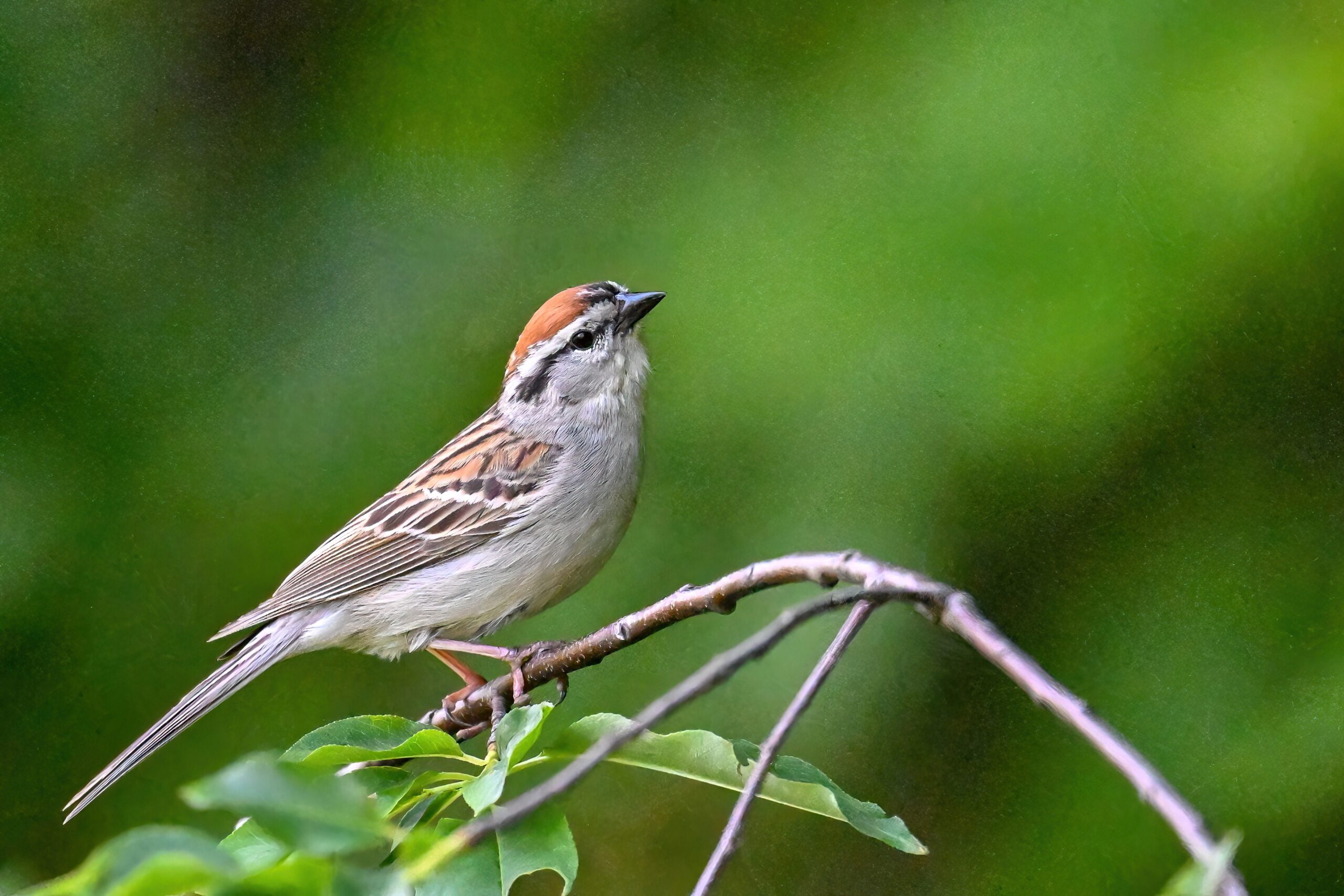
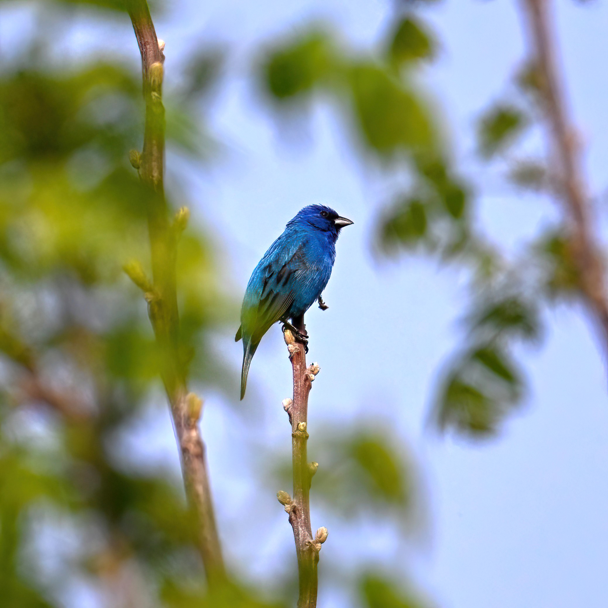
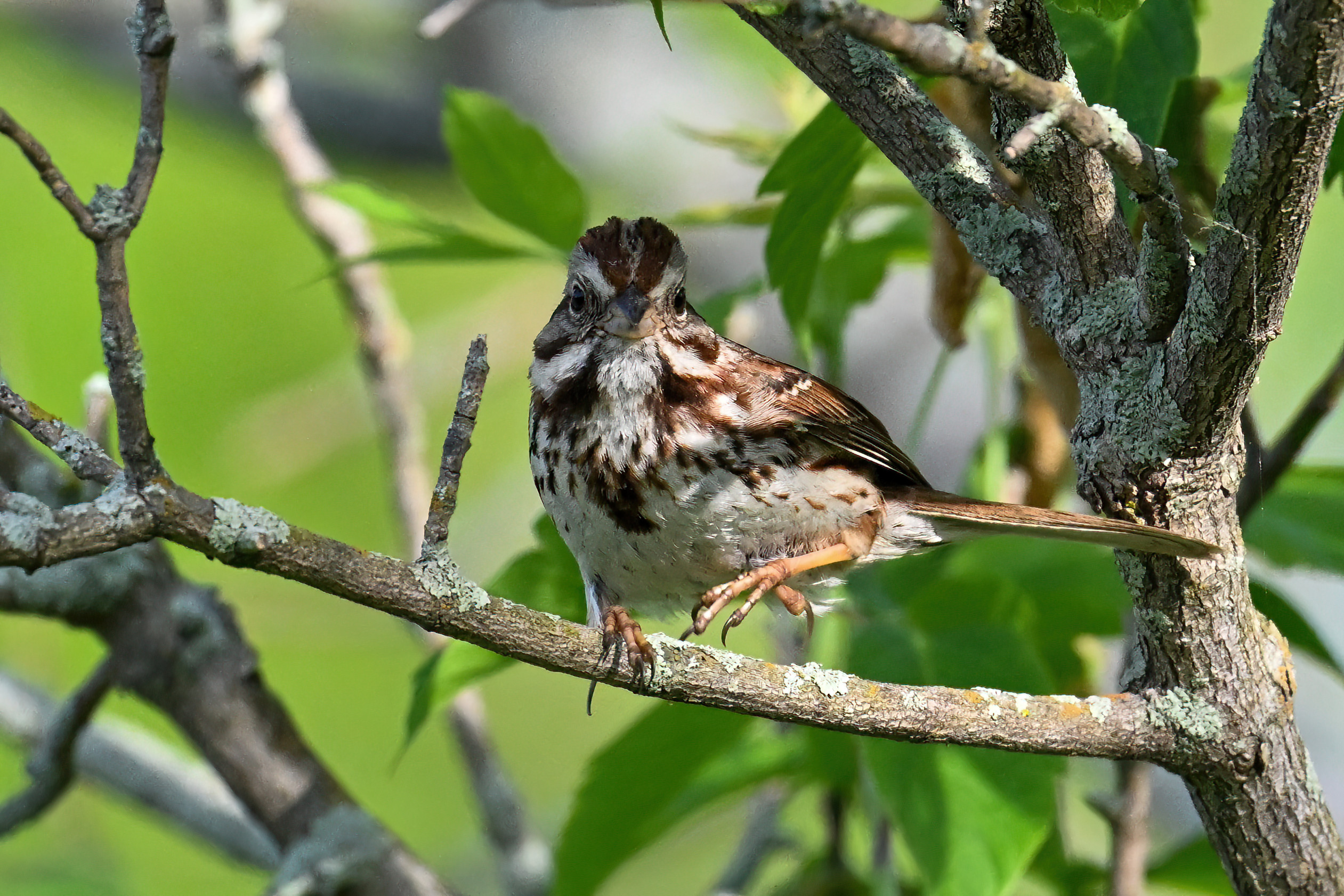
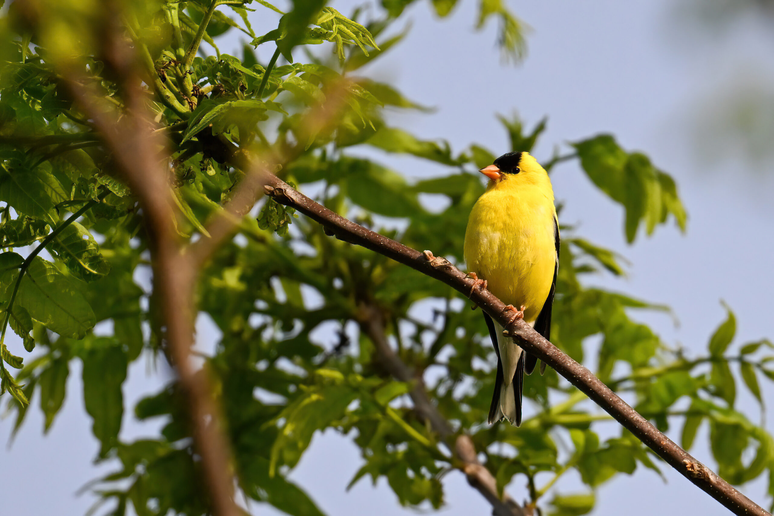
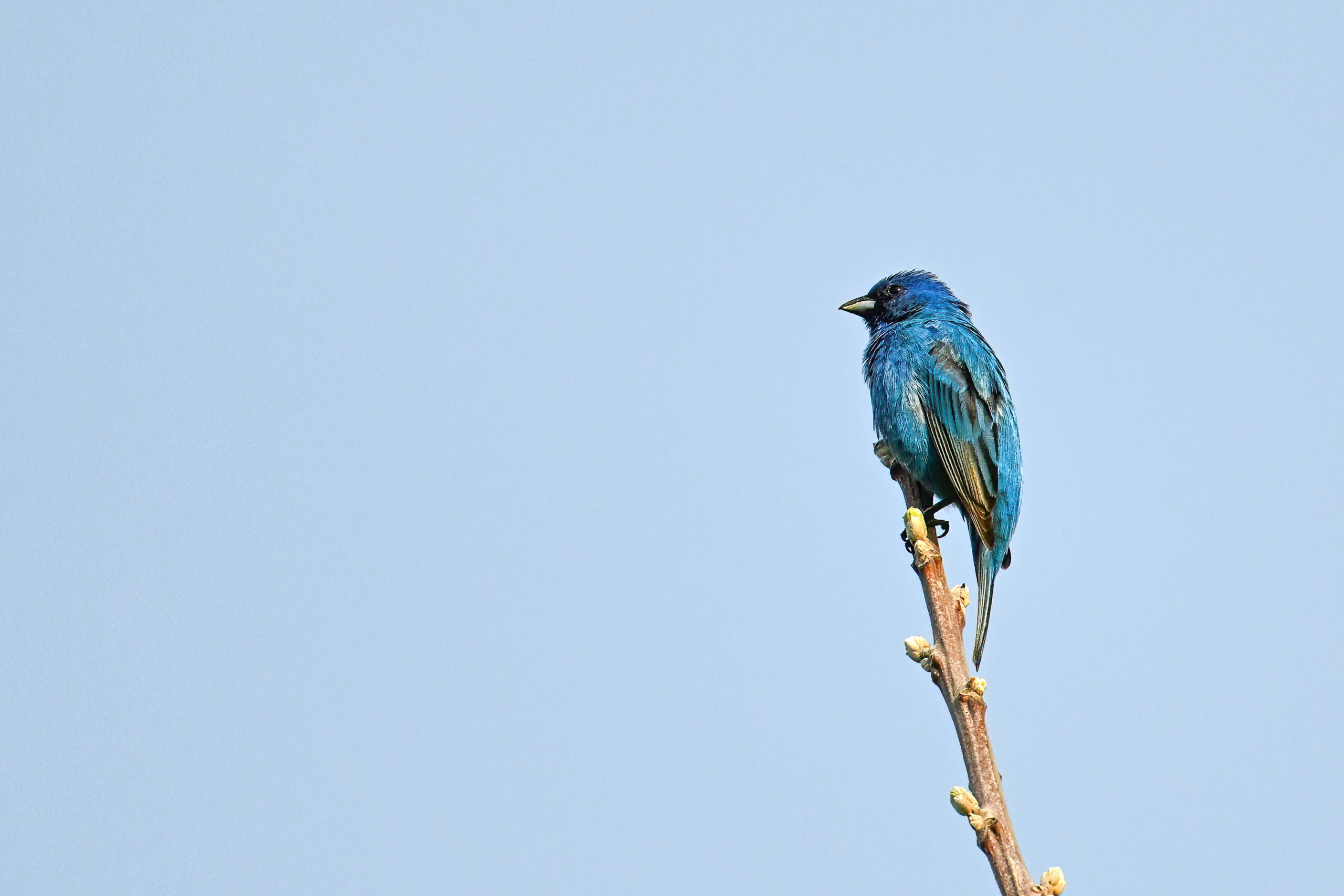
Mixed open field, brush, & scattered young trees, bordered by a line of mature forest along Elk Creek – great for Common Yellowthroat, Song Sparrow, Red-winged Blackbird, & probably the most reliable spot around (seasonally) for amazing Indigo Bunting:
Indigo Bunting (m)Field pathwayRed-winged BlackbirdPath down to Elk CreekSong SparrowElk Creek, view downstreamChipping SparrowAmerican GoldfinchElk Creek, view upstreamField view south
Directions: Take I79 to the McKean, PA exit. Turn left or right westwards onto West Road. Drive 2 kilometers (1.3 miles) to the parking lot on the right.
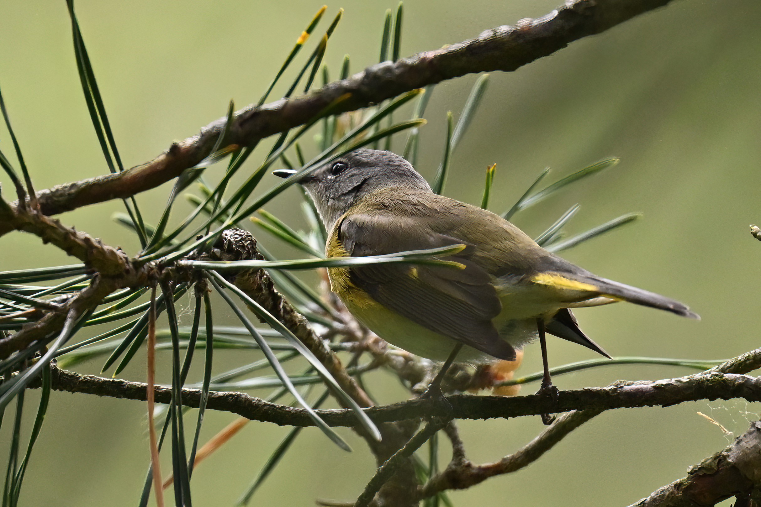
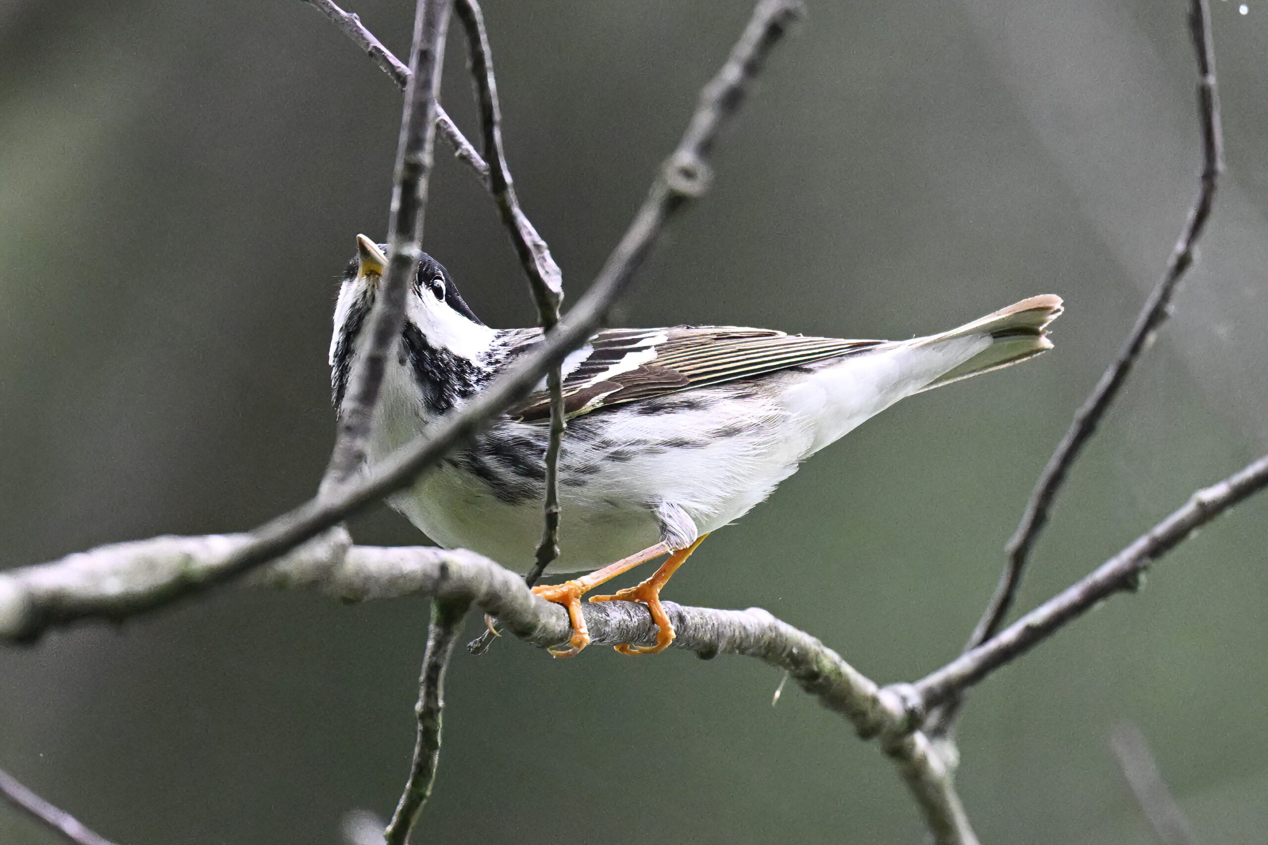
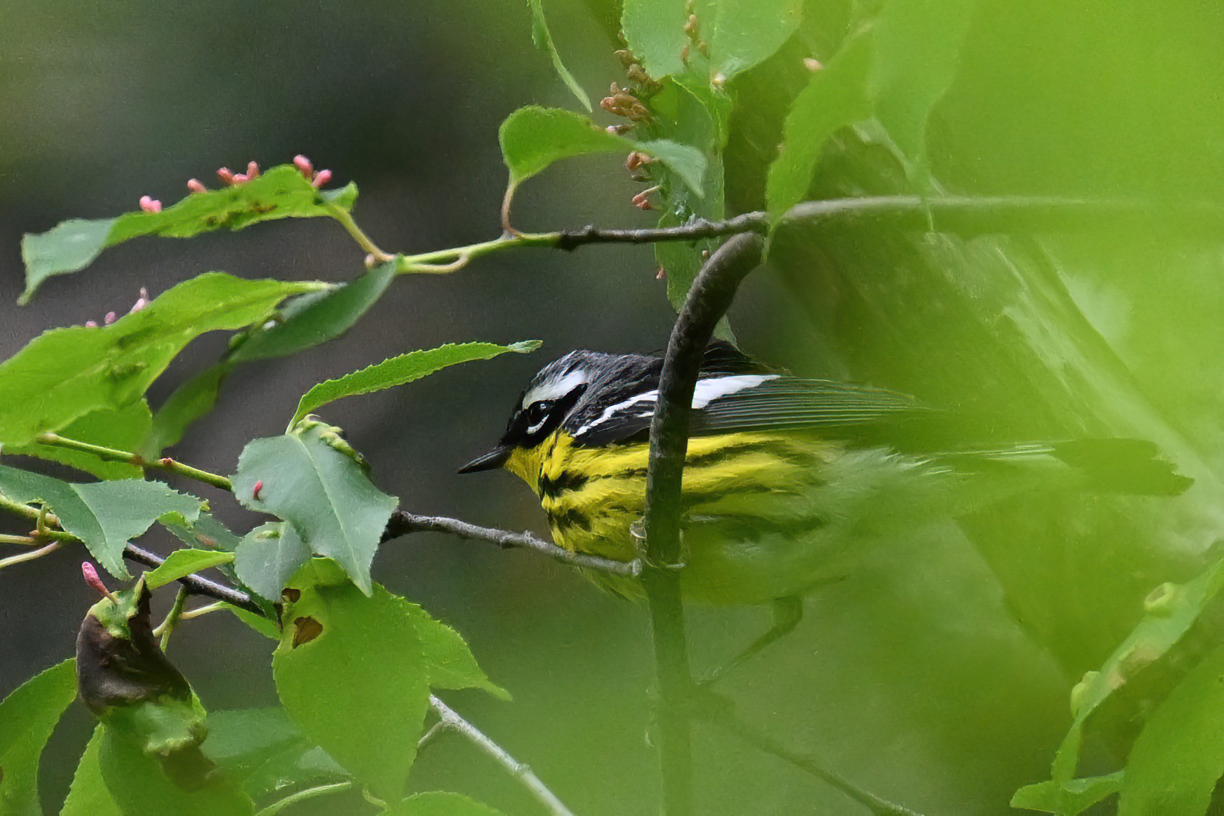
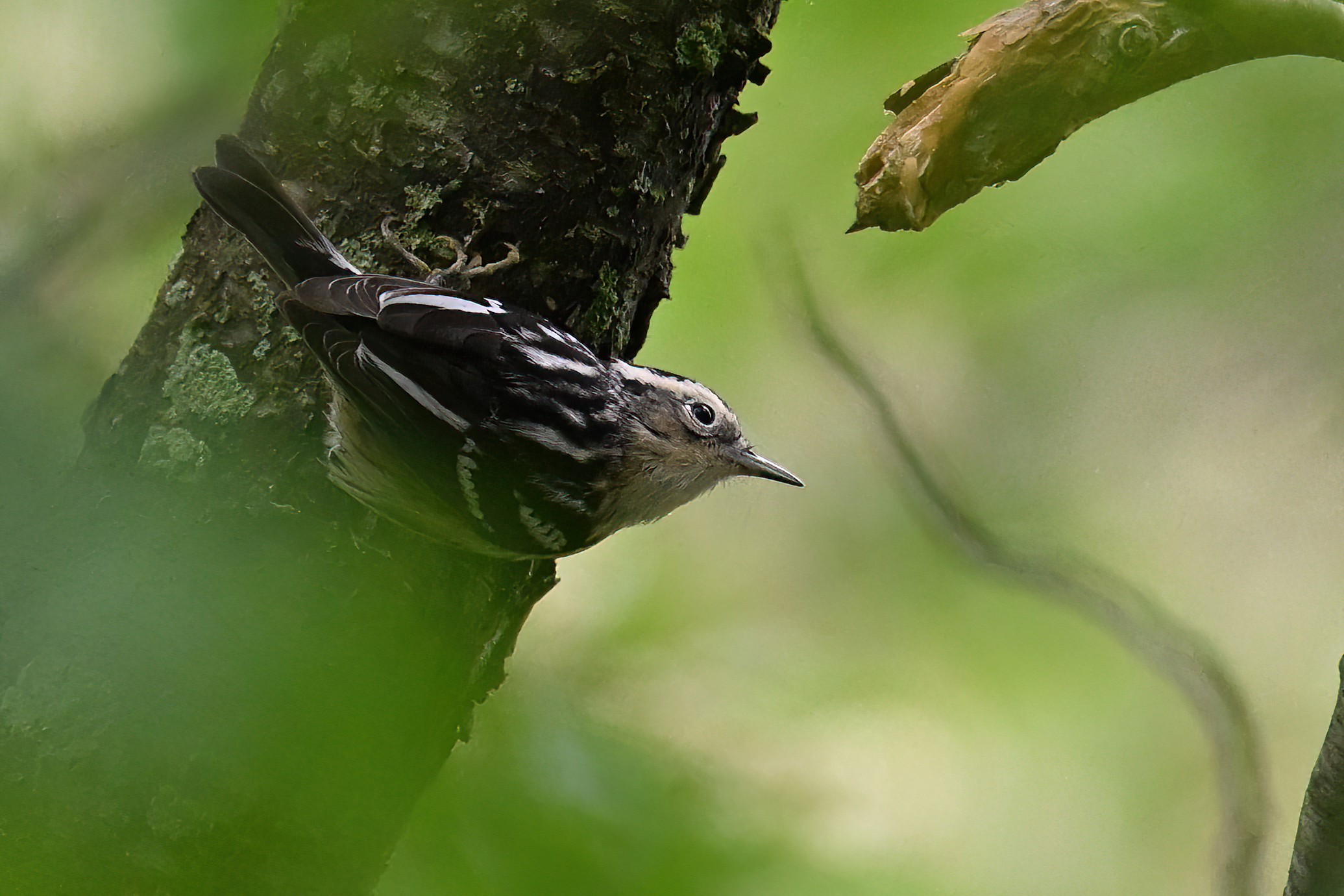
No post yesterday due to site maintenance. Today, it’s back to the height of warbler migration at Presque Isle State Park with shots from on and near the Pine Tree Trail.
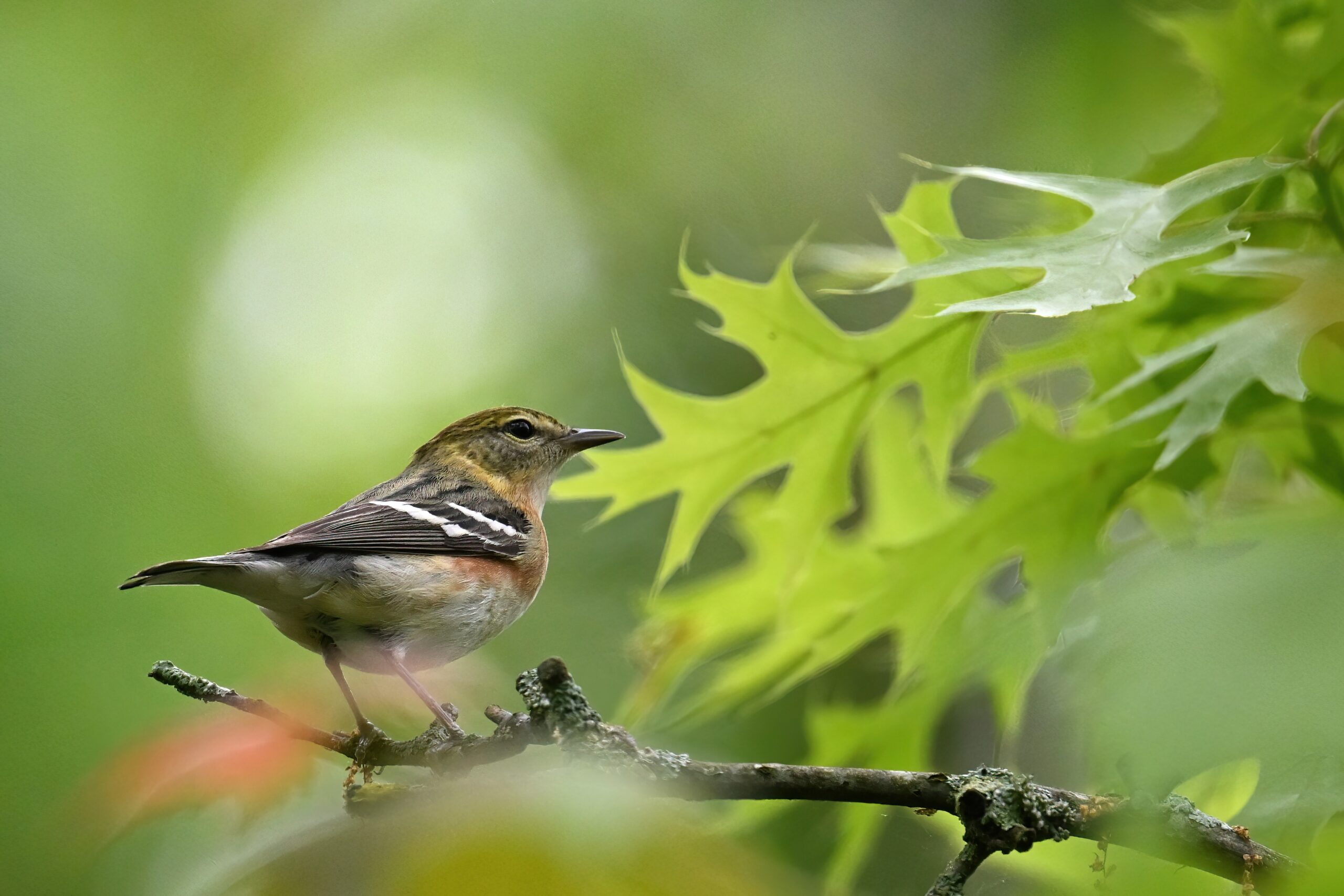
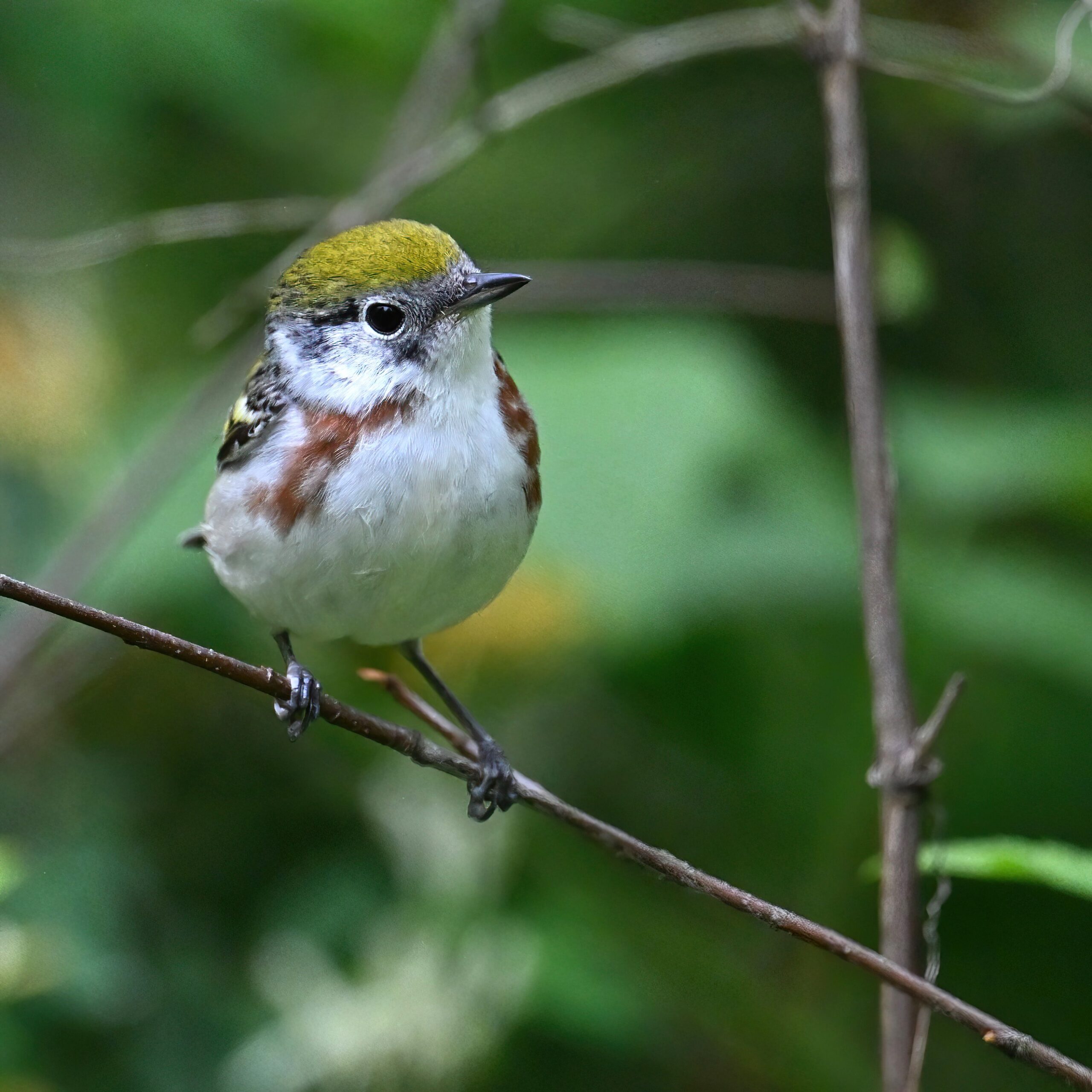
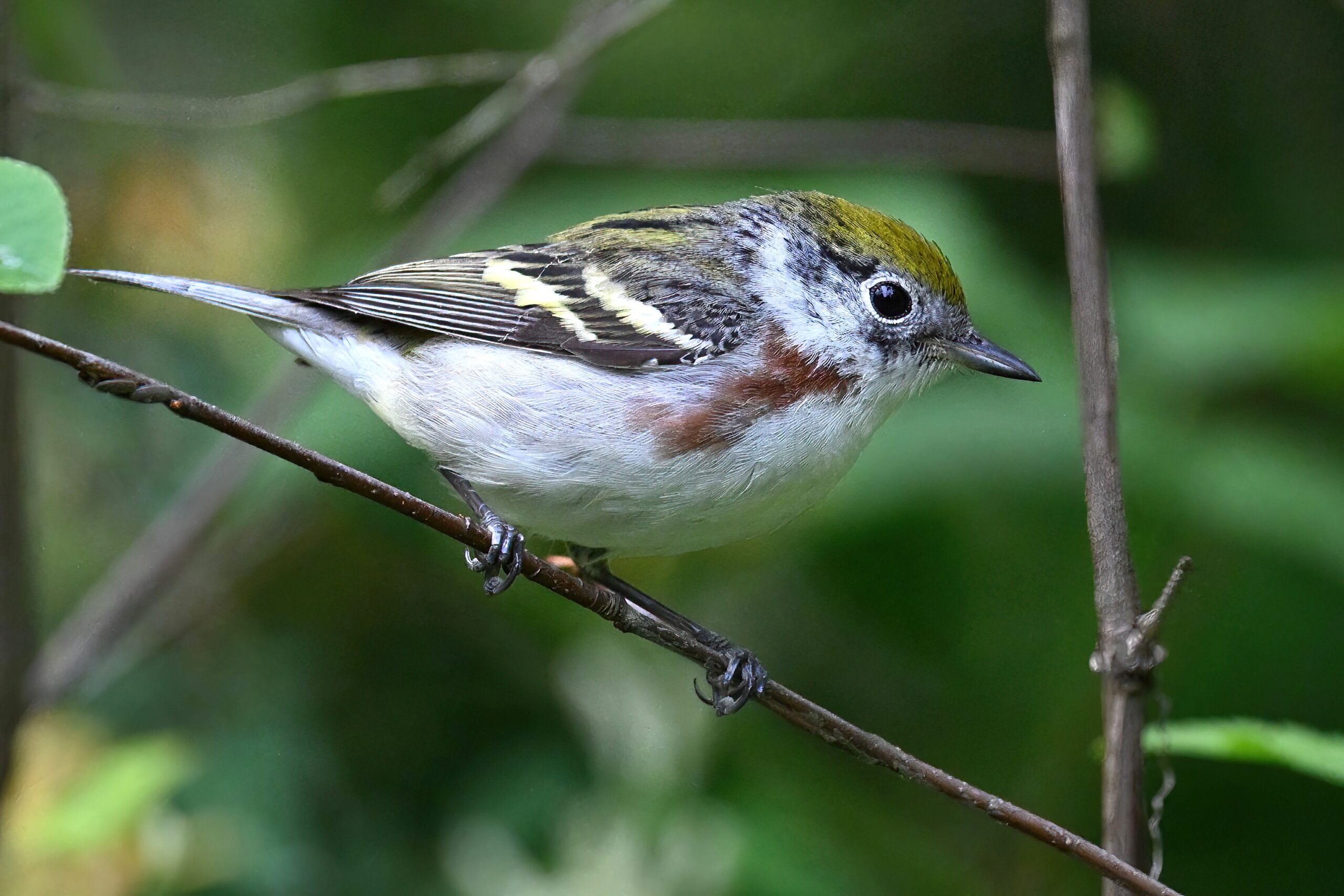
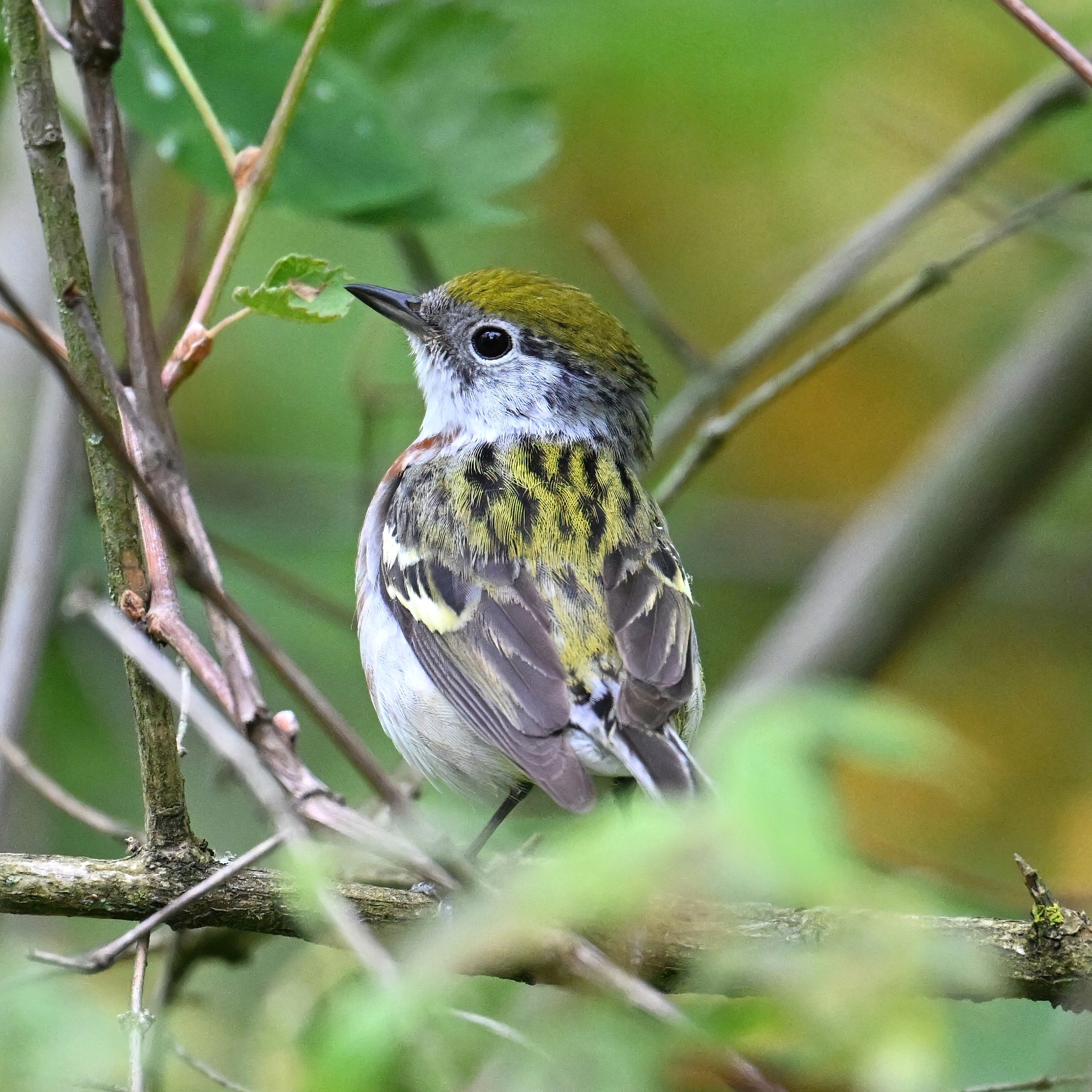
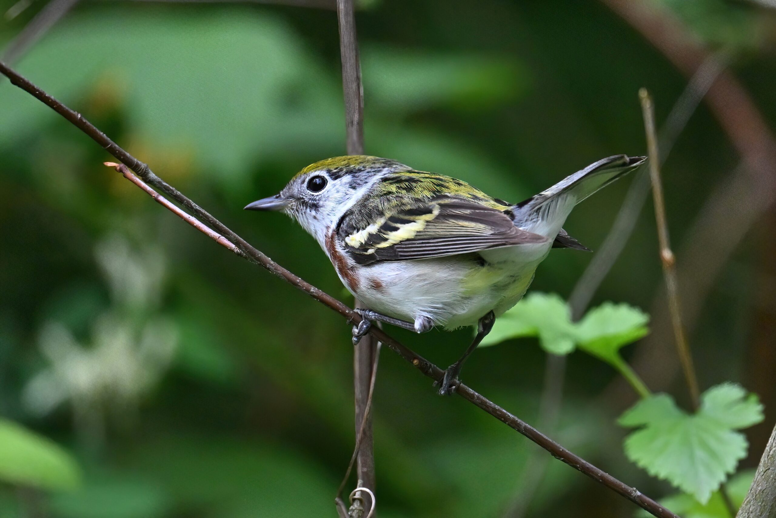
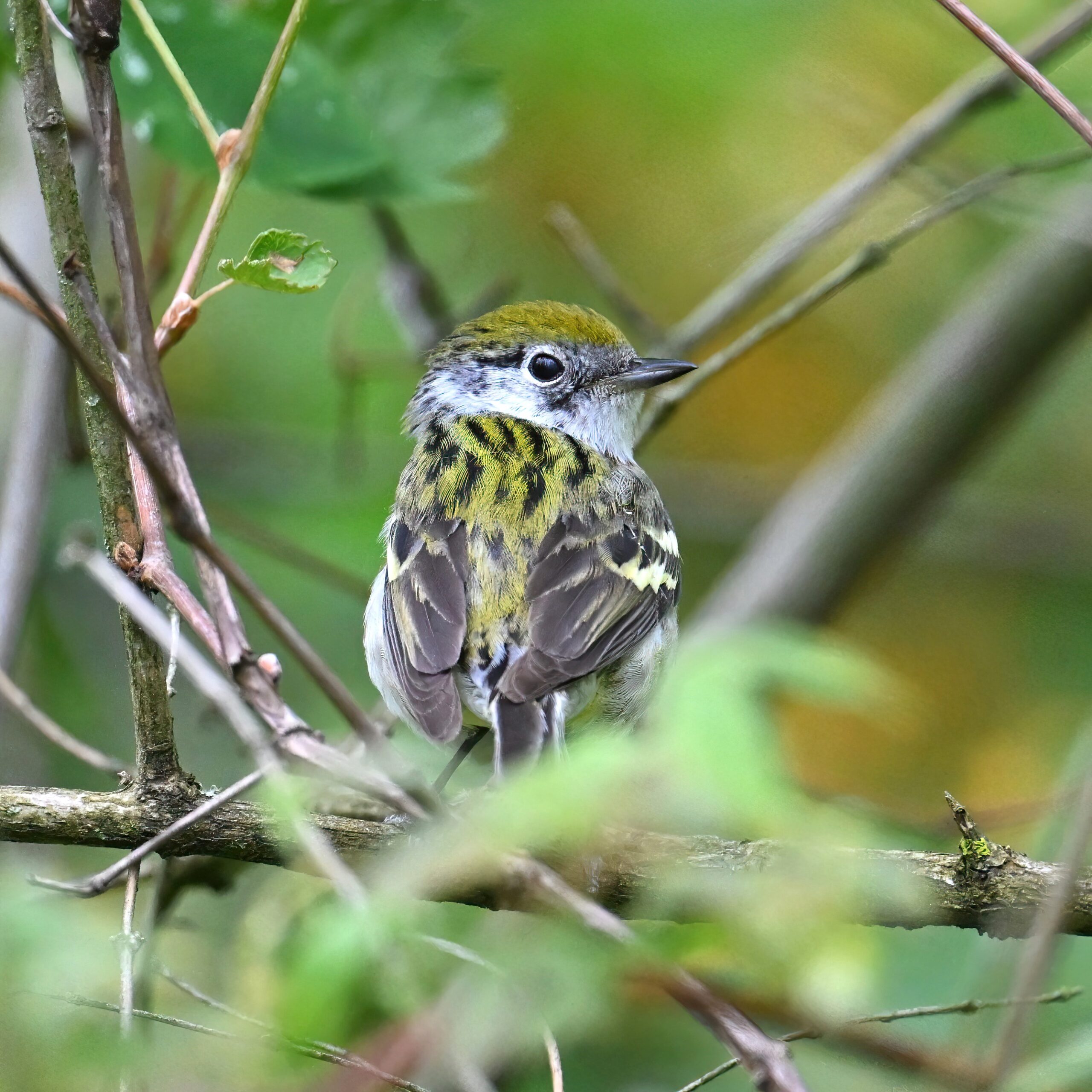
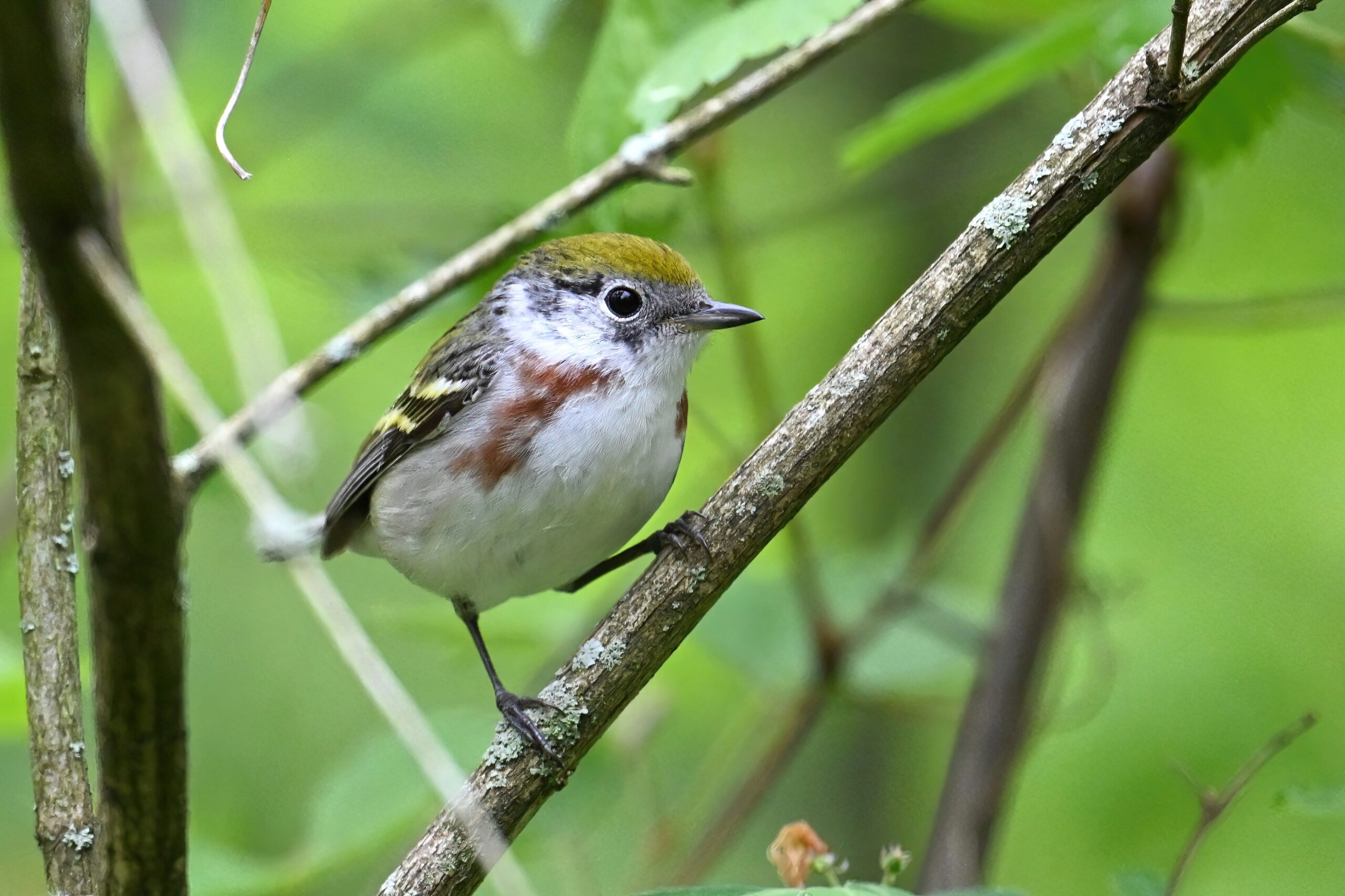
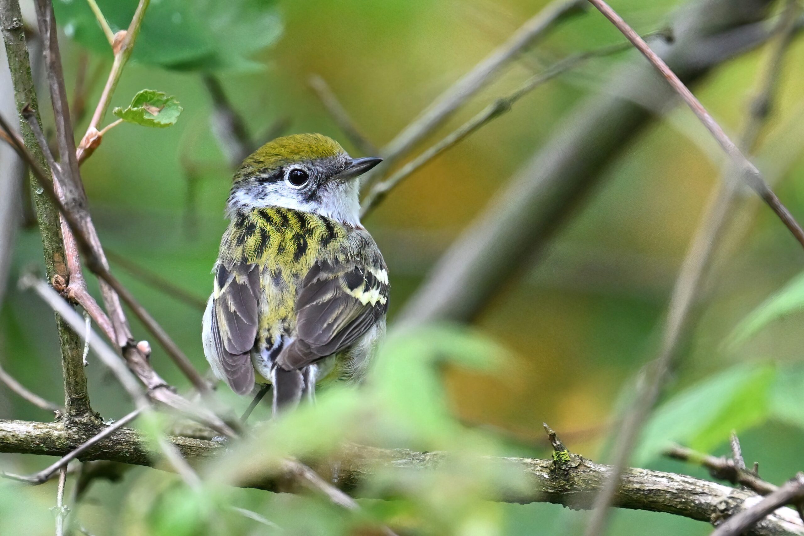
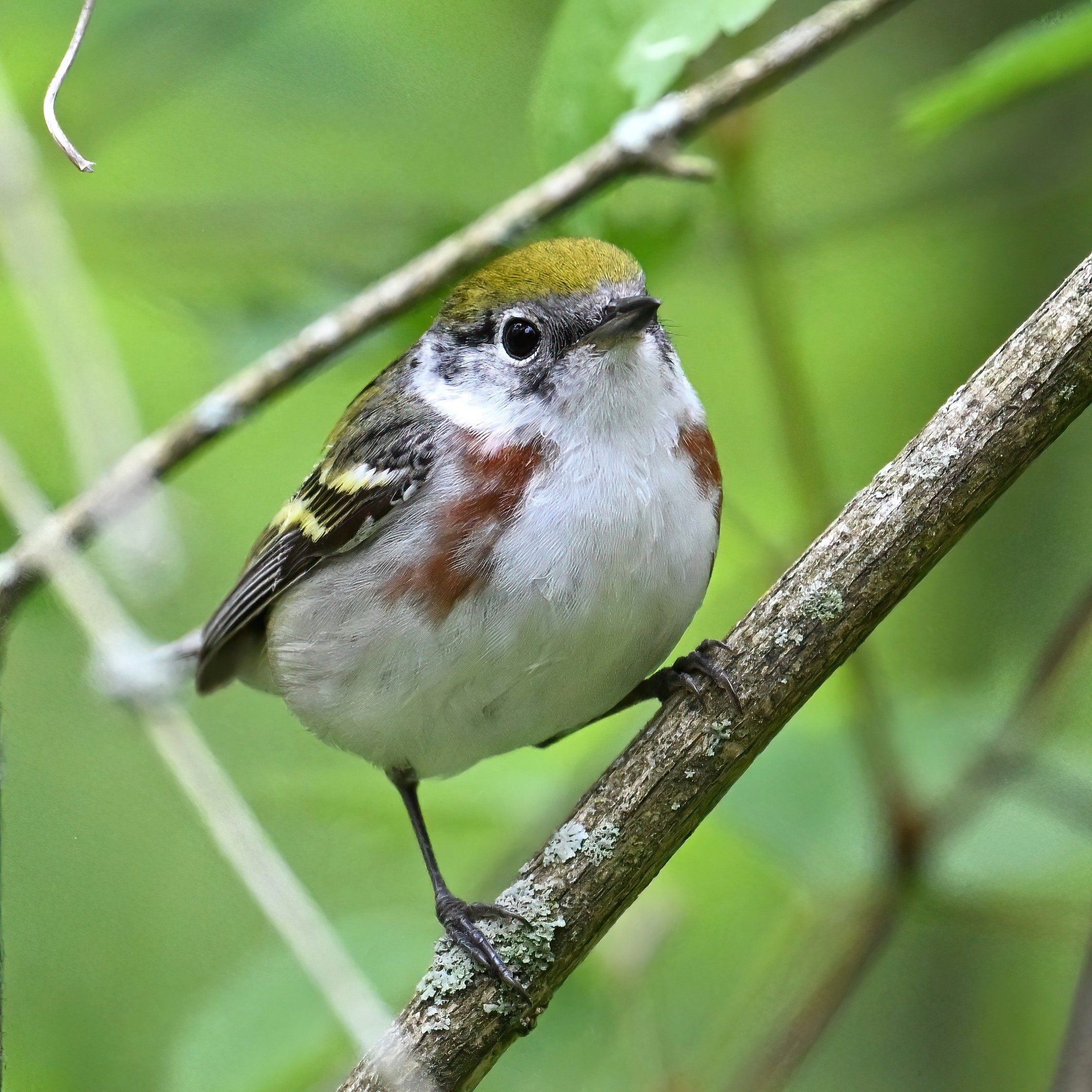
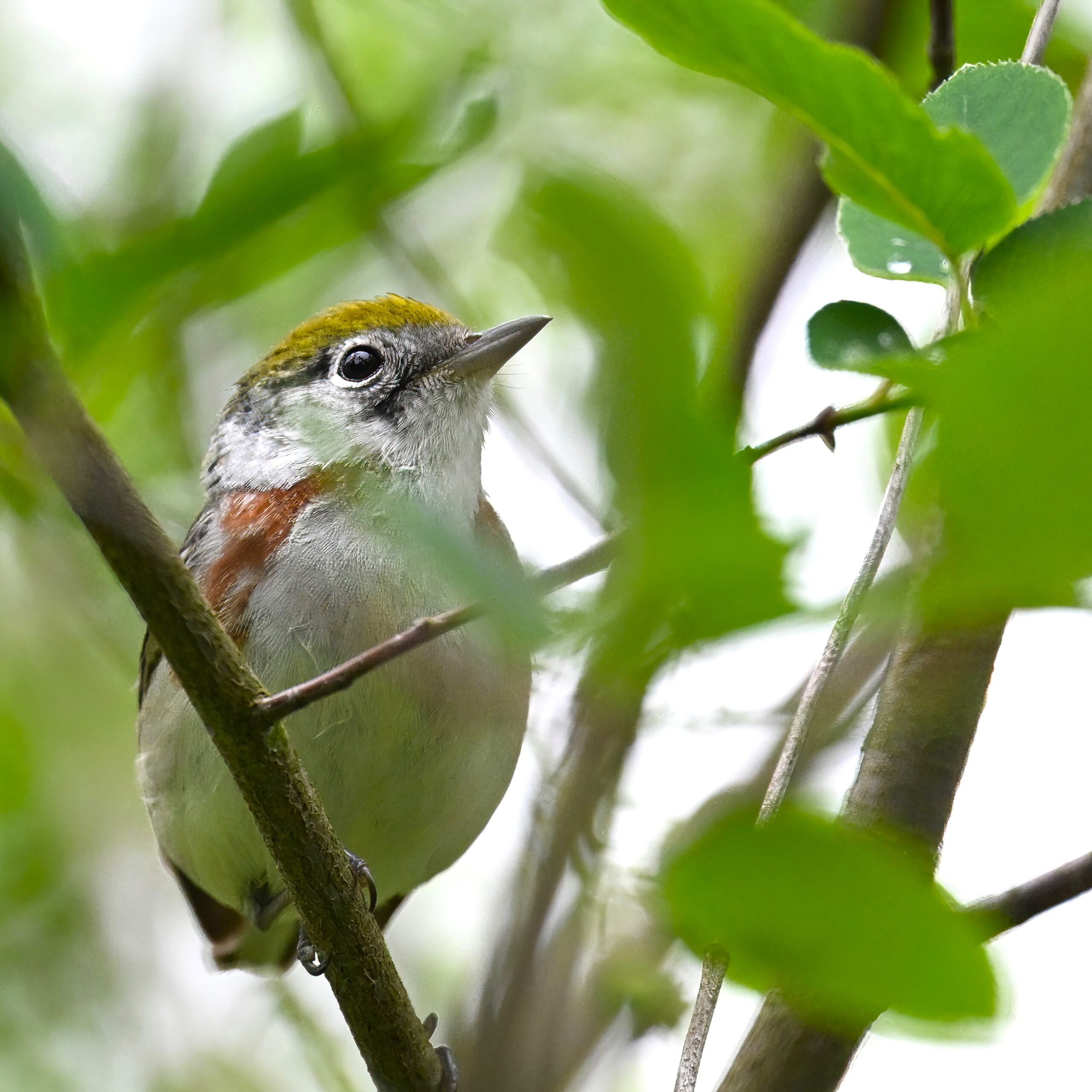
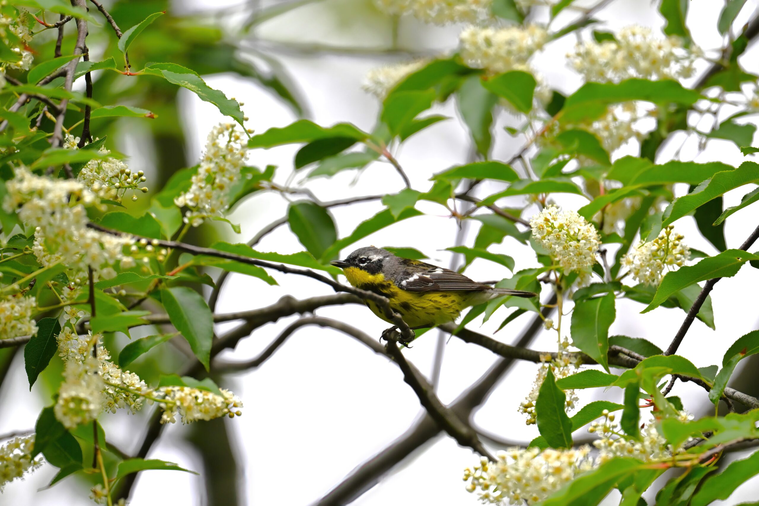
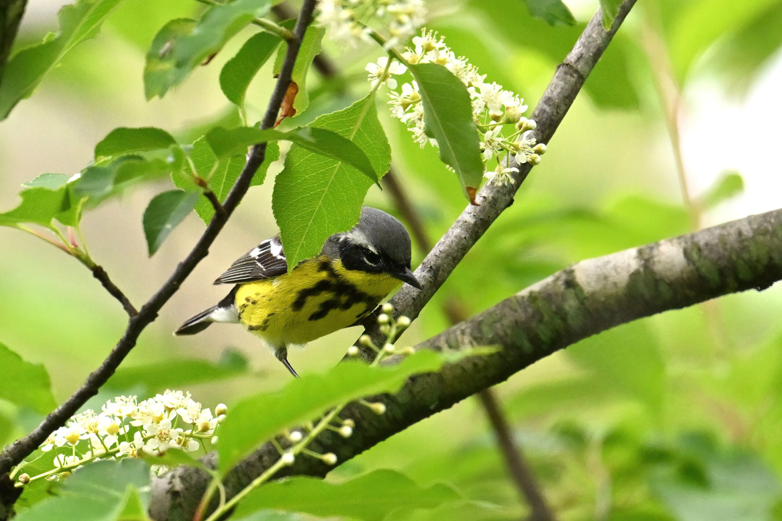
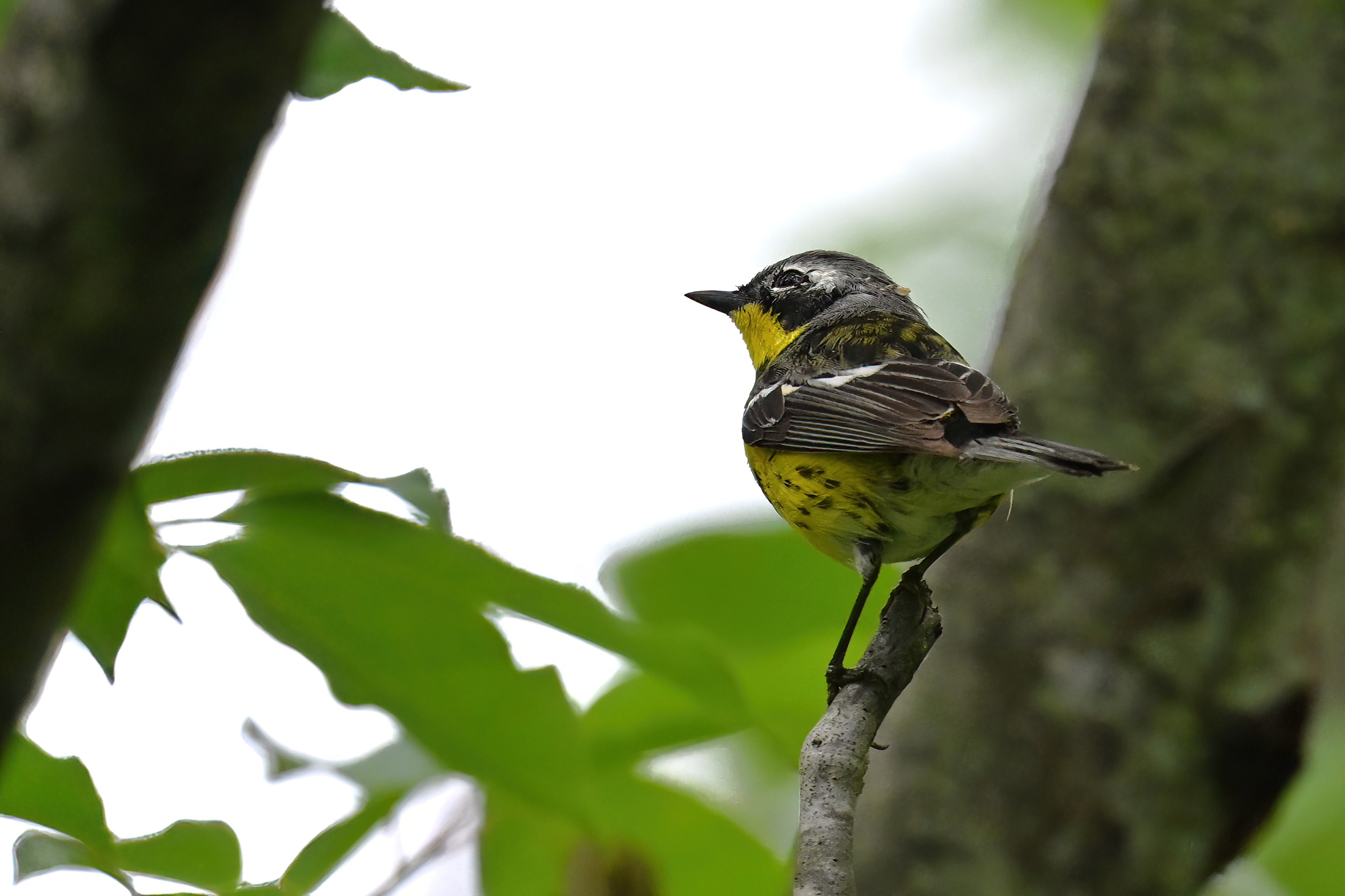
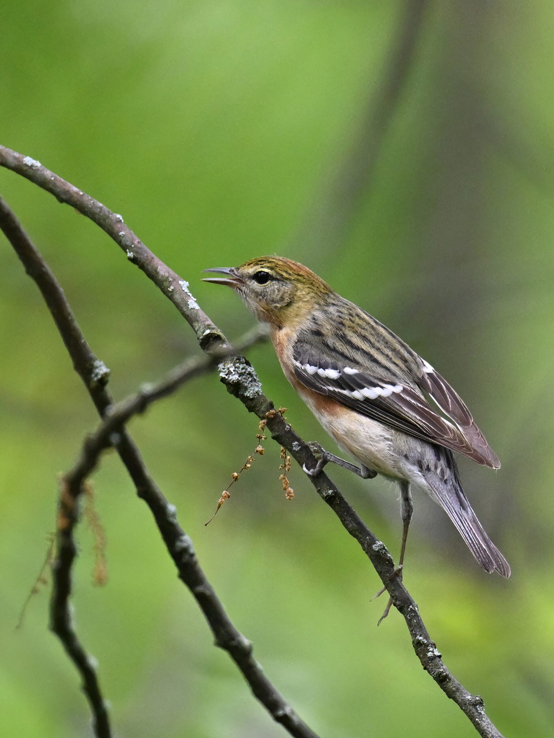
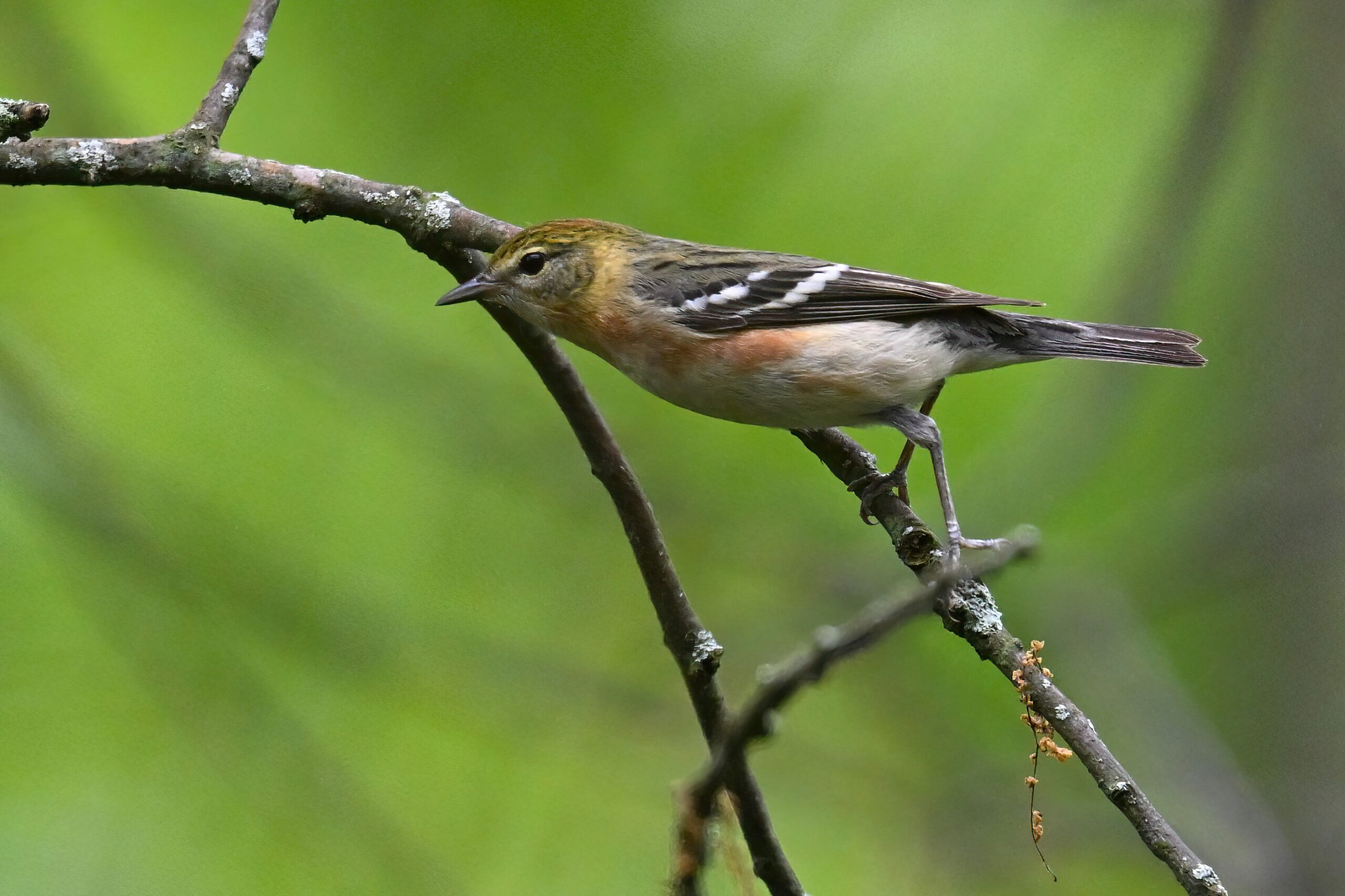
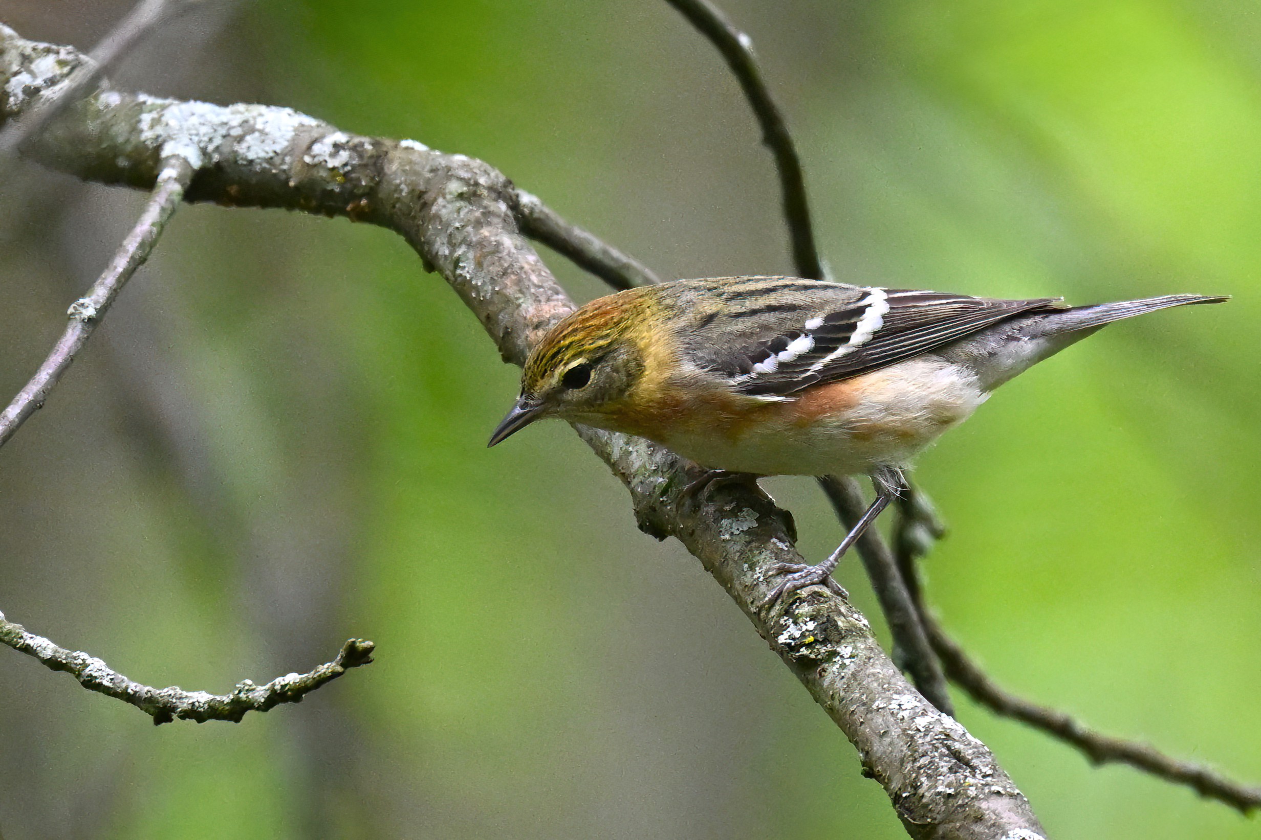
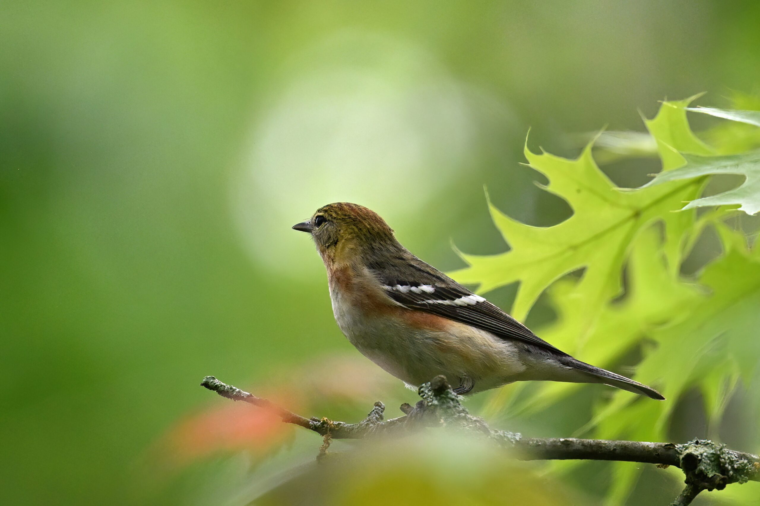
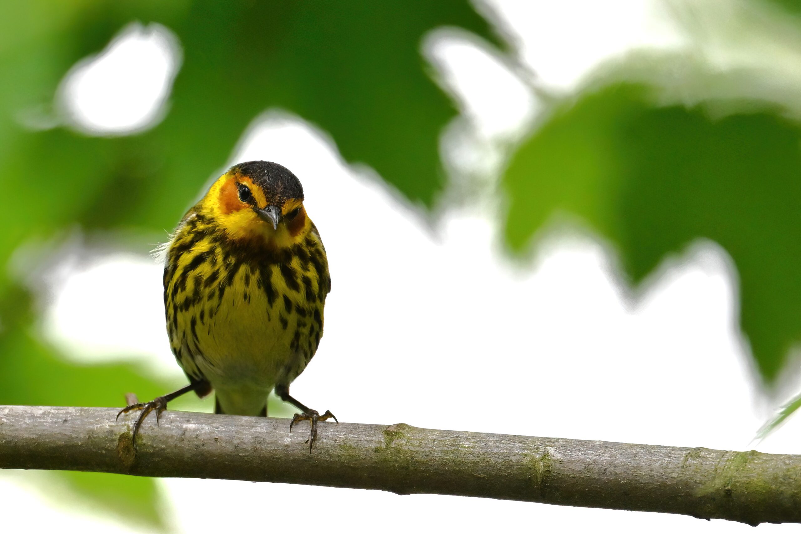
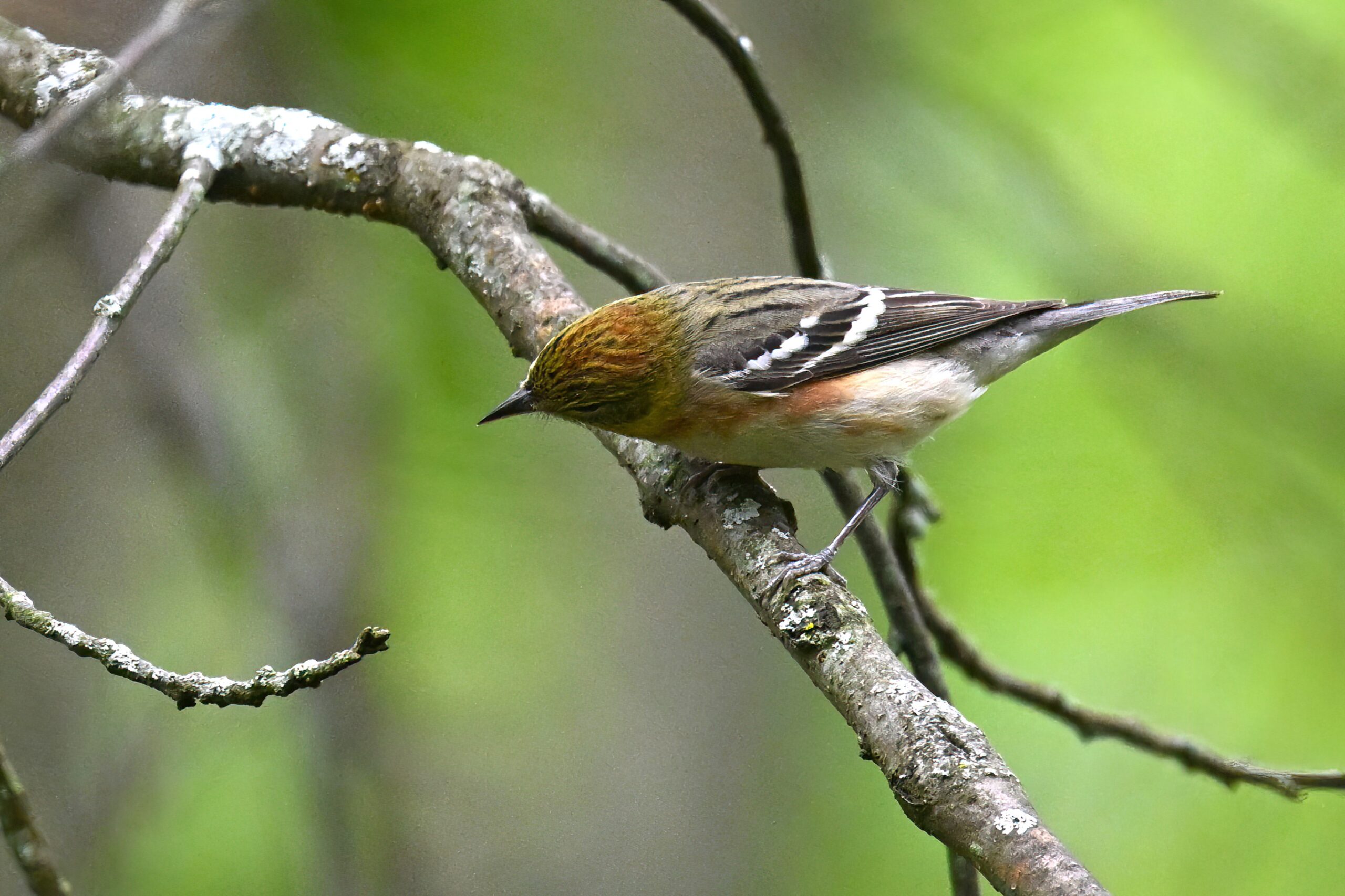
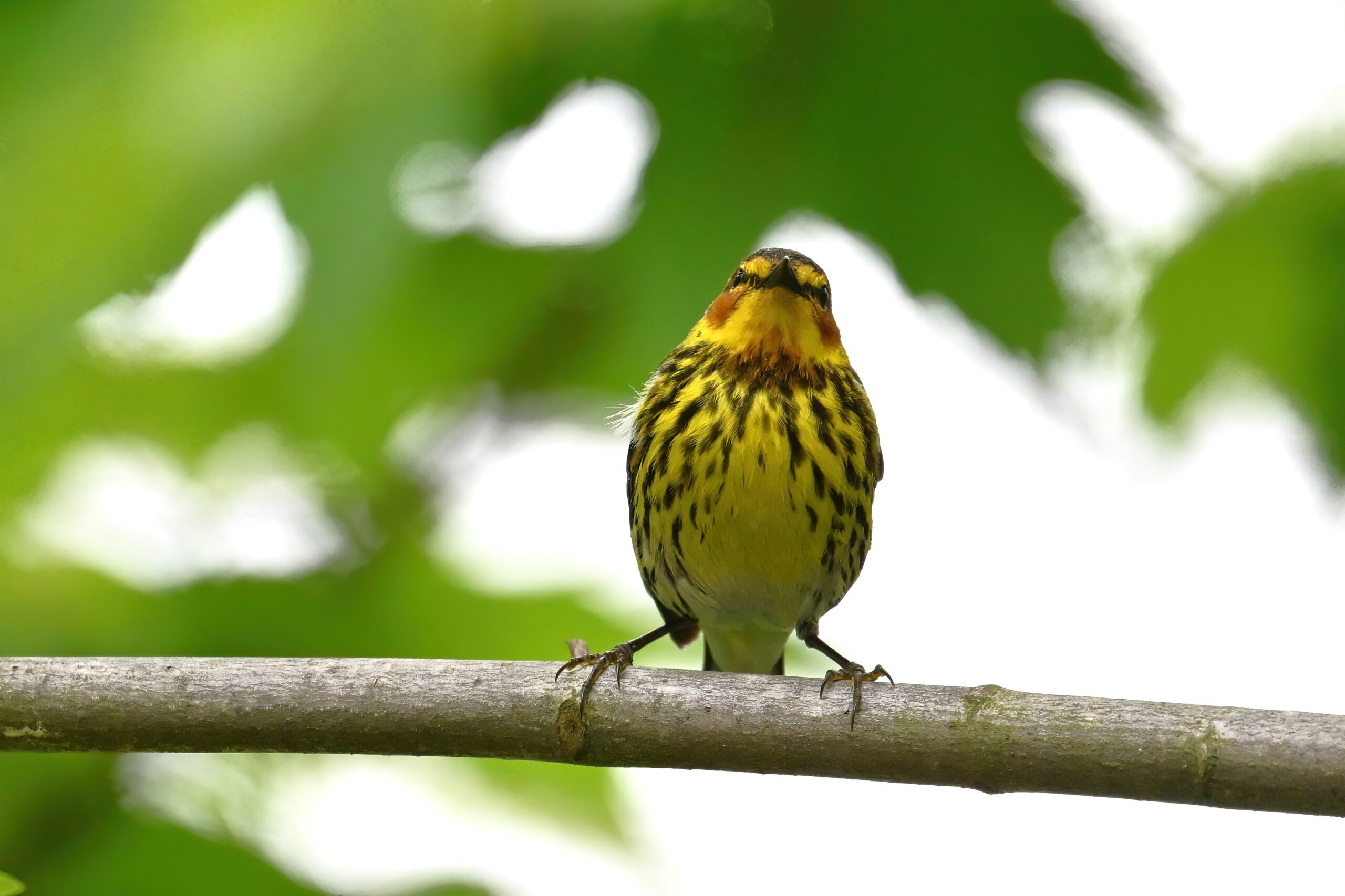
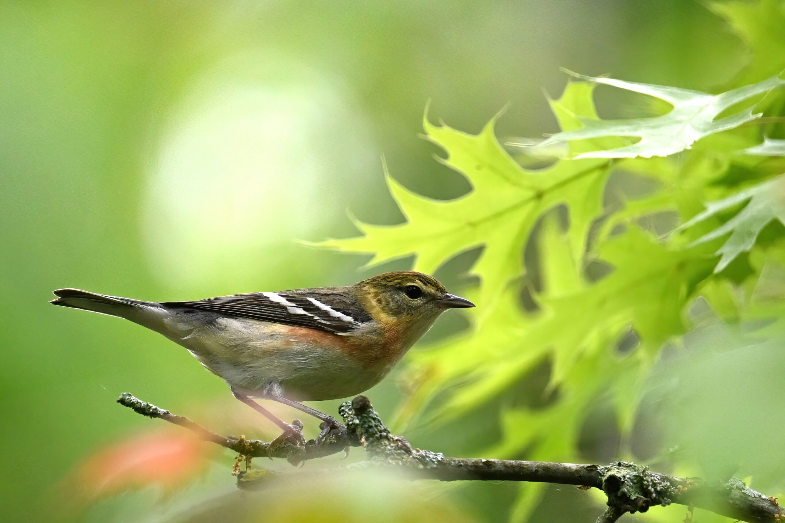
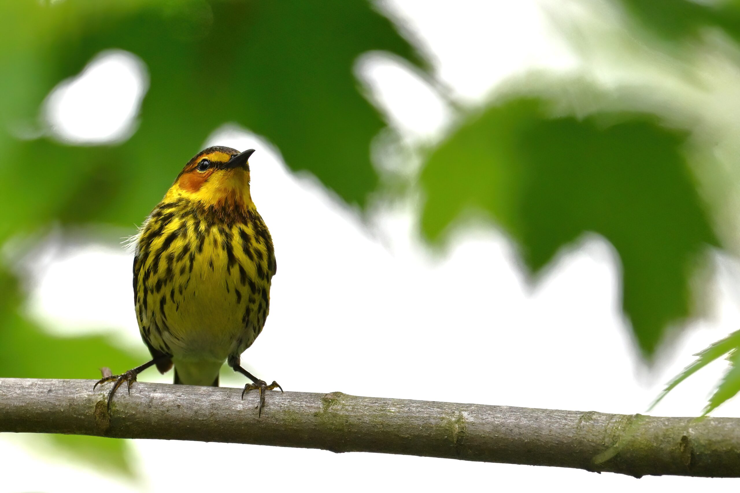
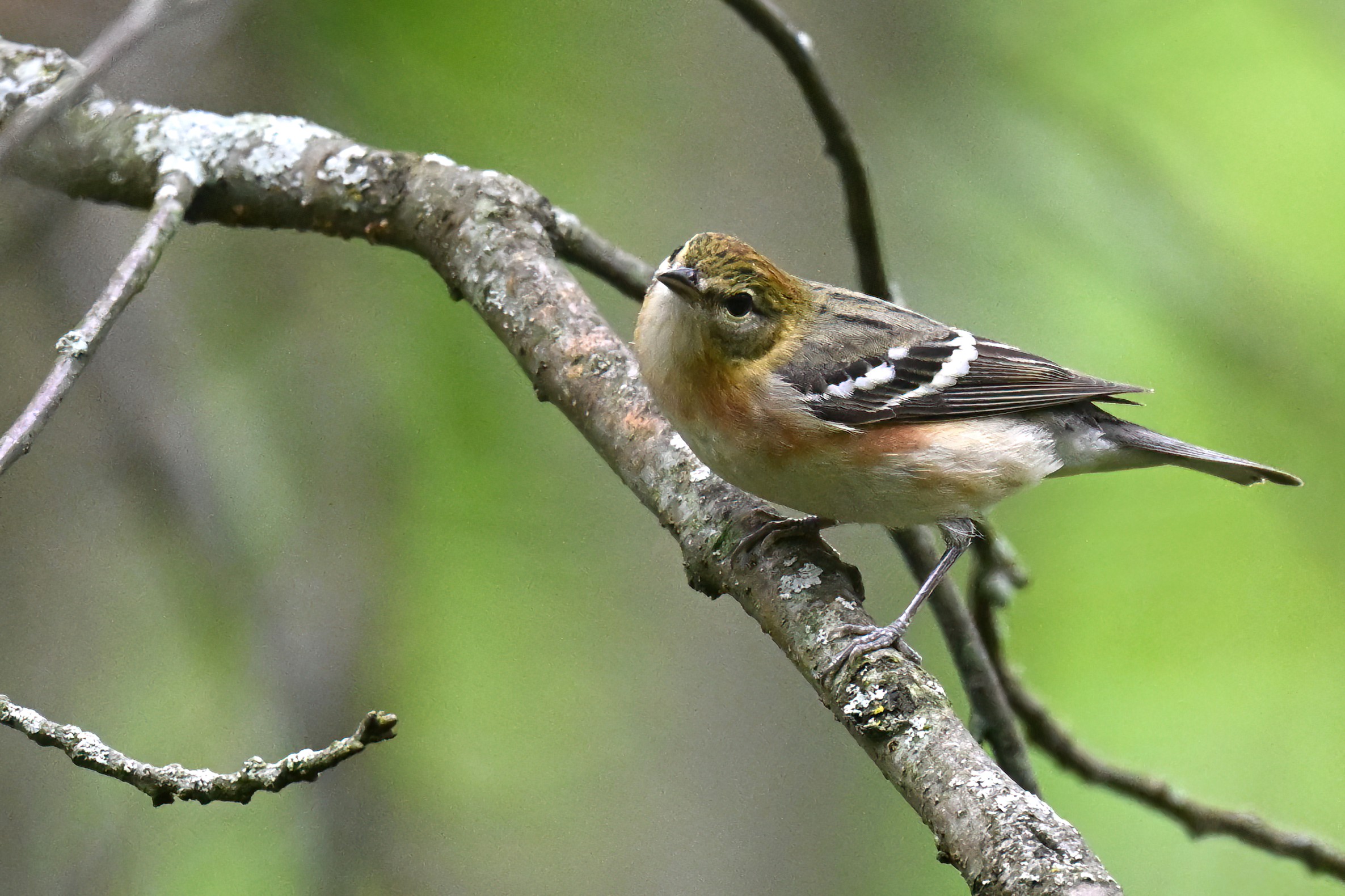
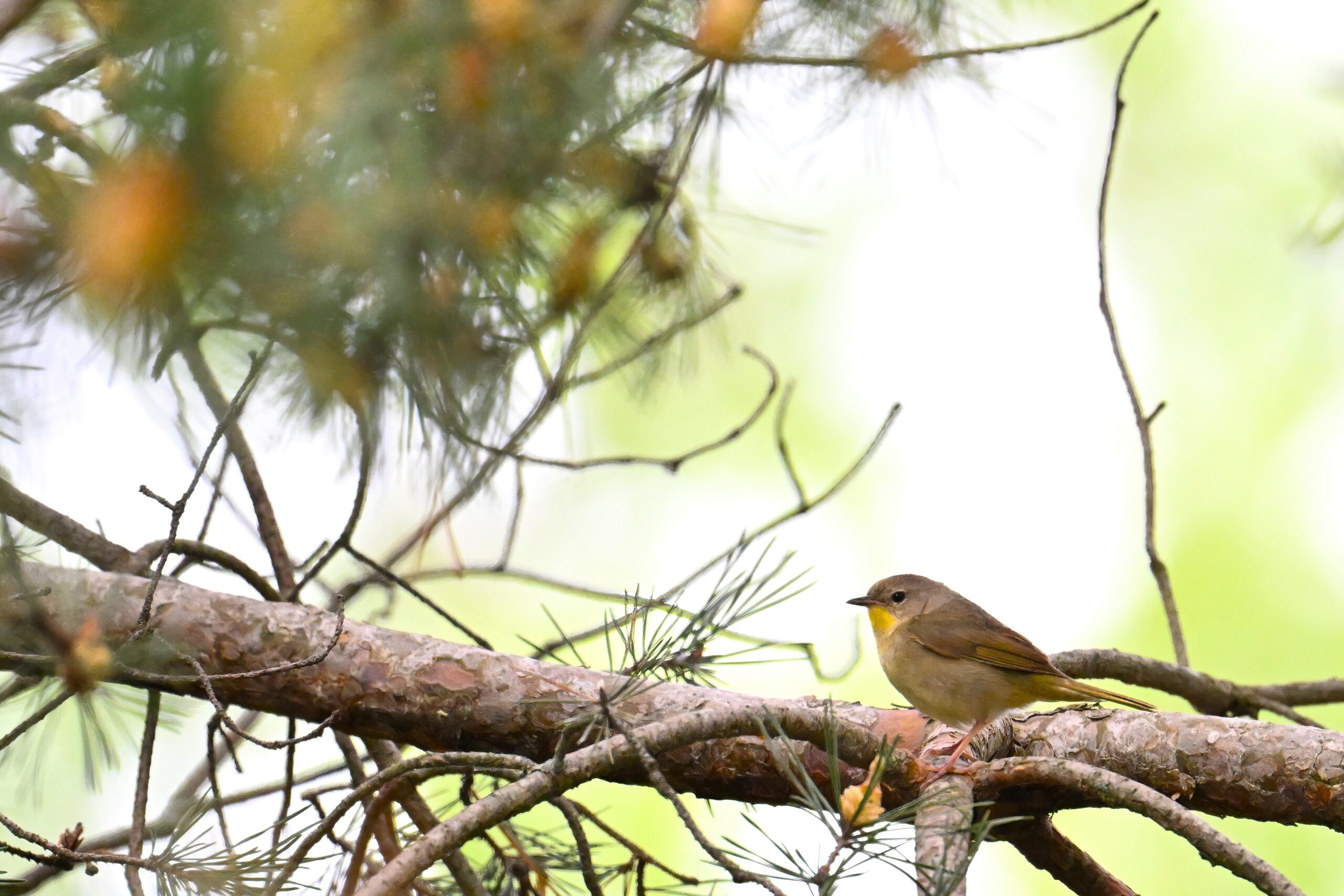
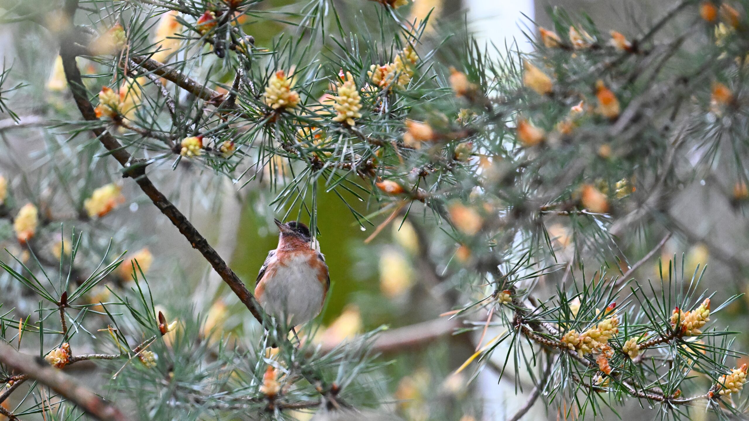
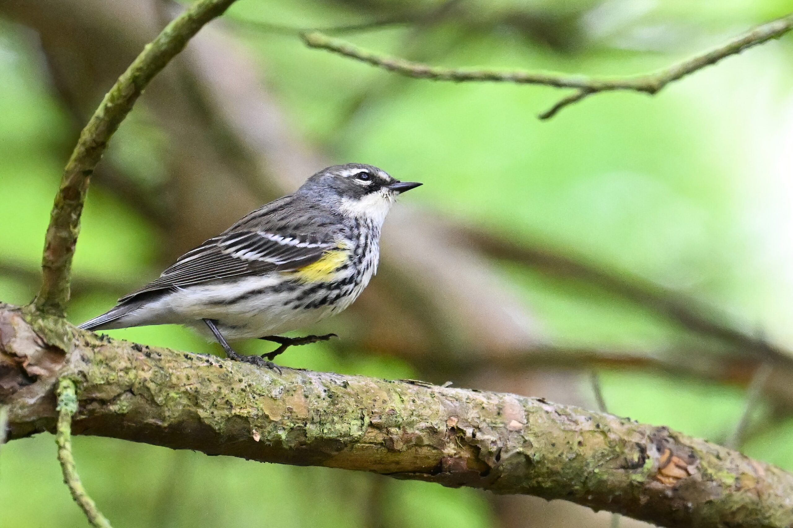
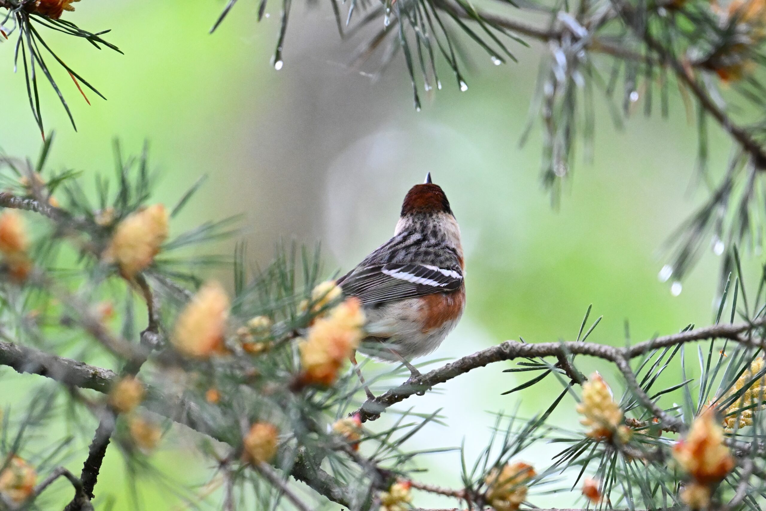
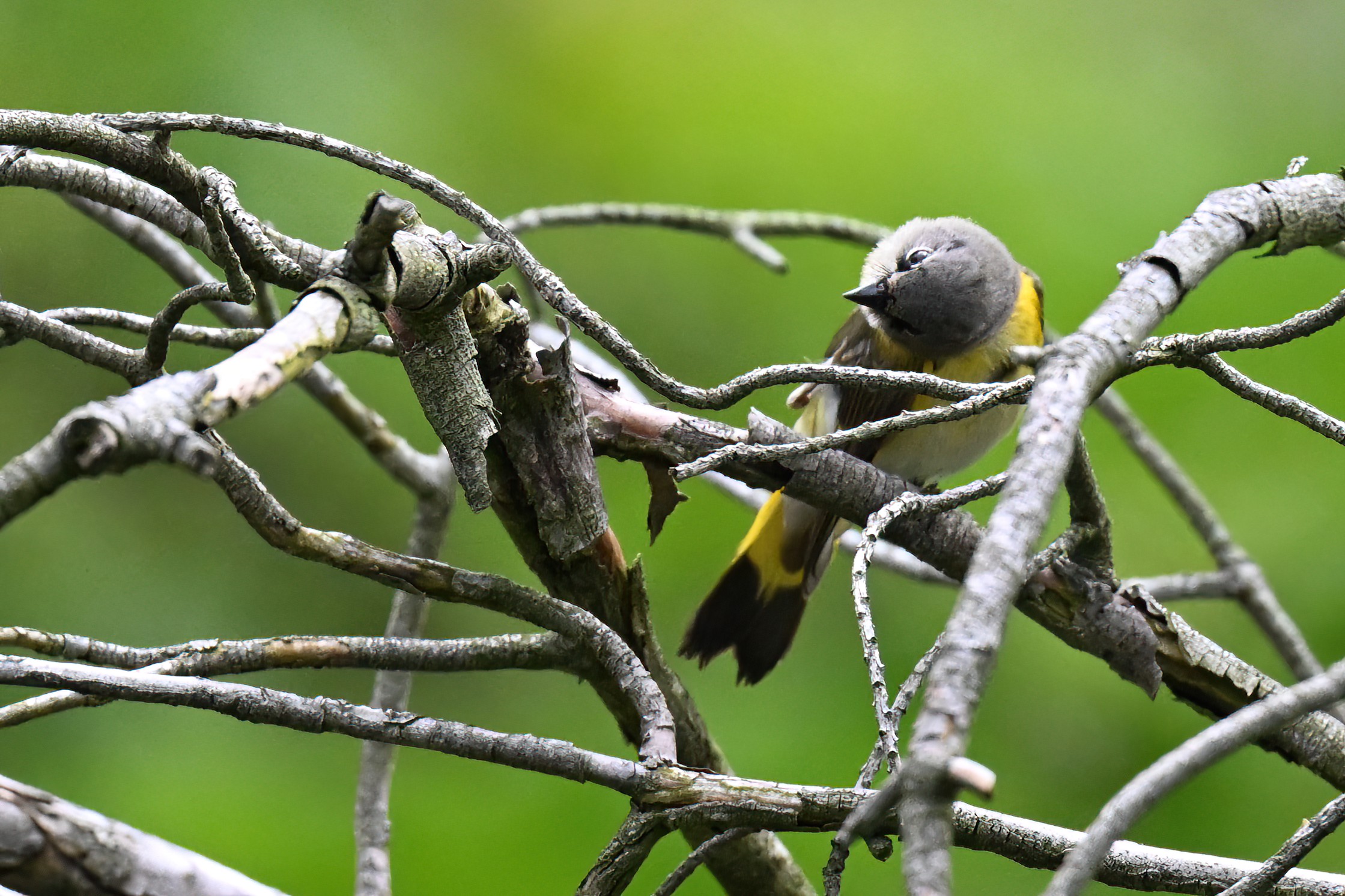
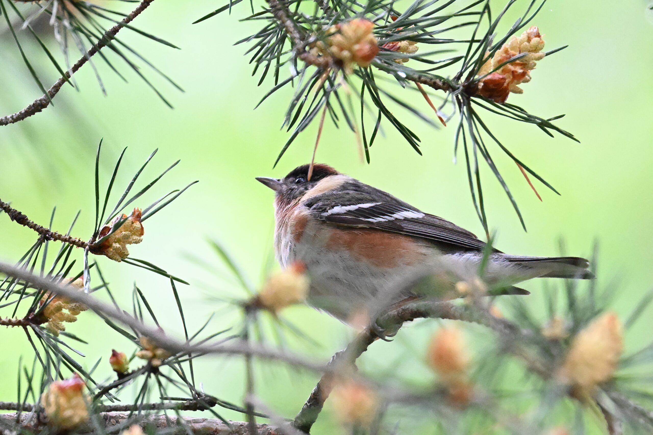
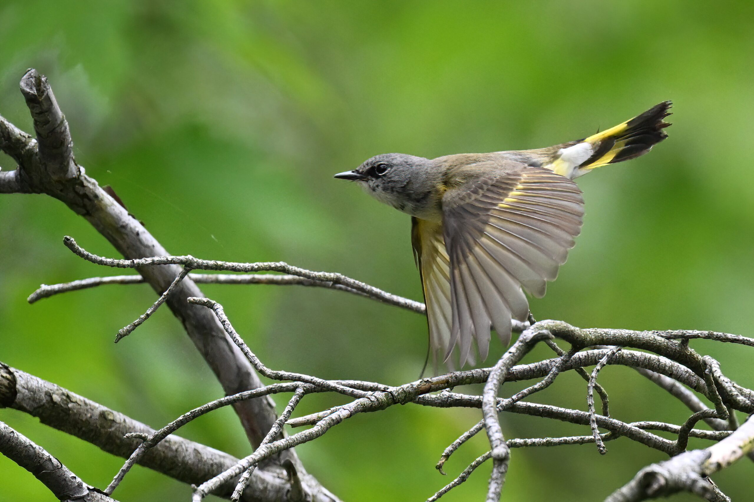
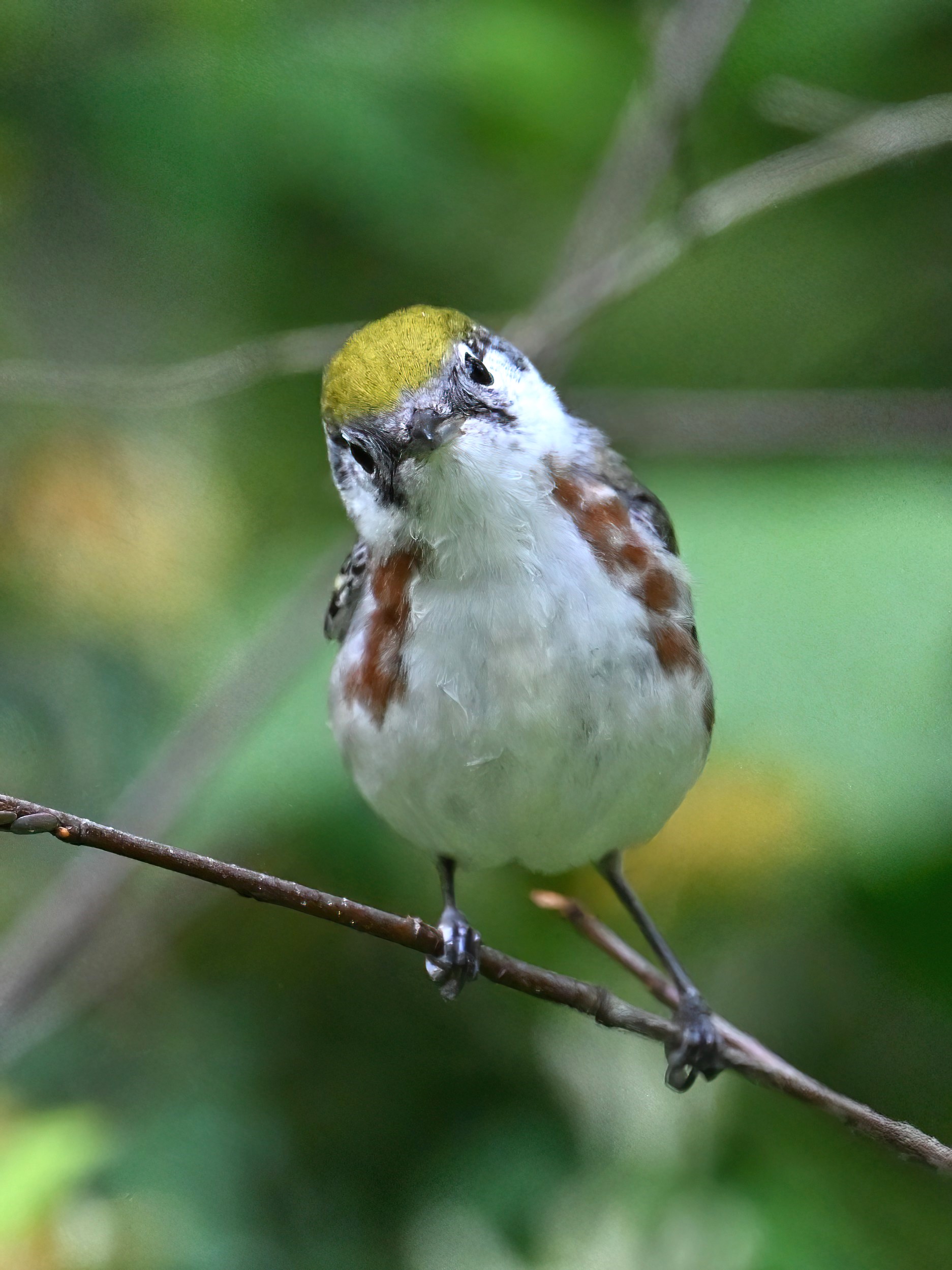
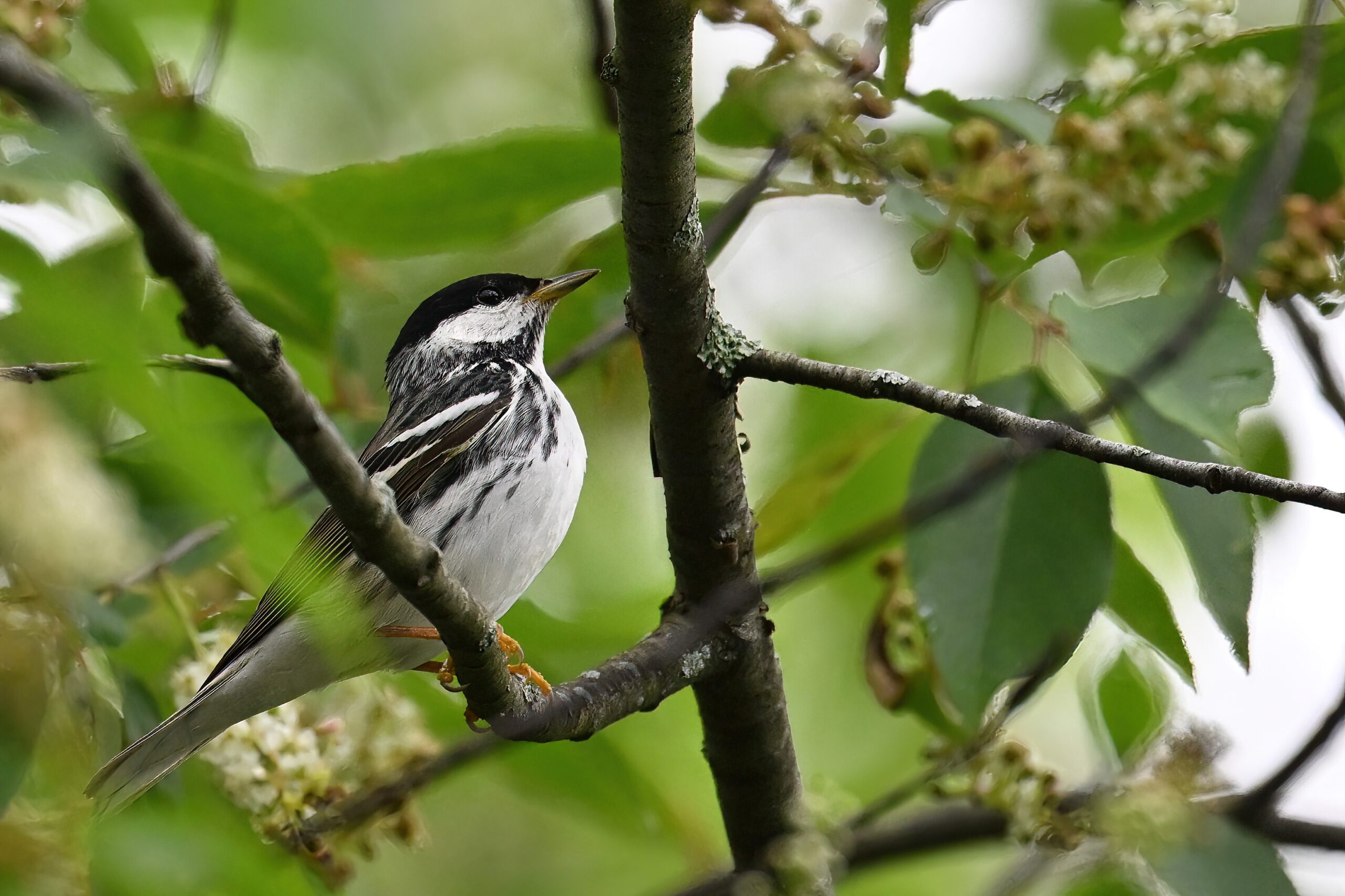
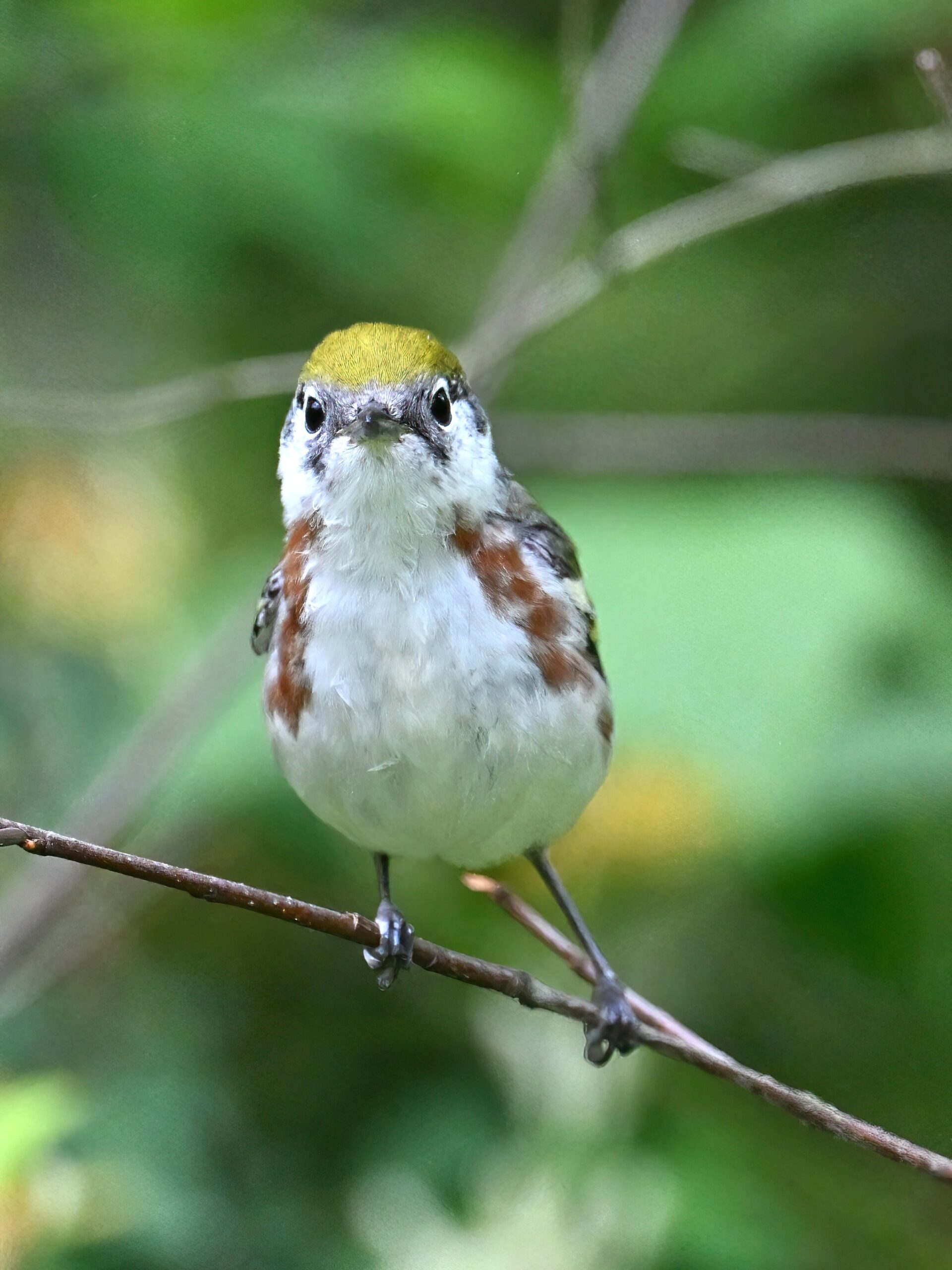
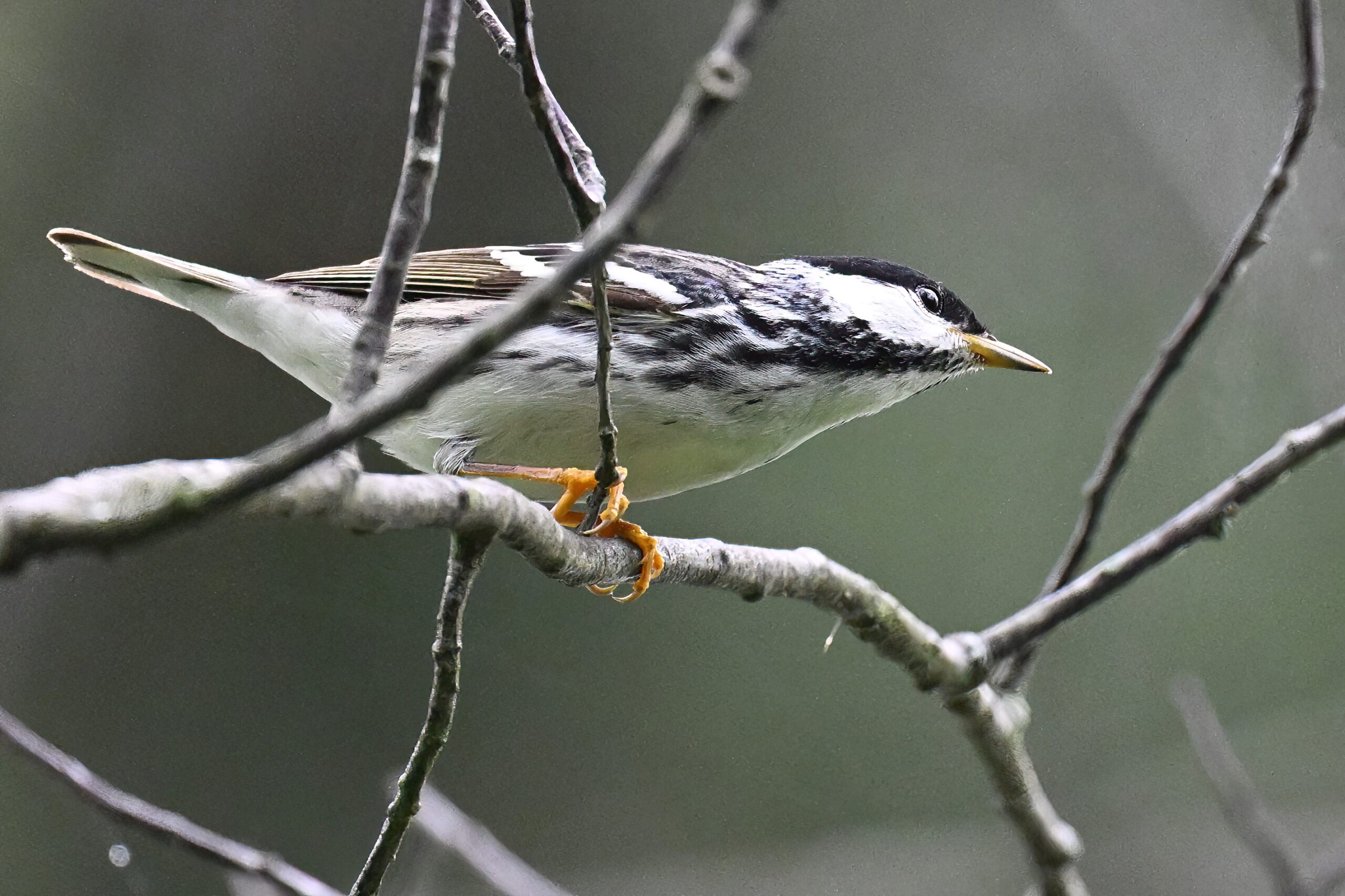
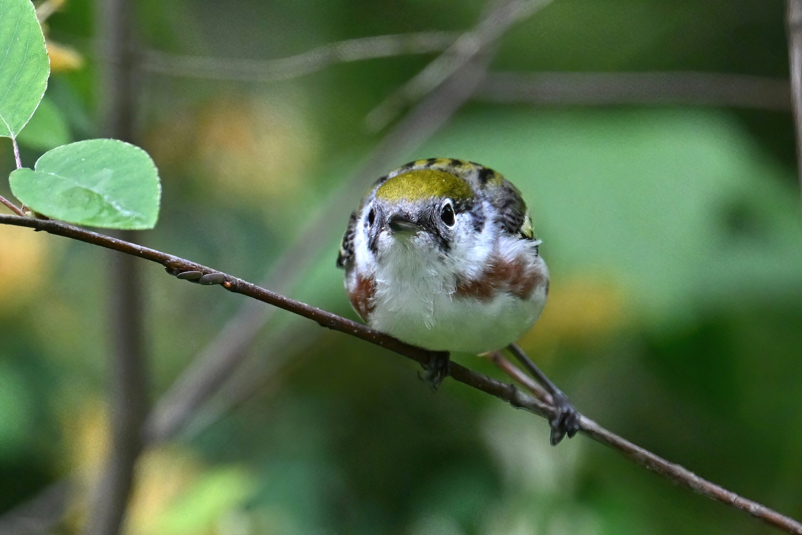
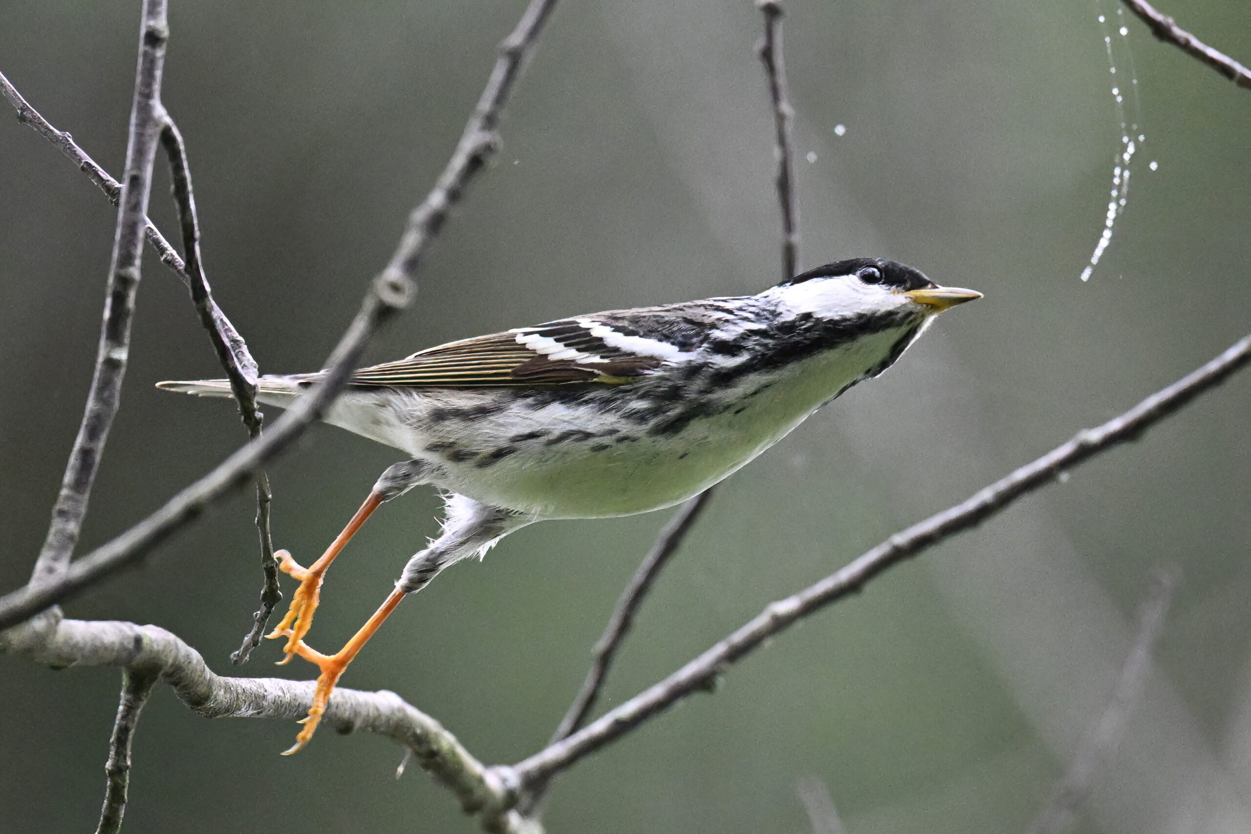
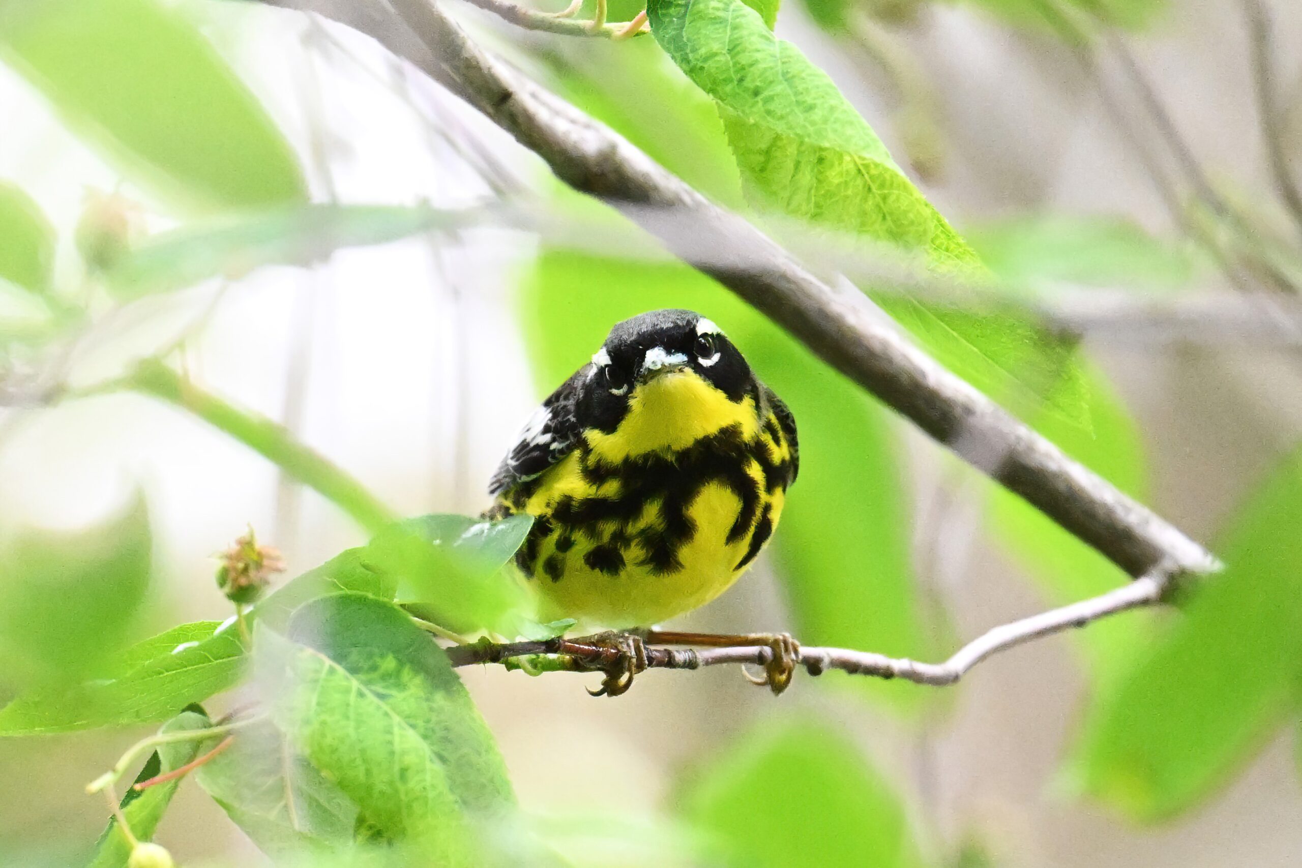
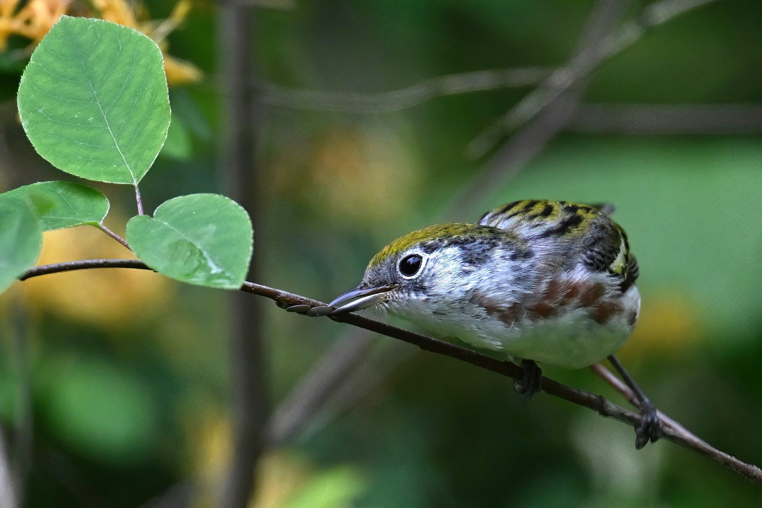
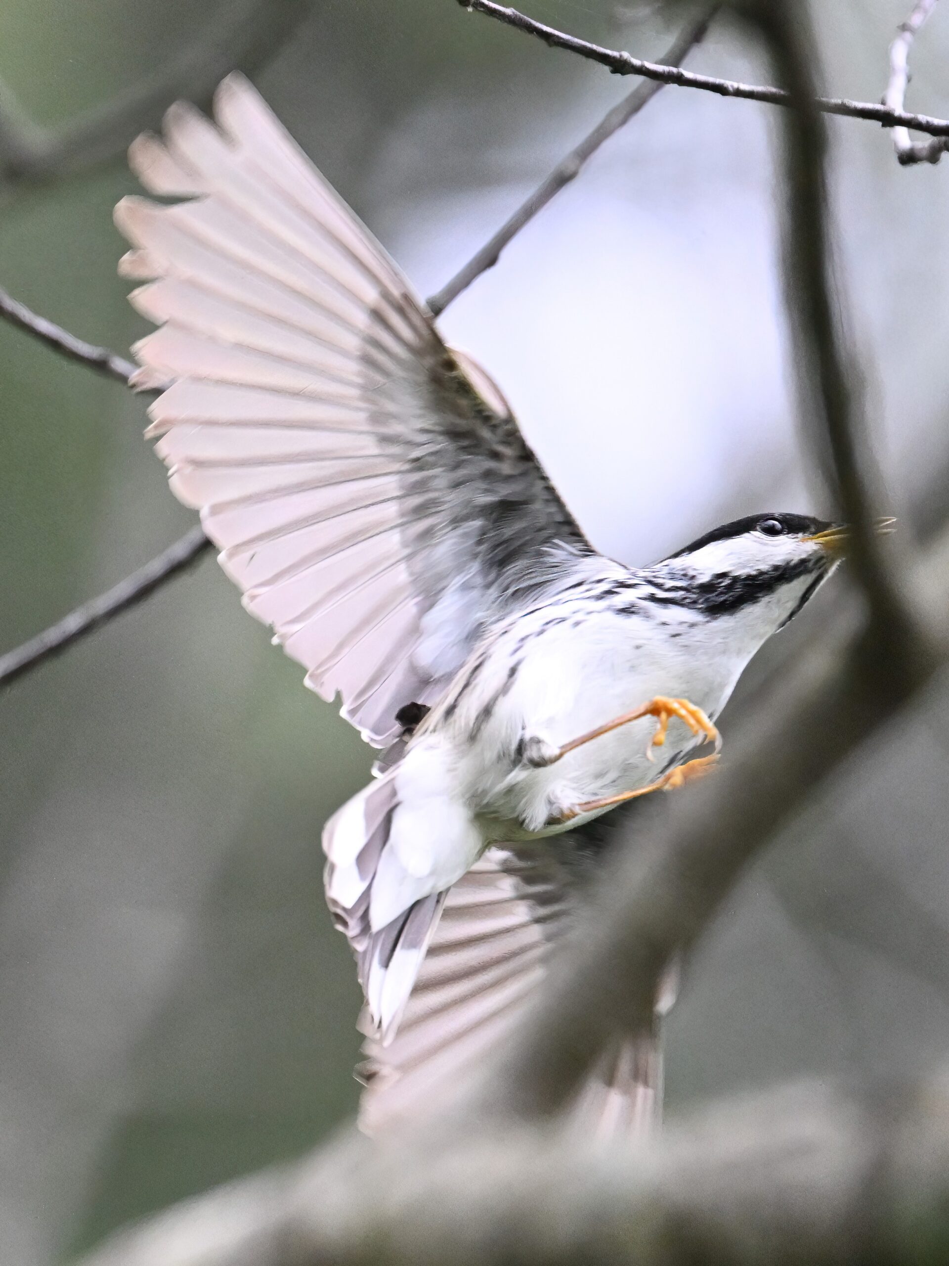
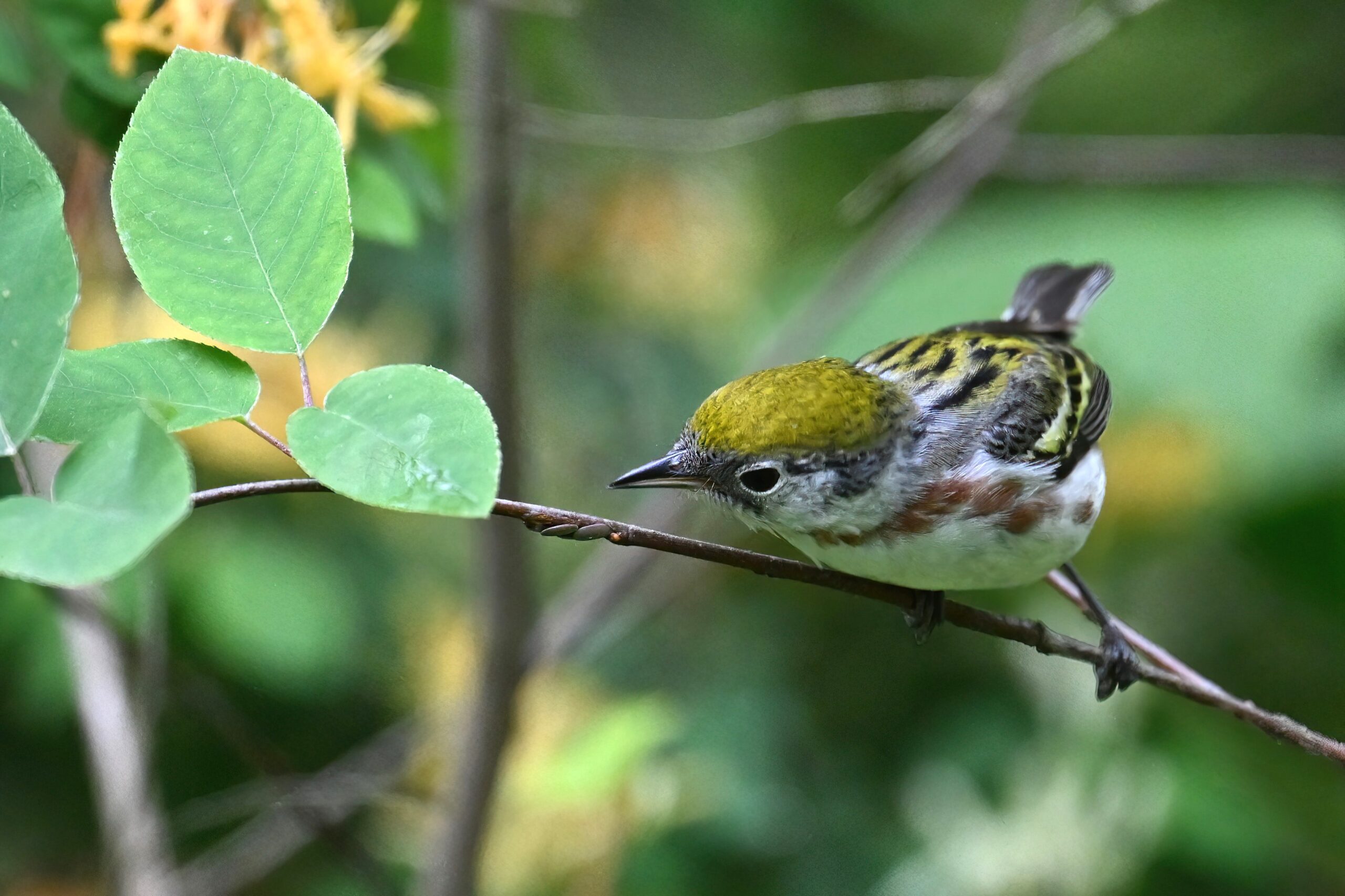
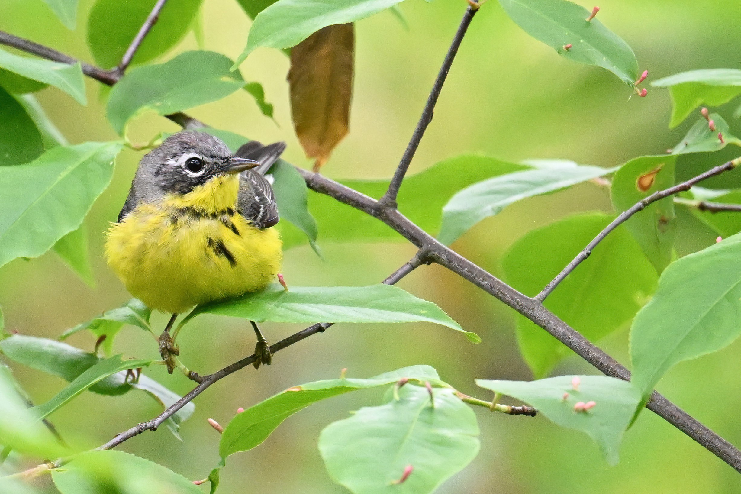
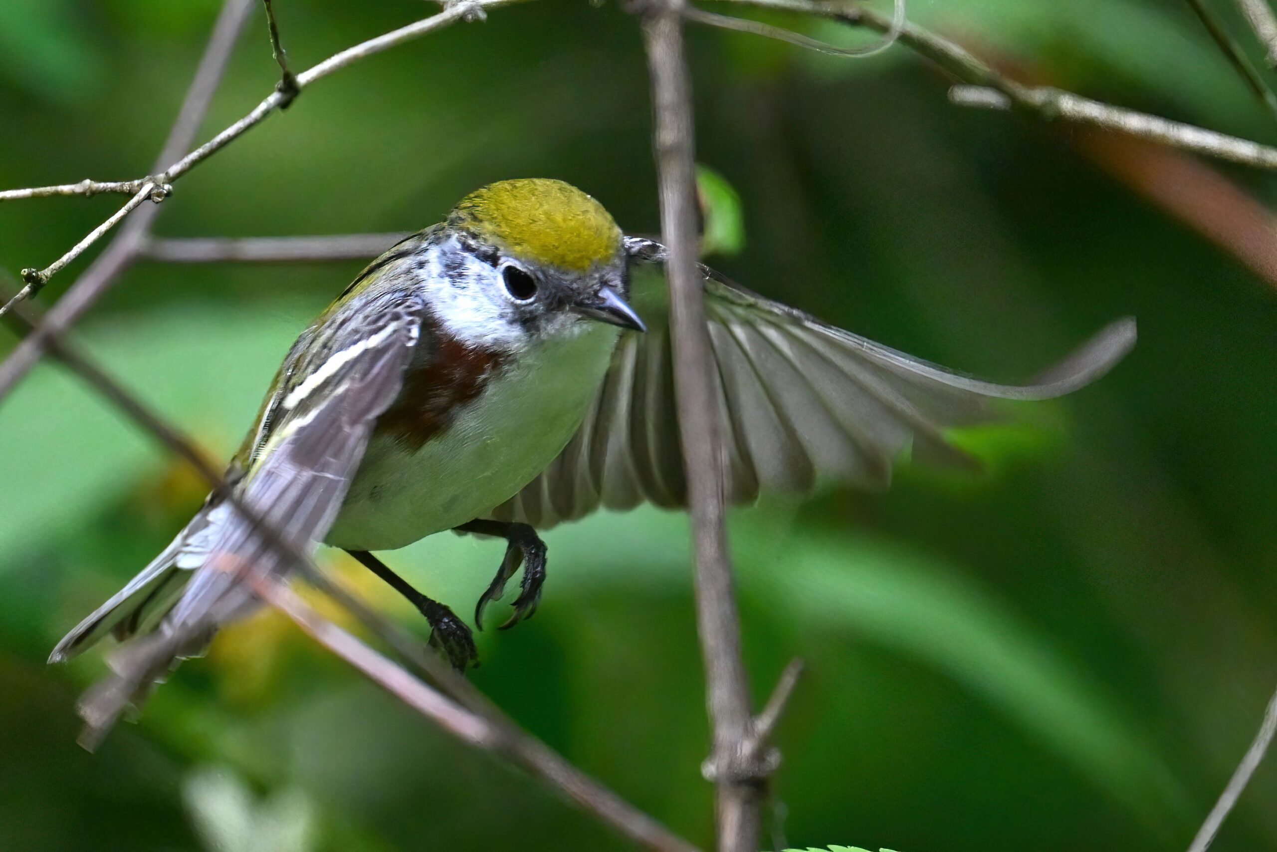
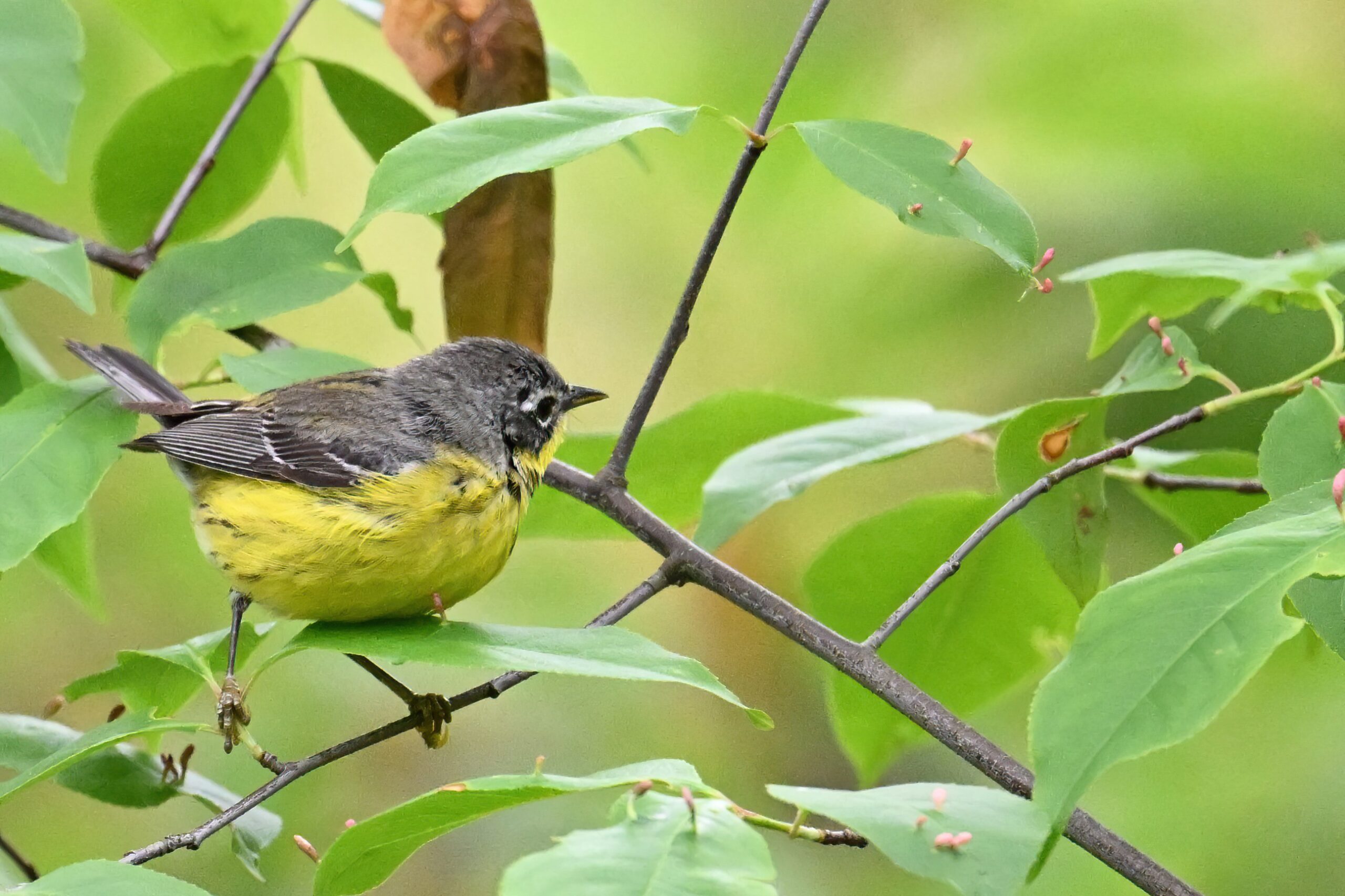
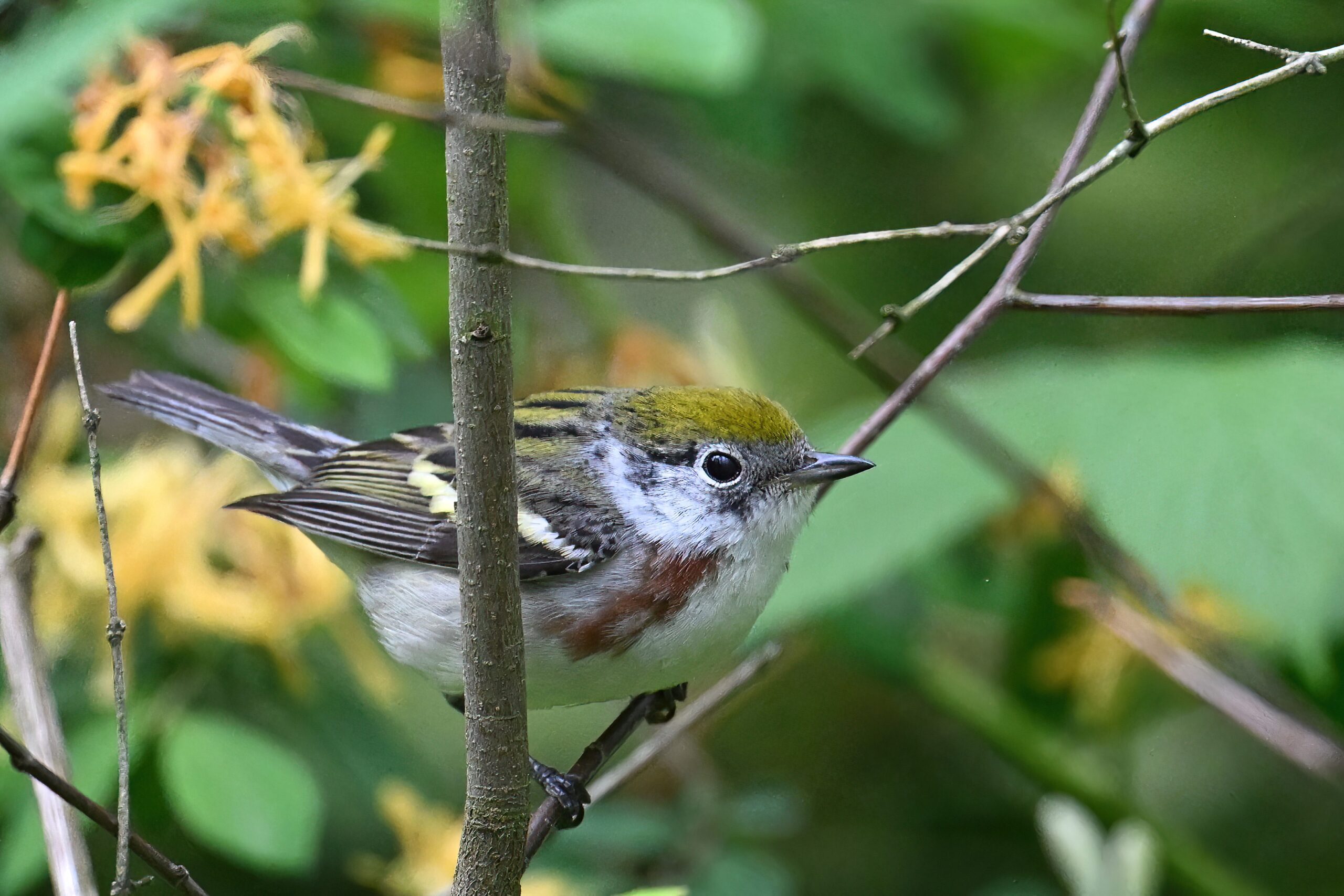
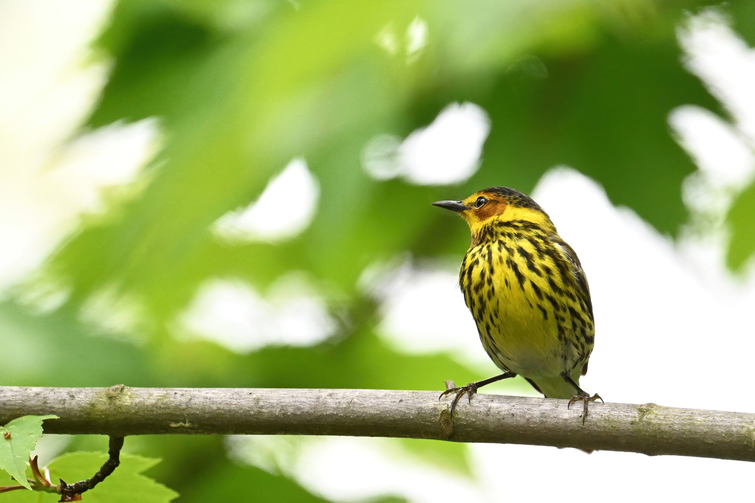
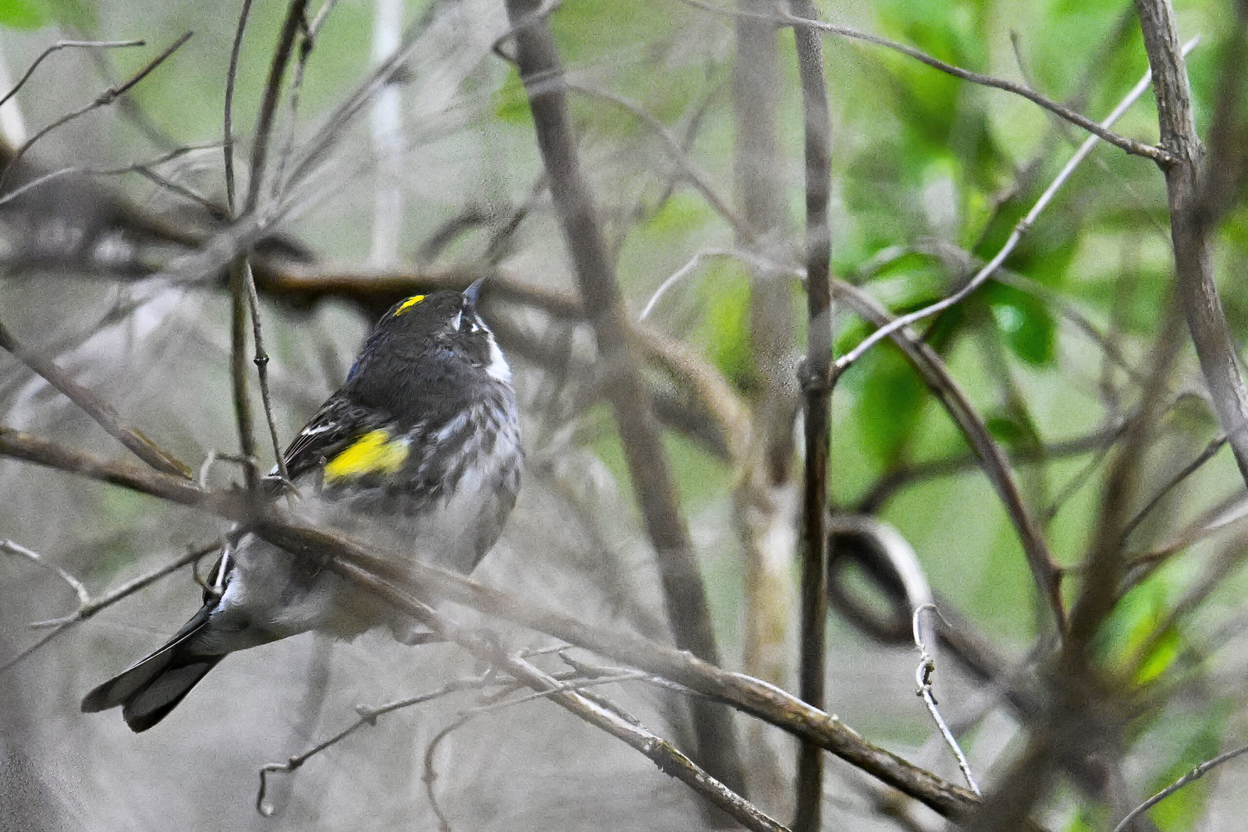
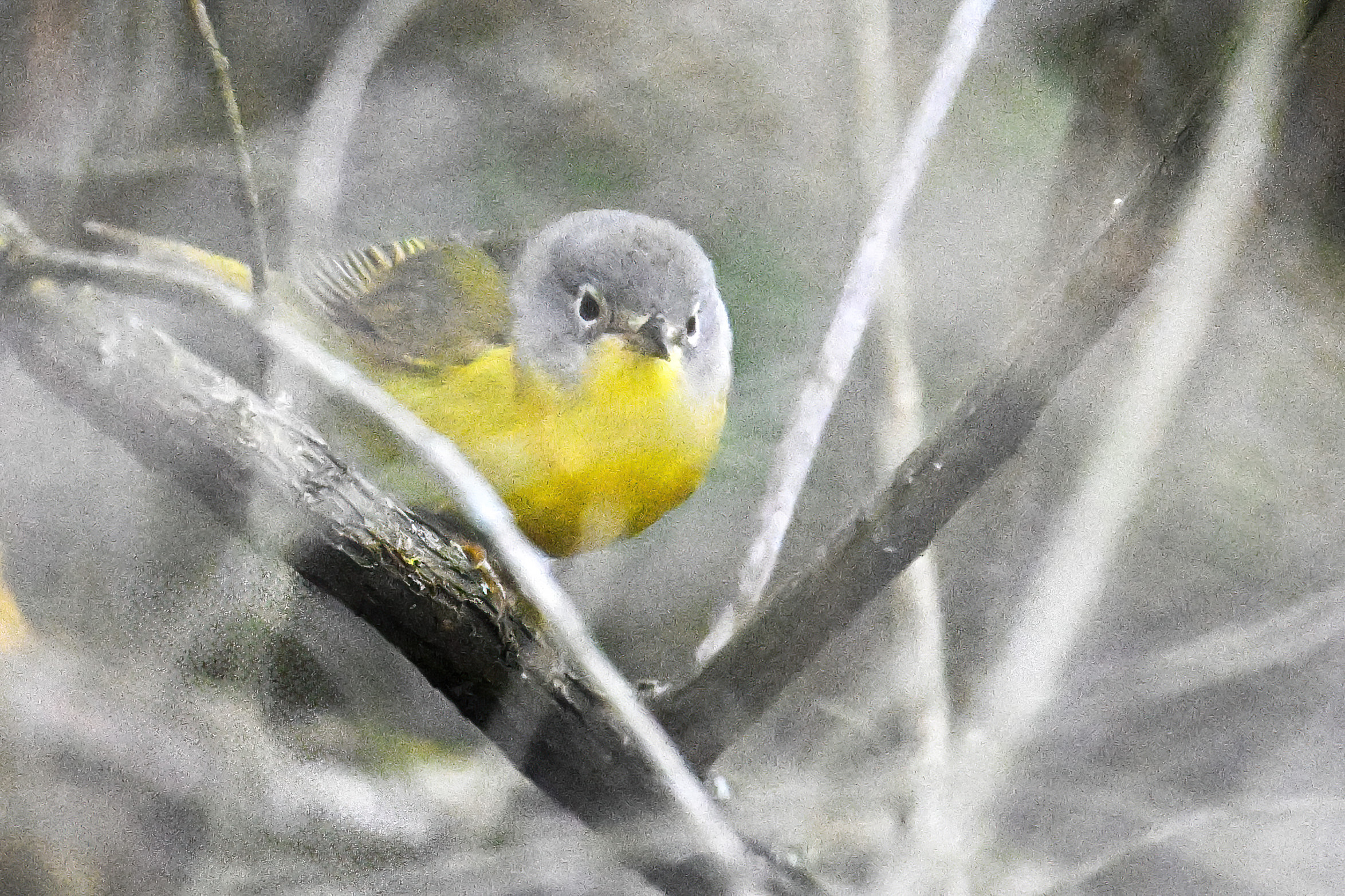
Bay-breasted Warbler (m) in pine treeYellow-rumped WarblerAnother shot of Bay-breasted Warbler (m)American Redstart (f)One more Bay-breasted WarblerRedstart taking flightChestnut-sided WarblerBlackpoll Warbler (m)More American RedstartAnother view of Blackpoll WarblerMagnolia WarblerBlack-and-white WarblerAnother view of Chestnut-sided WarblerMore Blackpoll Warbler@ ChestnutBlackpoll launchMore Magnolia WarblerChestnut-sided Warbler foragingBlackpoll in flight#more_warblerProbably Canada WarblerChestnut flight-hopMore Canada WarblerShady ChestnutCape May Warbler
It’s back to Global Big Day with more bird pictures from Presque Isle State Park, mostly after the rain started.
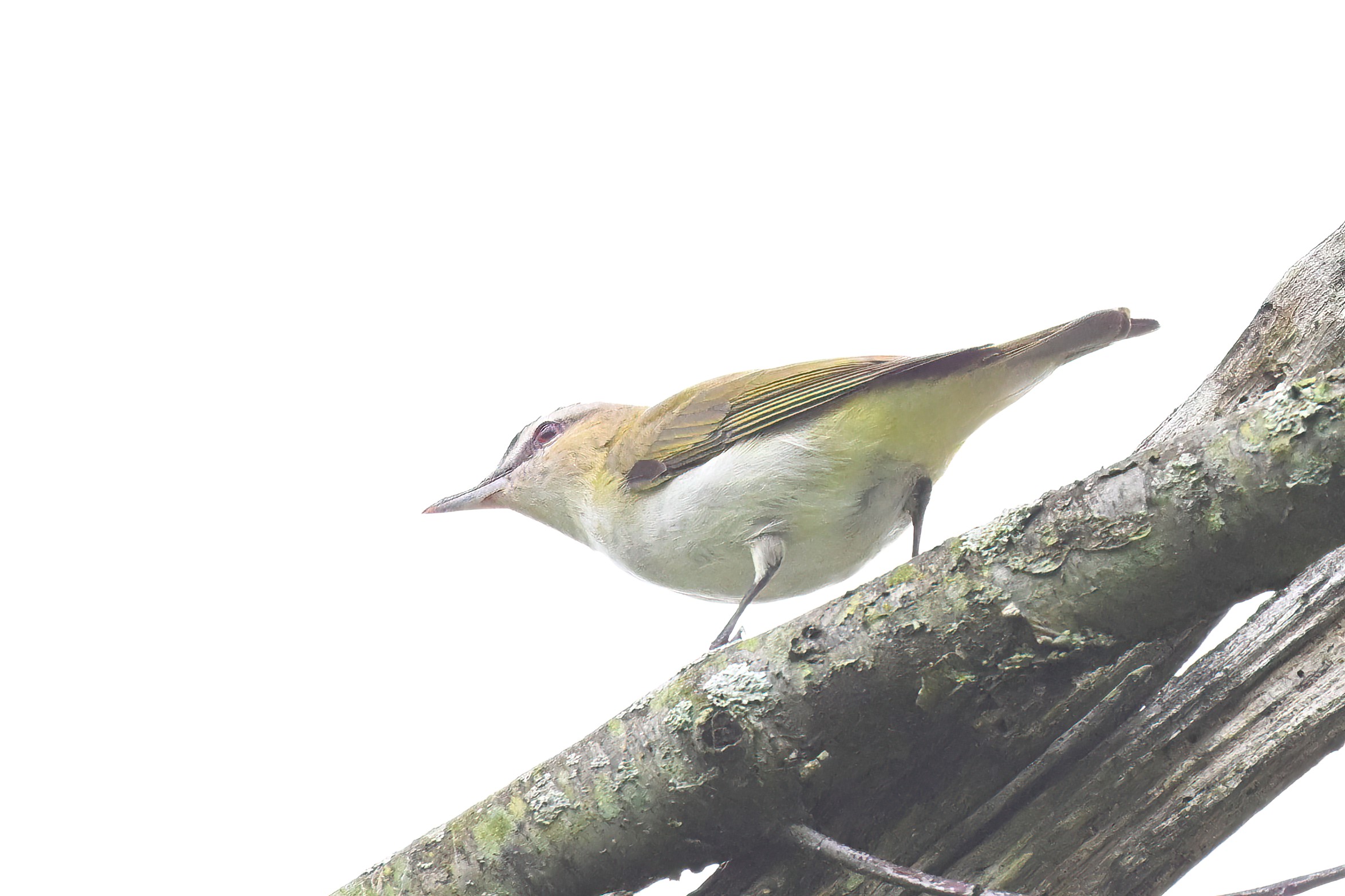
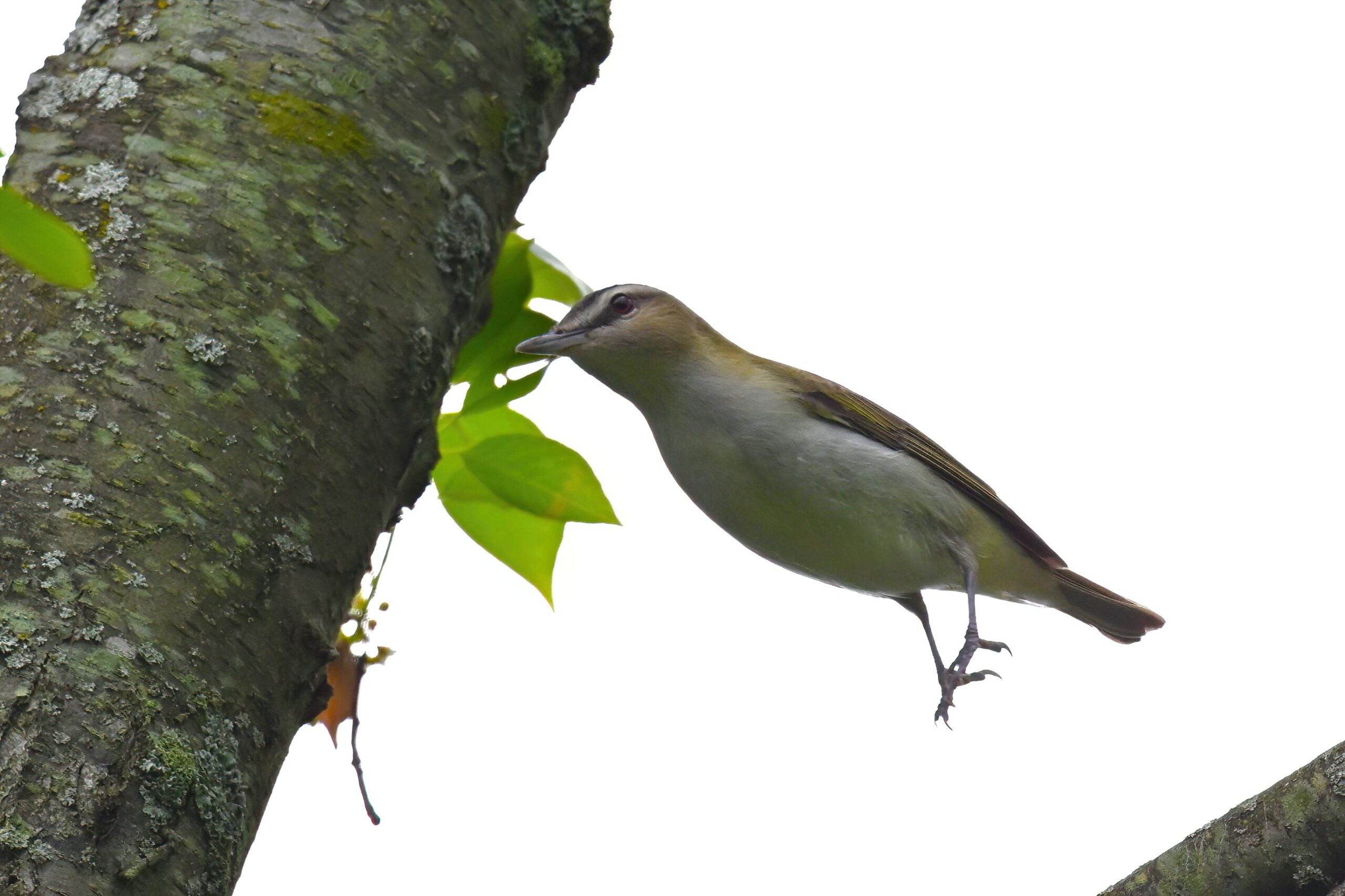
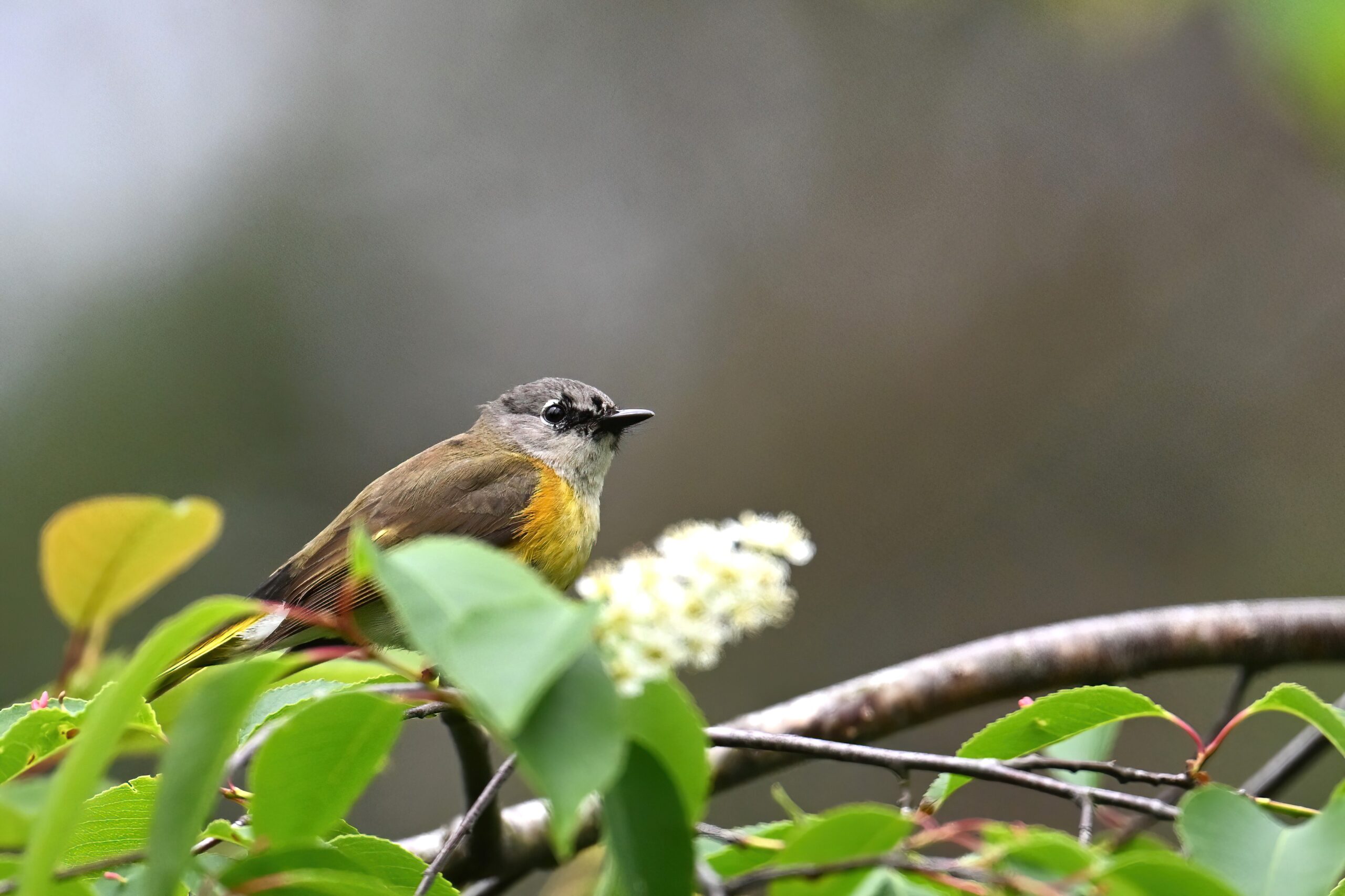
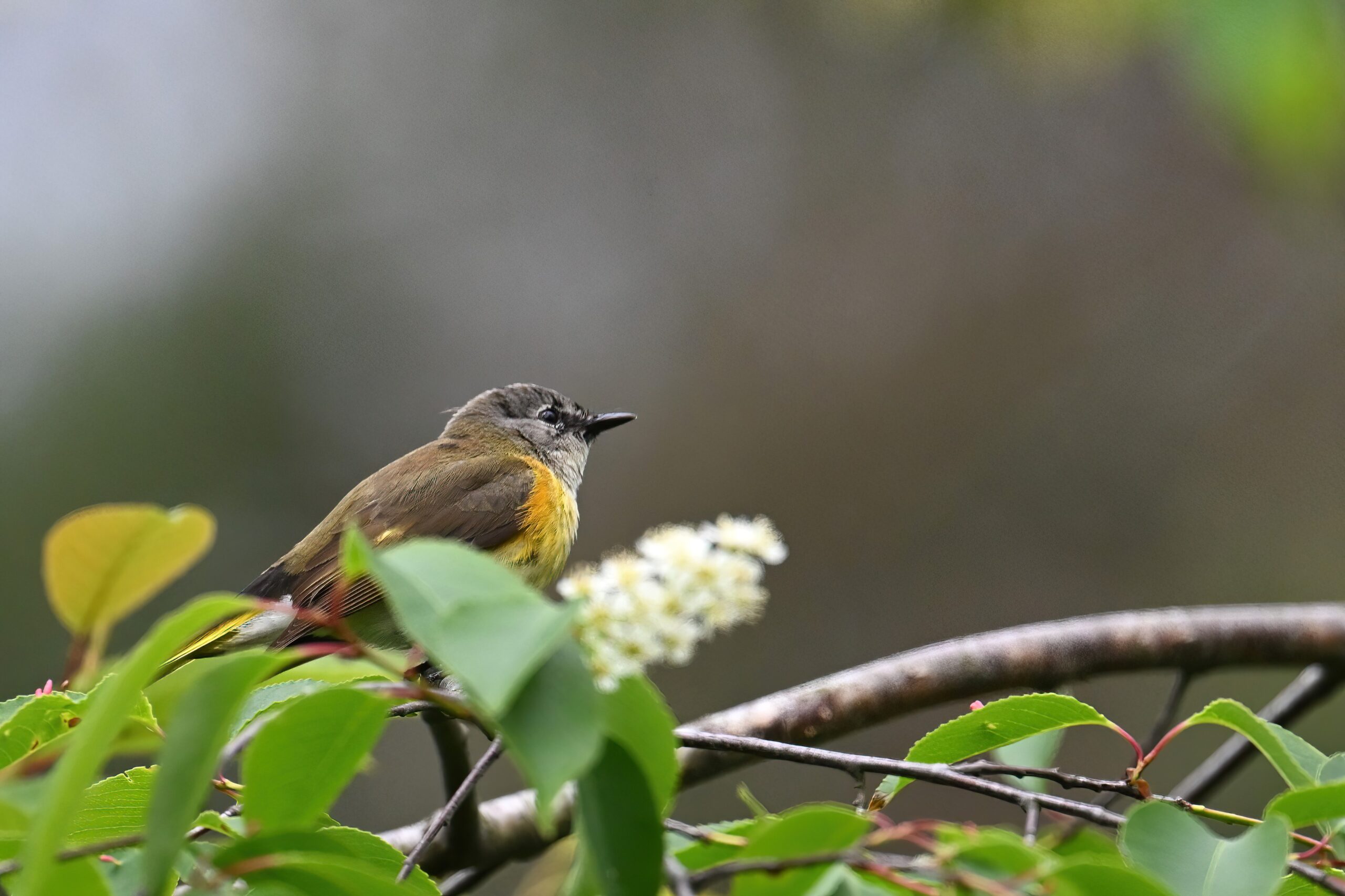
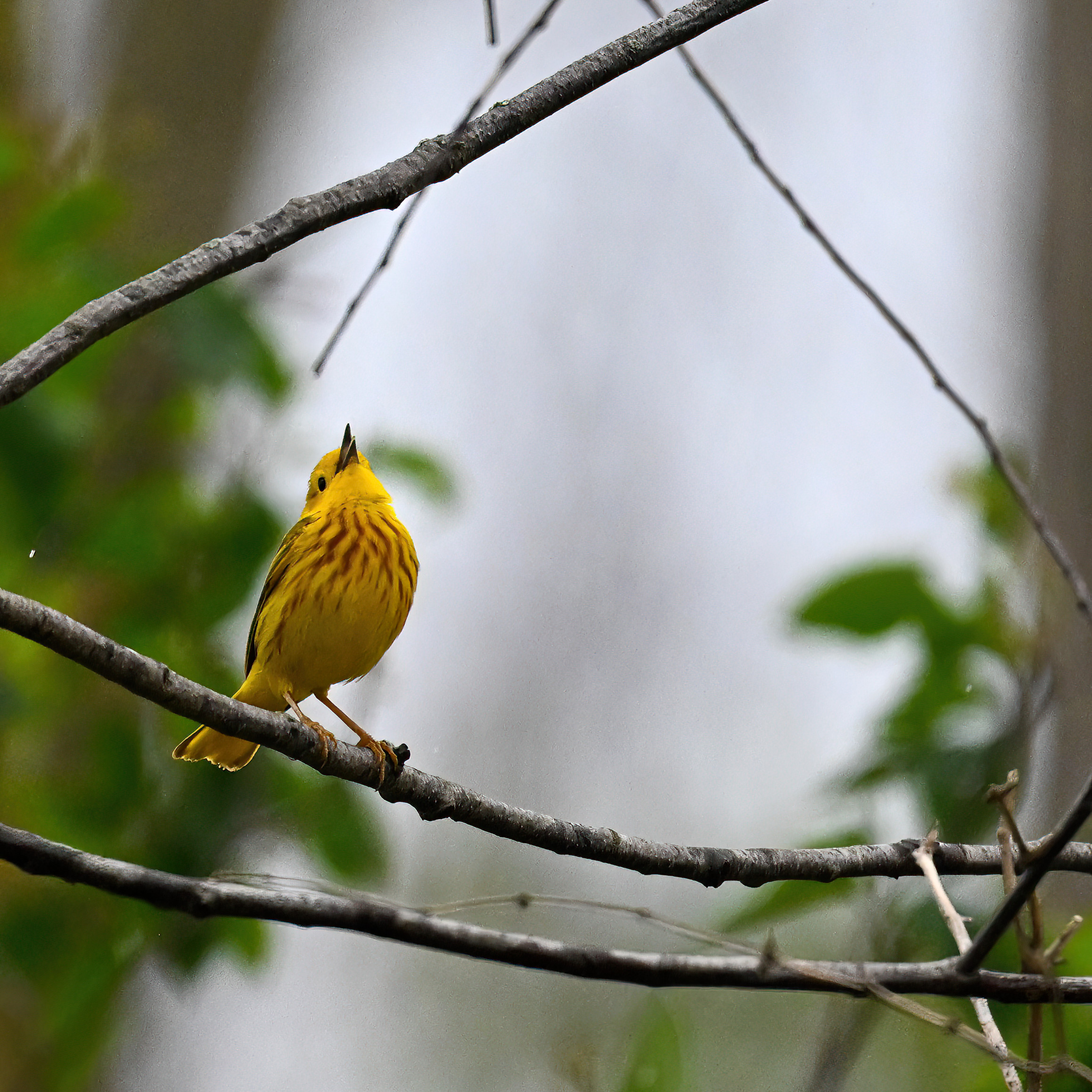
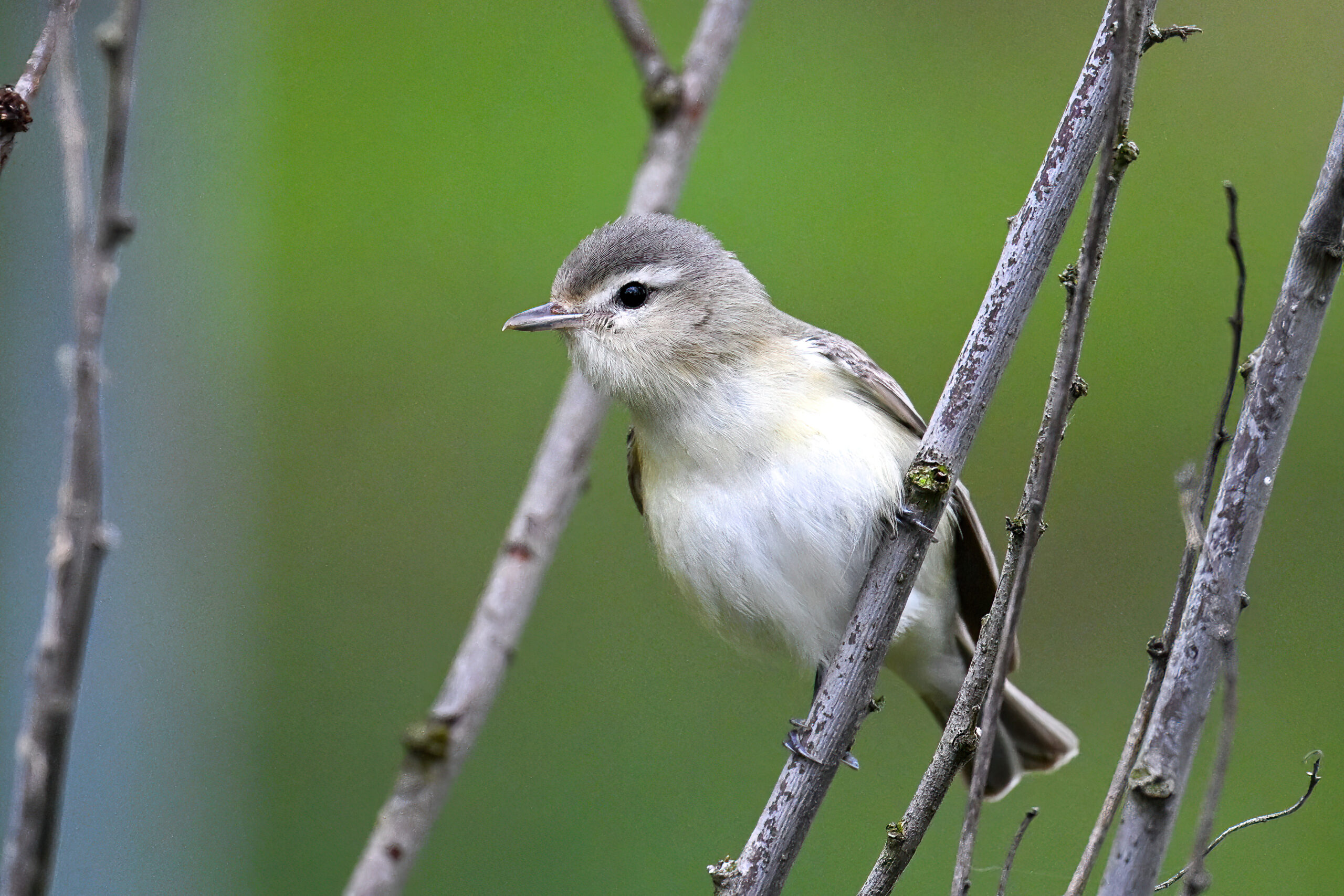
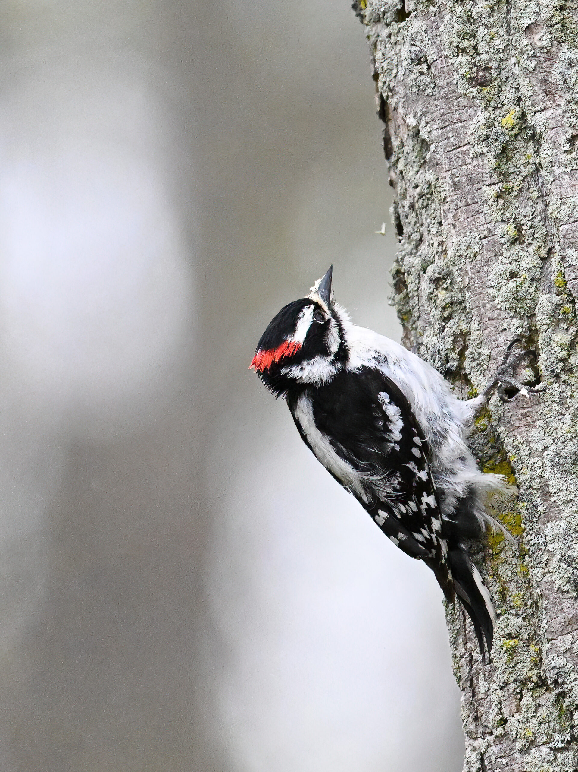
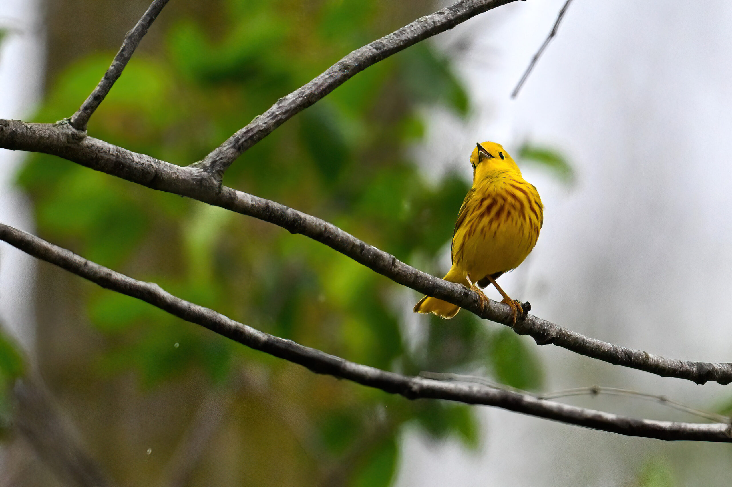
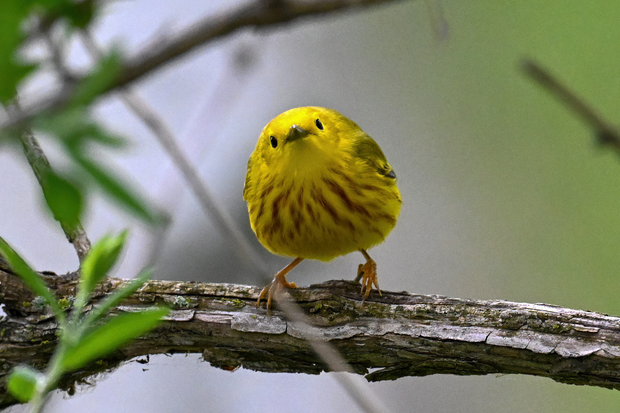
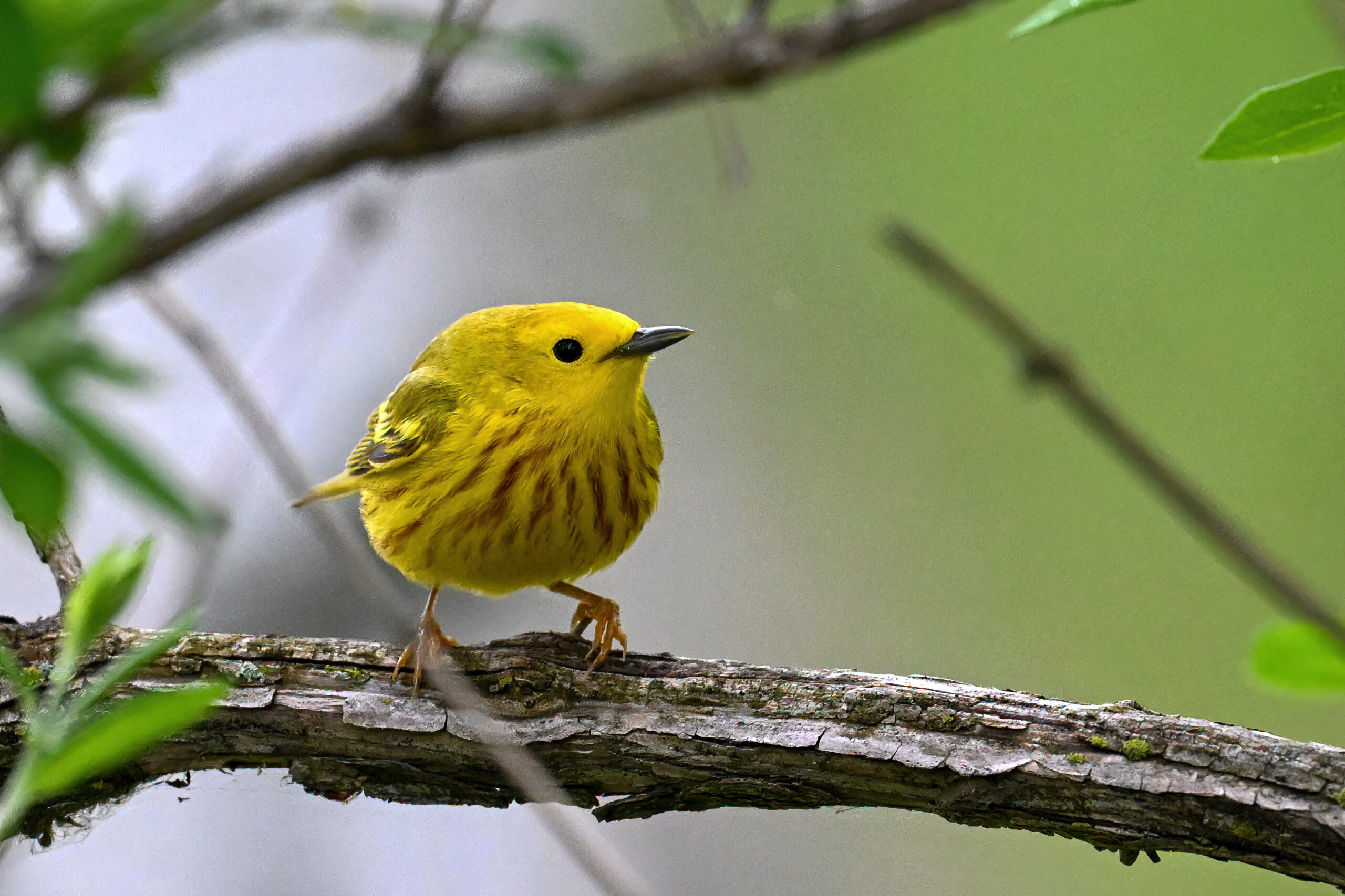
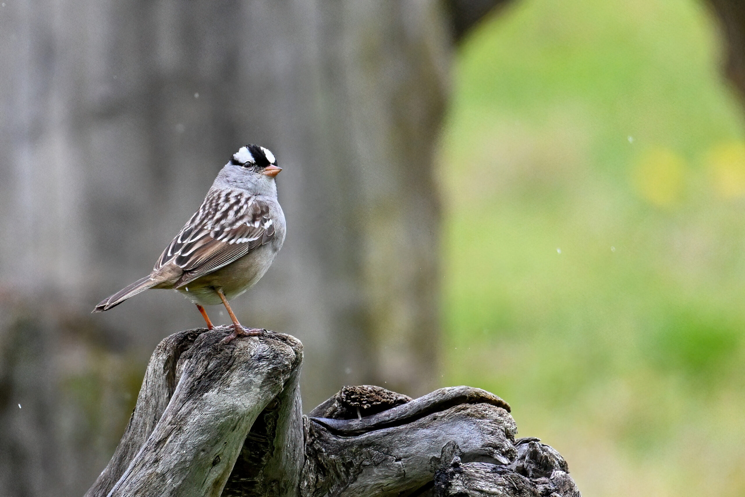
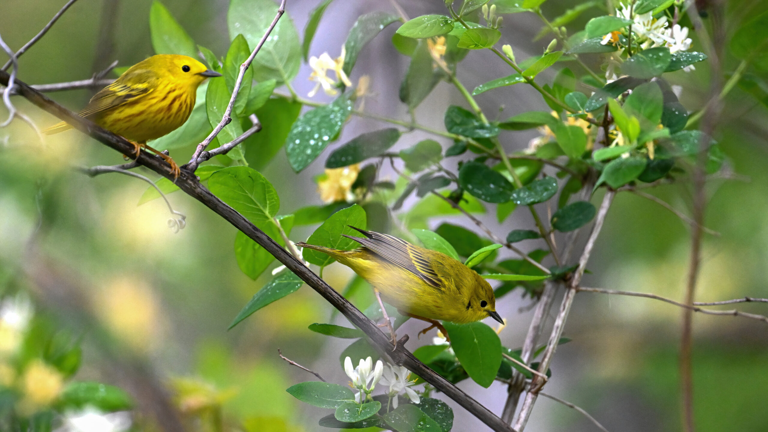
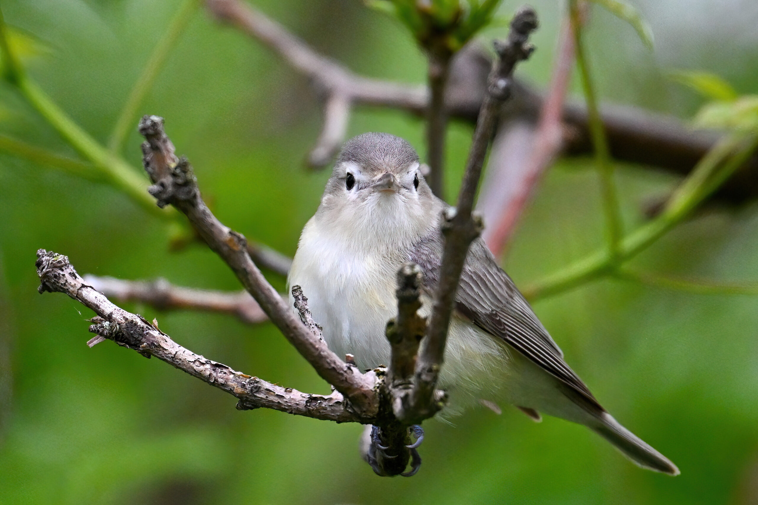
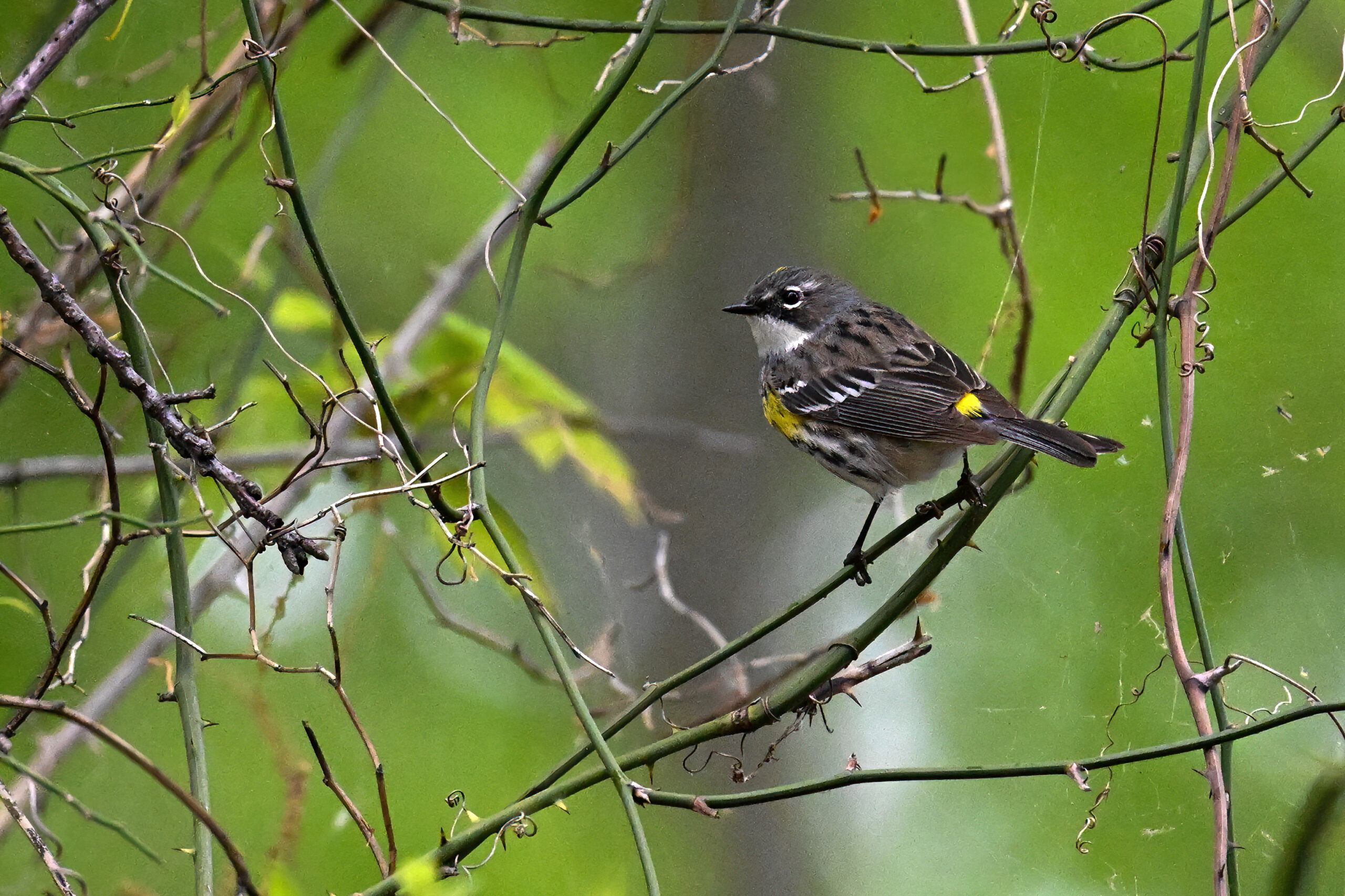
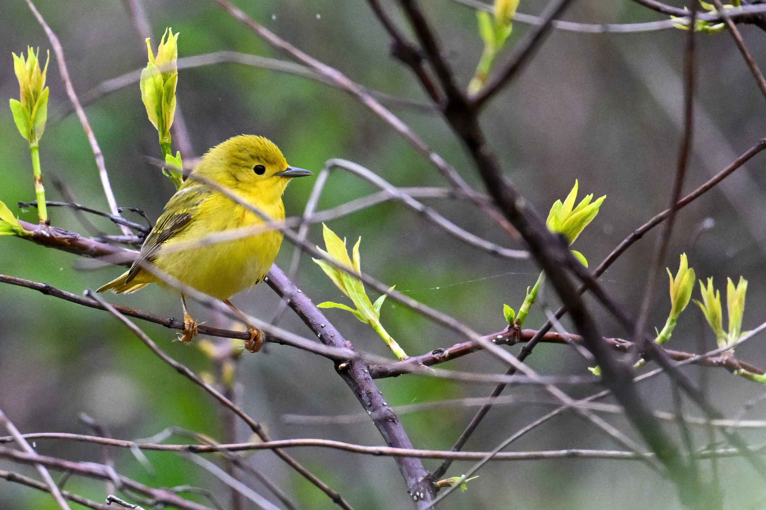
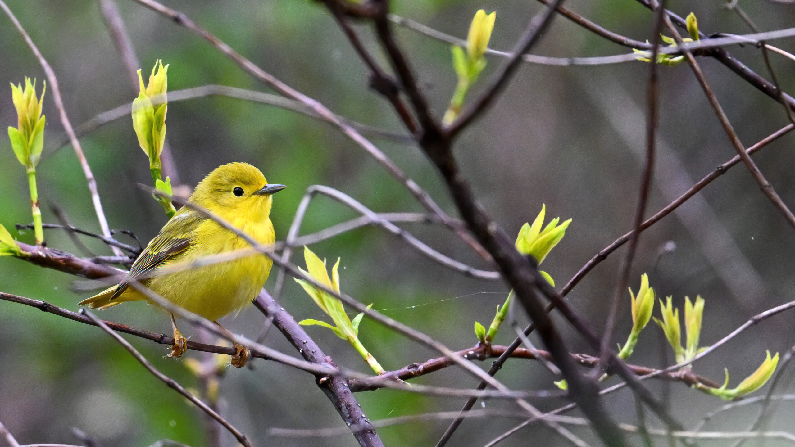
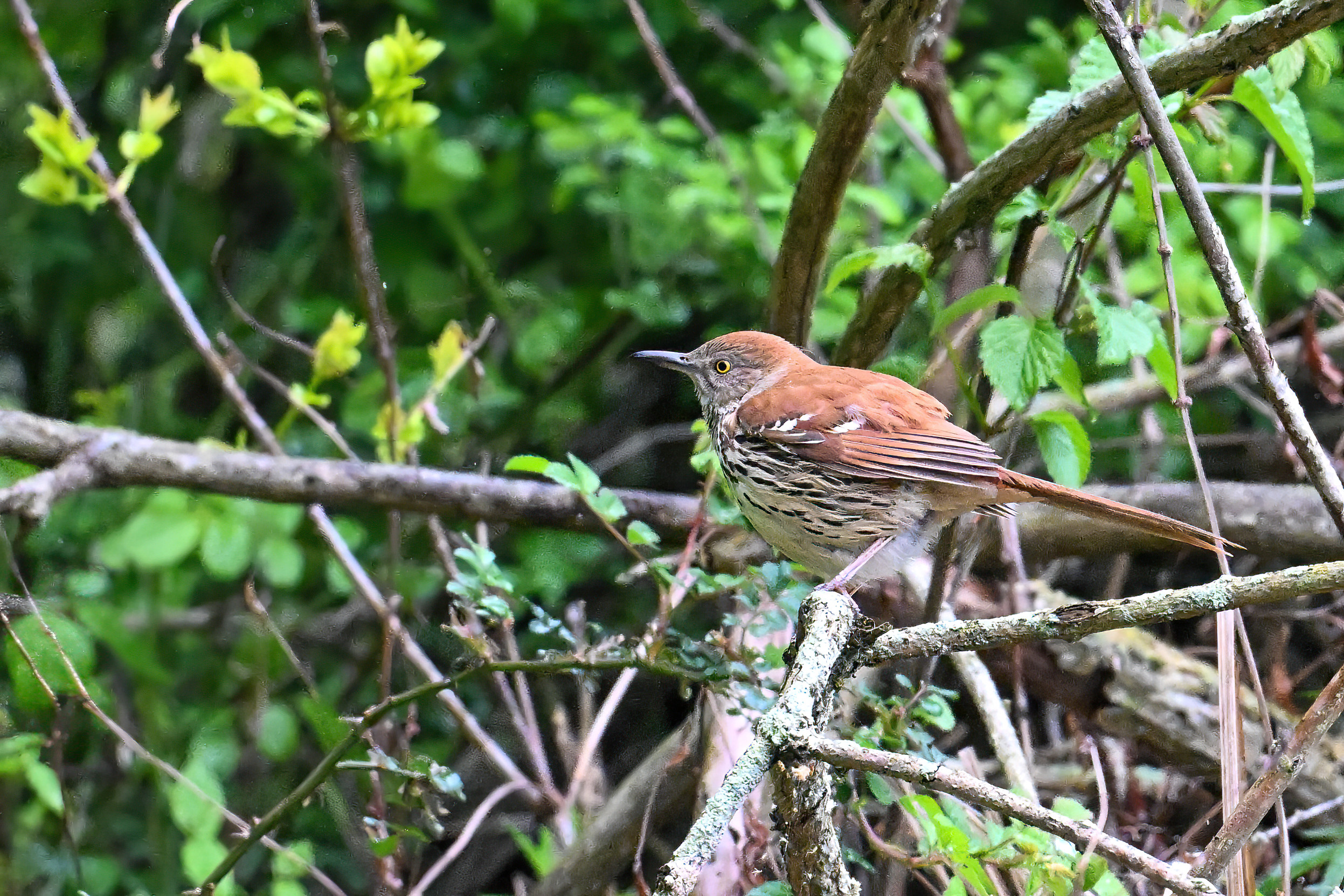
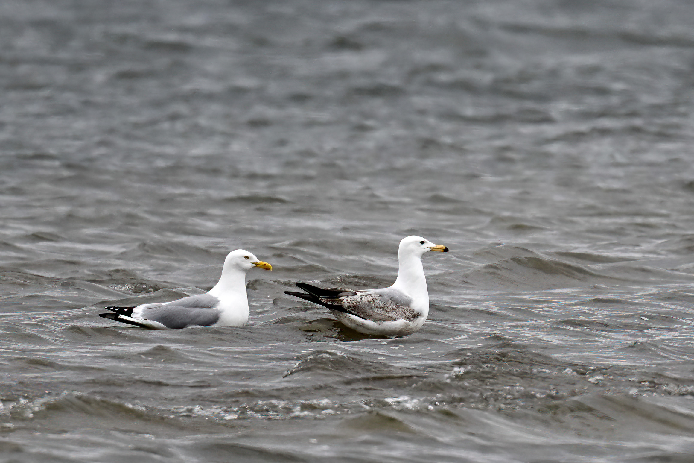
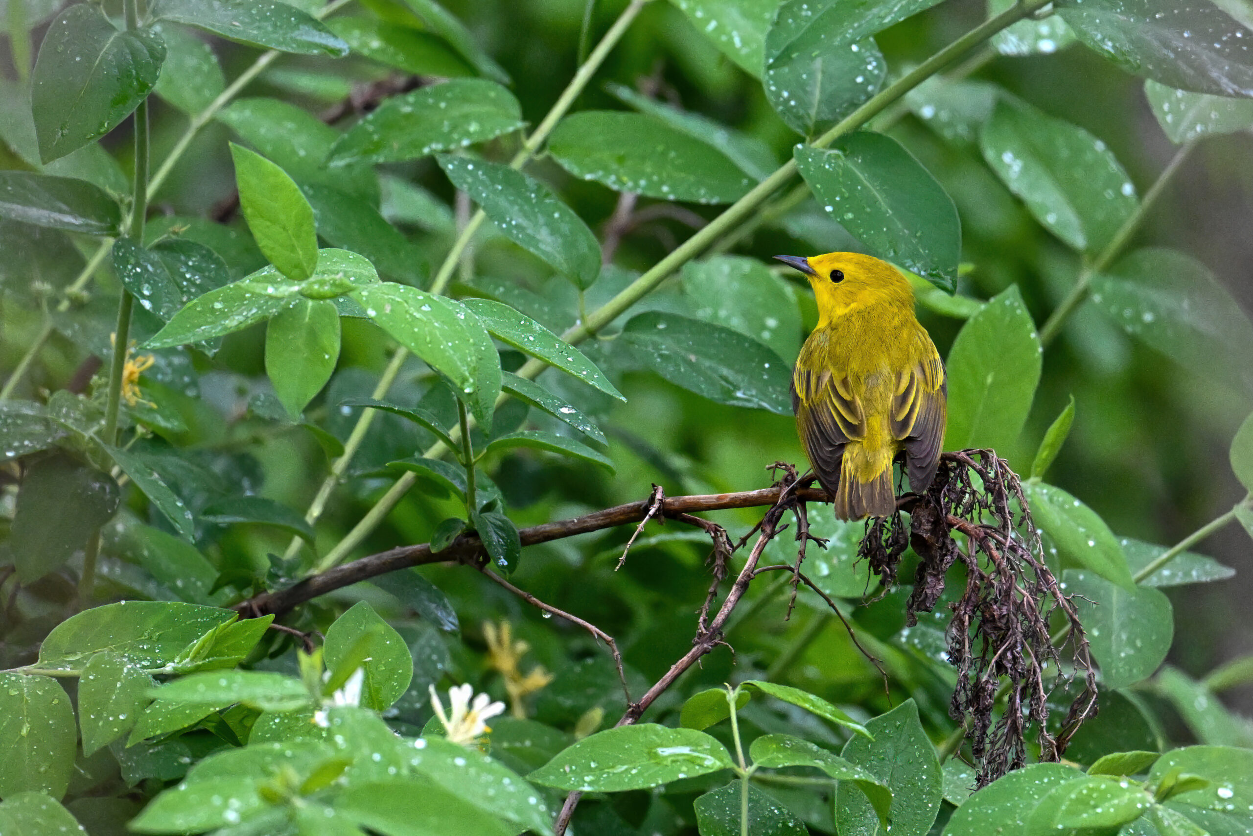
Yellow Warbler (m)Warbling VireoDowny Woodpecker (m)More male Yellow WarblerYellow-rumped Warbler by Beach No. 11More Warbling VireoGBH @ Leo’s LandingHead on Yellow WarblerGrainy Nashville WarblerRed-winged Blackbird in rainStill more male Yellow WarblerWhite-crowned Sparrow in rainMale and female Yellow Warbler in rainAnother shot of Warbling VireoYellow-rumped WarblerYellow Warbler (f)More Blackbird in rainWarbling Vireo IVNashville Warbler on Ridge TrailA walk on the Sidewalk TrailAnother view of female Yellow WarblerBrown ThrasherHerring Gulls off Leo’s LandingAfter the rainFinal Vireo
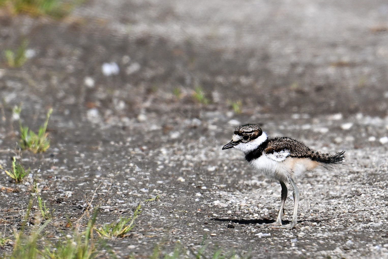
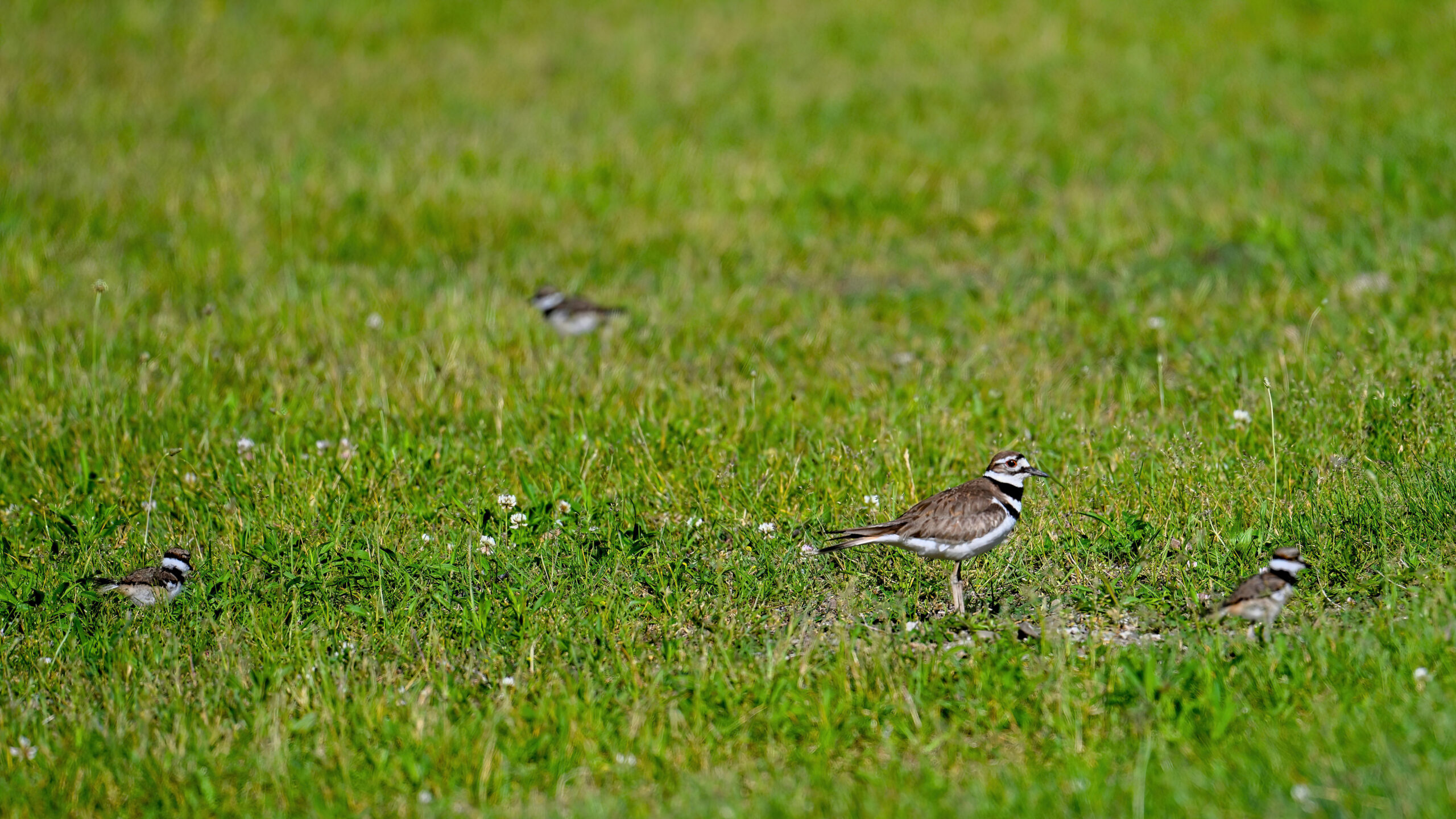
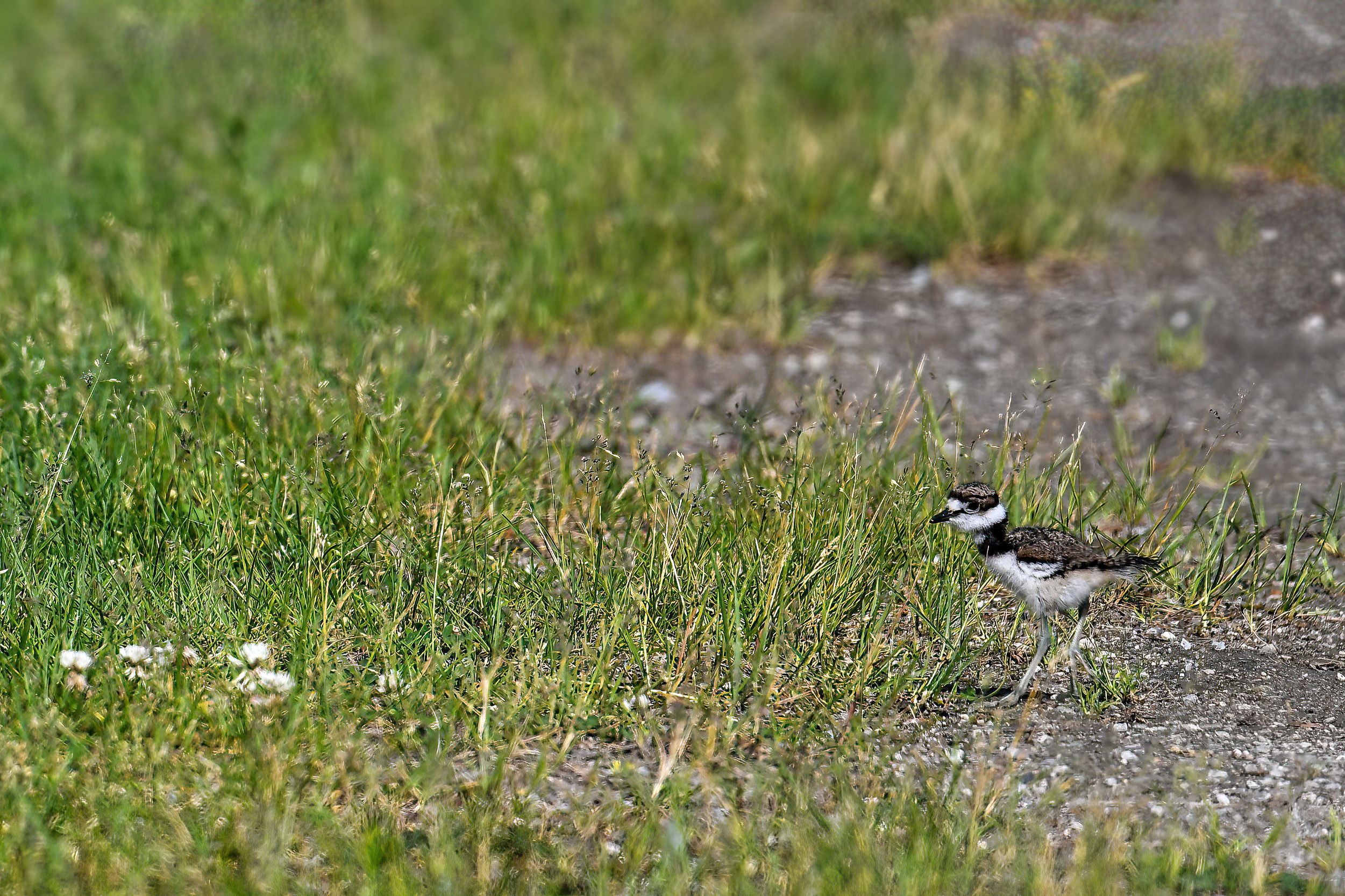
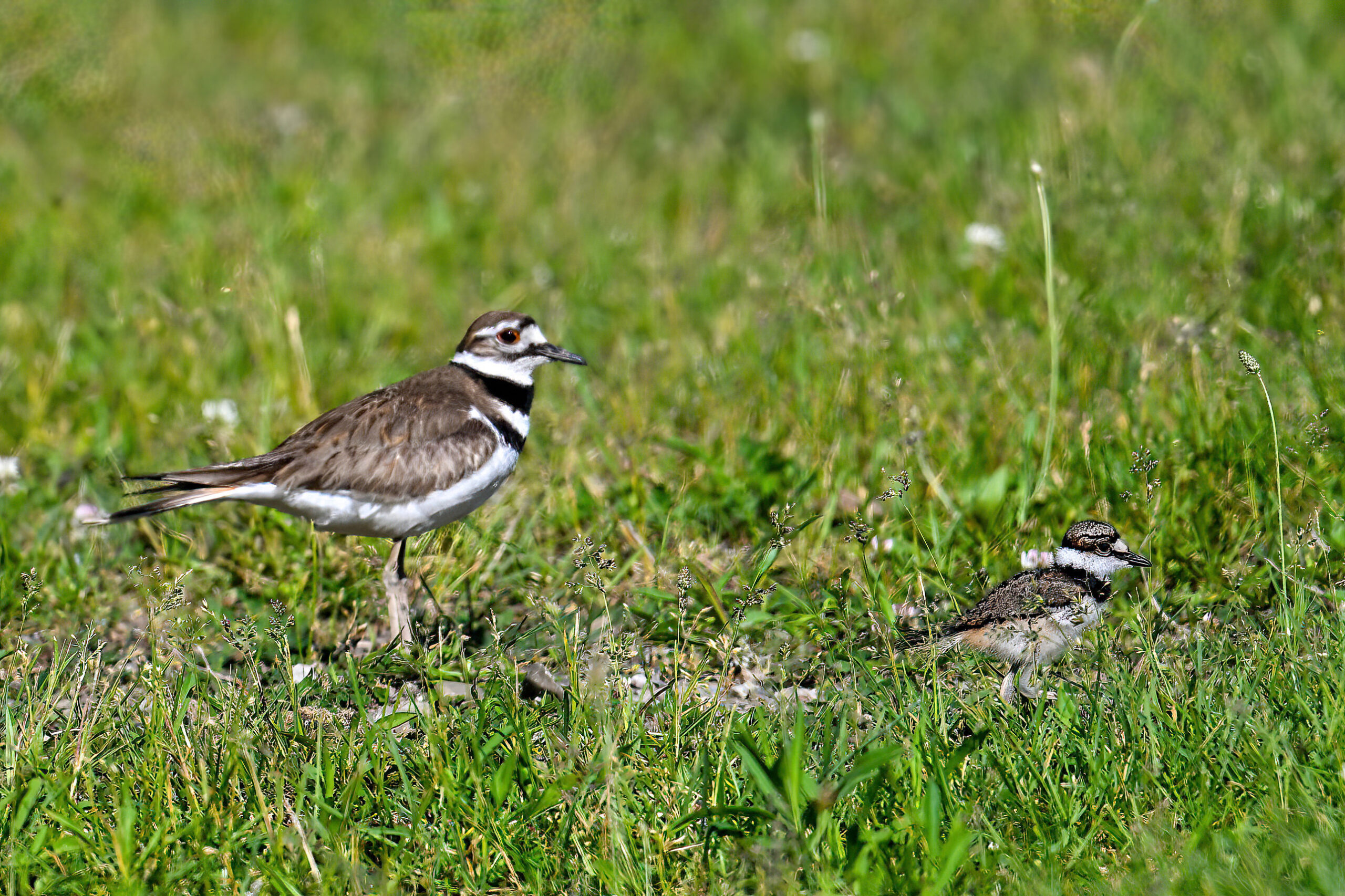
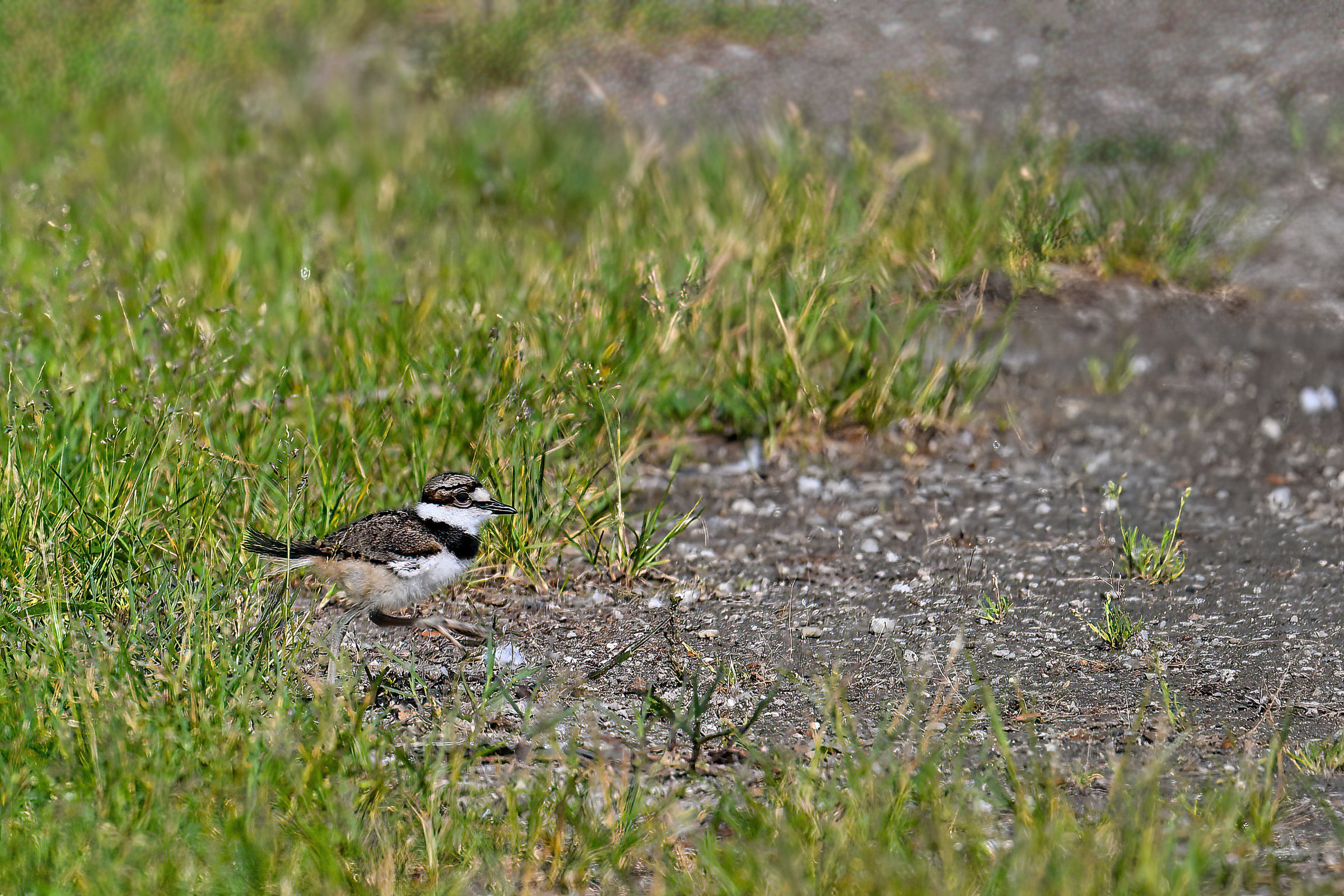
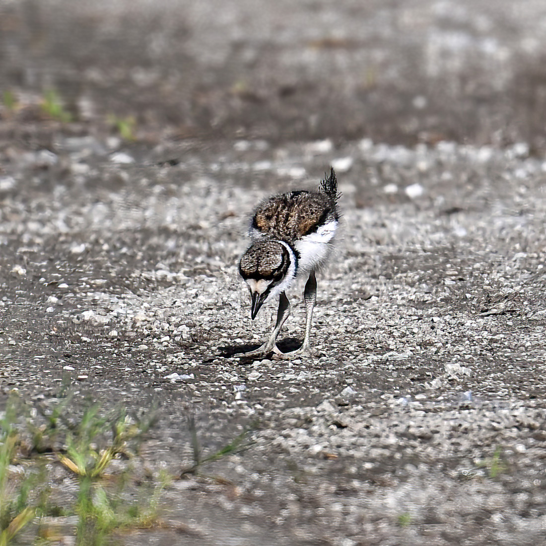
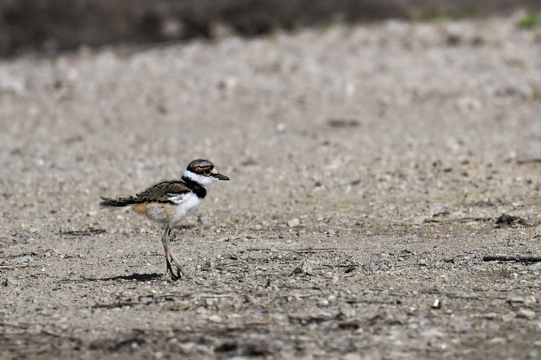
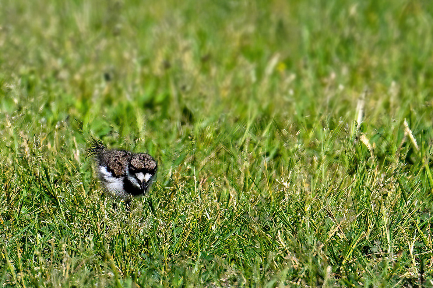
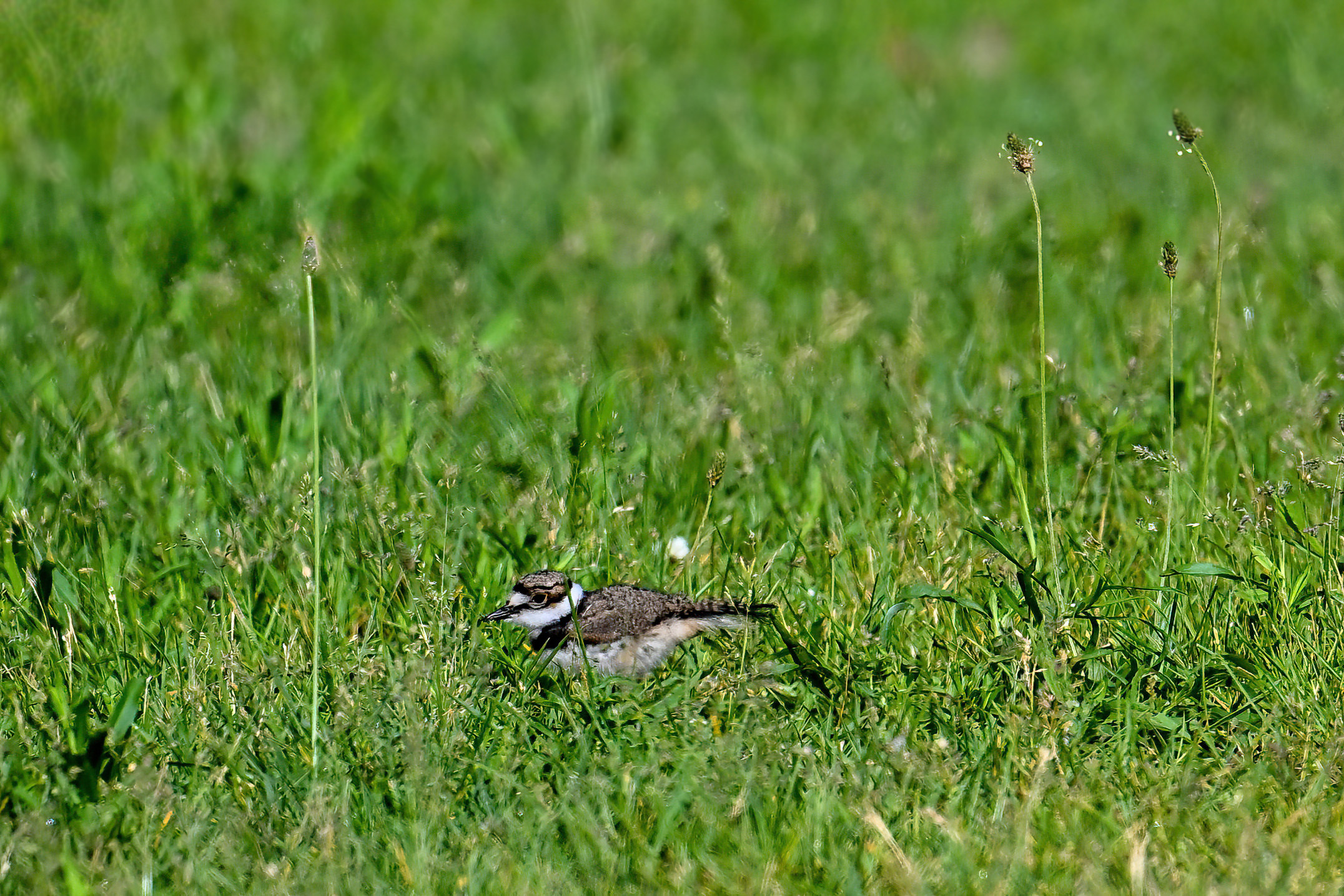
It was a rather amazing Sunday at Presque Isle State Park – sunny, warm/humid, the smell of Multiflora Rose in the air, then ocean-like ground fog along the outer beach. Bird-wise, things got off to the best start possible for a hike out to Gull Point with exceedingly cute Killdeer chicks in the Budny Beach east parking lot:
Killdeer baby @ Budny Beach parking lot
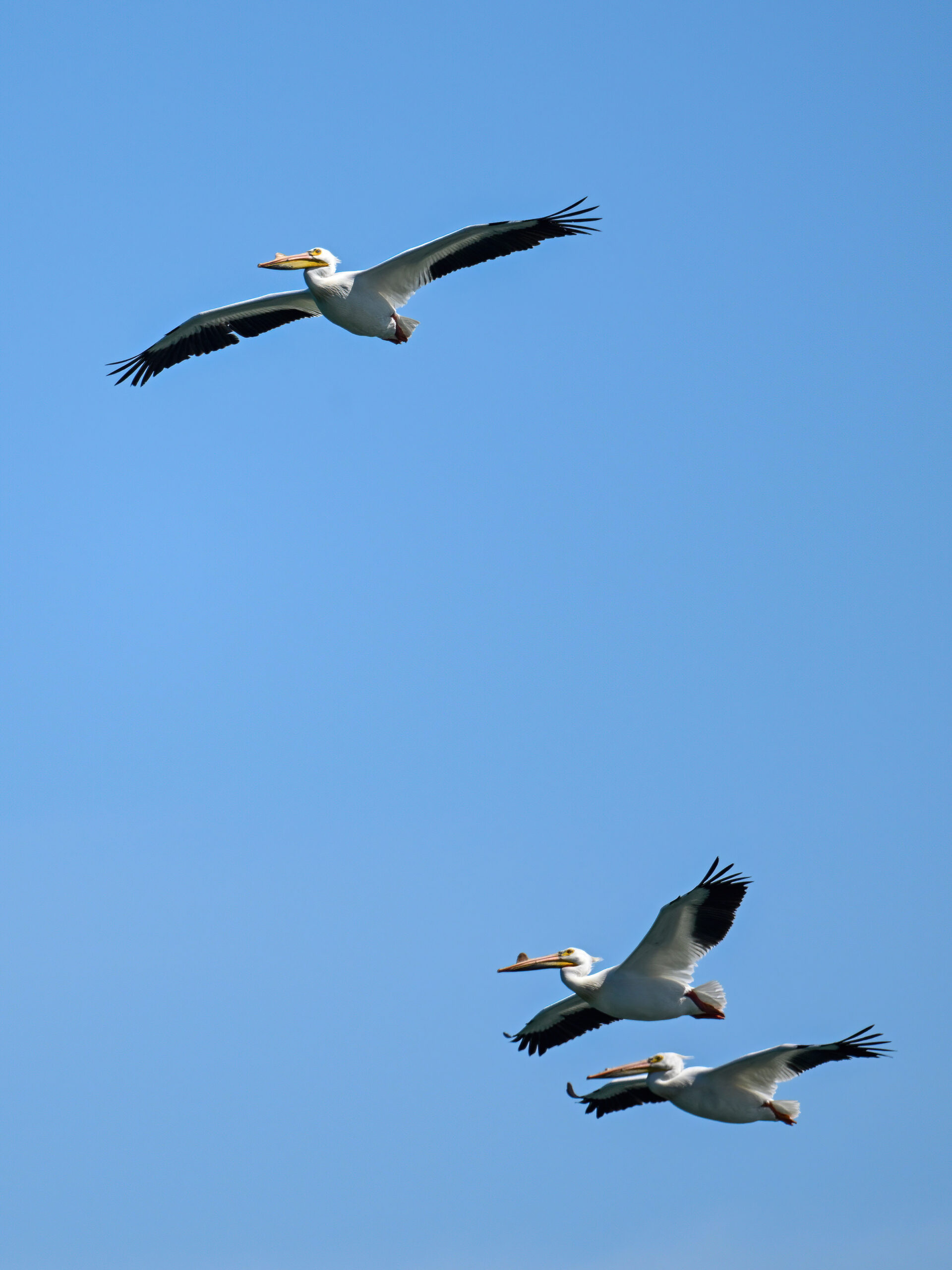
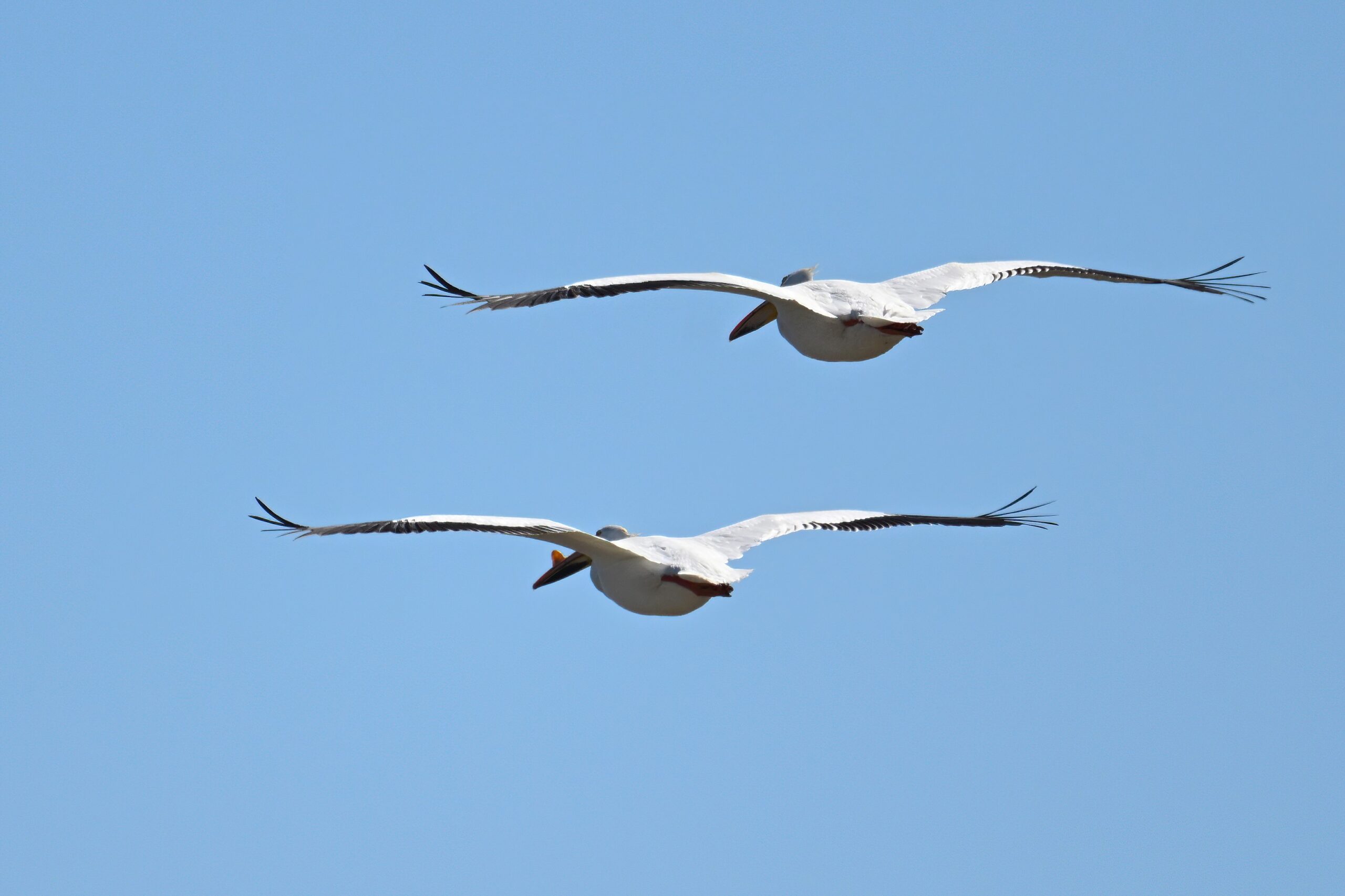
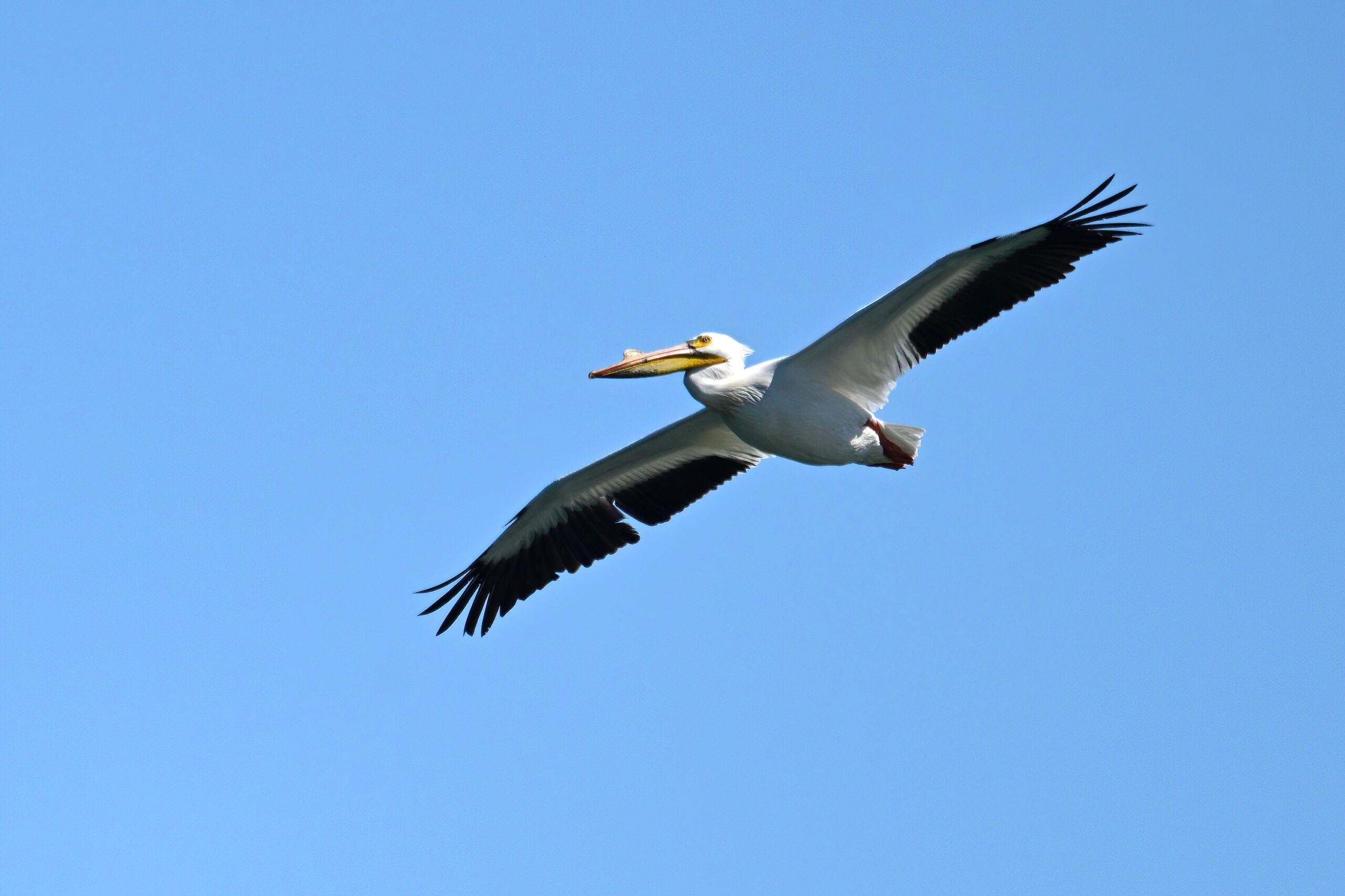
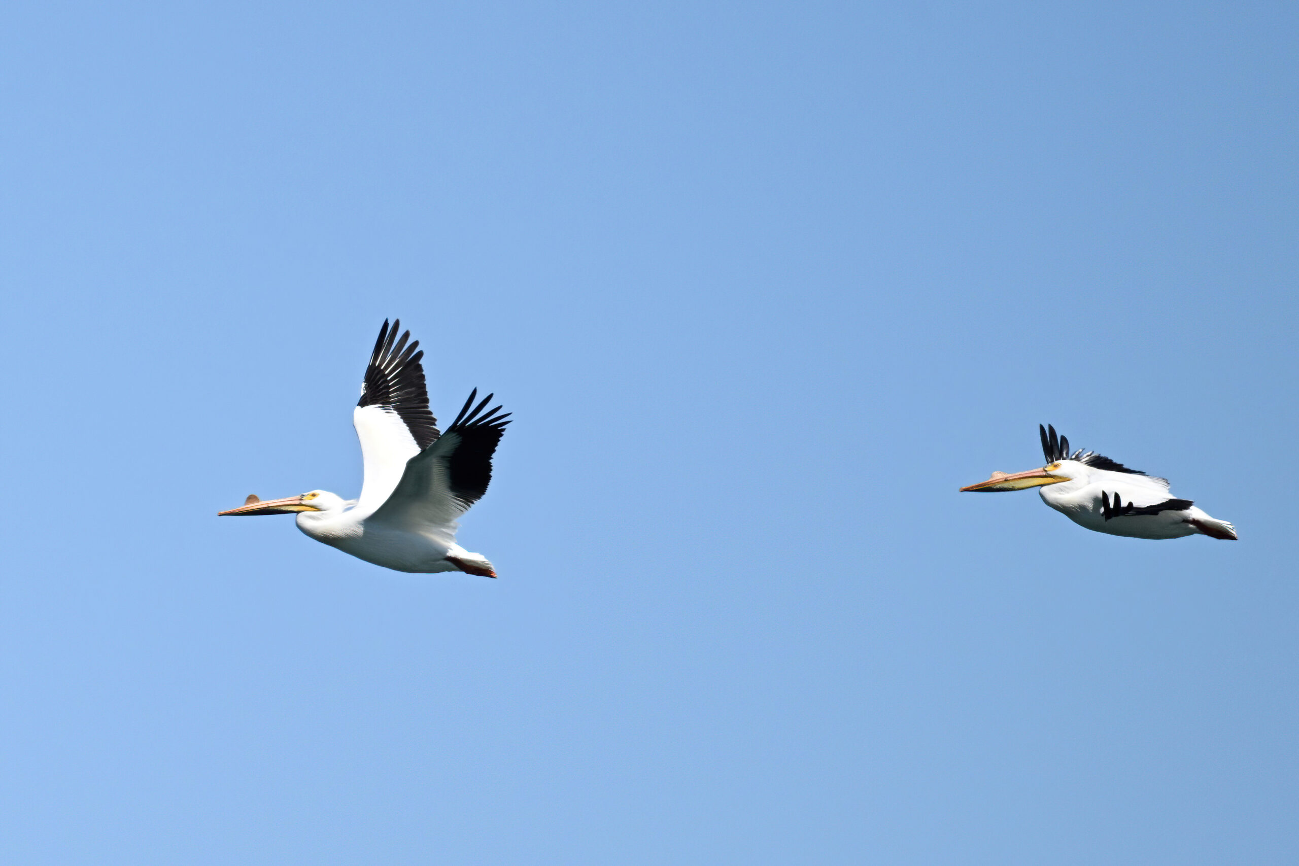
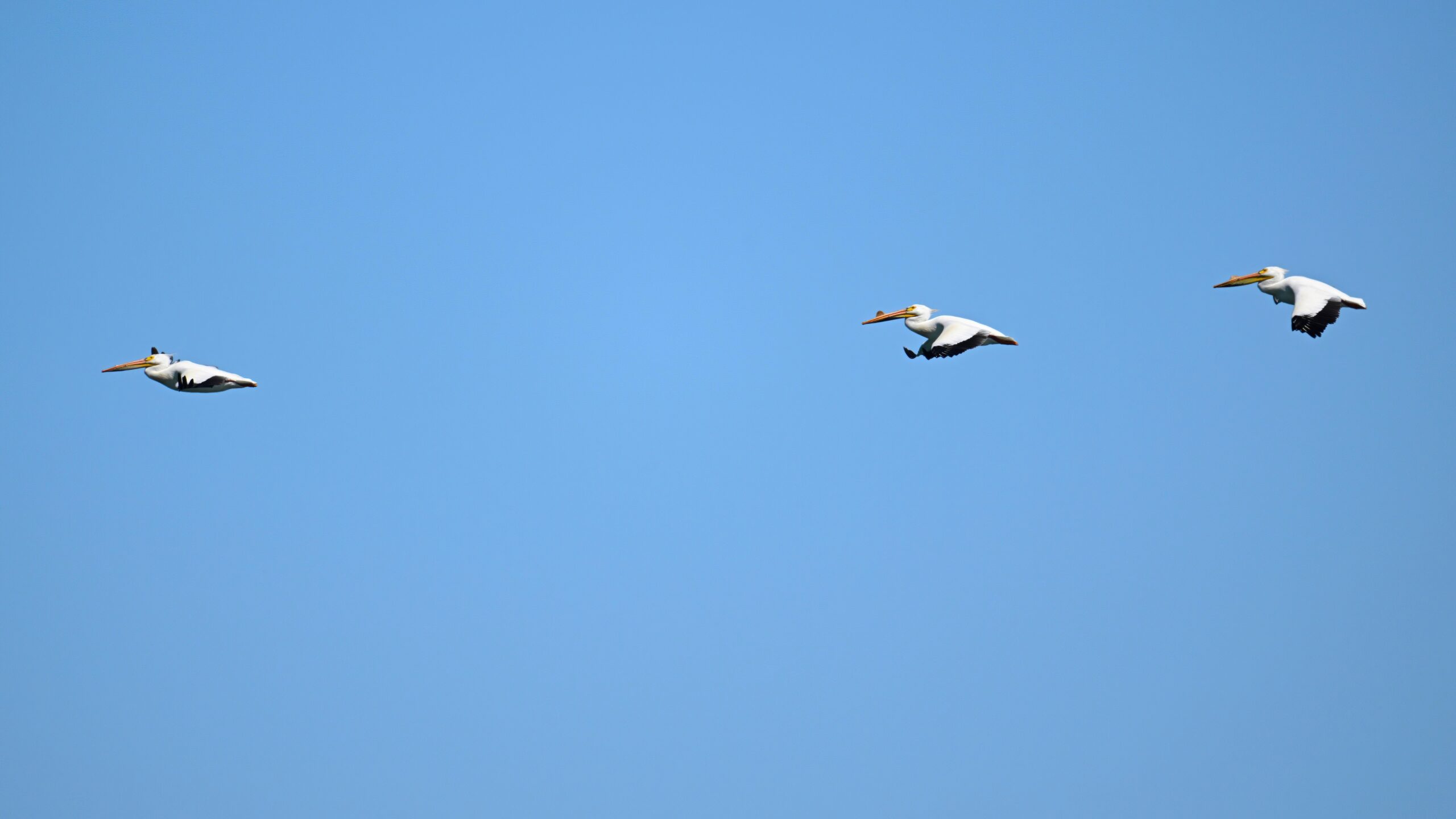
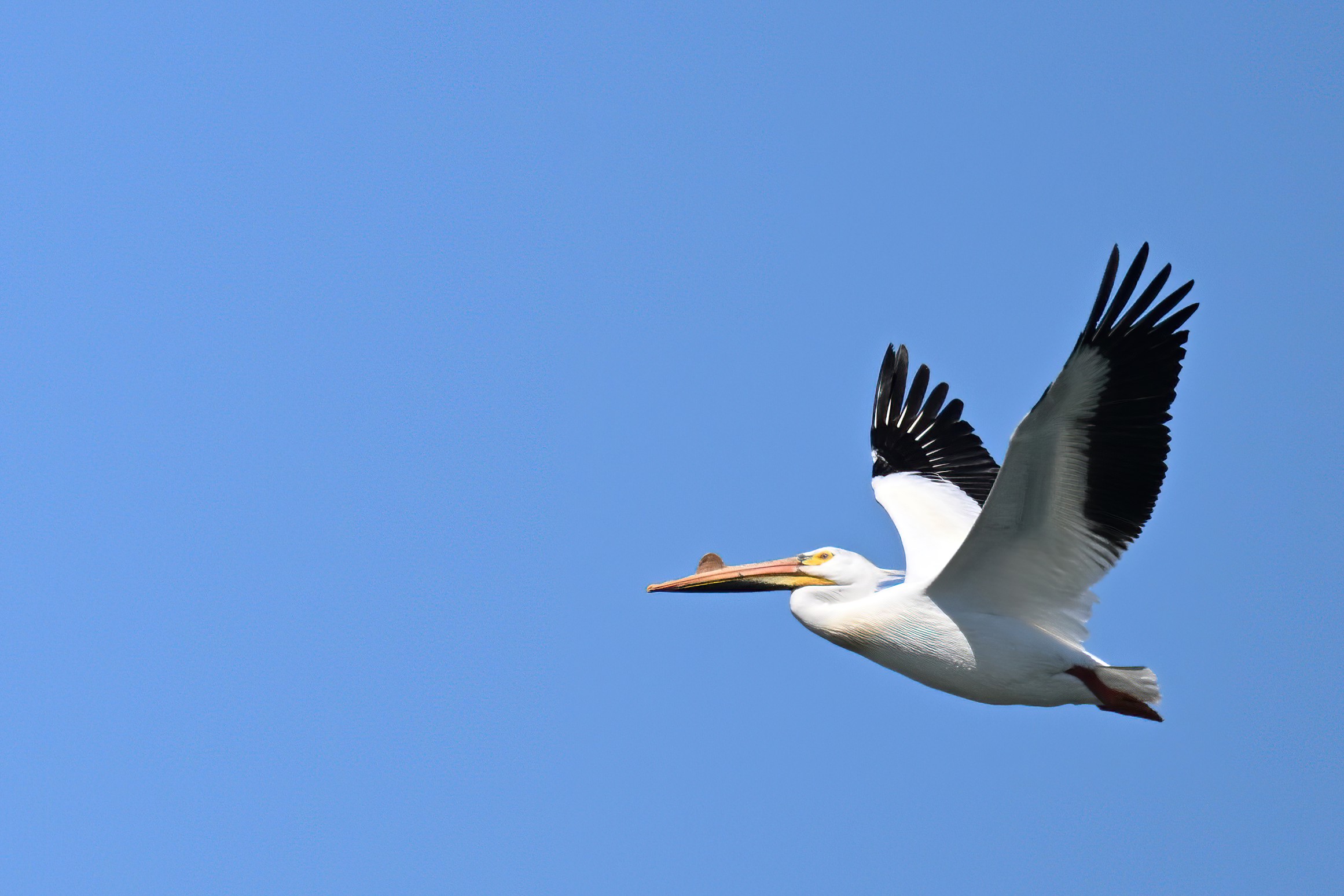
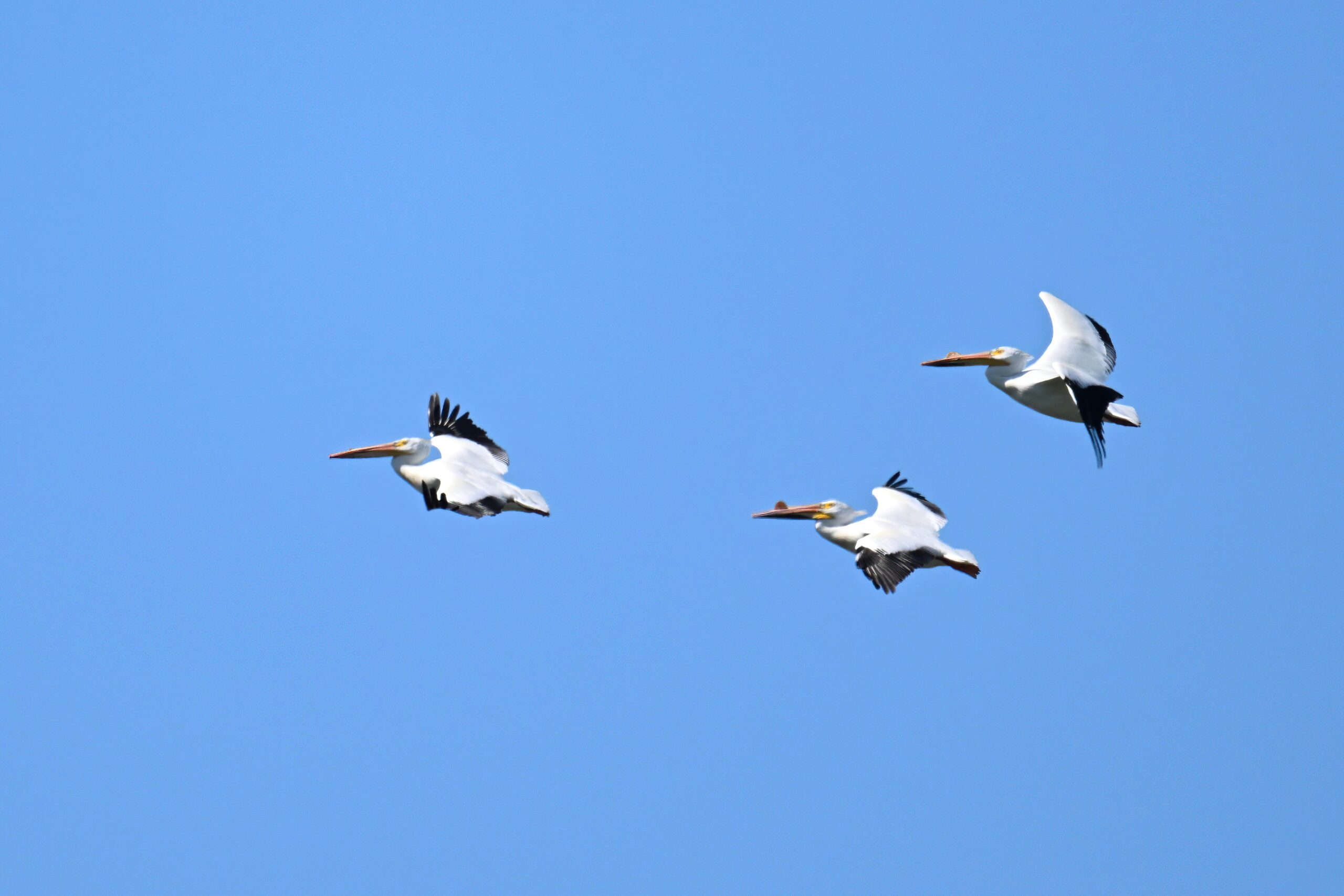
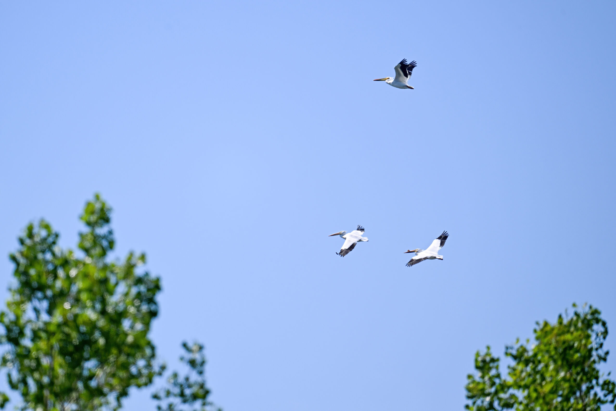
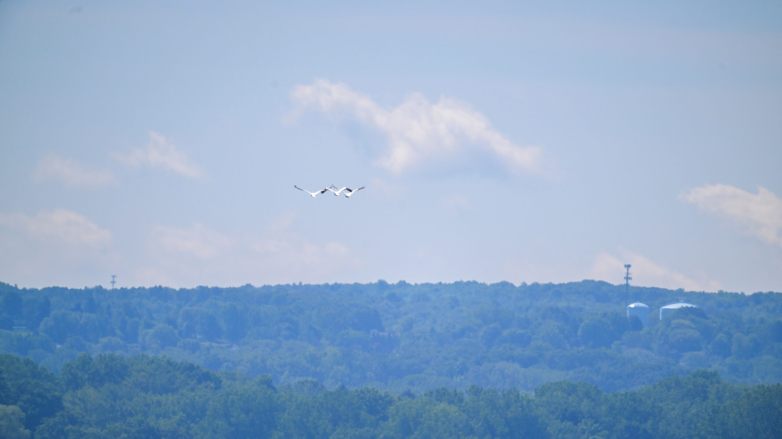
Later, an amazing American White Pelican trio over outer Gull Point. (Ho-hum, just another day at the Point… 😉 Reported occasionally on eBird, still a rare occurrence for Erie County and the east coast generally – this is the first BirdingPI.com local sighting ever:
American White Pelican x3
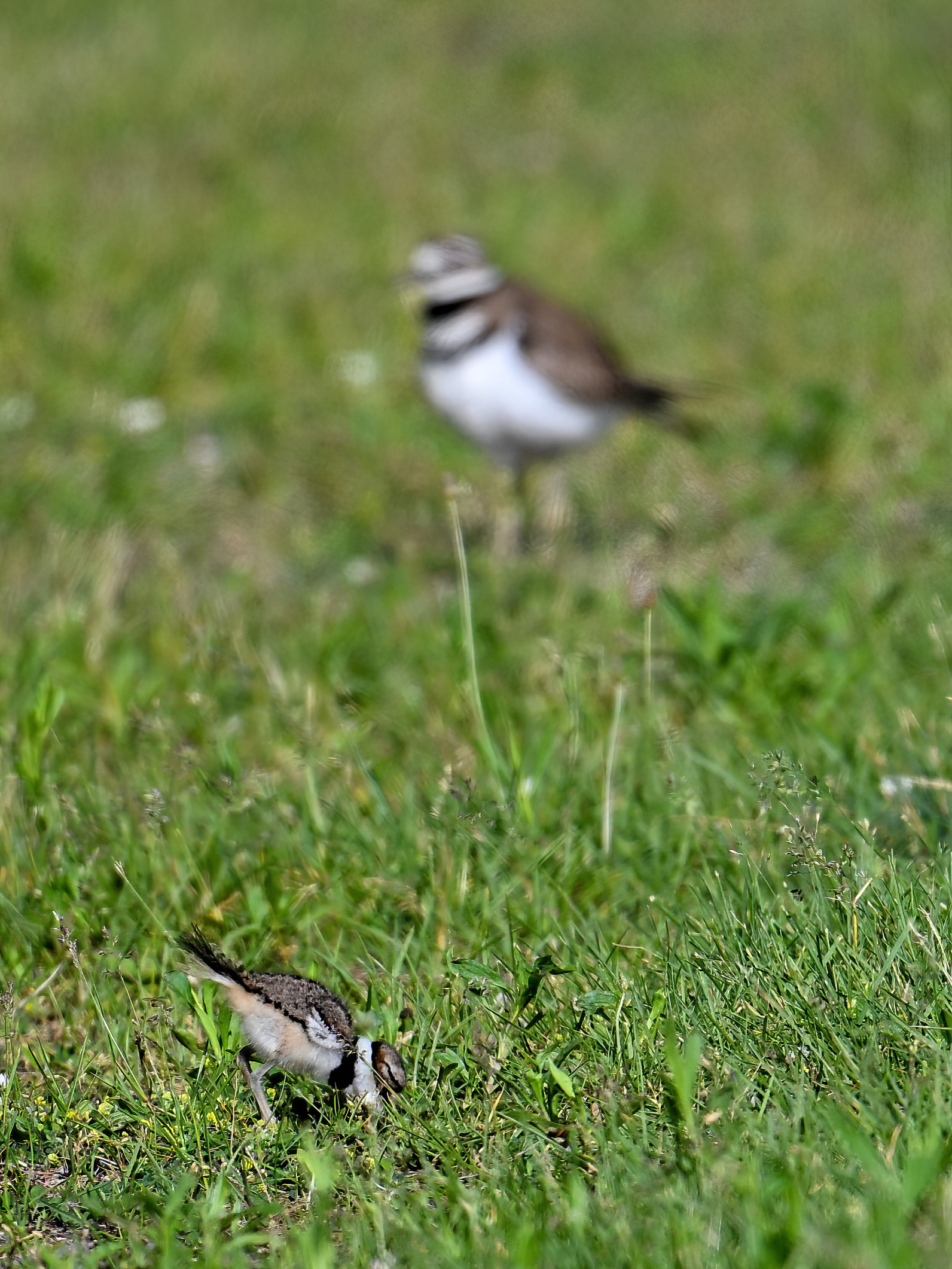
Here’s an alternating medley of more Killdeer and Pelican:
Killdeer parent & three chicks
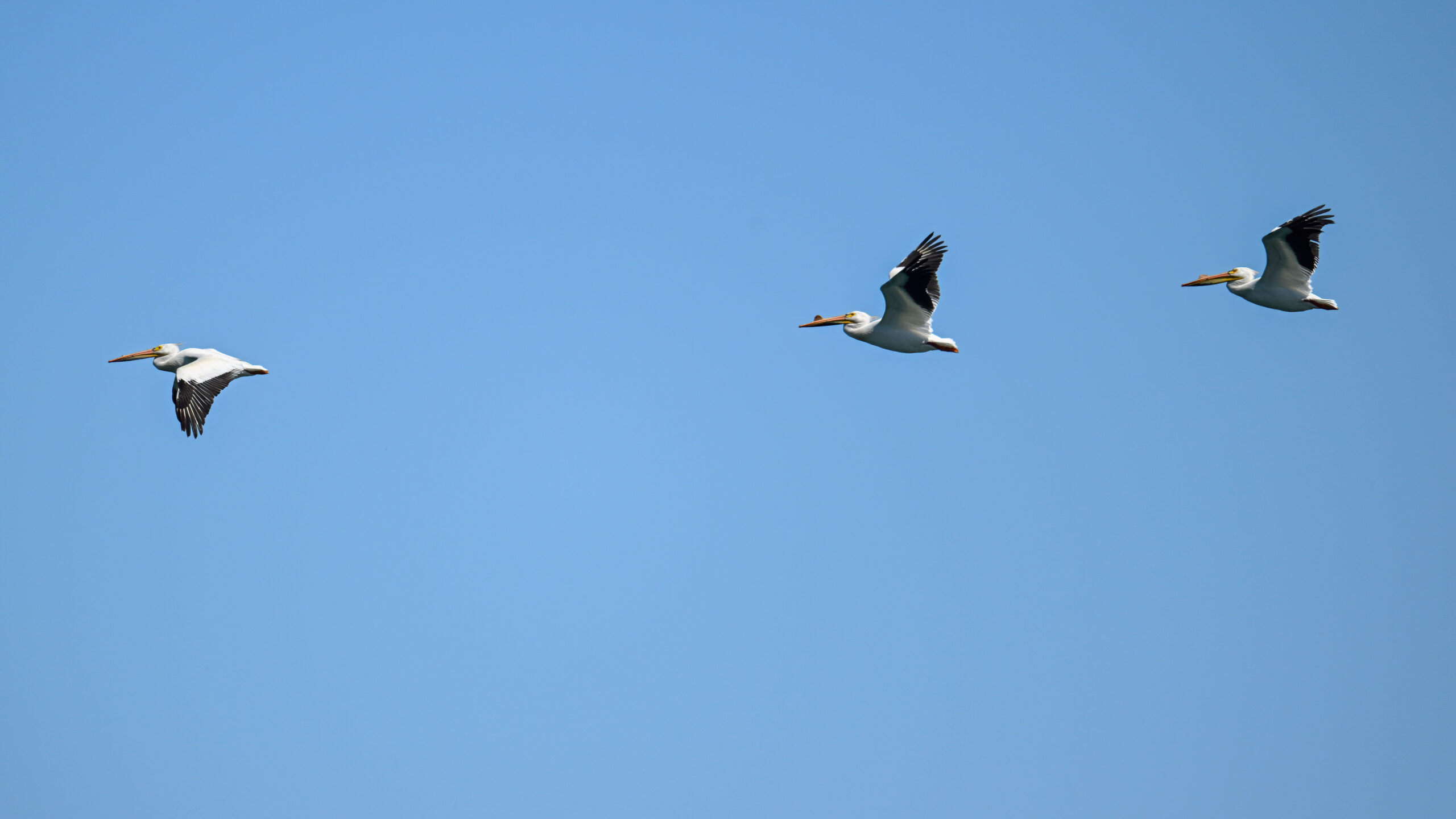
These Pelicans came in the from the west/northwest maybe, then made a looping turn over outer Gull Point to head pretty much due south:
Pure conjecture, but considering the abrupt turn south from the lake, wonder if they were using Gull Point as a navigation landmark. (“Bird things that make you go ‘hmmmm….'”)
Pelicans heading south
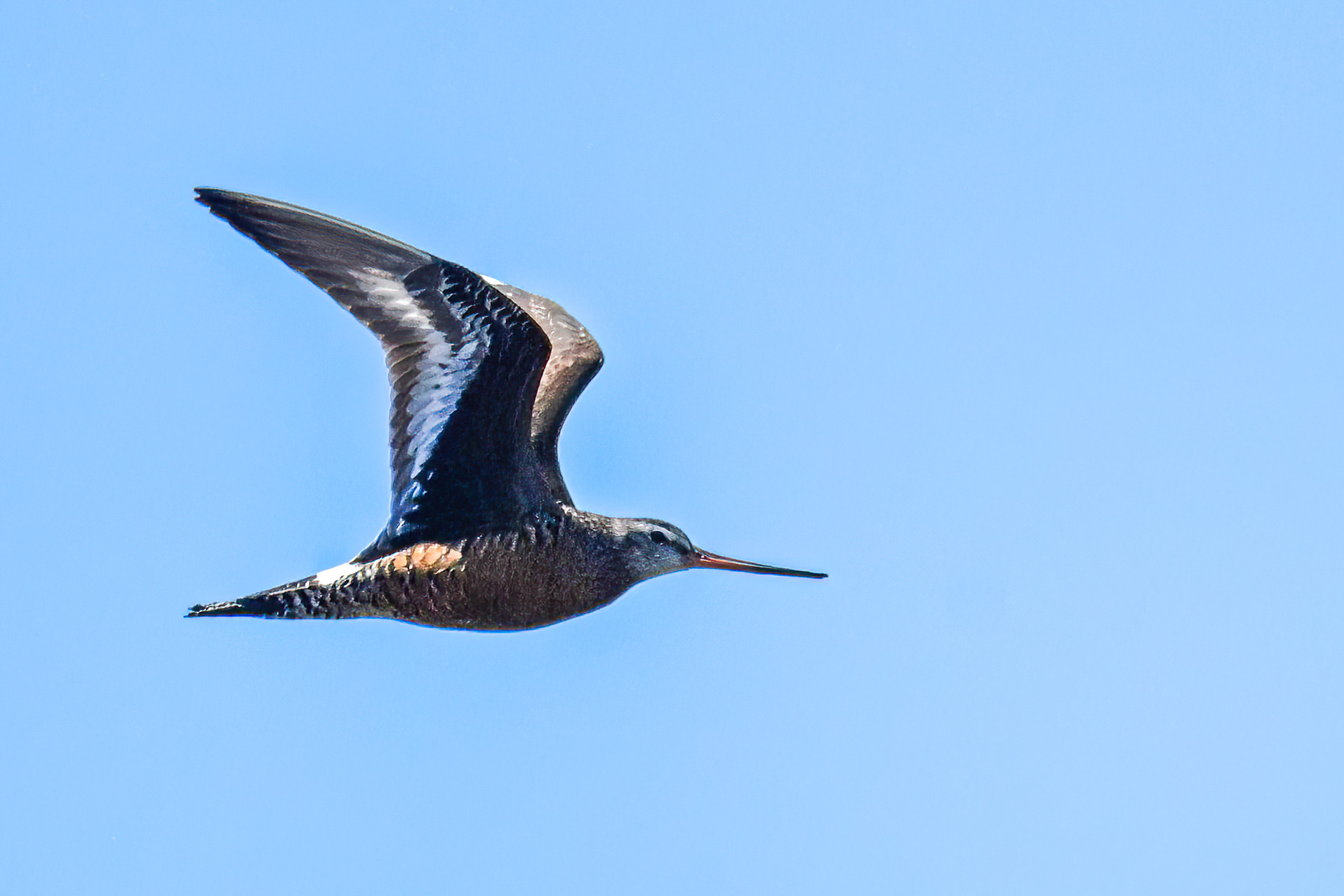
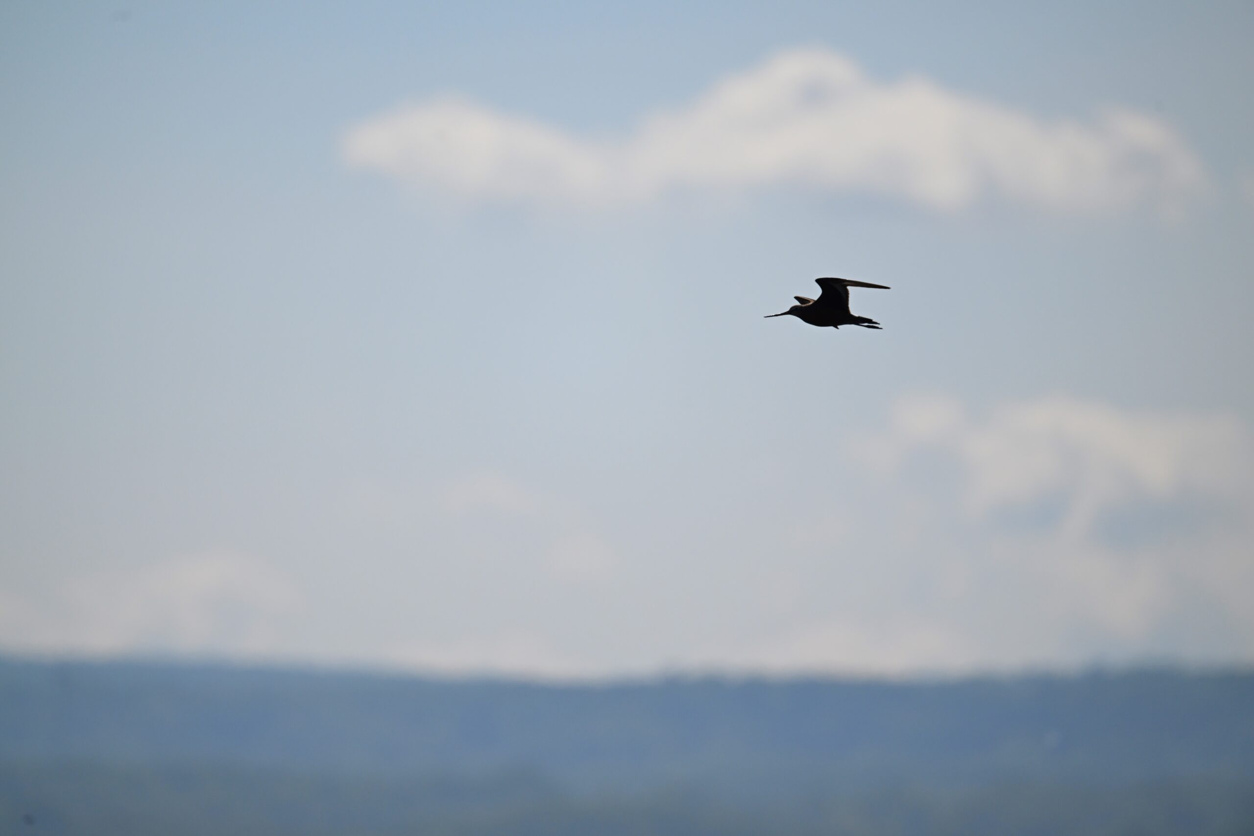
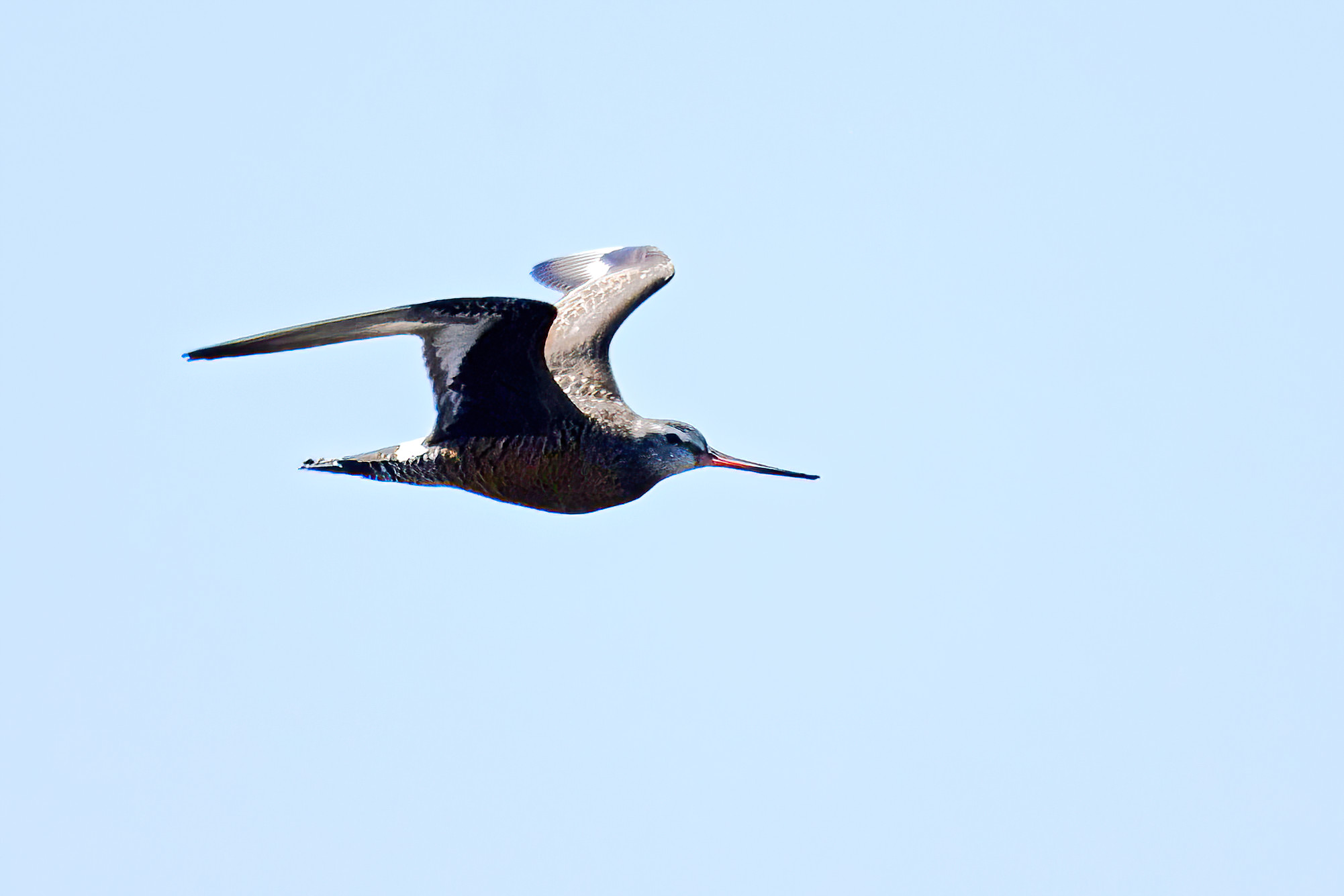
Finally, same day at Gull Point, the perils of field mis-identification. Following bird spotted flying overhead – obvious shorebird, decent sized, with long straight-ish beak – immediate thought is Yellowlegs. “Why does that Yellowlegs have a rusty belly?” Good question. The answer: not a Yellowlegs, but an unusual-for-Presque Isle Hudsonian Godwit:
To be fair, hard to see well under these lighting conditions, but still a good example of being cognizant of field marking inconsistencies (e.g., no species of Yellowlegs has a streaked, rusty belly, regardless of age).
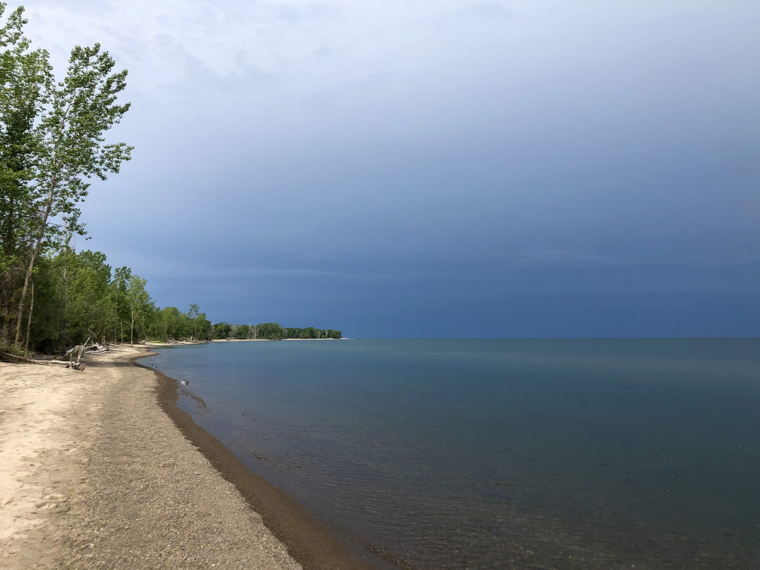
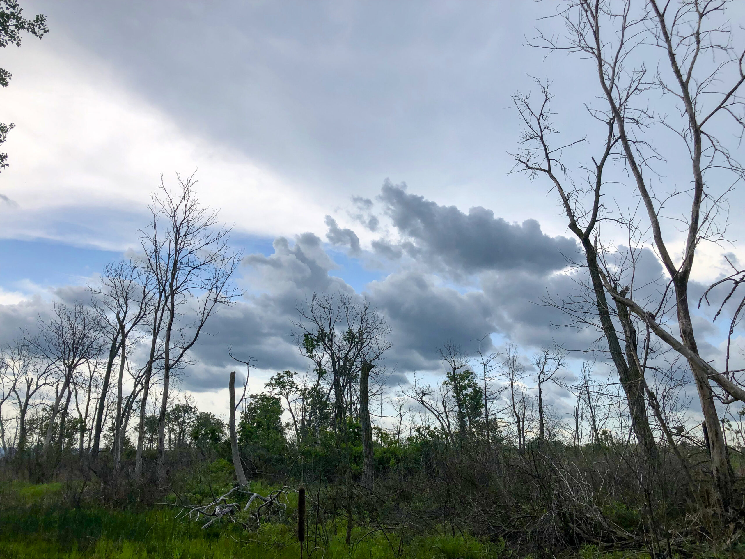
Well, Global Big Day weekend is long gone, and spring warbler migration is past-peak, but it was an oversized holiday weekend at Presque Isle State Park nevertheless. Compounded by rather amazing weather: a sunny Saturday start with rain by late morning (clearing later), a warm and humid Sunday w/ eventual ocean-like ground fog, & big afternoon thunderstorms Monday (including torrential rain & pea-size hail).
View west towards Budny Beach w/ approaching Saturday storm
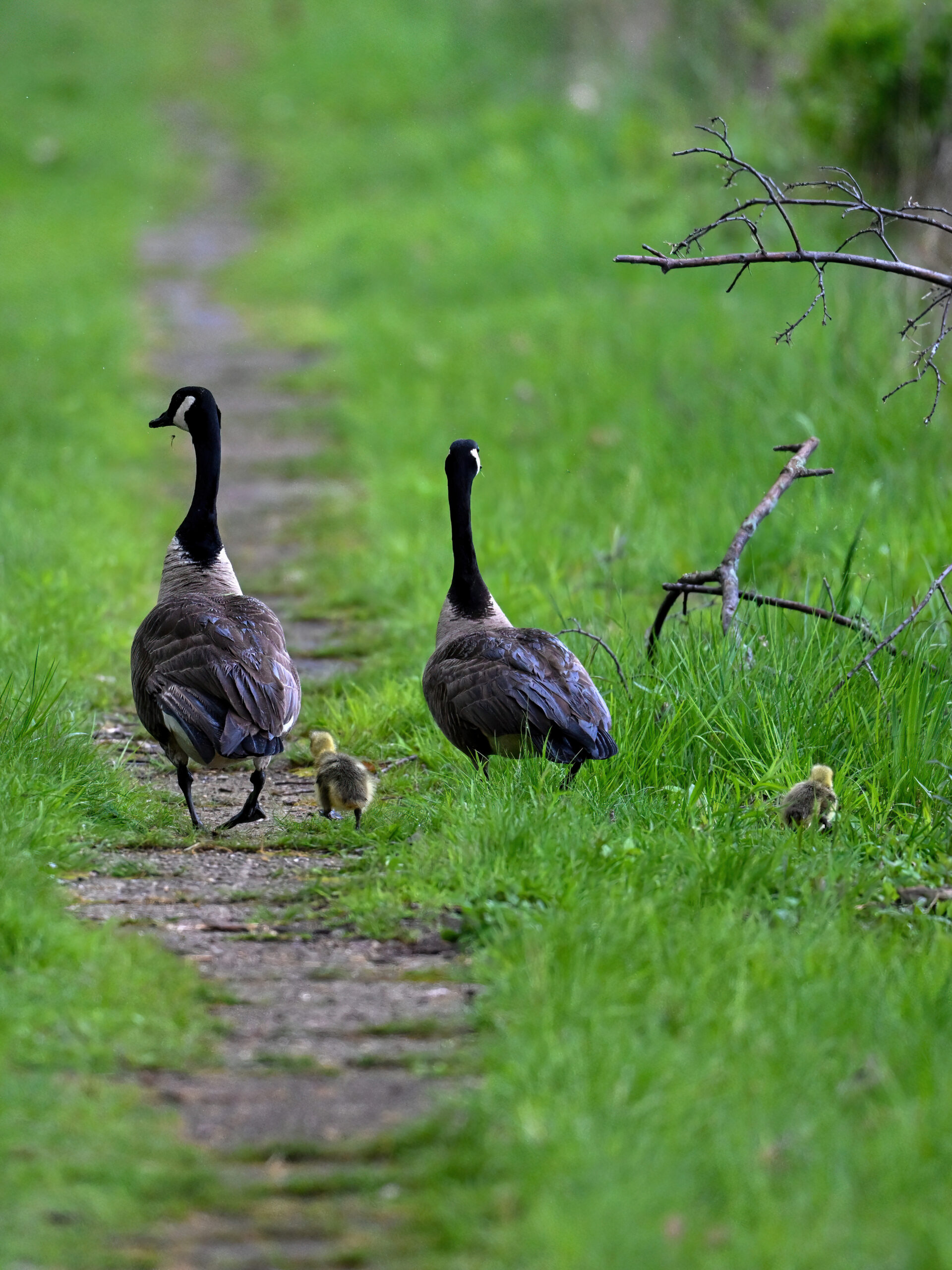
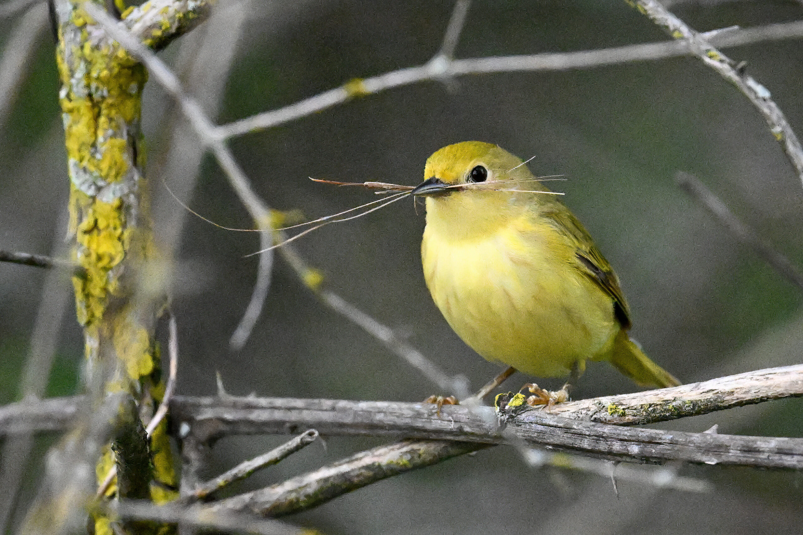
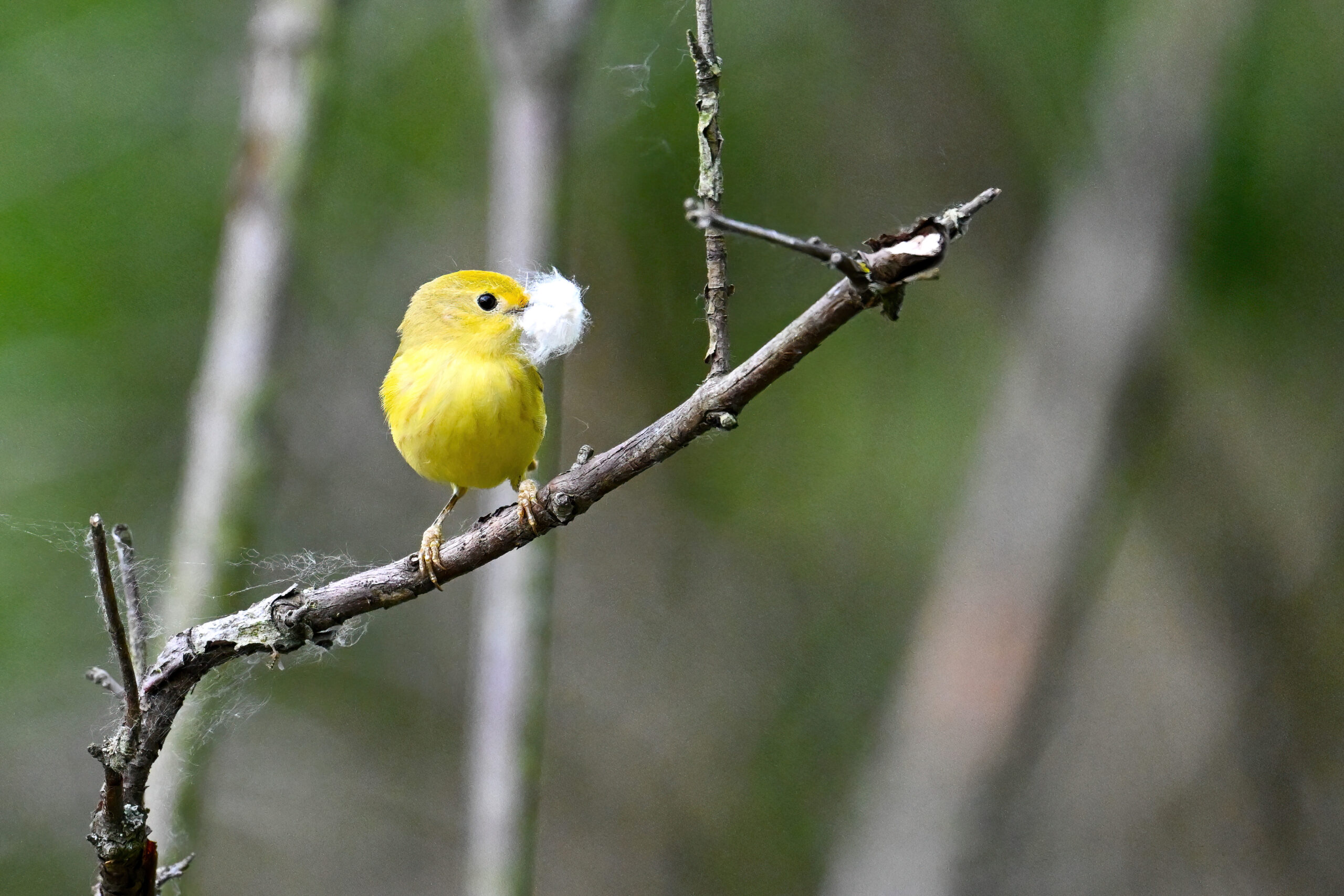
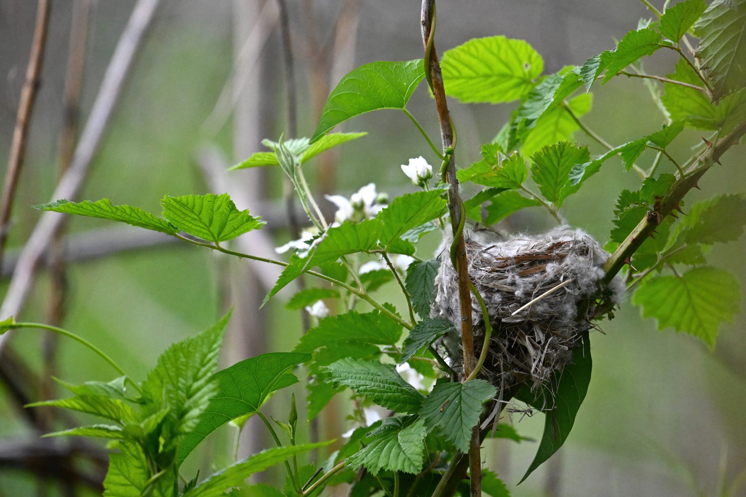
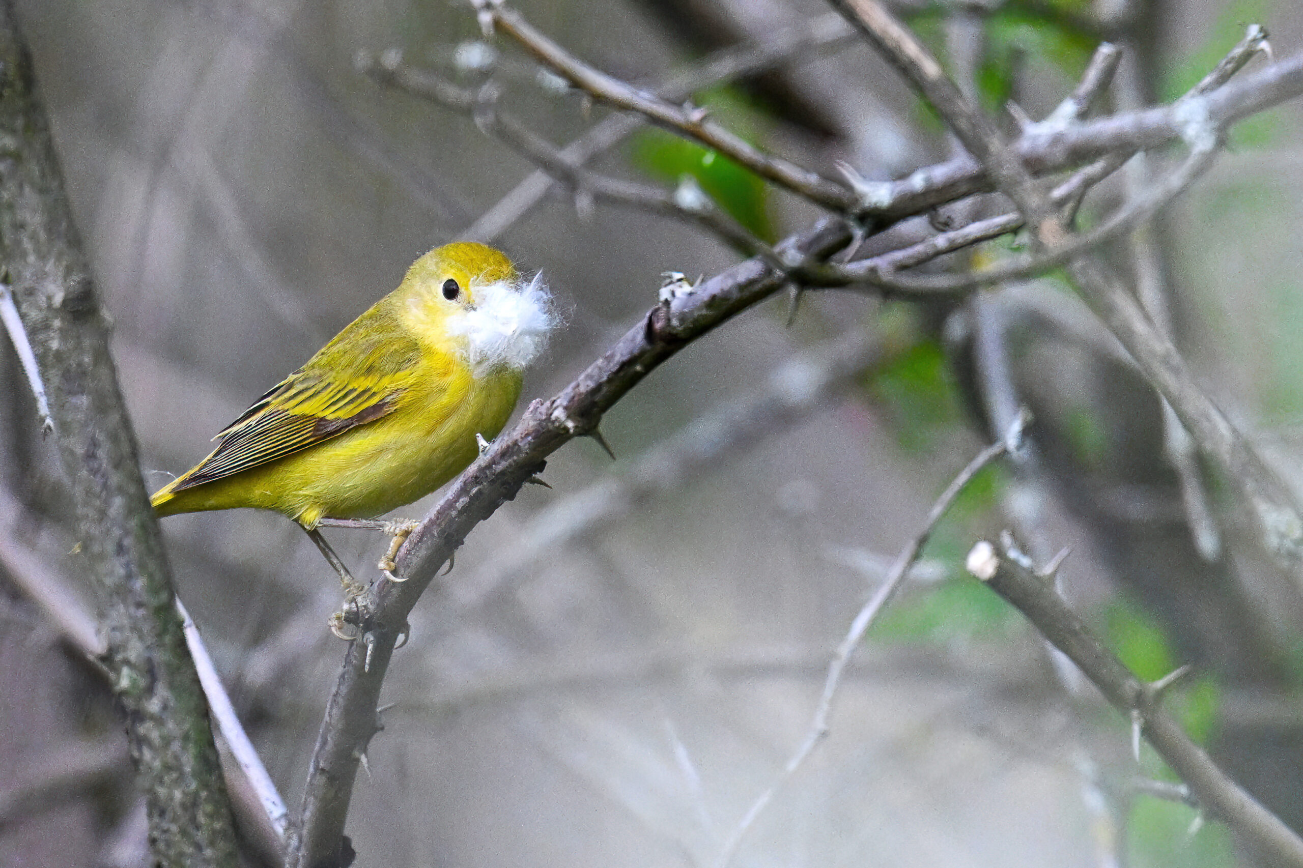
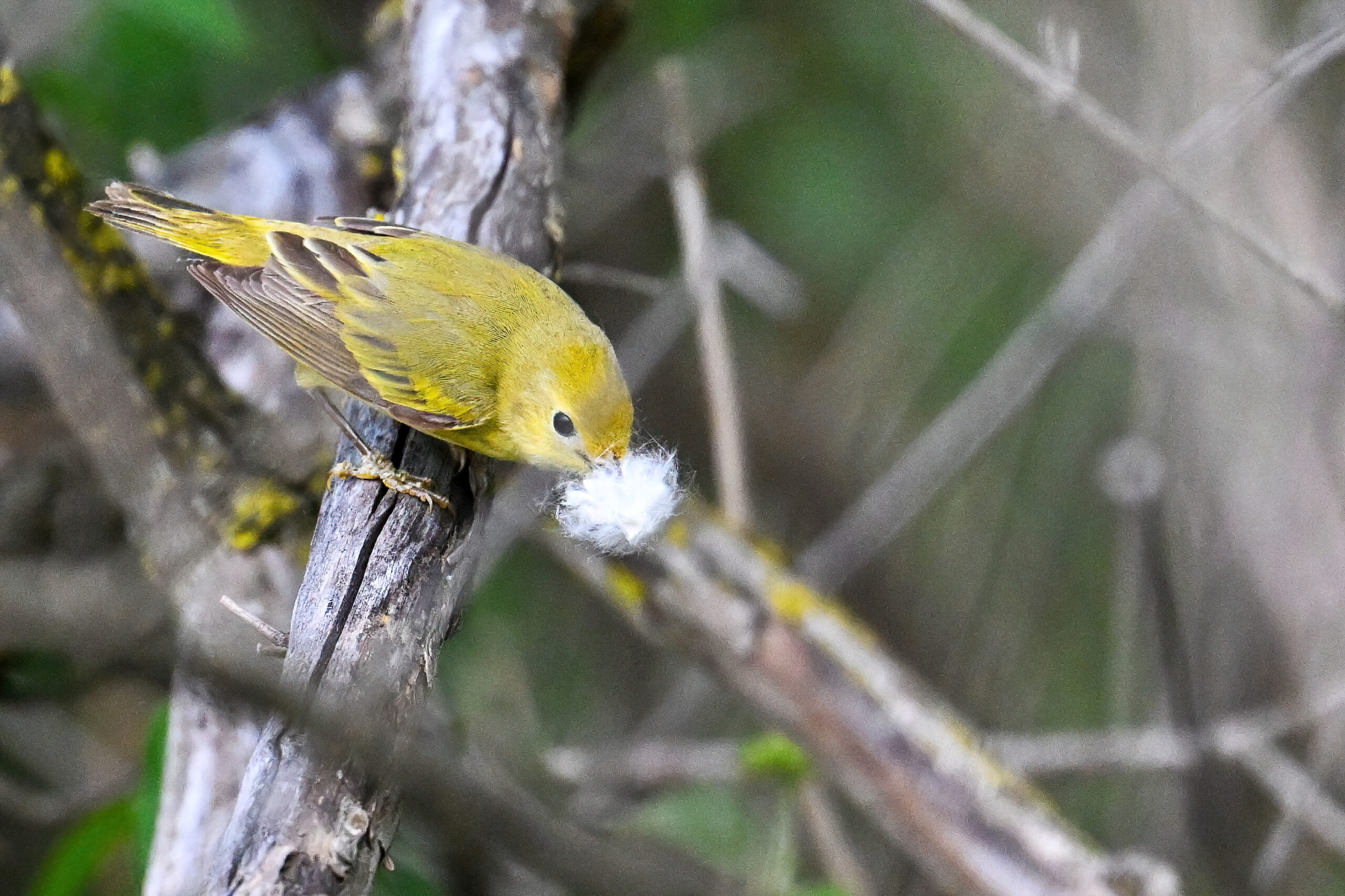
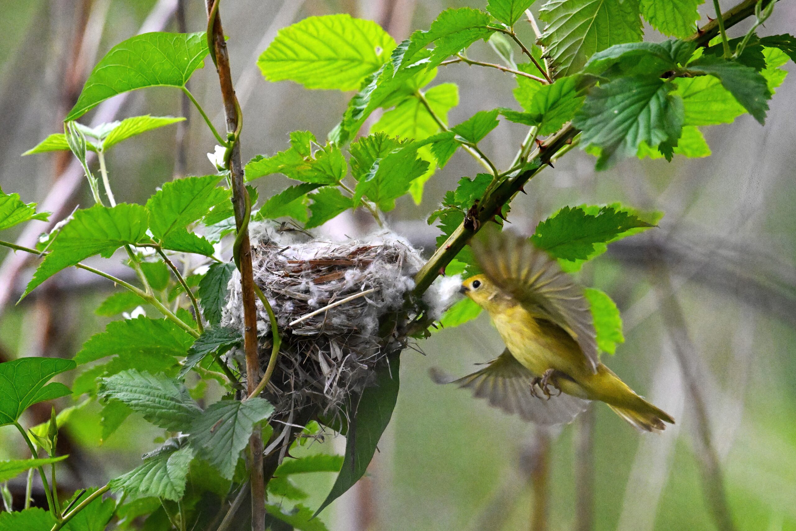
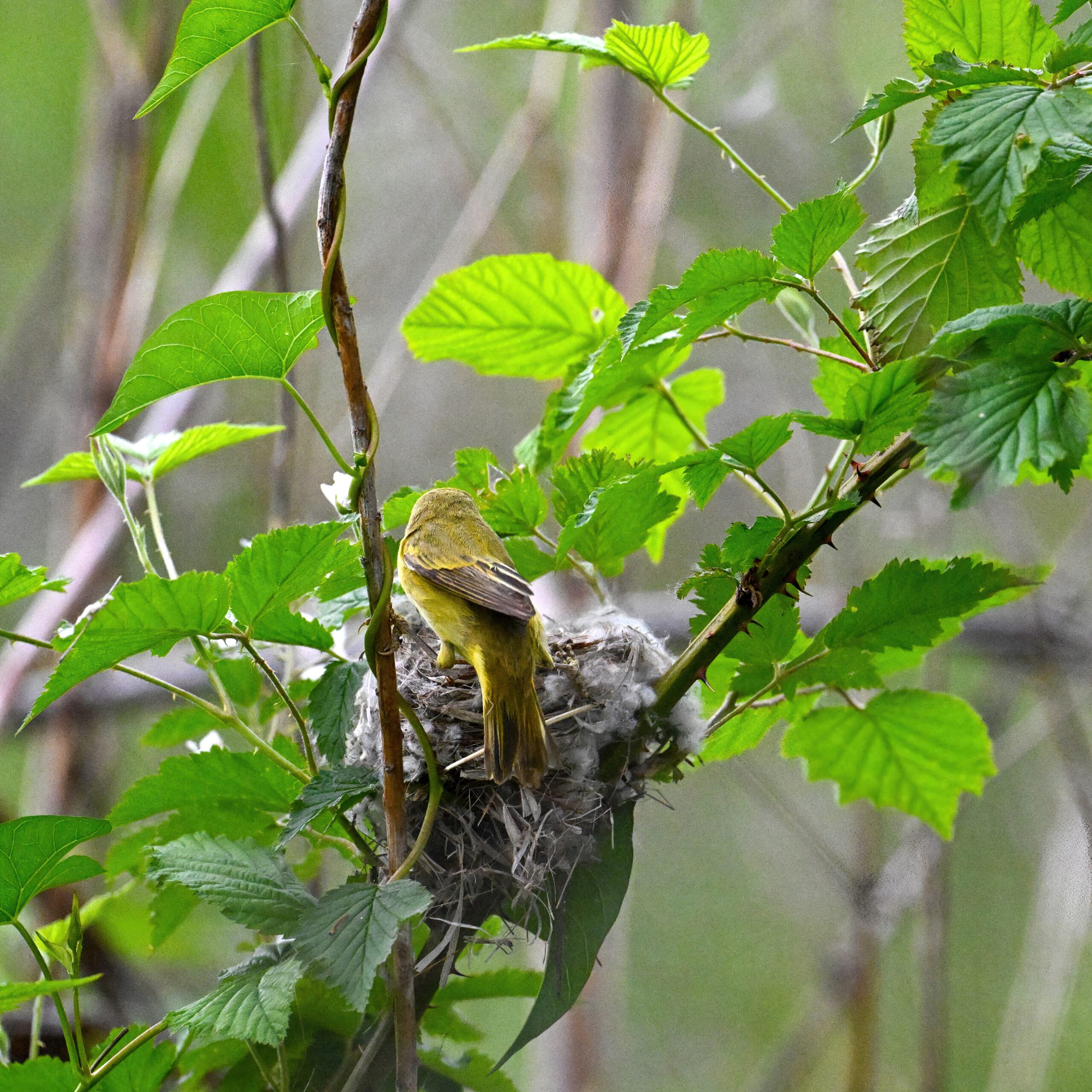
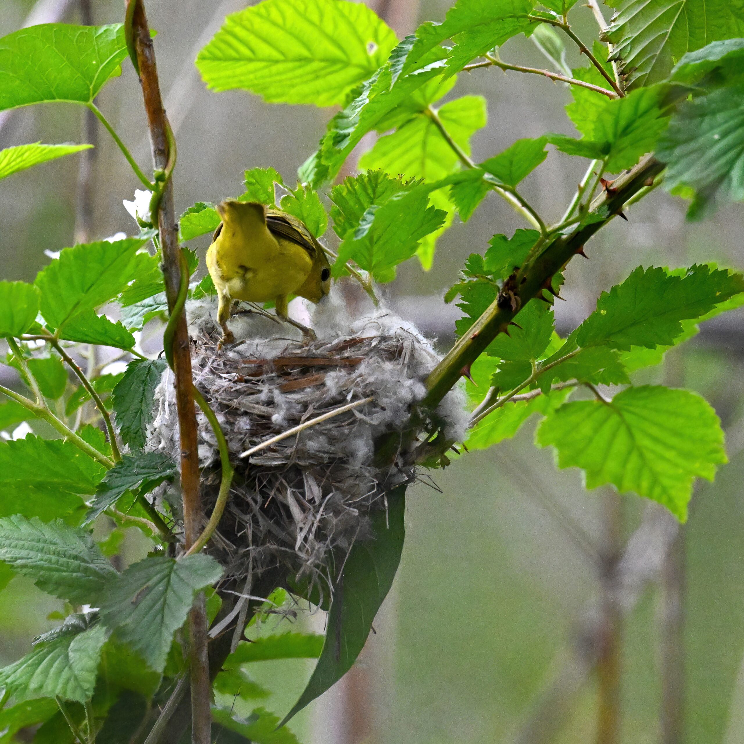
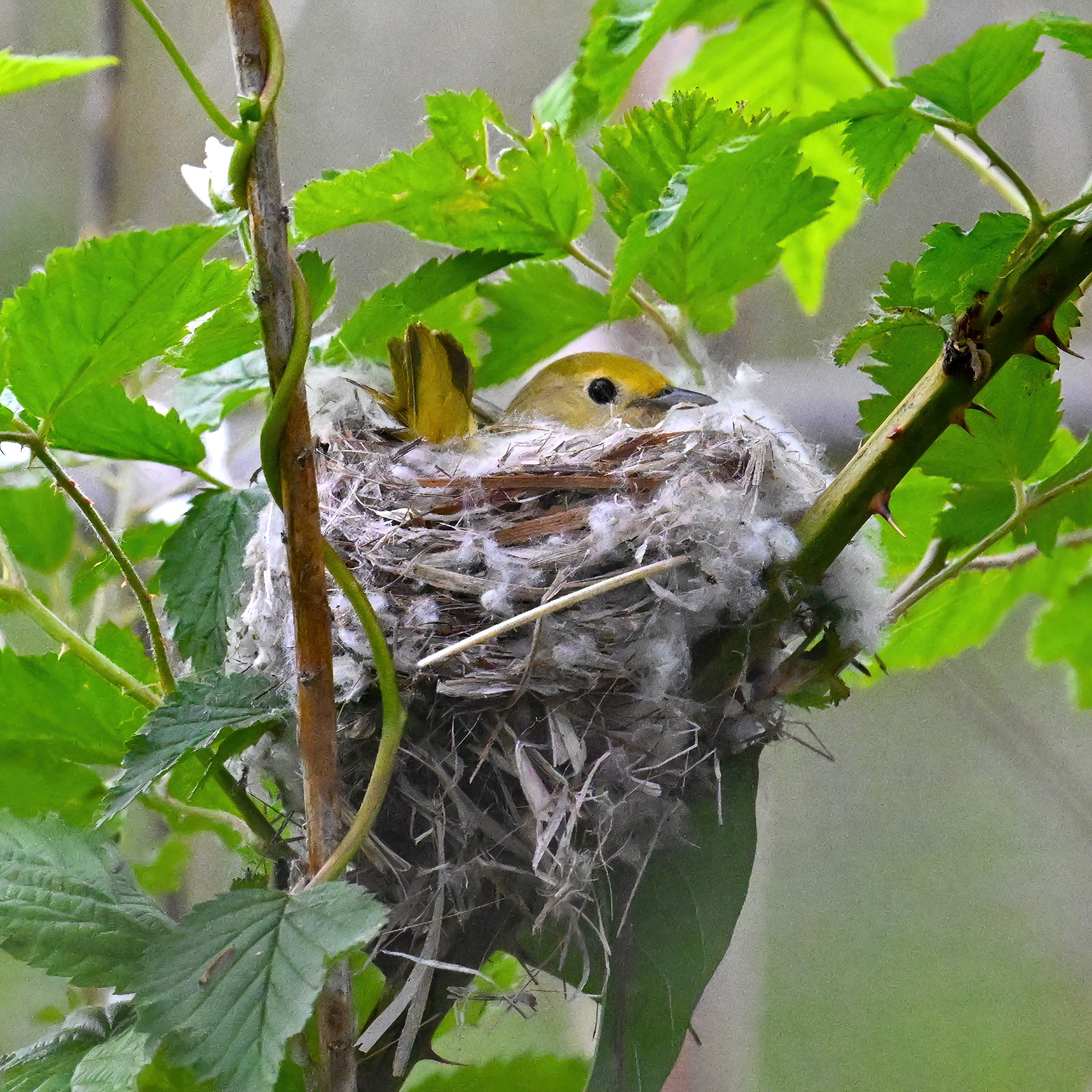
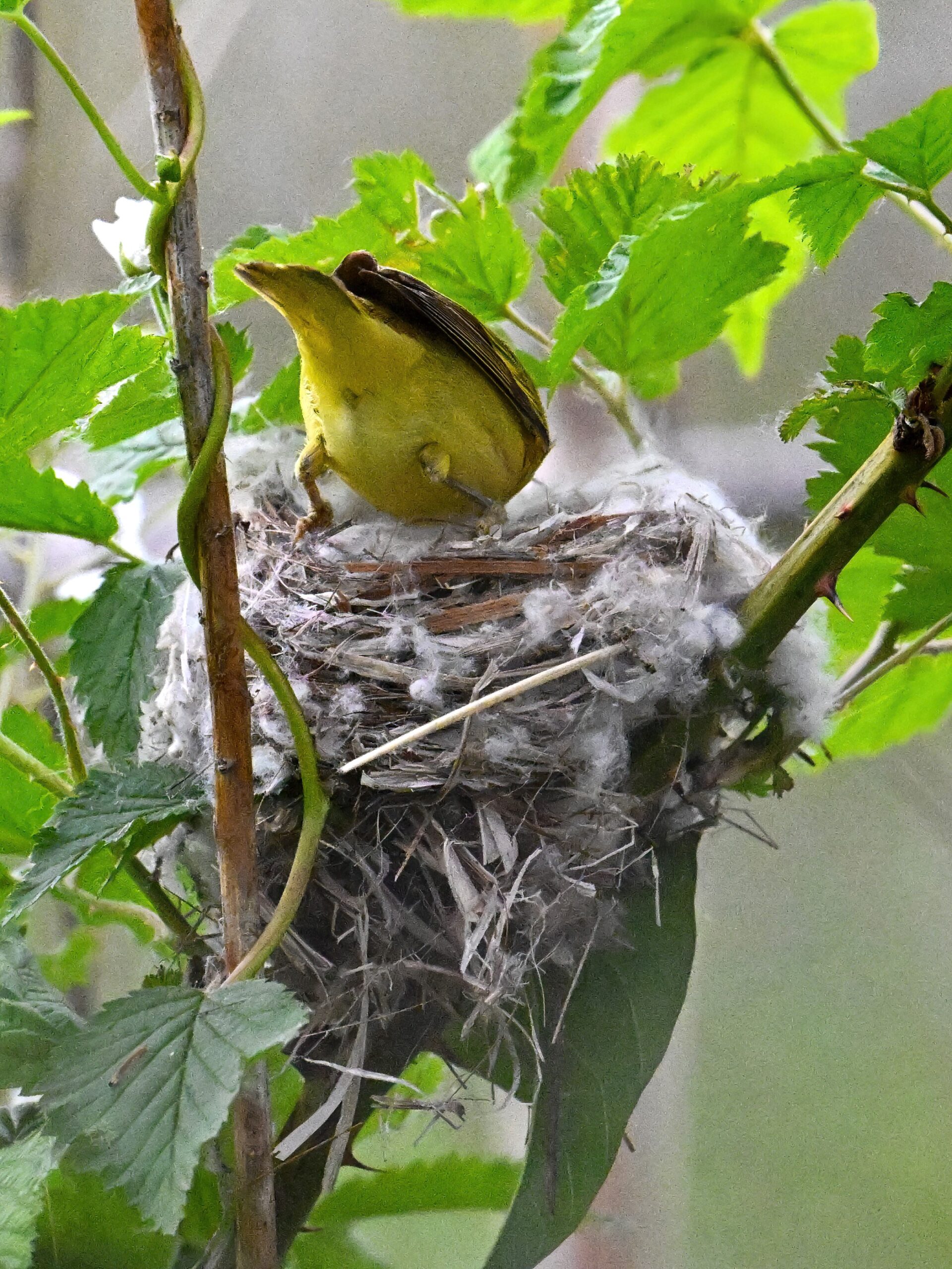
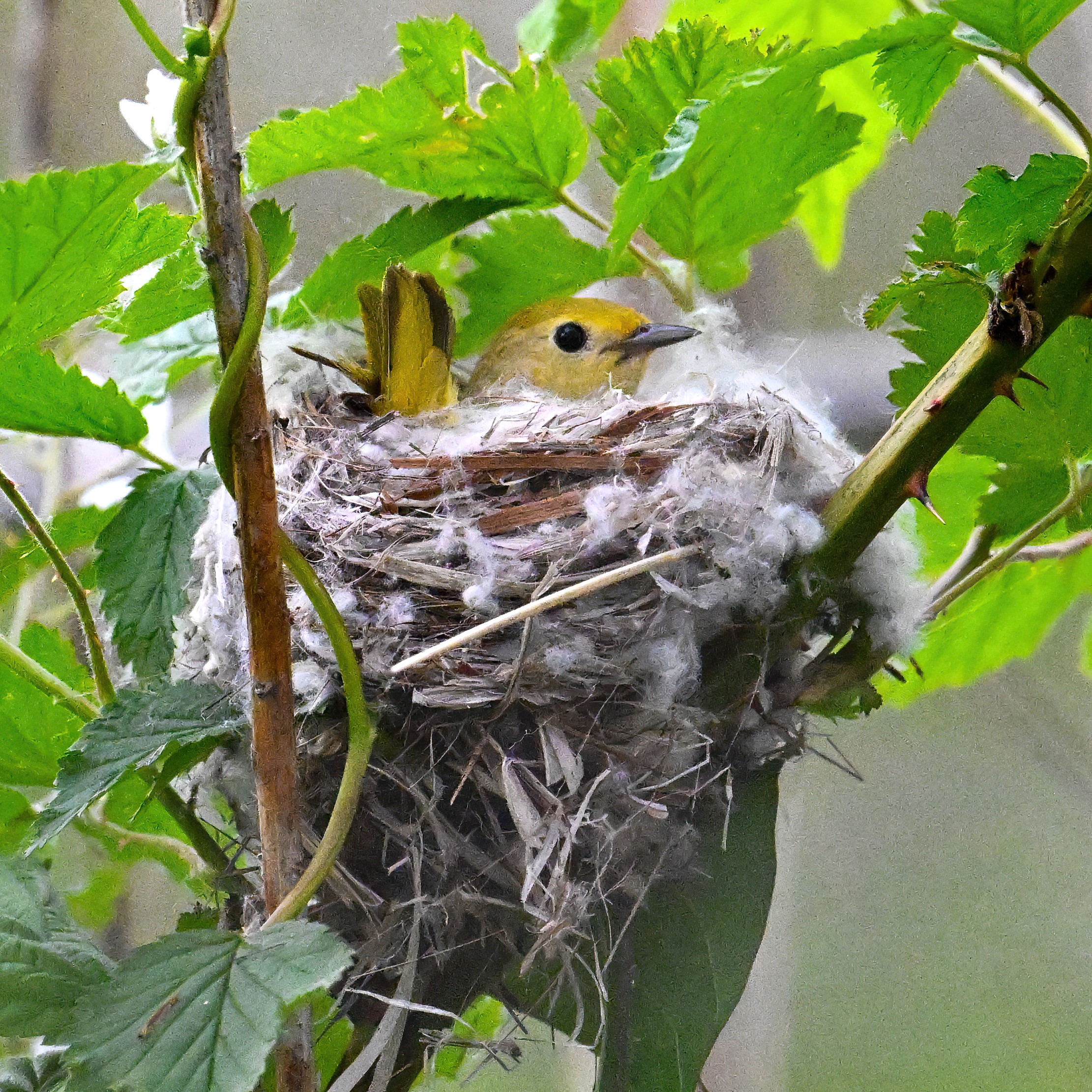
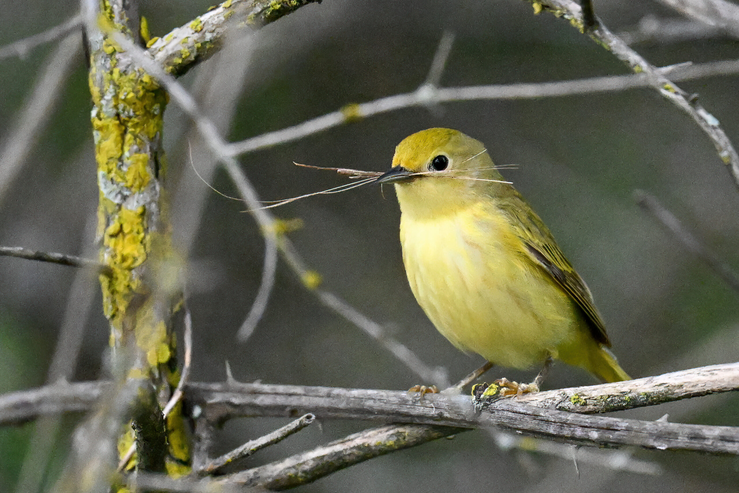
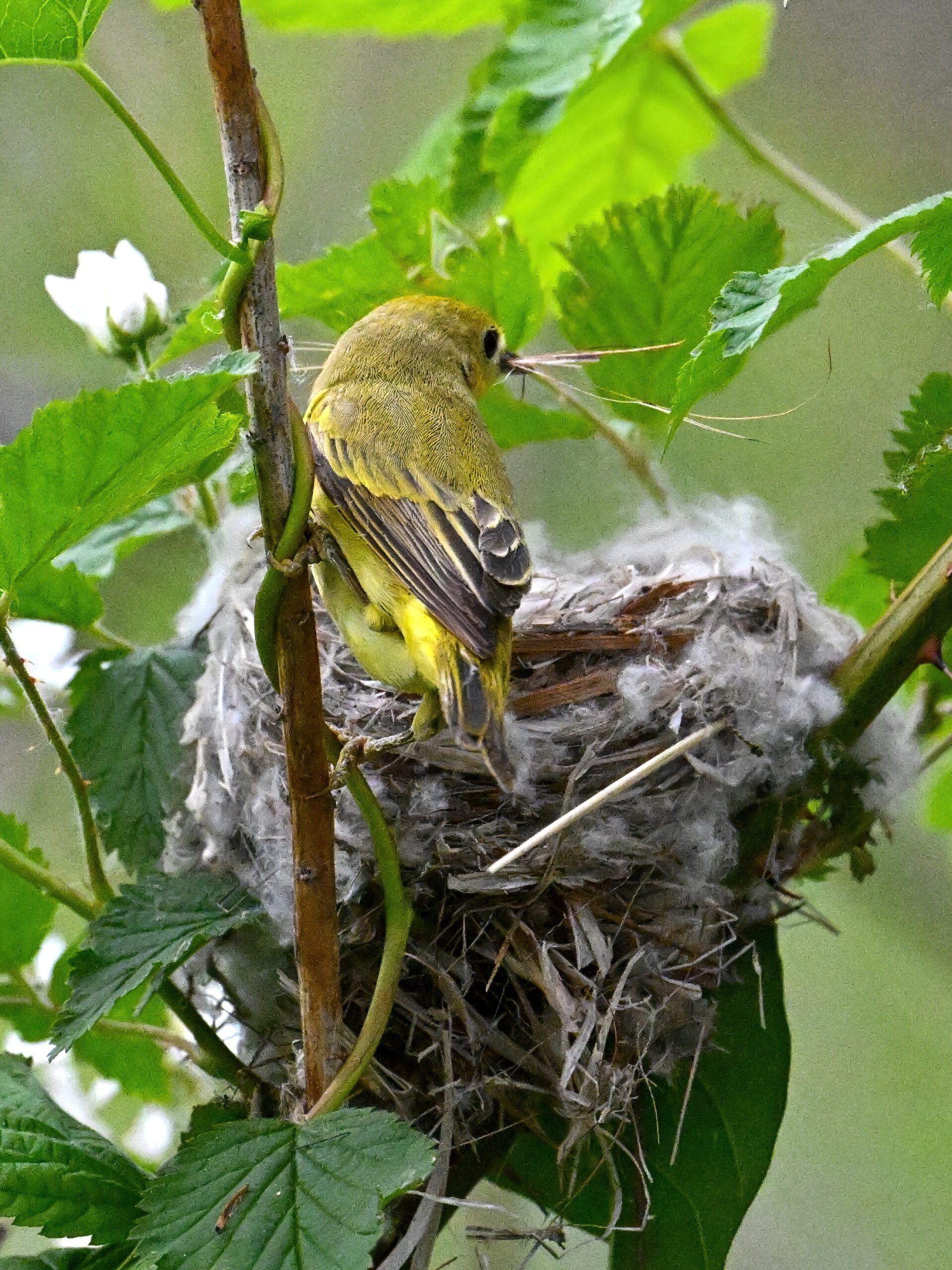
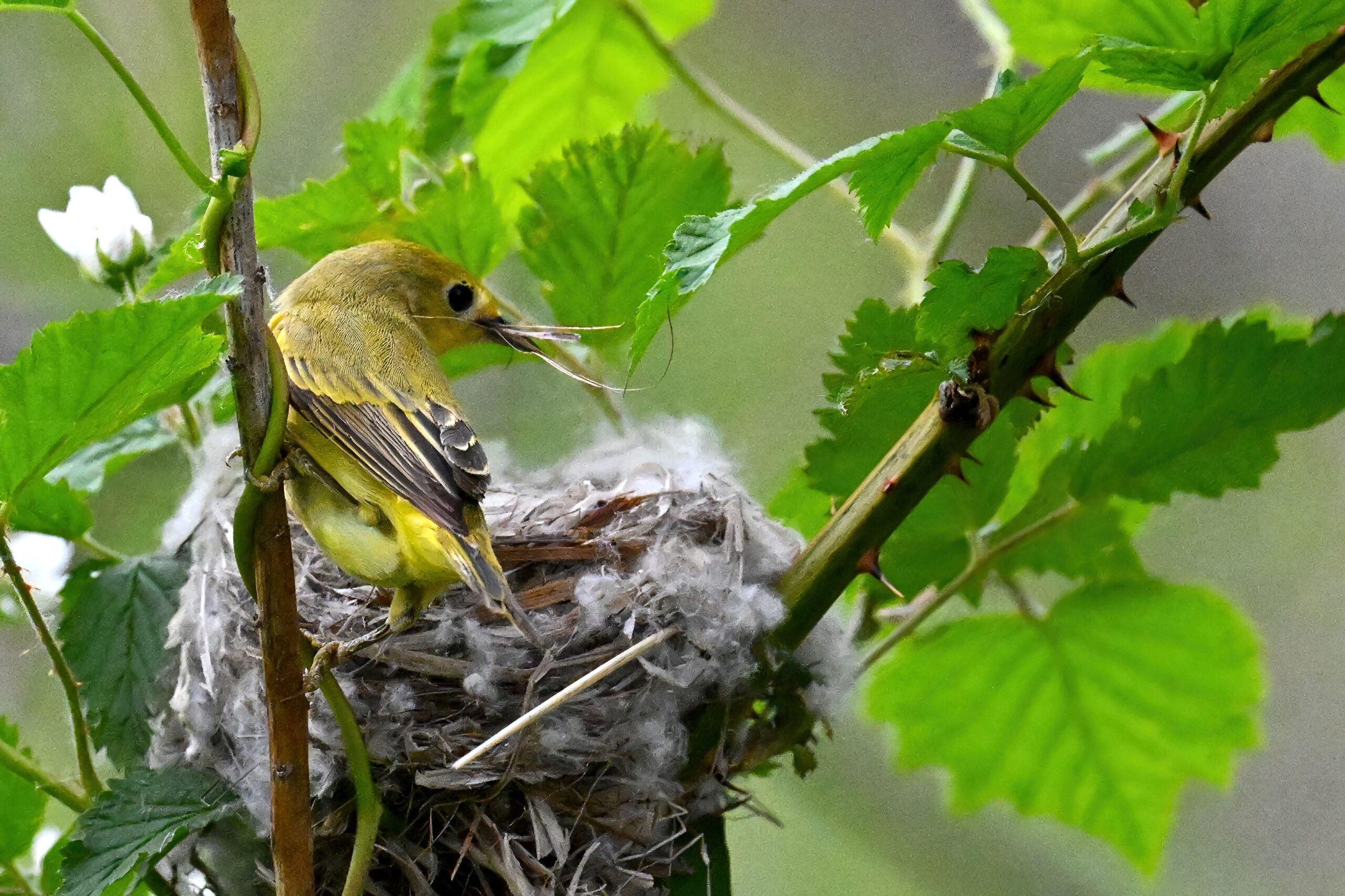
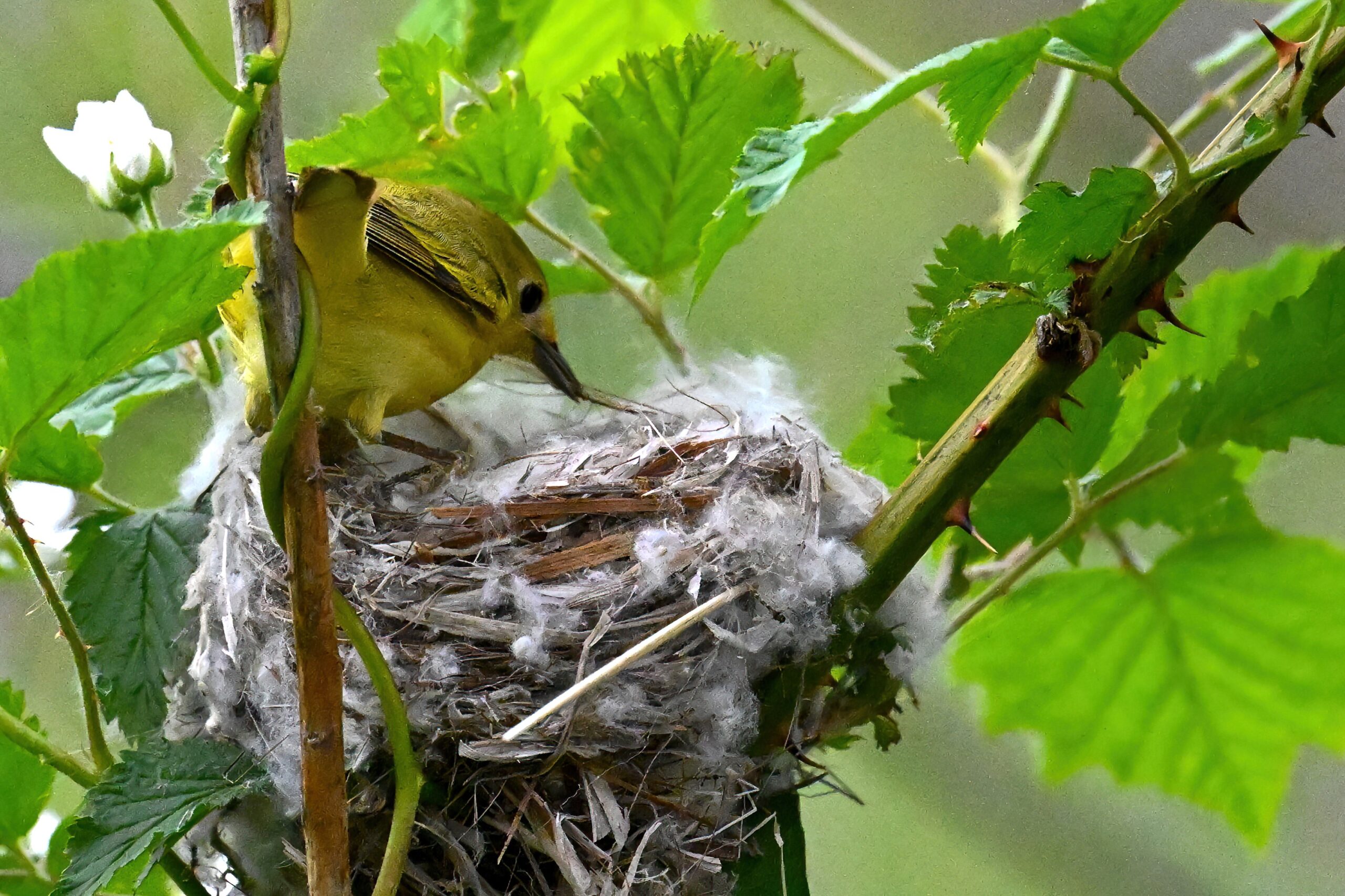
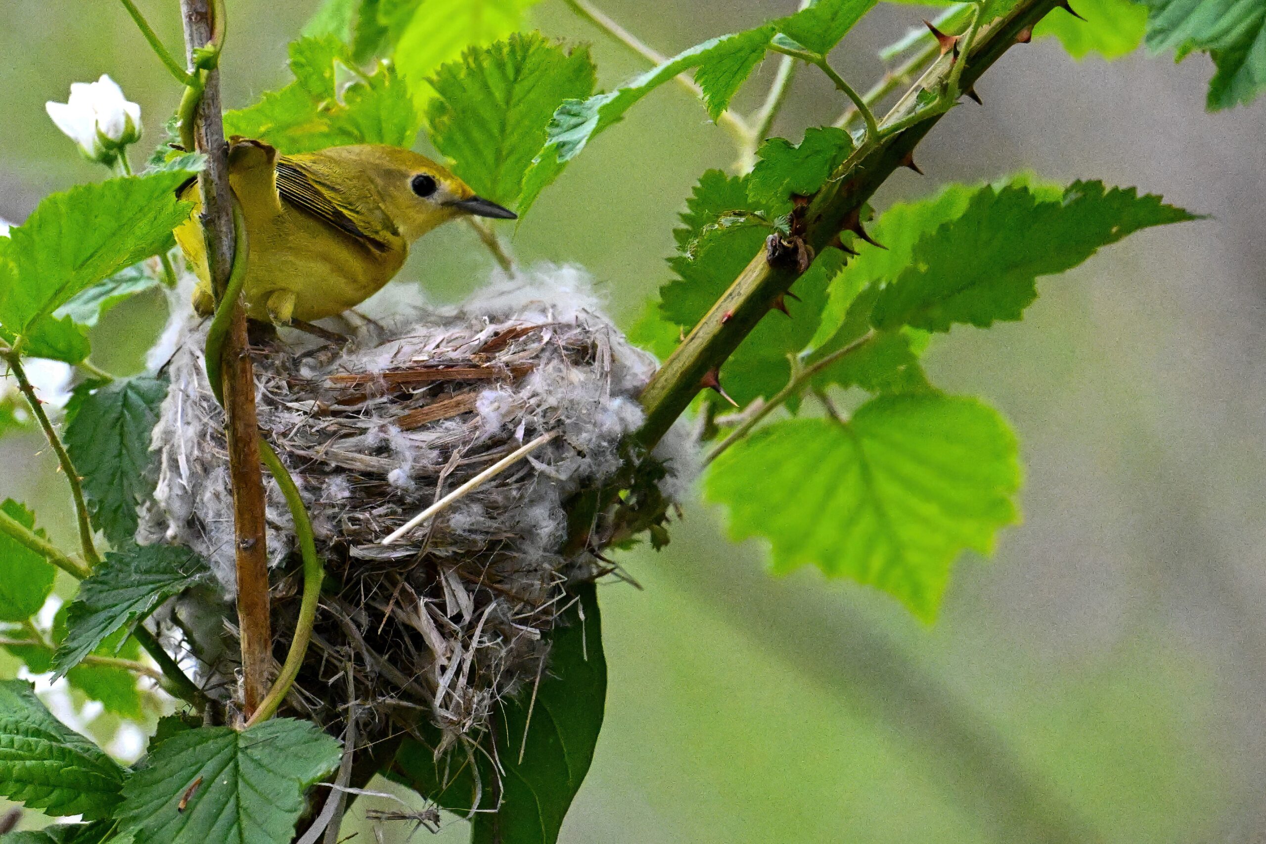
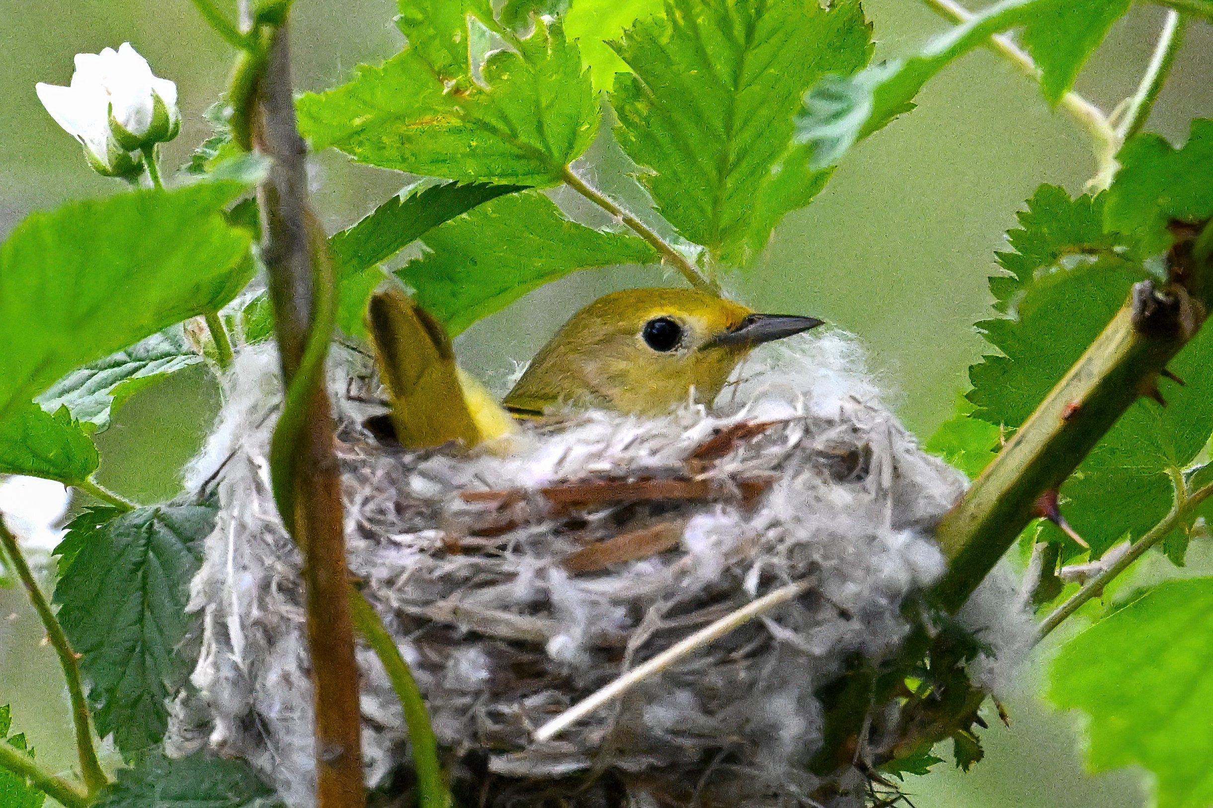
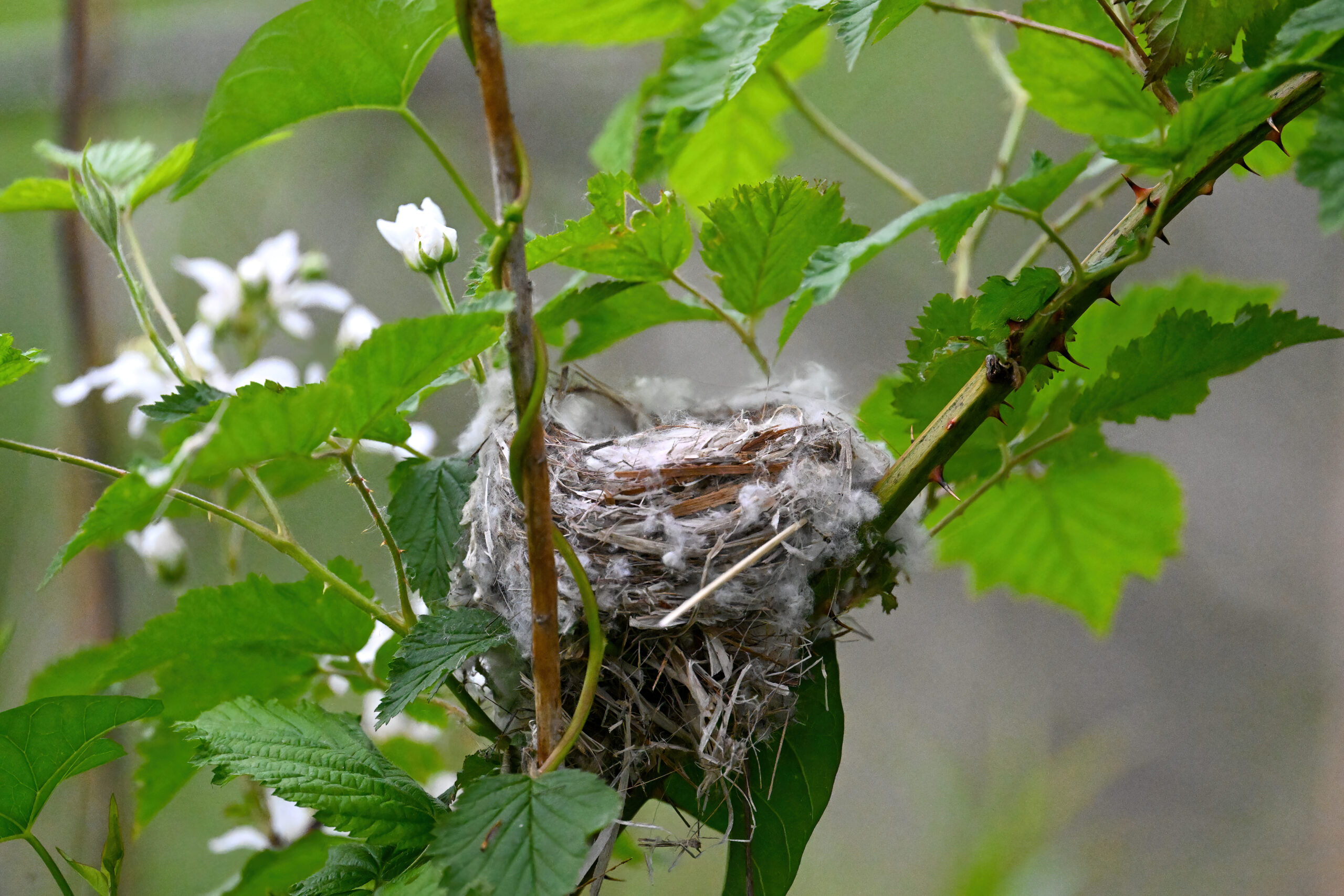
Concurrent with spring, of course it’s nesting season. Recent nests and/or chicks (juvenile birds) seen at Presque Isle: Bald Eagle, Osprey, Common Grackle, Red-winged Blackbird, Killdeer, American Robin, Wood Duck, Barn Swallow, & Tree Swallow. Here’s a great sequence of a lovely female Yellow Warbler nest building in a blackberry shrub along the Gull Point Trail, from Saturday (before the rain):
Yellow Warbler nestApproaching storm clouds
Coming up soon, amazing American White Pelicans at Presque Isle! Also, special Eastern Towhee portraiture! And baby Killdeer! #more_exclamation_points!!! #more_bird
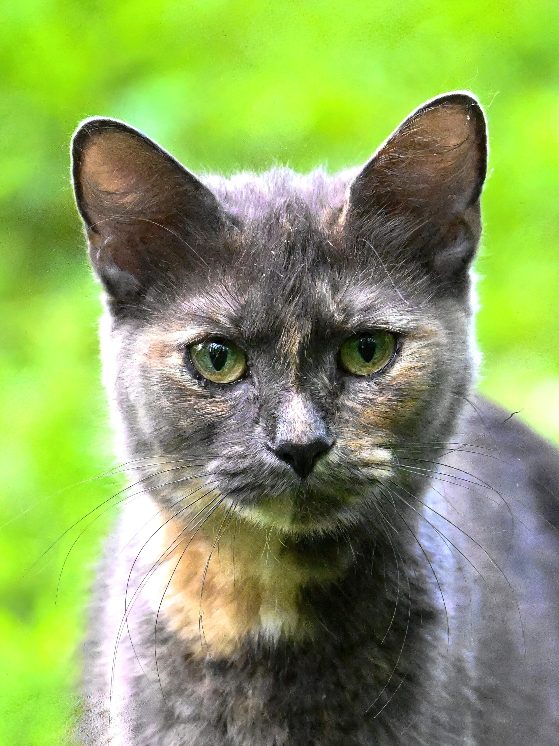
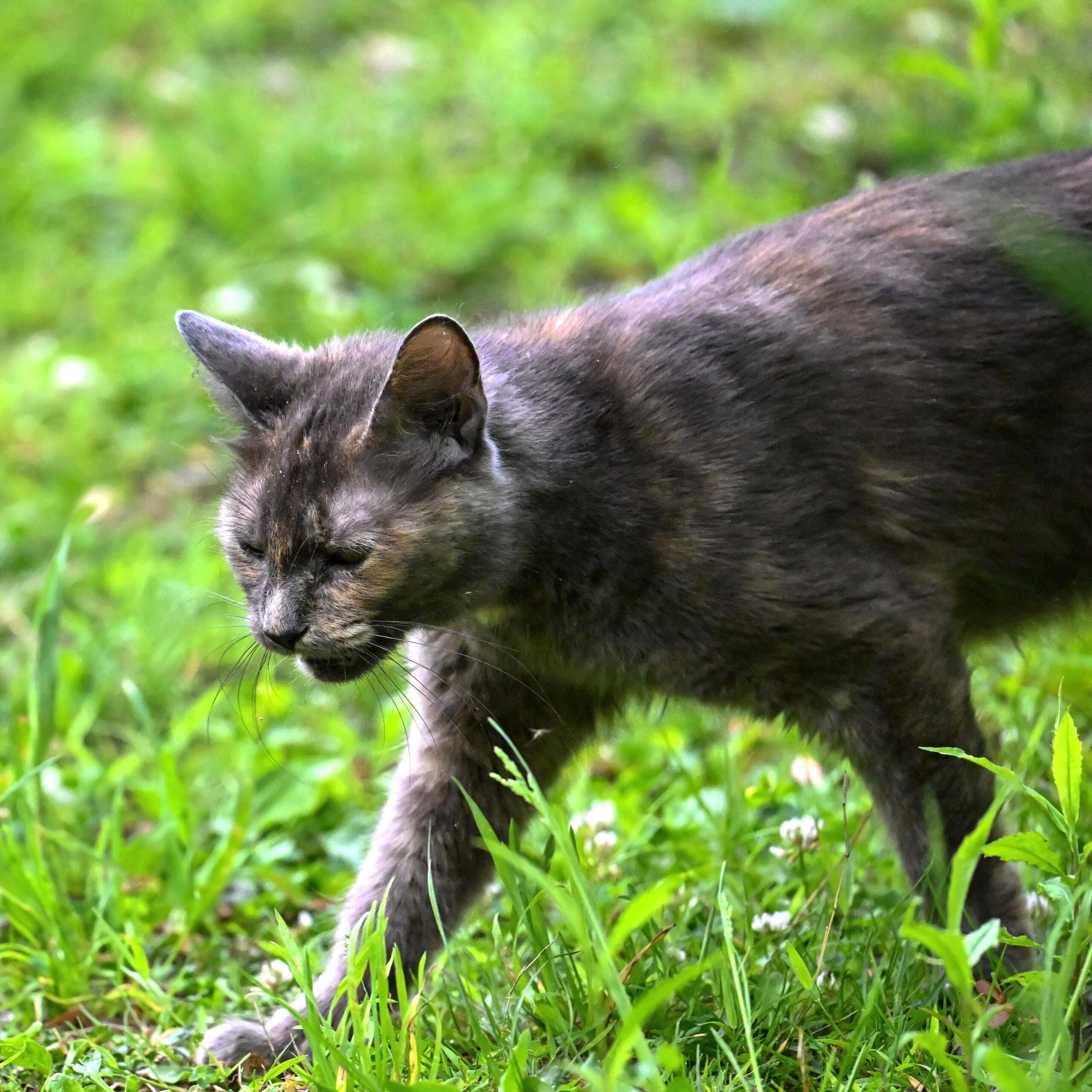
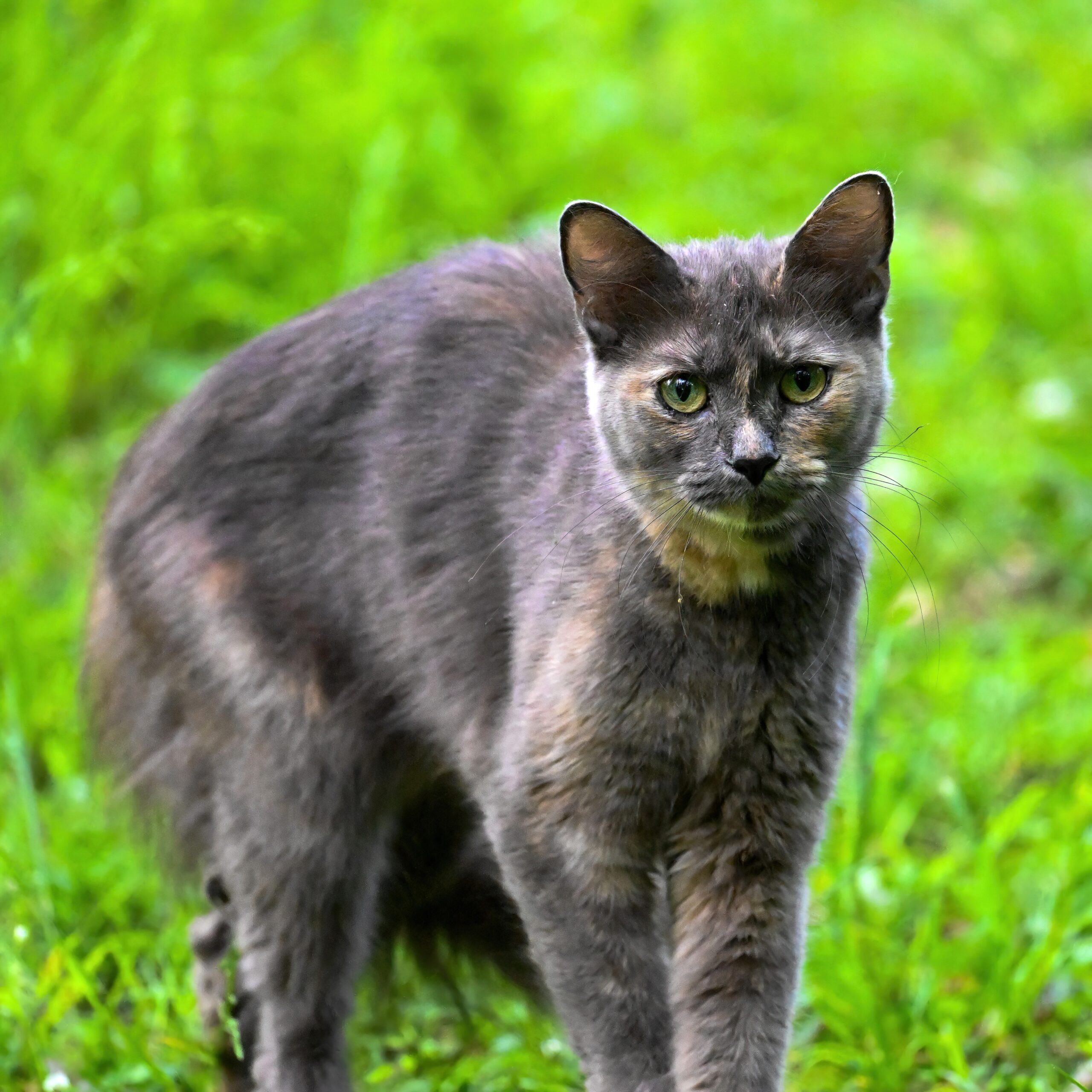
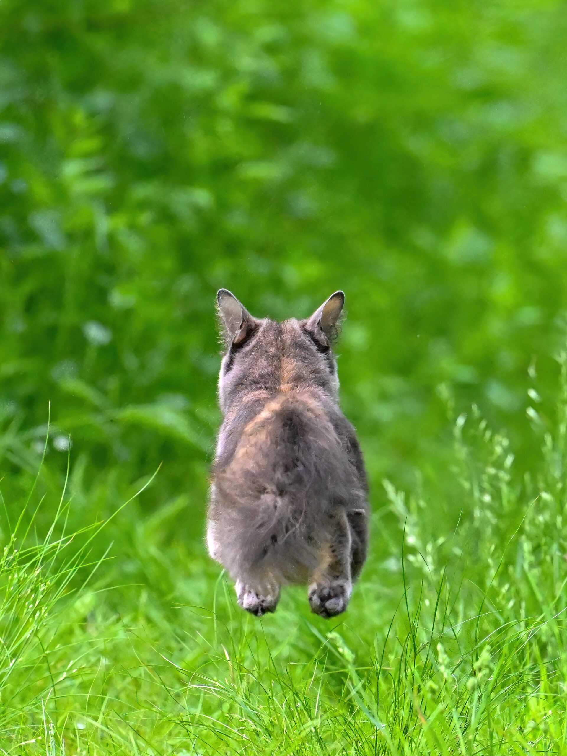
“Dr. Science, I didn’t know there was a feral cat population in Presque Isle State Park!”
Feral (?) House Cat (Felis catus)
“Yes, Joey, there is. Although due to harsh winter conditions, ‘population’ more likely means transient individuals, such as strays wandering in over the ‘land bridge,’ or abandonments, or perhaps wide-ranging house cats from nearby neighborhoods.”
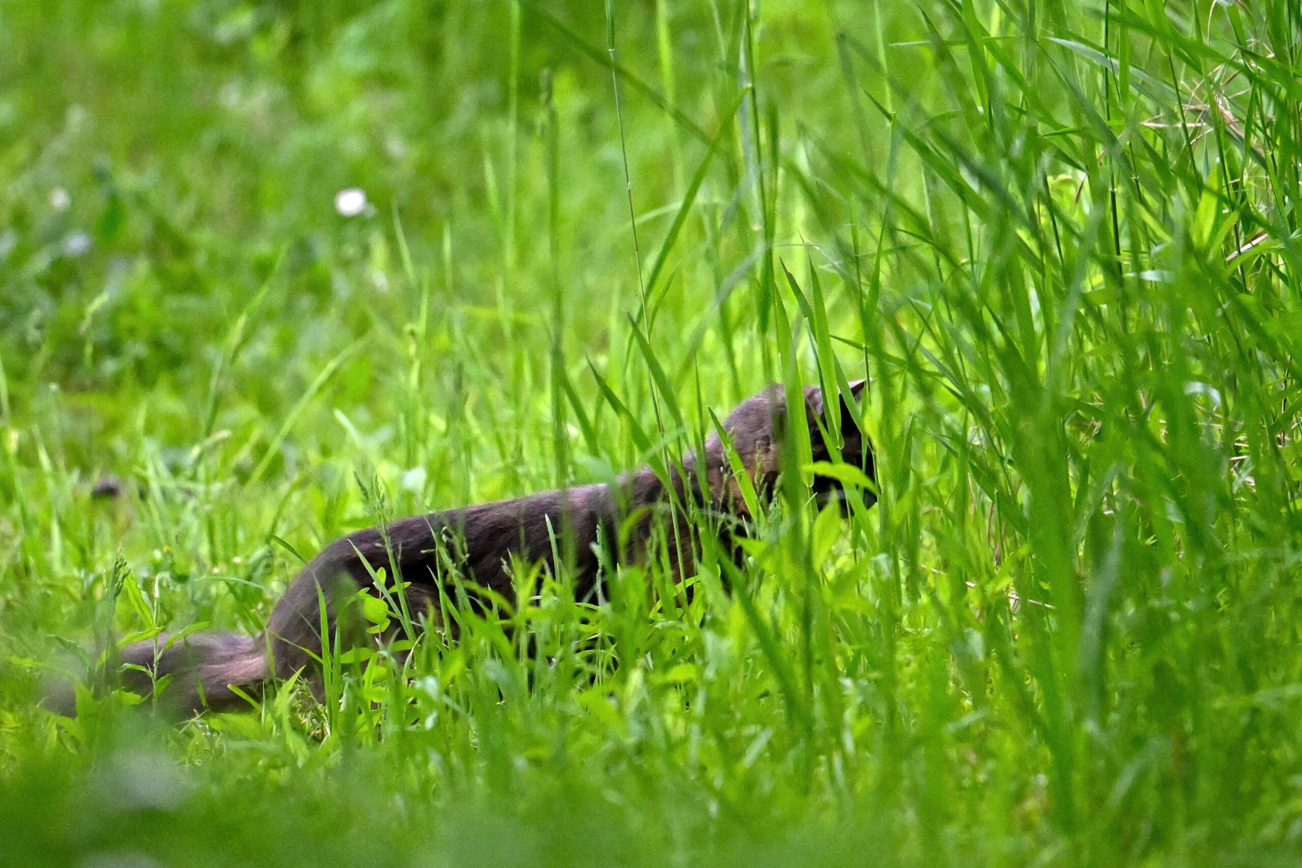
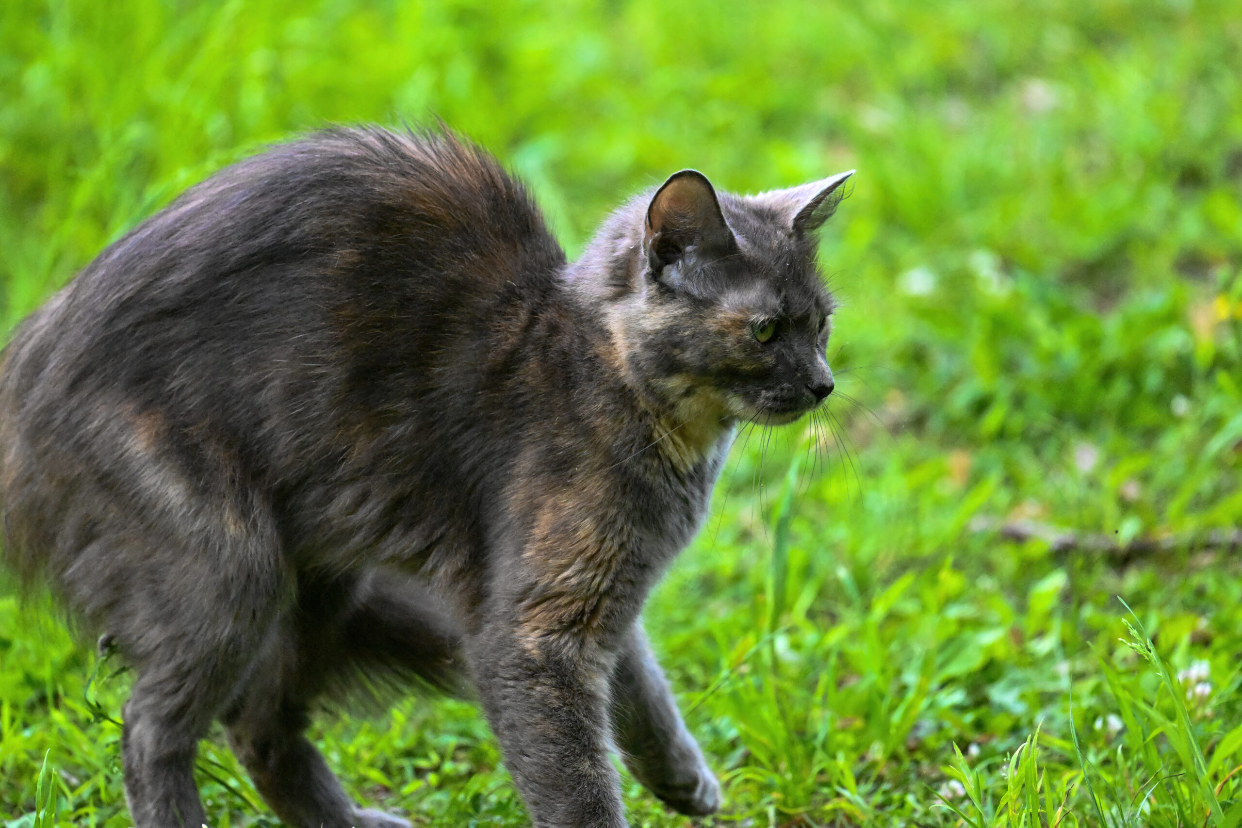
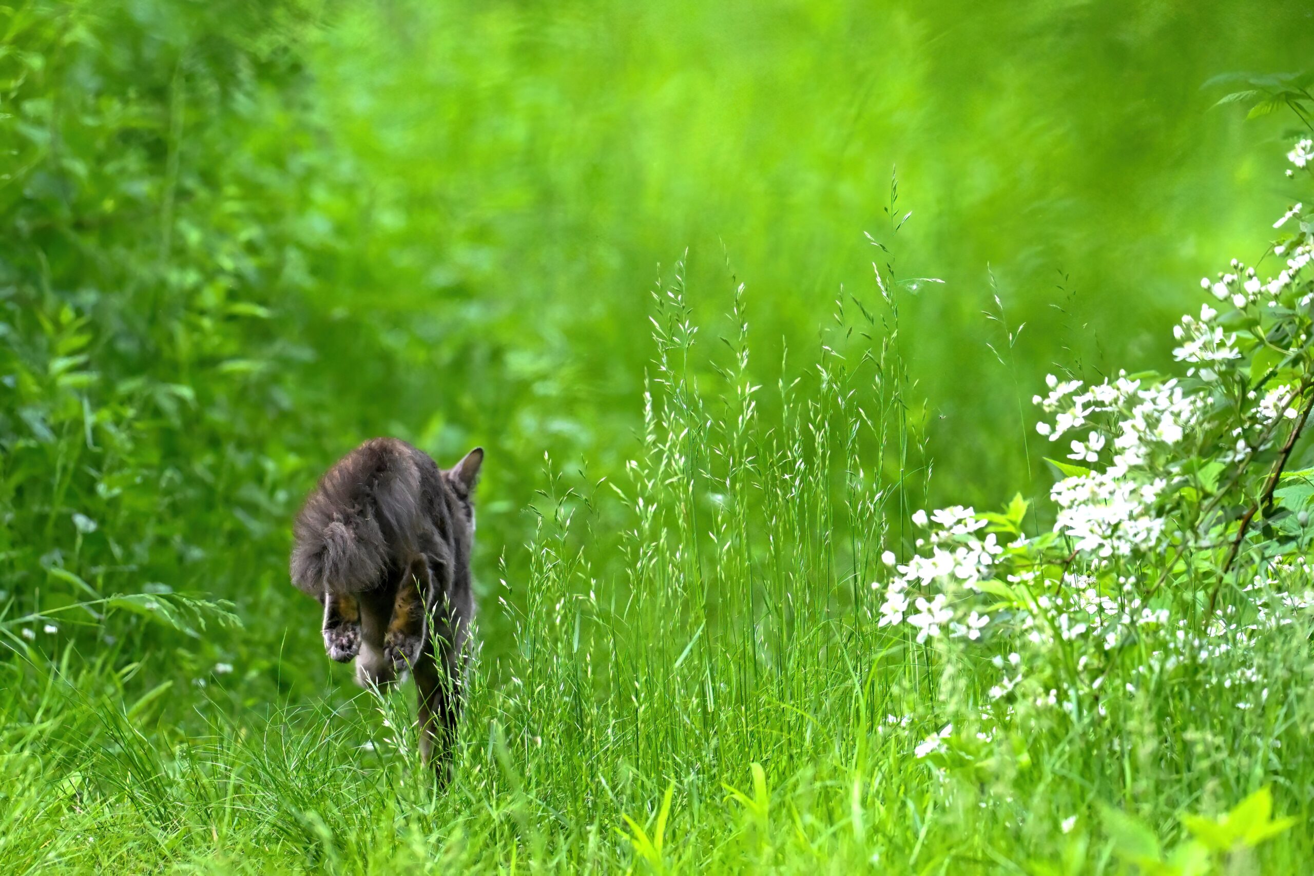
Hunting along the Duck Pond Trail
“Dr. Science, a ‘wide-ranging house cat from a nearby neighborhood’ wouldn’t be feral exactly, right?”
The hunt appears unsuccessful
“You’re very astute, Joey. That means smart and observant. But take this example spotted recently by Dr. Science’s field team along the Duck Pond Trail. No houses around here!”
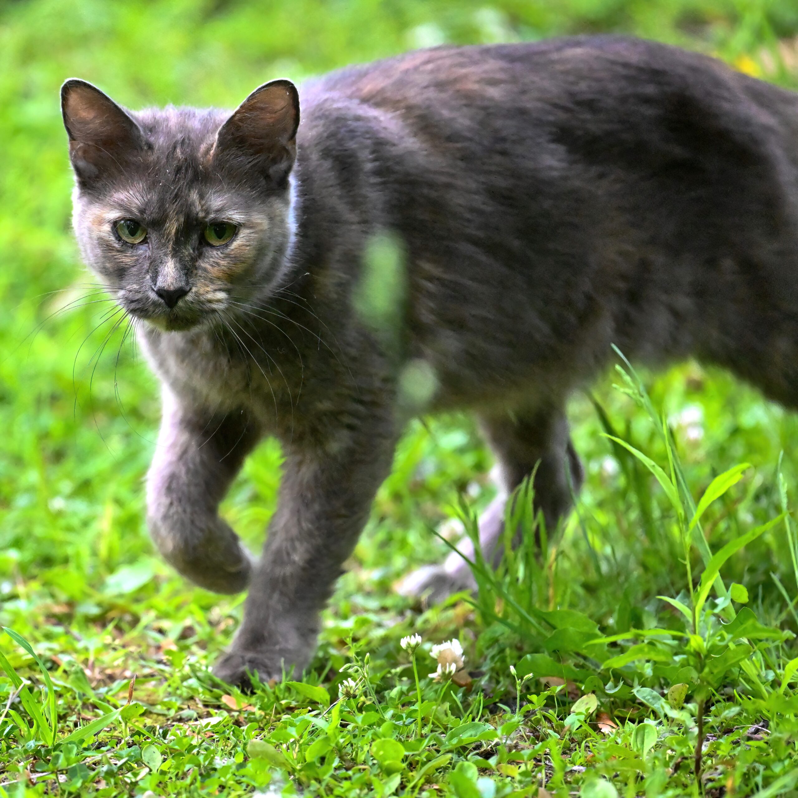
Hmmmm?
“That’s a beautiful cat, Dr. Science. It seems healthy.”
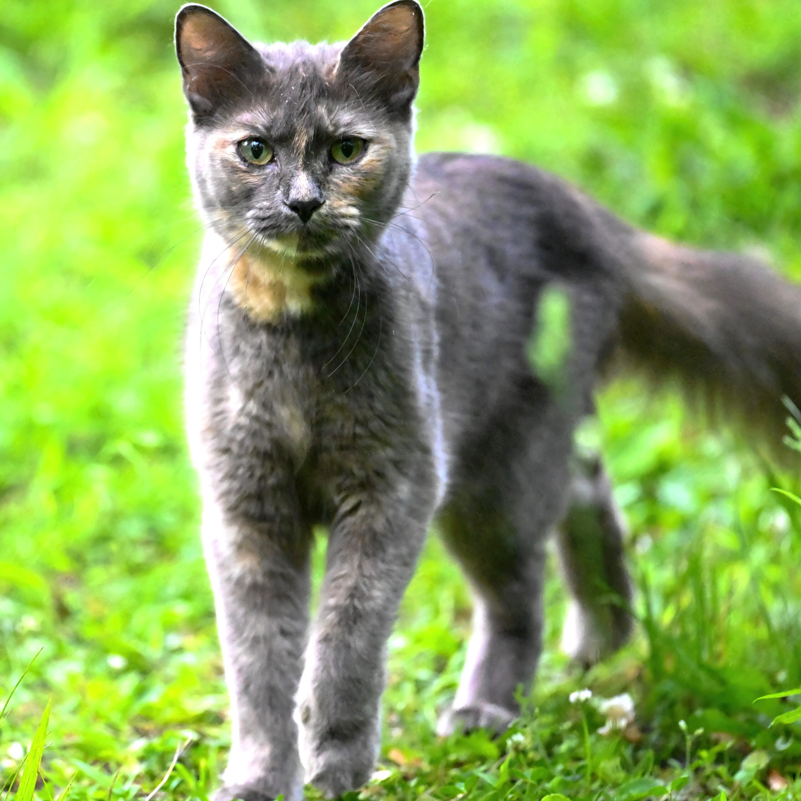
Stranger danger
“Probably a reasonably steady diet of songbirds and chipmunks, Joey. House cats are great hunters.”
‘Wild’ cat portrait
“Chipmunks!?! But they’re so cute, Dr. Science!”
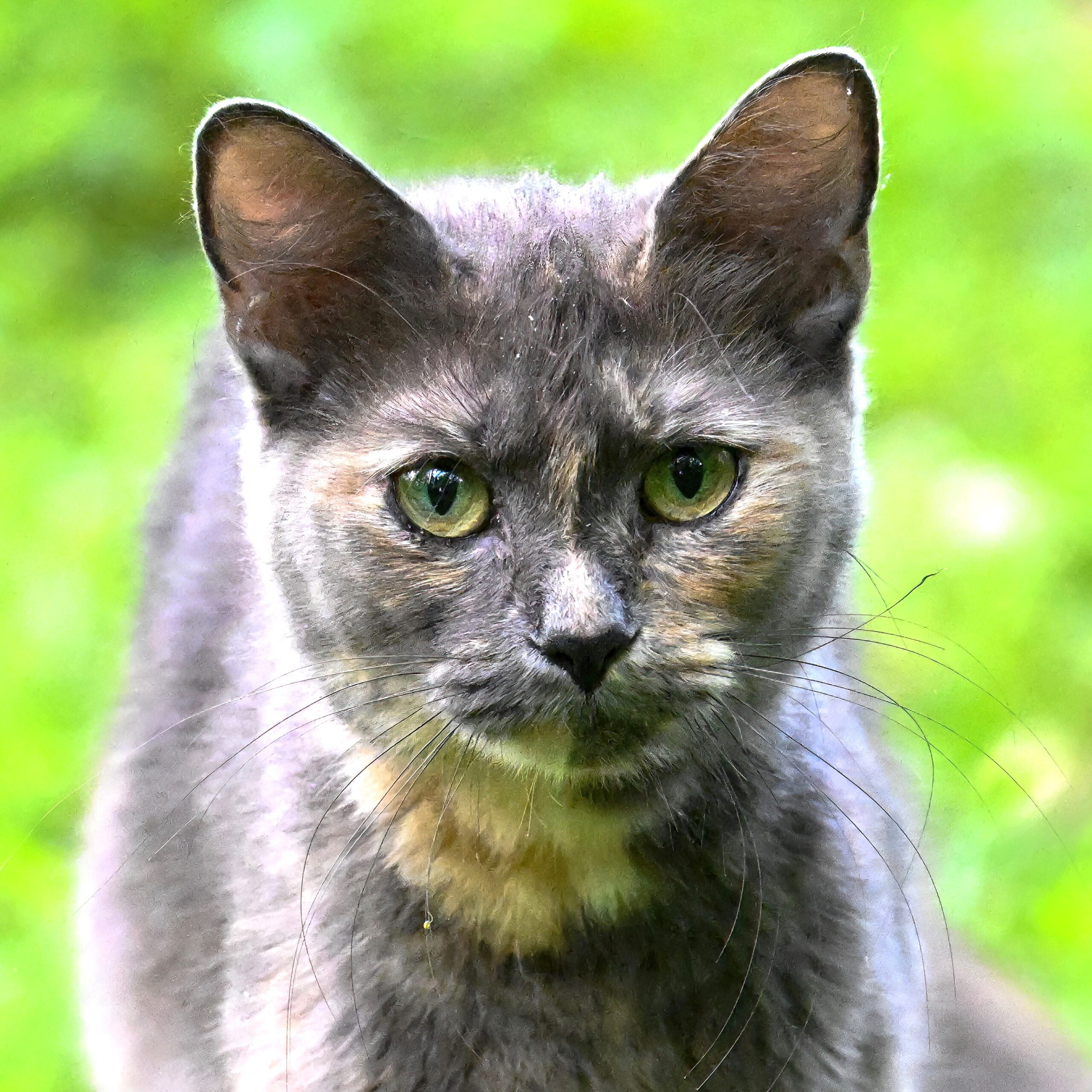
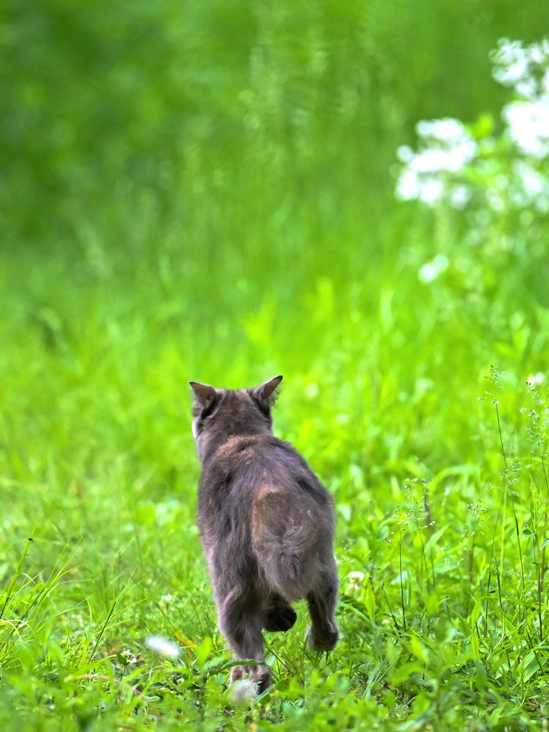
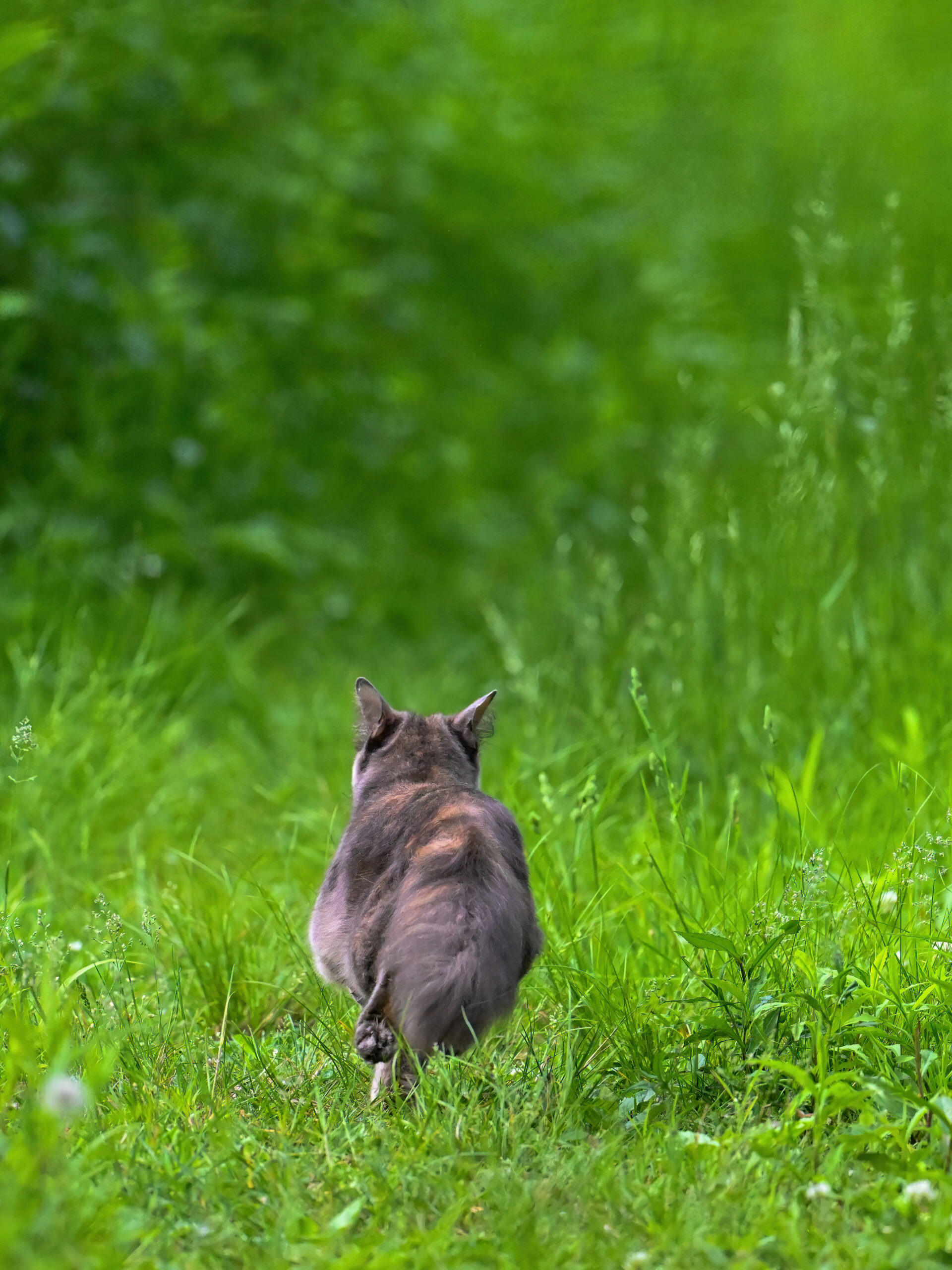
Time to escape I
“Probably also tasty, from a cat perspective, Joey.”
Time to escape II
“Yuck. What’s going to happen to this cute kitty, Dr. Science?”
Time to escape III
“No way to know, Joey – that’s nature for you. Hopefully it will wander back into inhabited areas, or be captured by the friendly park rangers for safe relocation to a good home.”
Time to escape IV
“Dr. Science, is the scientific name of the domestic house cat really ‘Felis Catus?’ That sounds made up.”
Bounding along the trail
“Yes, it really is. … Say, Joey, have you ever been in a Turkish prison?”
Into the woods and away
[Editor’s note: BirdingPI.com management apologies for the general goofiness of this post, which is clearly the result of either too much or too little black coffee. … Feral house cat pictures taken along the Duck Pond Trail @ Presque Isle State Park on 25 May 2024.]
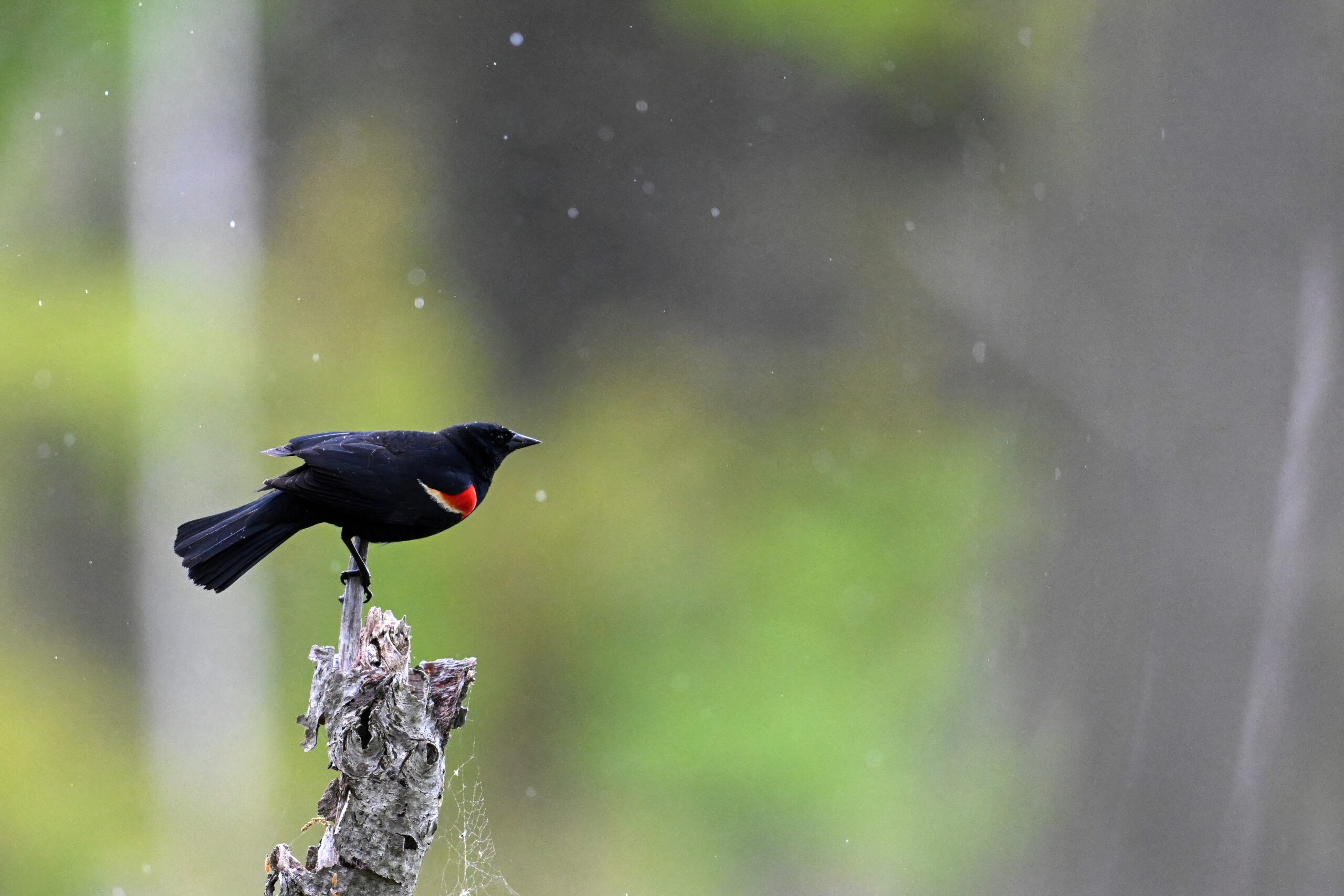
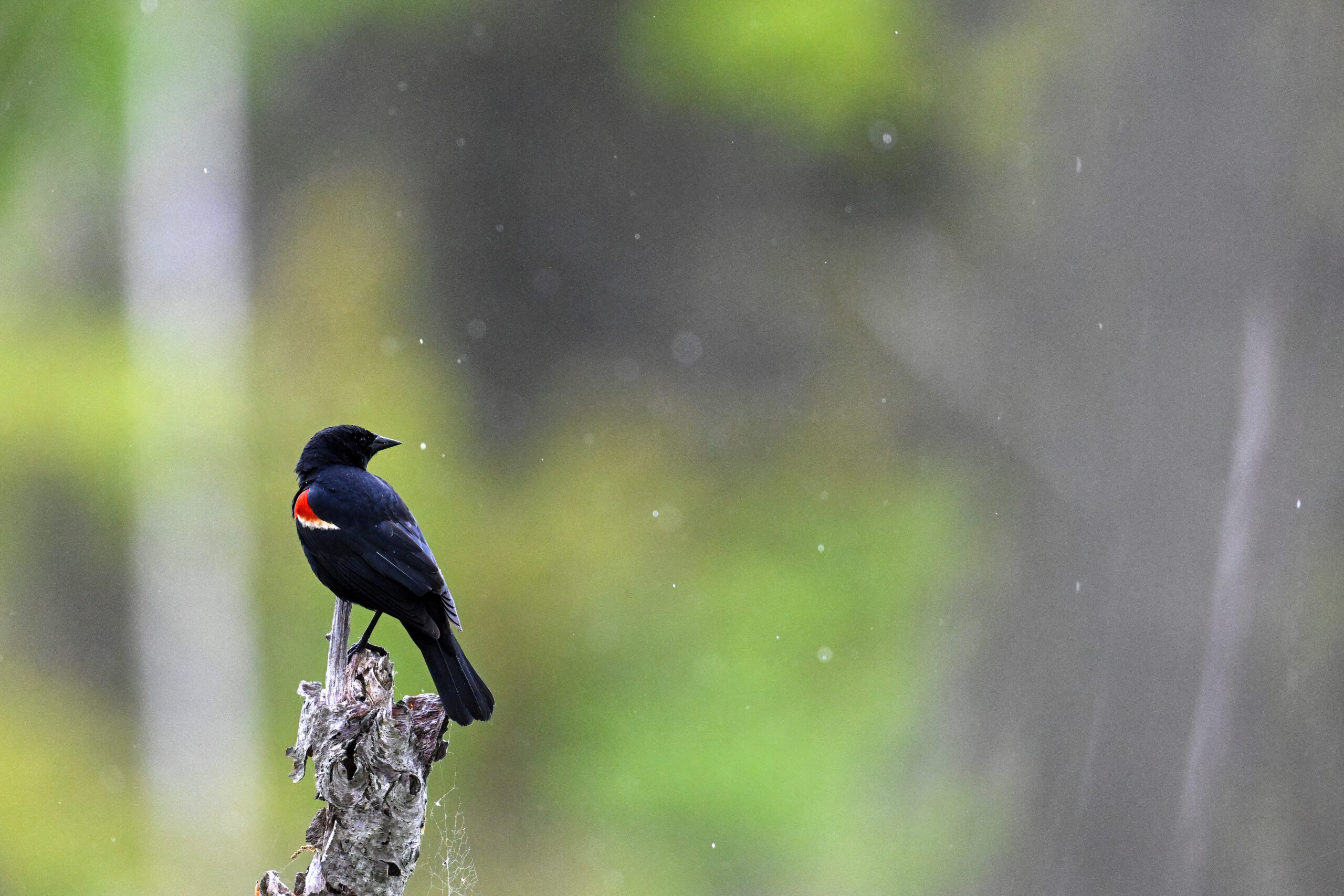
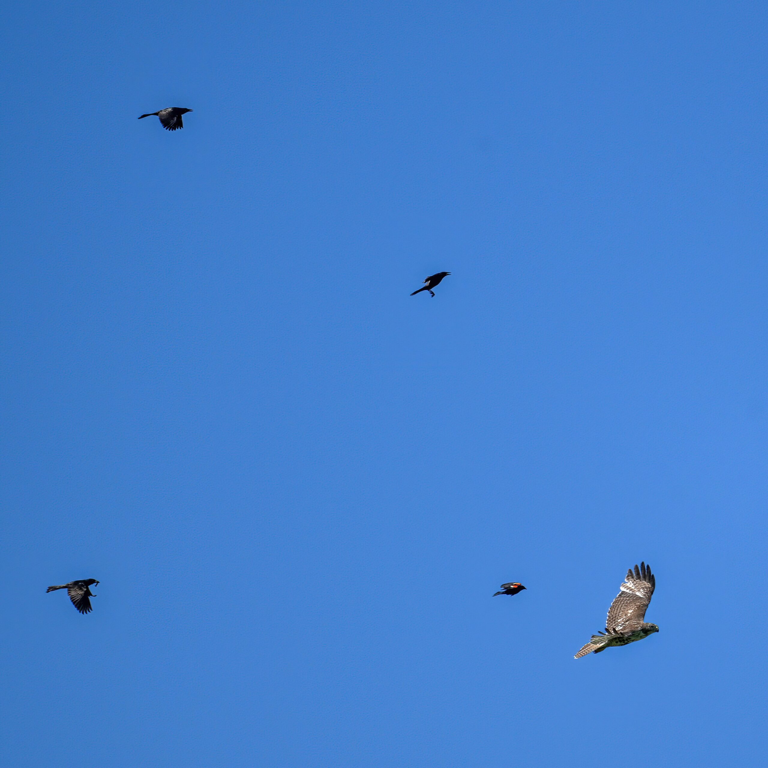
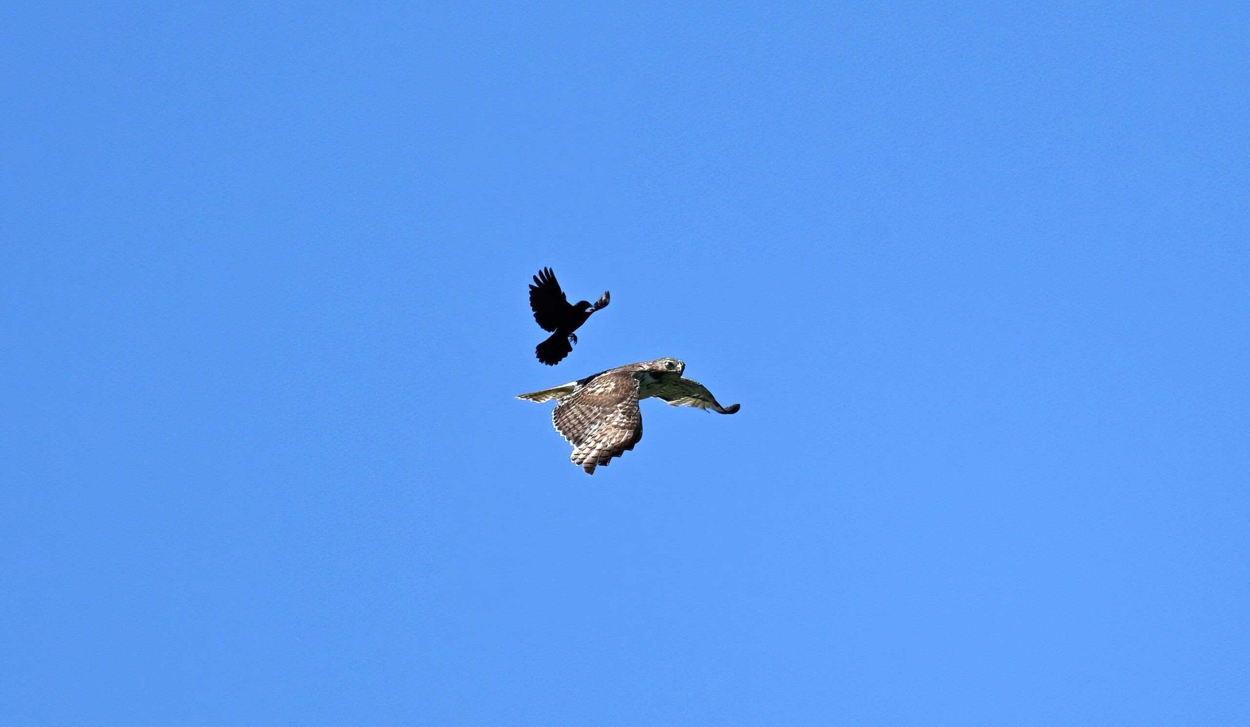
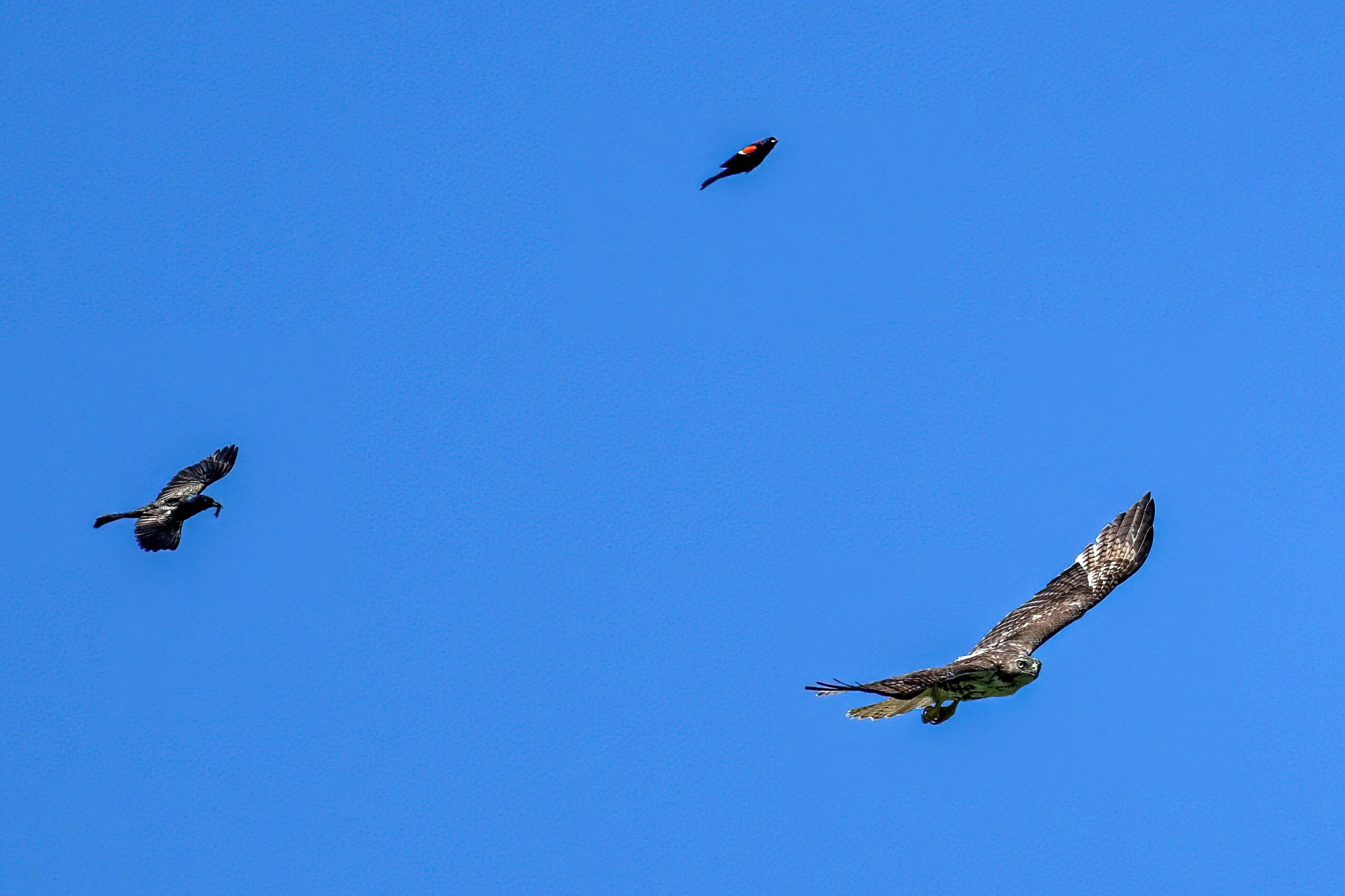
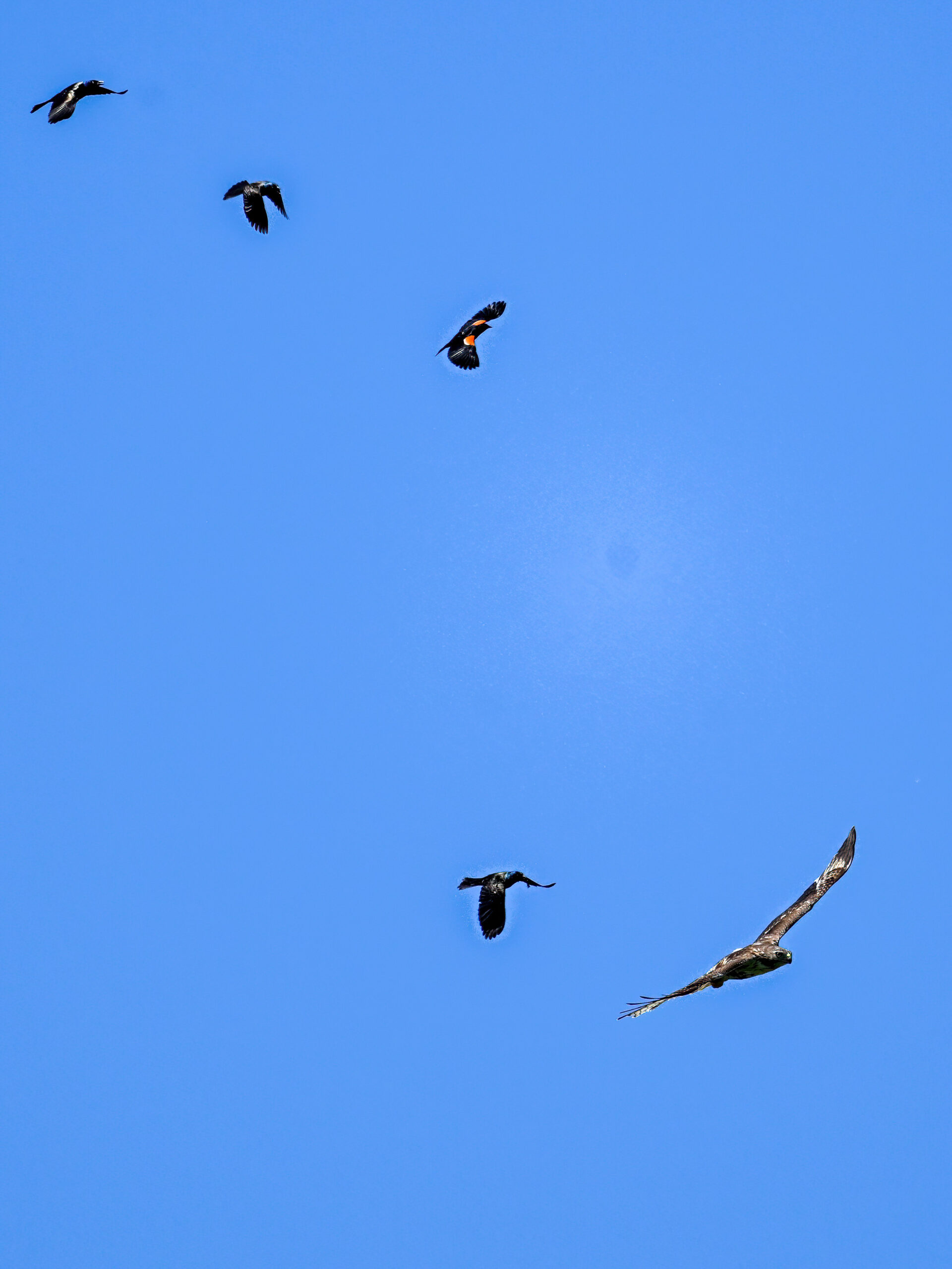
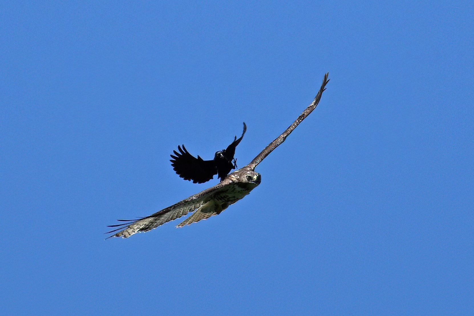
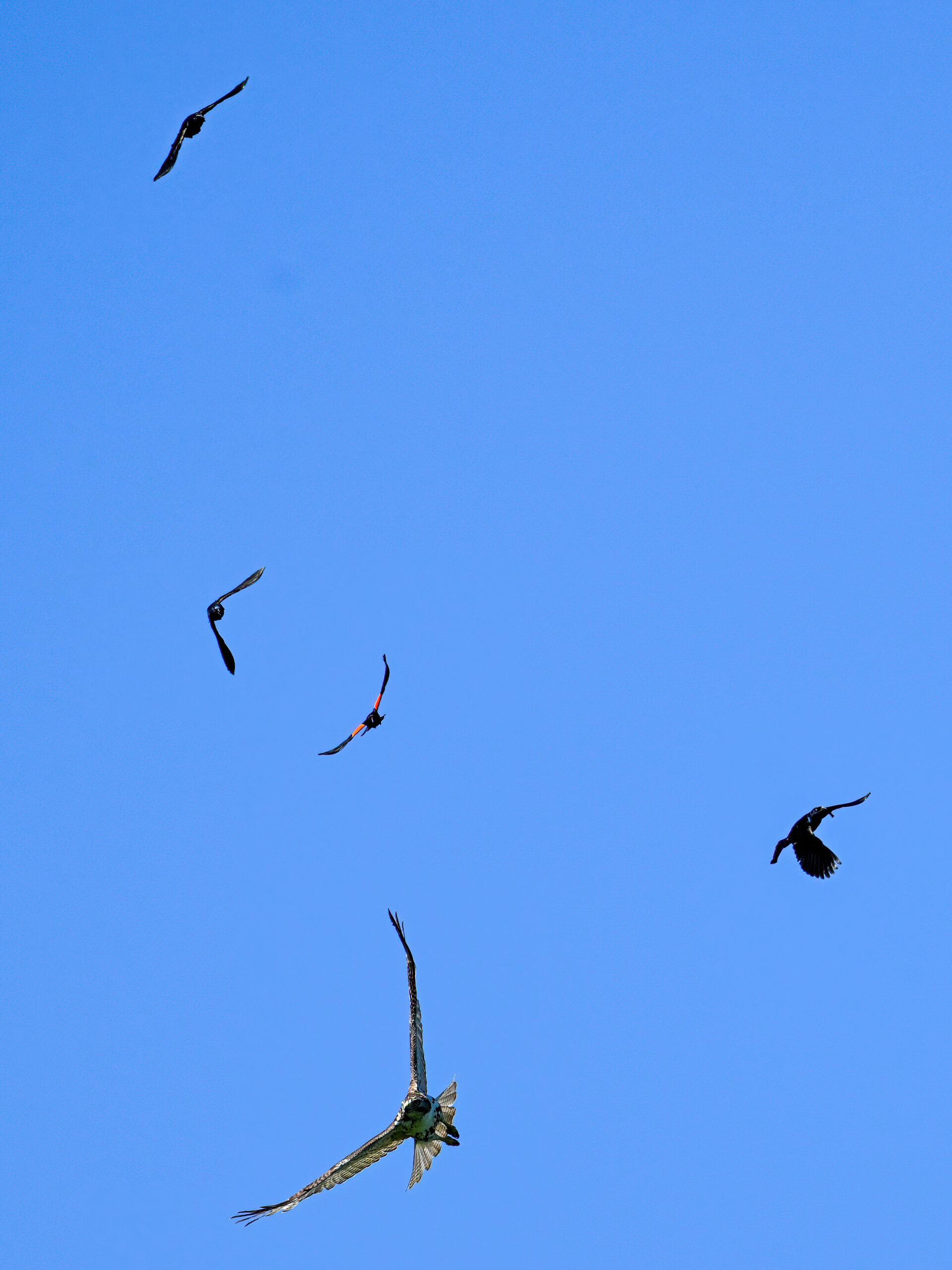
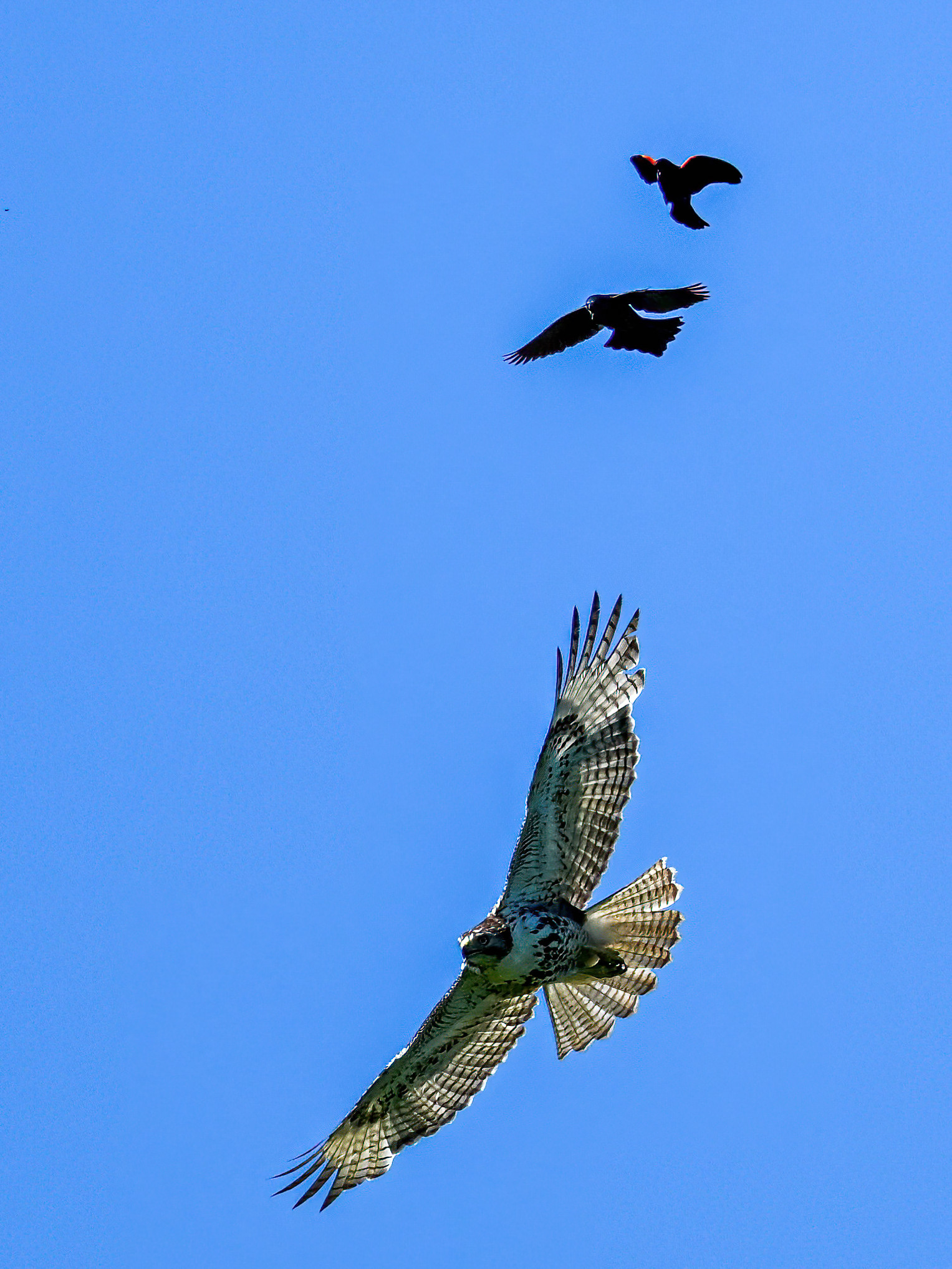
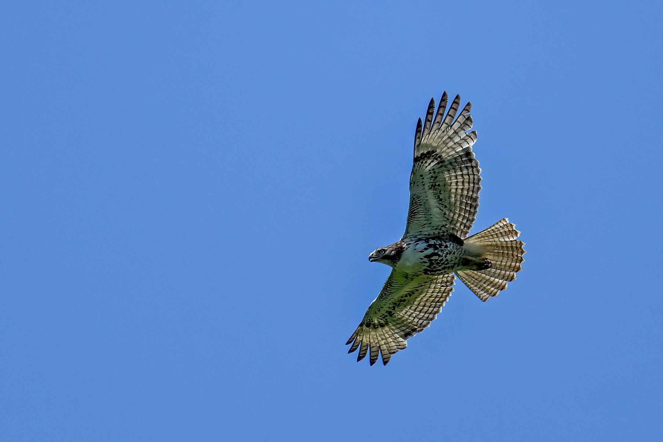
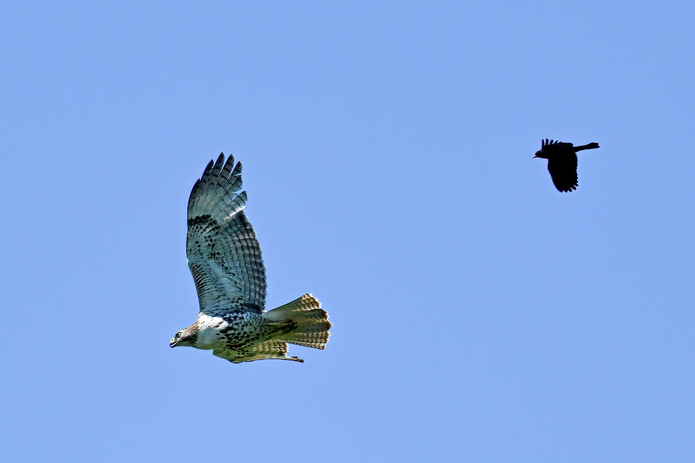
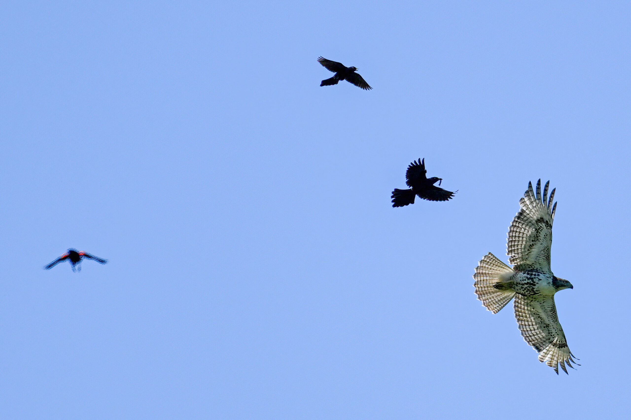
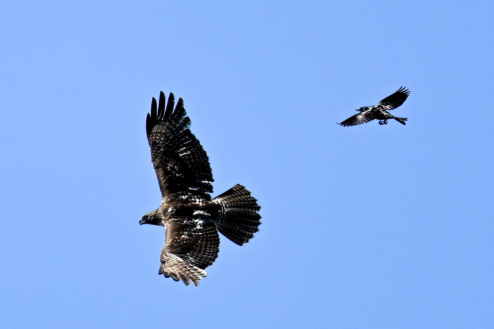
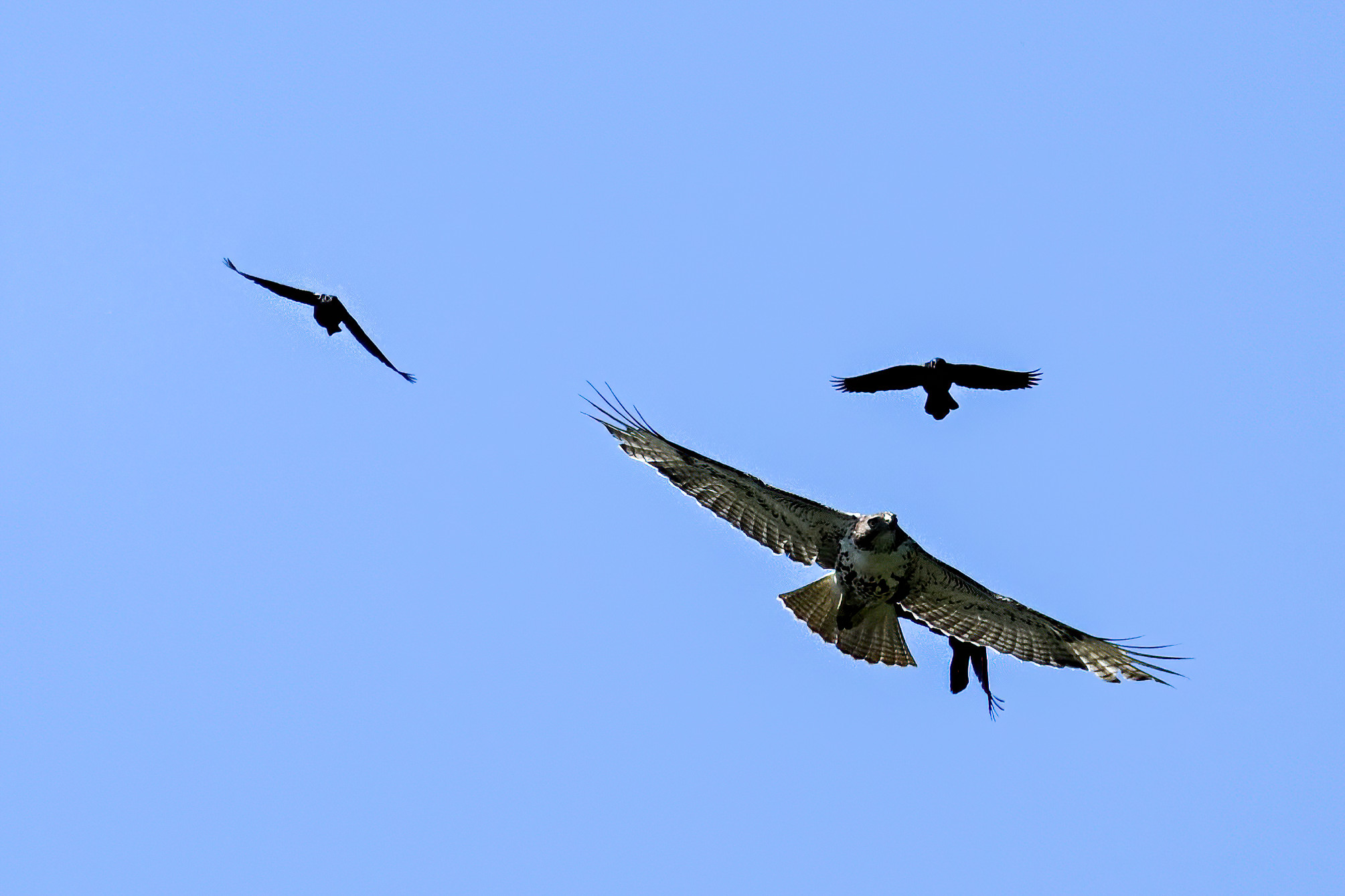
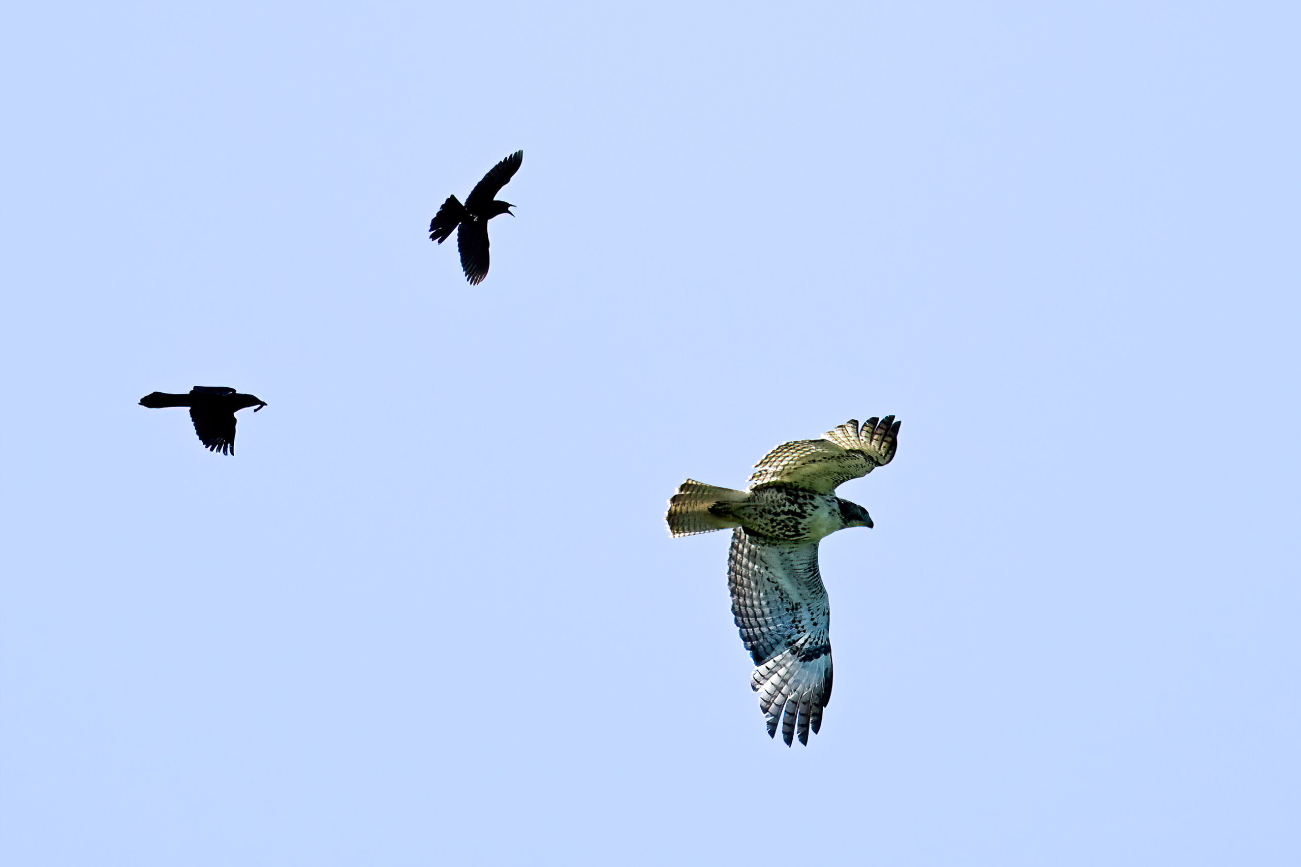
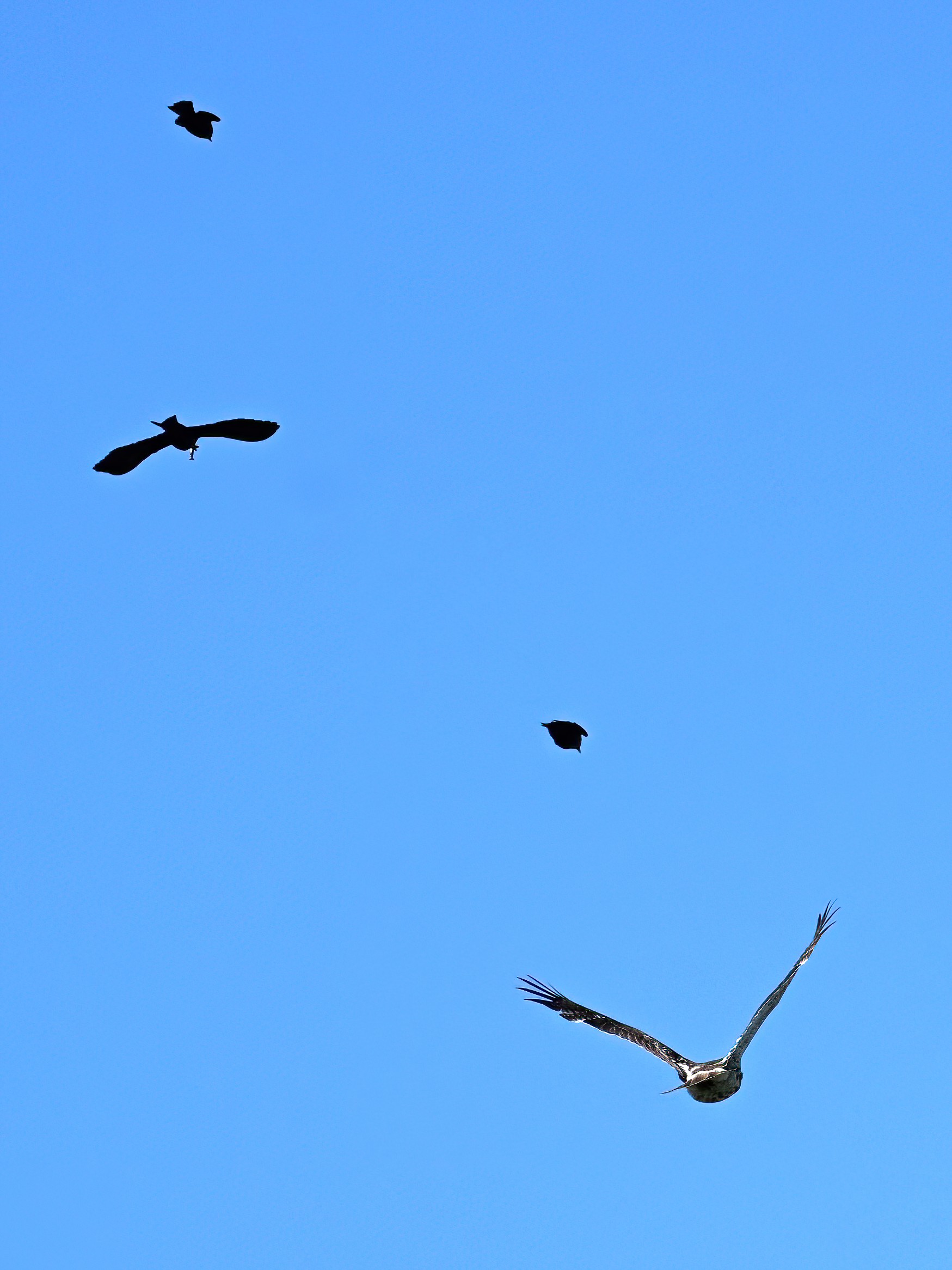
So far this year there’s been Red-winged Blackbird harassing Red-tailed Hawk, Red-winged Blackbird harassing American Crow, Red-winged Blackbird and American Crow co-harassing Red-tailed Hawk, and Red-winged Blackbird harassing Canada Goose (<– true story; sadly, no pictures, but the goose seemed rather offended.) Here, it’s three Common Grackle and one Red-winged Blackbird harassing a Red-tailed Hawk, high above Erie County, PA:
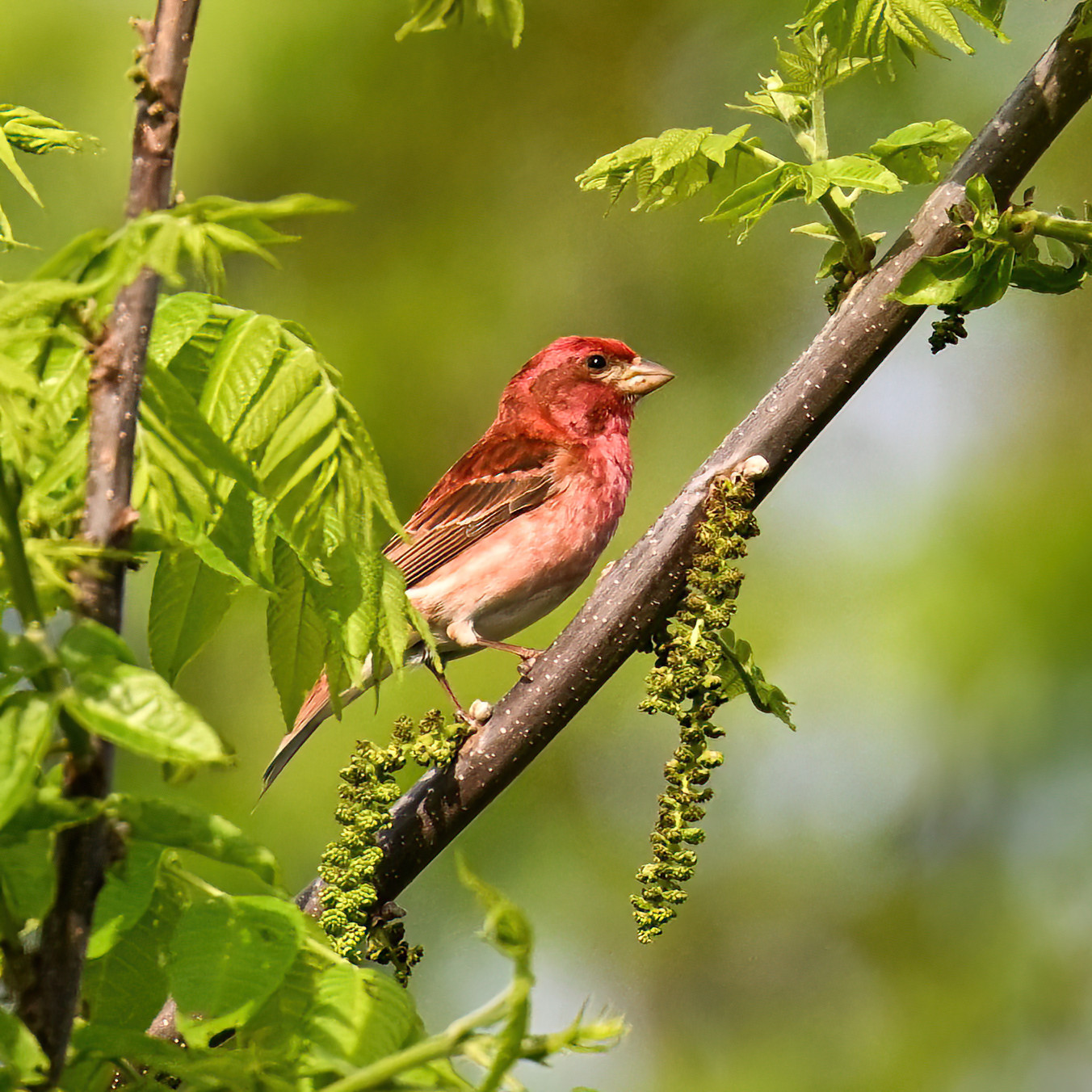
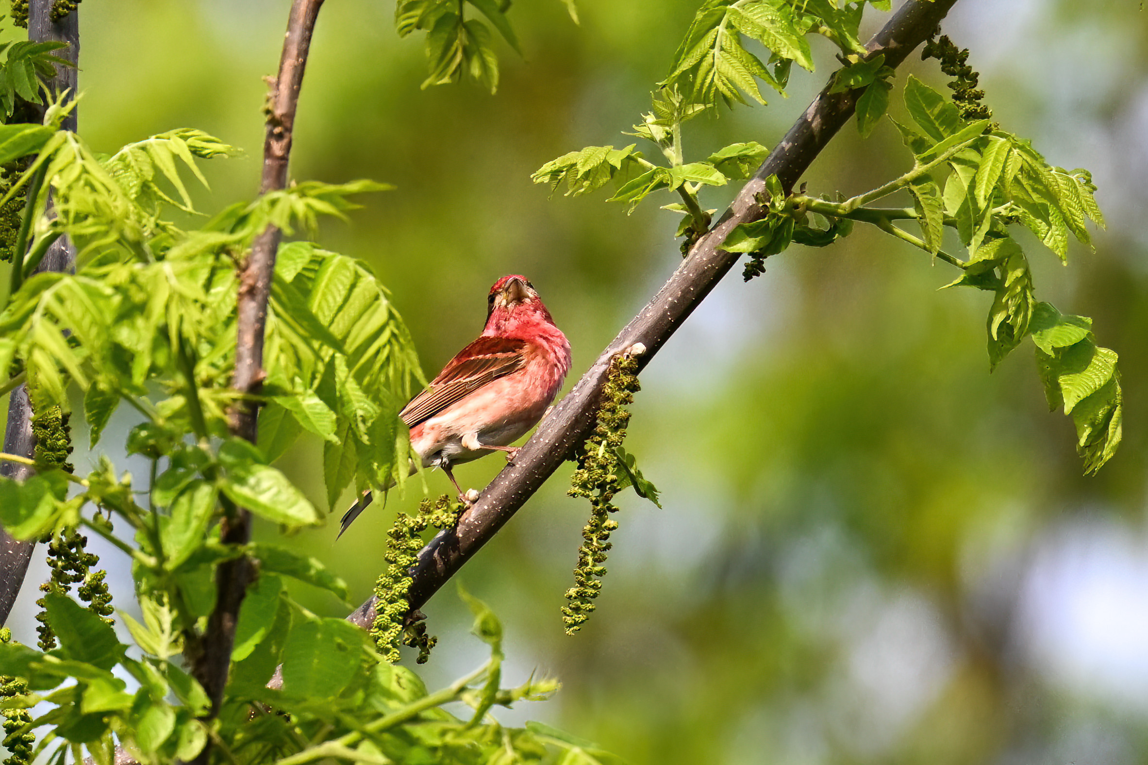
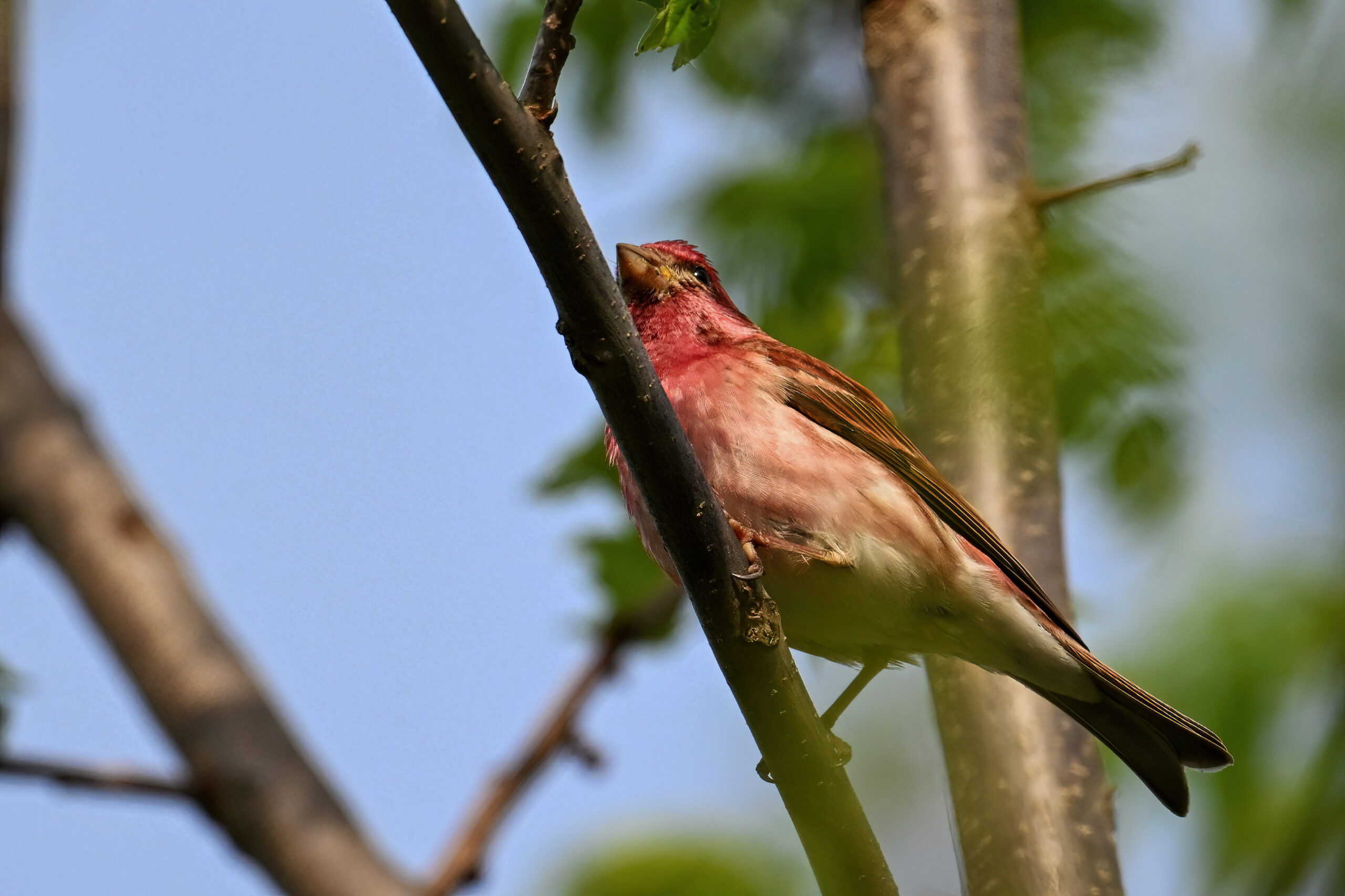
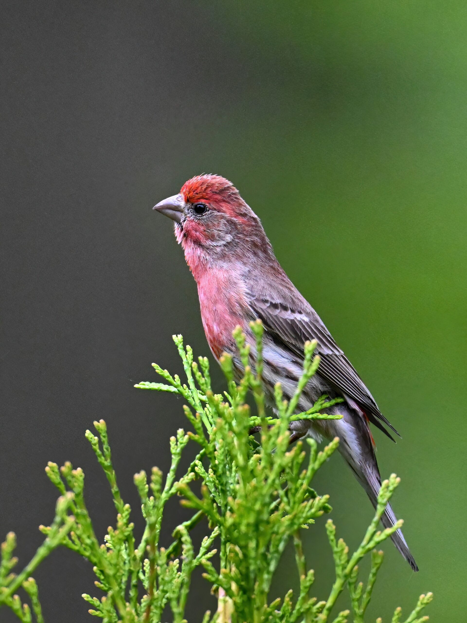
First up, very special pictures of what may be the first ever BirdingPI.com coverage of Purple Finchin Erie County, PA! (Much less common than House Finch.) Taken recently at West Road Elk Creek access.
Purple Finch (m)
ID tip: typical finch features w/ an overall red-purple/raspberry wash.
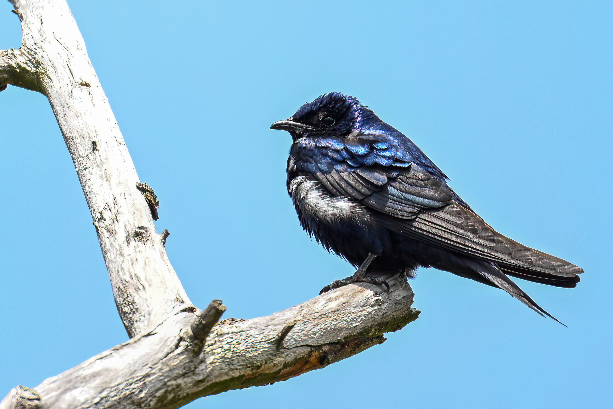
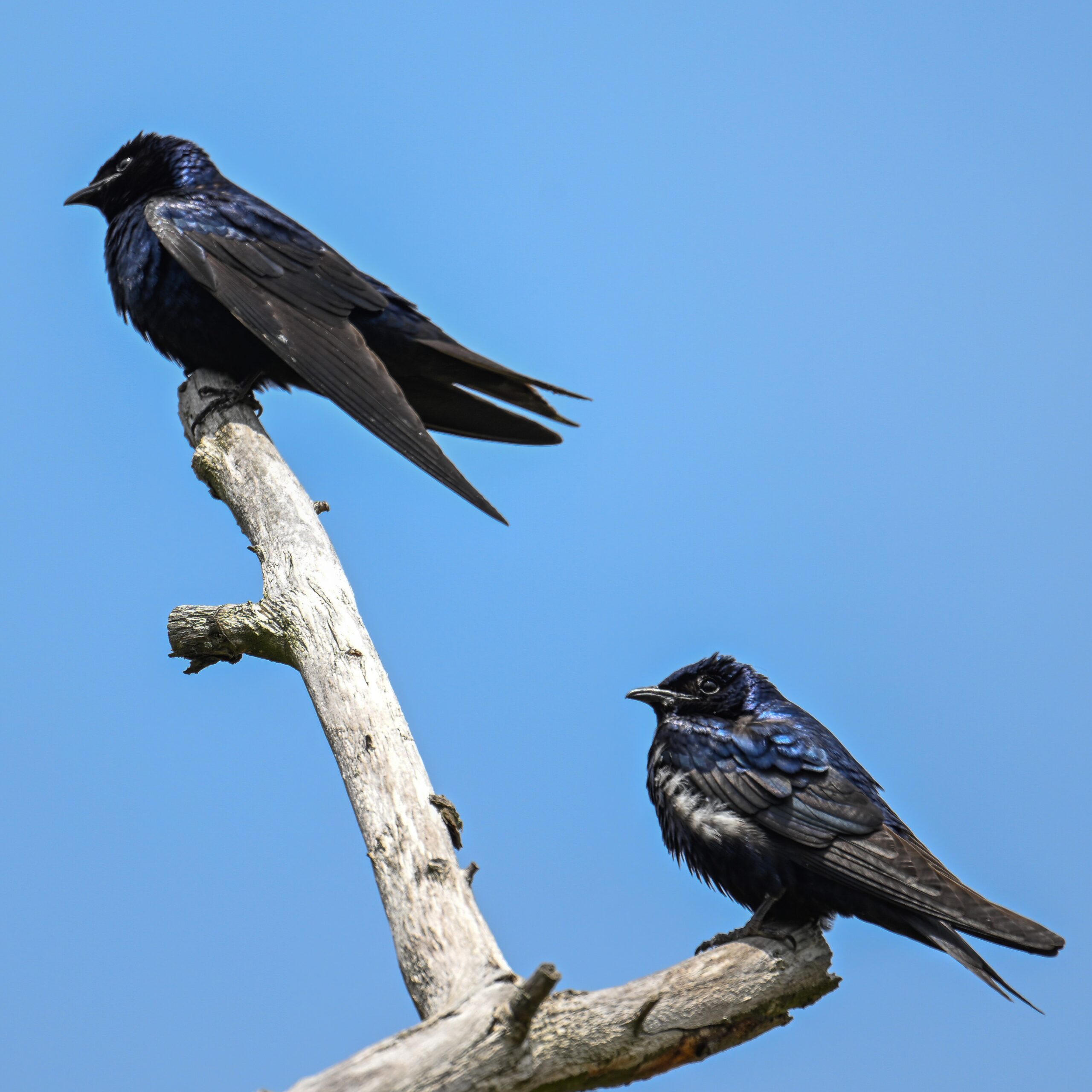
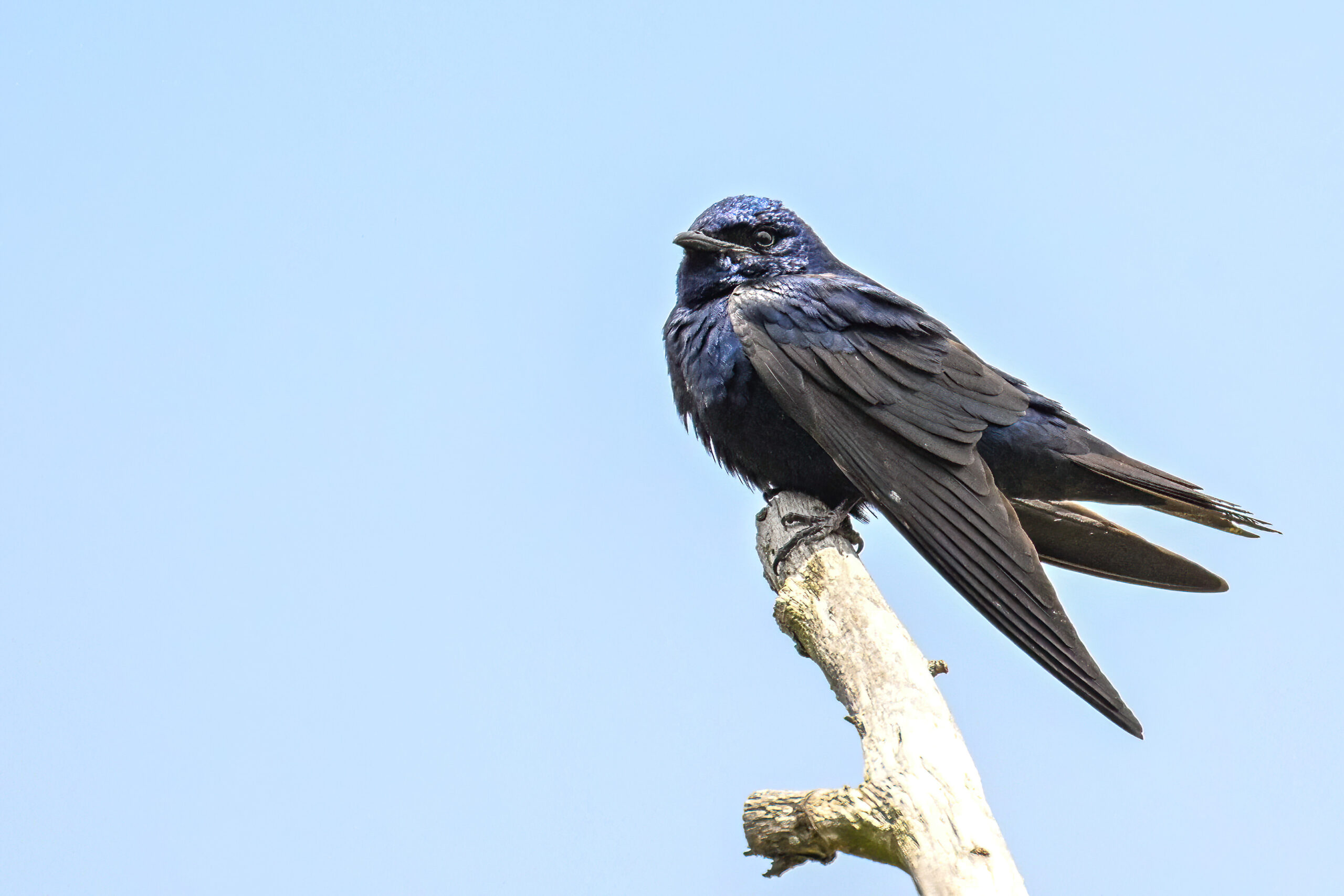
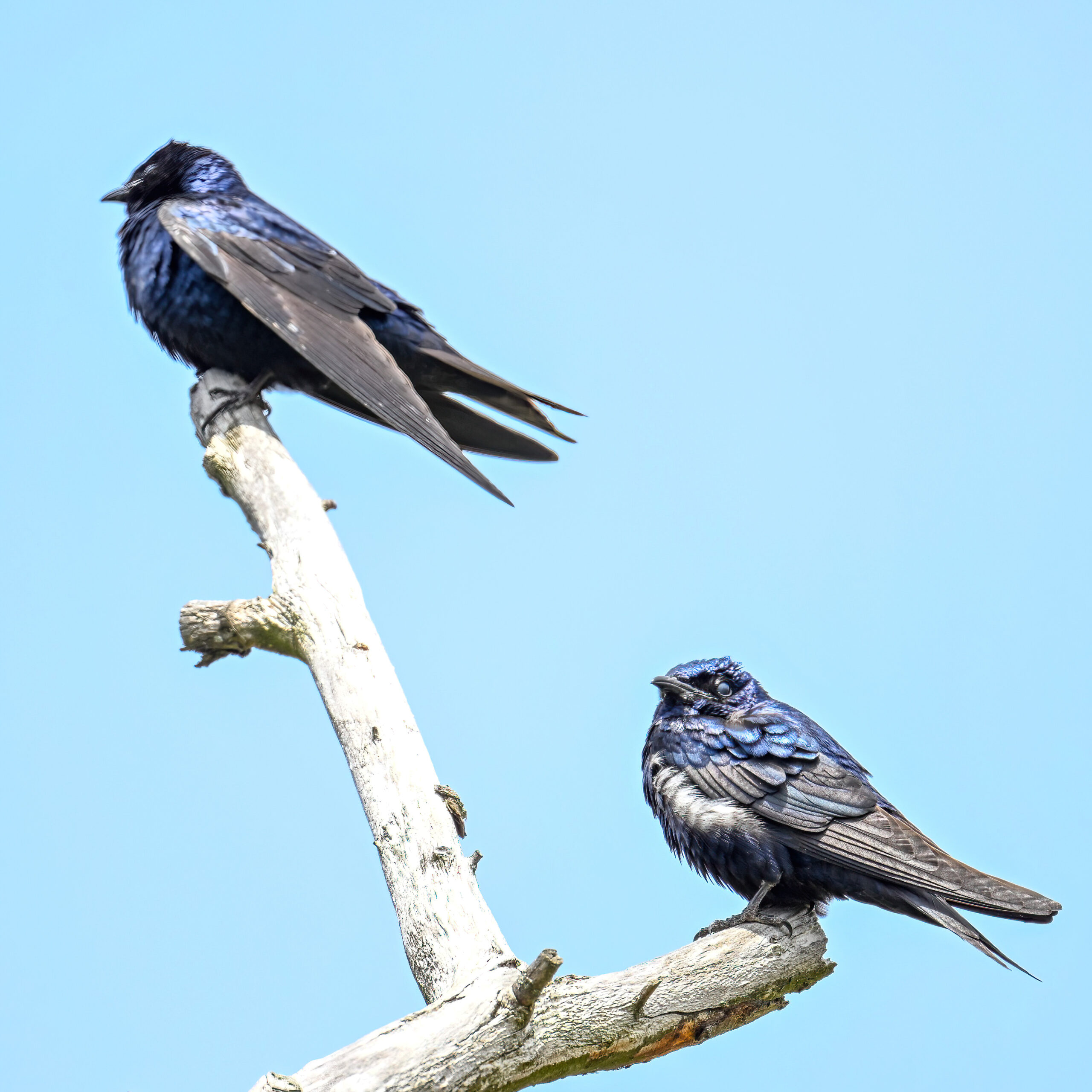
Also exciting, amazing Purple Martin “in the wild.” Meaning not at or around a Purple Martin house. These pictures from the swampy area near the east Long Pond Trail trailhead.
Purple Martin
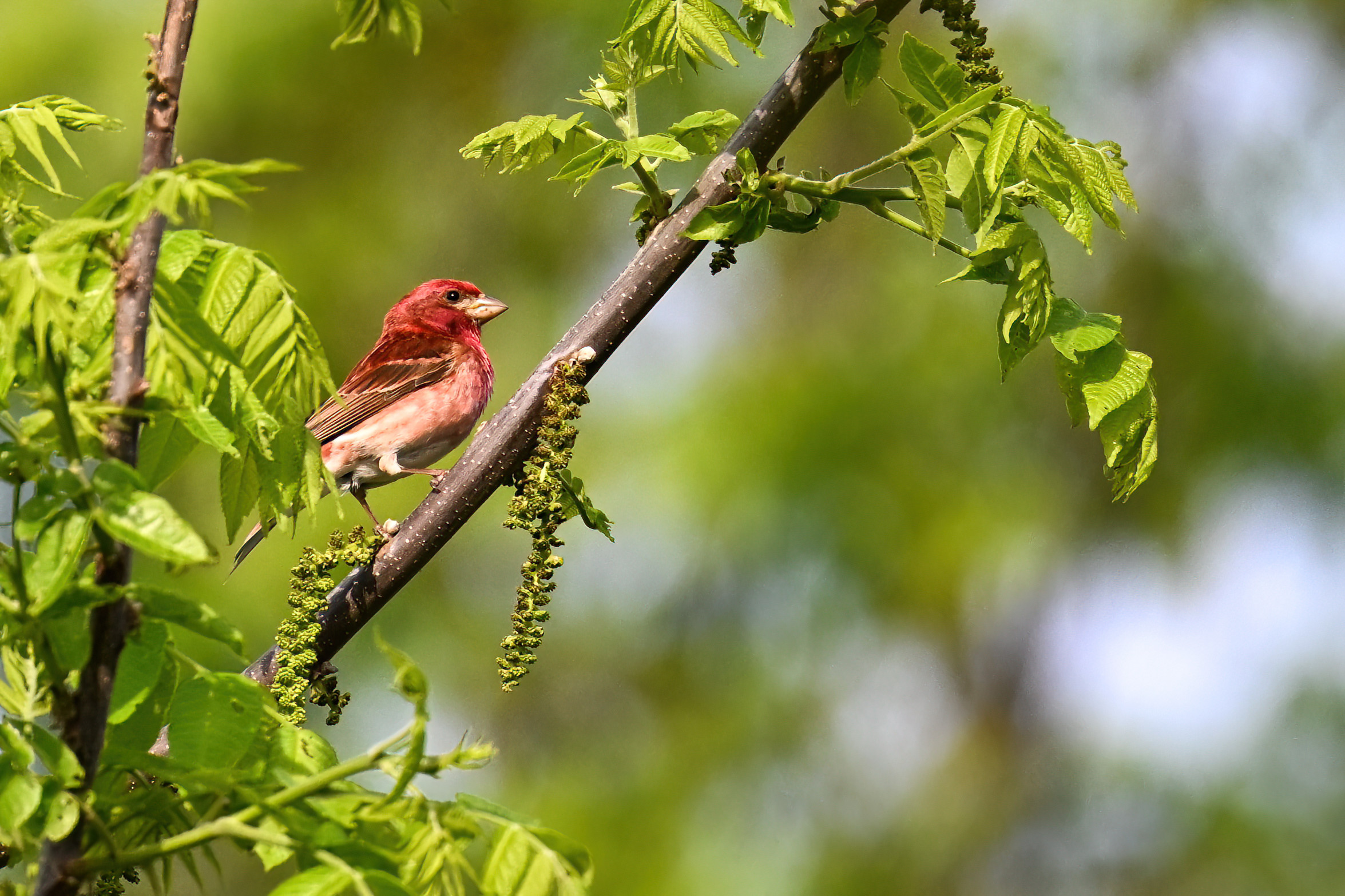
Following are alternating Purple Finch & Purple Martin:
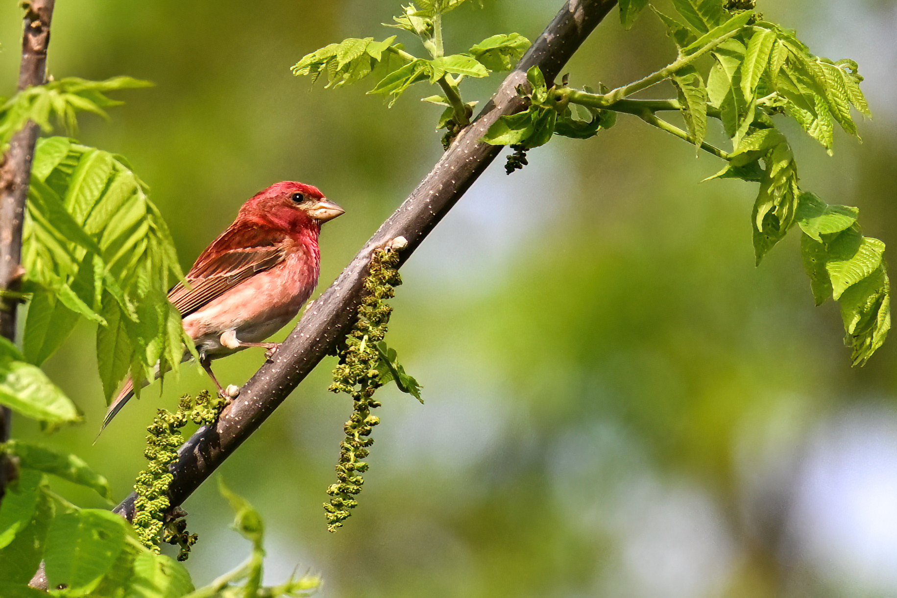
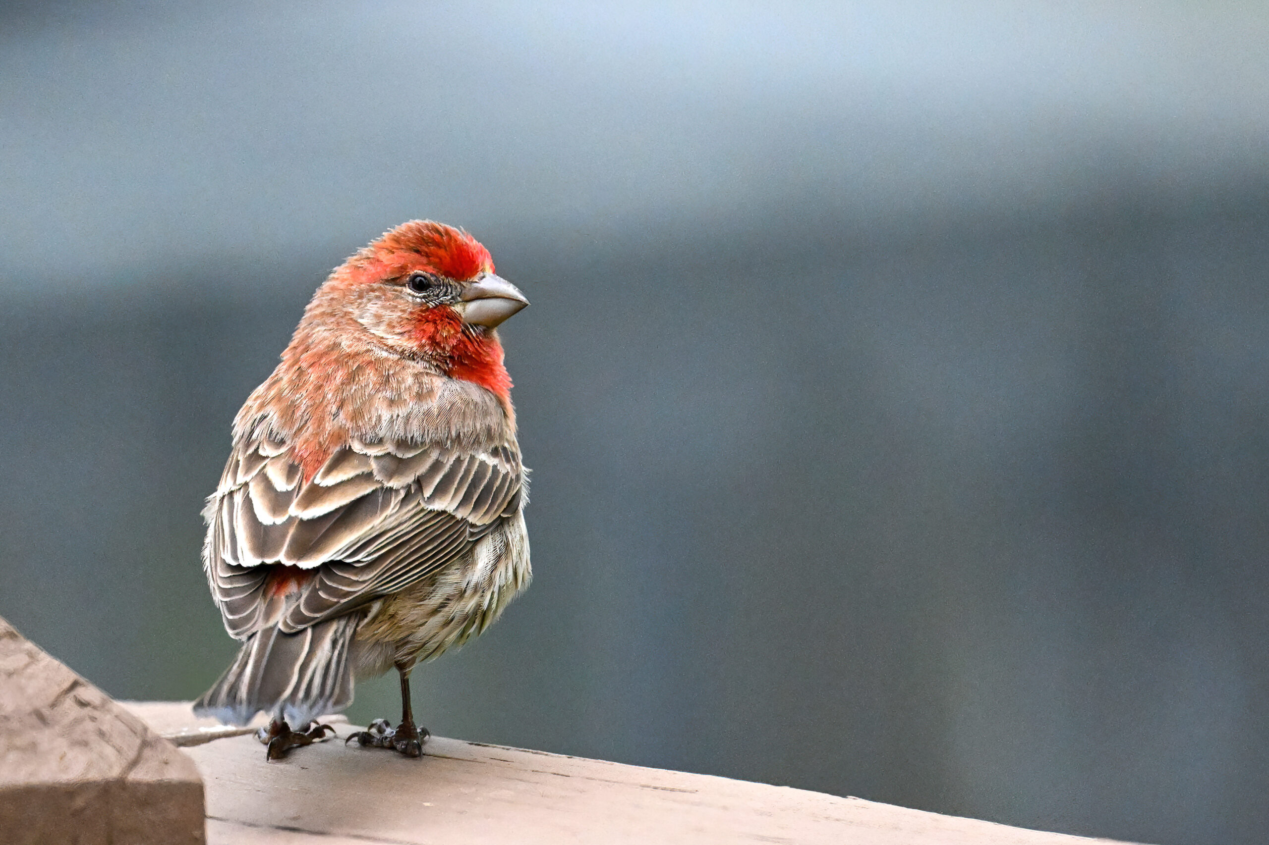
It wouldn’t be complete coverage without a comparison to House Finch. Following shots are of beautiful males in Millcreek Twp (“Gateway to Presque Isle”). Note the similar features but much less extensive red-purple colour: